Category:West Wellow
Jump to navigation
Jump to search
English: West Wellow is a village in the civil parish of Wellow, in the Test Valley district, in the county of Hampshire, England.
village in Hampshire, UK  | |||||
| Upload media | |||||
| Instance of |
| ||||
|---|---|---|---|---|---|
| Location | Wellow, Test Valley, Hampshire, South East England, England | ||||
 | |||||
Subcategories
This category has the following 3 subcategories, out of 3 total.
W
- Wellow Christian Centre (12 F)
- West Wellow Methodist Church (11 F)
Media in category "West Wellow"
The following 93 files are in this category, out of 93 total.
-

-
-
 Bridge Farm, Romsey Road, West Wellow - geograph.org.uk - 730026.jpg 640 × 427; 136 KB
-

-
 Buttons, Lower Common Road, West Wellow - geograph.org.uk - 729808.jpg 640 × 427; 122 KB
-
 Centenary of the Red Cross cover 1963.jpg 1,923 × 1,272; 534 KB
-

-

-

-
 Entrance to West Wellow Golf Club - geograph.org.uk - 2339974.jpg 640 × 480; 122 KB
-
 Field at end of The Drove, West Wellow - geograph.org.uk - 729832.jpg 640 × 427; 127 KB
-
 Fields south of Maury's Lane, West Wellow - geograph.org.uk - 733744.jpg 640 × 427; 117 KB
-

-
 Football fields, Romsey Road, West Wellow - geograph.org.uk - 730012.jpg 640 × 427; 143 KB
-

-
 Funny Farm, Romsey Road, West Wellow - geograph.org.uk - 729961.jpg 640 × 427; 139 KB
-
 Gurnay's Mead, West Wellow - geograph.org.uk - 733187.jpg 640 × 427; 100 KB
-
 Gurnays Mead, West Wellow - geograph.org.uk - 729842.jpg 640 × 427; 112 KB
-

-

-

-

-

-
-

-
 Looking along Slab Lane, West Wellow - geograph.org.uk - 733200.jpg 640 × 427; 130 KB
-

-

-

-

-

-

-
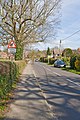
 Lower Common Road, West Wellow - geograph.org.uk - 729814.jpg 640 × 427; 157 KB
-
 Lower Common Road, West Wellow - geograph.org.uk - 729820.jpg 427 × 640; 149 KB
-
 Lucerne, Maury's Lane, West Wellow - geograph.org.uk - 733730.jpg 427 × 640; 182 KB
-
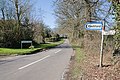
 Maury's Lane looking towards A36 - geograph.org.uk - 733754.jpg 427 × 640; 142 KB
-
 Maytrees, Romsey Road, West Wellow - geograph.org.uk - 729953.jpg 640 × 427; 123 KB
-

-
 Nightingale Close, West Wellow - geograph.org.uk - 733202.jpg 640 × 427; 129 KB
-
 North end of Buttons Lane, West Wellow - geograph.org.uk - 730198.jpg 427 × 640; 105 KB
-
 Old Cottage Close, West Wellow - geograph.org.uk - 733218.jpg 640 × 427; 111 KB
-

-
 Old Garage at Salisbury Road (A27), West Wellow (July 2021).JPG 2,800 × 1,800; 2.11 MB
-

-
 Post Office, Salisbury Road, West Wellow - geograph.org.uk - 733183.jpg 640 × 481; 163 KB
-

-
 Recreation ground, West Wellow - geograph.org.uk - 733211.jpg 640 × 427; 125 KB
-
 Reeves Close, Buttons Lane, West Wellow - geograph.org.uk - 729797.jpg 640 × 427; 114 KB
-

-

-

-

-
 Rowden Close, West Wellow - geograph.org.uk - 729854.jpg 640 × 427; 112 KB
-

-

-
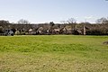
 Silver Birches on West Wellow Common - geograph.org.uk - 733836.jpg 640 × 424; 127 KB
-

-

-

-
 Stream near Headlands Farm, West Wellow - geograph.org.uk - 729987.jpg 427 × 640; 150 KB
-
 Stream that drains West Wellow Common - geograph.org.uk - 733780.jpg 427 × 640; 155 KB
-

-

-
 The Beeches, Slab Lane, West Wellow - geograph.org.uk - 733208.jpg 640 × 427; 128 KB
-
 The Drove, West Wellow - geograph.org.uk - 729823.jpg 640 × 427; 168 KB
-
 The Drove, West Wellow - geograph.org.uk - 729837.jpg 640 × 427; 138 KB
-
 The end of School Road, West Wellow - geograph.org.uk - 729918.jpg 427 × 640; 132 KB
-
 The end of The Drove, West Wellow - geograph.org.uk - 729833.jpg 640 × 427; 139 KB
-
 The Greetings, Slab Lane, West Wellow - geograph.org.uk - 733229.jpg 475 × 640; 148 KB
-
 The Red Rover - geograph.org.uk - 109364.jpg 640 × 480; 73 KB
-

-

-
 Village Hall, Buttons Lane, West Wellow - geograph.org.uk - 729791.jpg 640 × 427; 120 KB
-
 Warwick Place, Slab Lane, West Wellow - geograph.org.uk - 733222.jpg 640 × 427; 121 KB
-

-

-
 West Wellow , Nisa Local - geograph.org.uk - 3126550.jpg 4,288 × 2,848; 5.51 MB
-
 West Wellow Car Centre, on the A36 - geograph.org.uk - 733785.jpg 640 × 427; 117 KB
-
 West Wellow Common - geograph.org.uk - 1775197.jpg 640 × 480; 46 KB
-

-
 West Wellow, daffodils at muddy lay-by - geograph.org.uk - 710459.jpg 640 × 480; 101 KB
-
 West Willow , A36 Salisbury Road - geograph.org.uk - 3106772.jpg 3,216 × 2,136; 3.15 MB
-
 West Willow , A36 Salisbury Road Roundabout - geograph.org.uk - 3106774.jpg 3,056 × 1,858; 2.98 MB
-
 West Willow , The Red Rover ^ A36 Road - geograph.org.uk - 3106769.jpg 3,216 × 2,136; 3.79 MB
-
 Wheatears Drive, West Wellow - geograph.org.uk - 729810.jpg 640 × 427; 132 KB
-

-
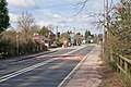
 Approaching West Wellow on Romsey Road - geograph.org.uk - 730165.jpg 640 × 427; 119 KB
-

-

-
 Brookfields, Maury's Lane, West Wellow - geograph.org.uk - 733763.jpg 640 × 427; 118 KB
-
 Brookfields, Maury's Lane, West Wellow - geograph.org.uk - 733771.jpg 640 × 427; 117 KB
-

-


_from_Canada_Corner_-_geograph.org.uk_-_732732.jpg)


,_West_Wellow_(July_2021).JPG)


_passes_the_Post_Office_at_West_Wellow_-_geograph.org.uk_-_733180.jpg)


