Category:Westendorf (Allgäu)

Wikimedia Commonsdan olingan
Navigatsiya qismiga oʻtish Qidirish qismiga oʻtish
  Landkreis Ostallgäu: Aitrang · Baisweil · Bidingen · Biessenhofen · Buchloe · Eggenthal · Eisenberg · Friesenried · Füssen · Germaringen · Görisried · Günzach · Halblech · Hopferau · Irsee · Jengen · Kaltental · Kraftisried · Lamerdingen · Lechbruck am See · Lengenwang · Marktoberdorf · Mauerstetten · Nesselwang · Obergünzburg · Oberostendorf · Osterzell · Pforzen · Pfronten · Rettenbach am Auerberg · Rieden · Rieden am Forggensee · Ronsberg · Roßhaupten · Rückholz · Ruderatshofen · Schwangau · Seeg · Stötten am Auerberg · Stöttwang · Unterthingau · Untrasried · Waal · Wald · Westendorf ·
<nowiki>Westendorf; Westendorf (Allgäu); Westendorf; Westendorf; Westendorf; Westendorf; Վեսթենդորֆ; Westendorf (Allgäu); Westendorf; ヴェステンドルフ; Westendorf; Вестендорф; Вестендорф (Алльгой); Westendorf; Westendorf; Вестендорф; Westendorf; Westendorf; Westendorf; Vestendorf; ۆەستەندورف; Vestendorf; Вестендорф; Вестендорф; Westendorf; Westendorf; Westendorf; Вестендорф; Westendorf; Westendorf; Westendorf; Westendorf; Вестендорф; Вестендорф; Westendorf; وشتندورف (آلگو); Westendorf; Westendorf; Вестендорф (Алльгой); Westendorf (Allgäu); comune tedesco; commune allemande; település Németországban; obec v zemském okresu Ostallgäu v Německu; بلدية في ألمانيا; kommune i Bayern i Tyskland; Allgäu; komunë në Gjermani; gmejna w Bayerskej; Gemeinde im Landkreis Ostallgäu in Bayern; municipality in the Ostallgäu district, Bavaria; municipality in the Ostallgäu district, Bavaria; komunumo en Bavario, Germanio; kumun alaman; Şaredariyeke Almanyayê; Westendorf (Ostallgäu); Westindorf; Westendorff; Westerndorf; Oberosstendorf; Westedorff; Westndorff; Undter Osstendorf; Wестендорф</nowiki>
Westendorf 
municipality in the Ostallgäu district, Bavaria
Fayl yuklash
Bu konsepsiyaning alohida holati
  • non-urban municipality in Germany
Qismi
  • Verwaltungsgemeinschaft Westendorf
  • Stimmkreis Marktoberdorf (2018)
LocationOstallgäu, Swabia, Bavariya, Germaniya
Aholisi
  • 1 924 (2022)
Hudud
  • 11,93 km² (2017)
Dengiz sathidan balandligi
  • 688 m
...dan farqli
rasmiy vebsayti
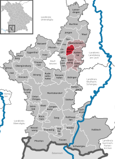
Map47° 56′ 00″ N, 10° 43′ 00″ E
Hokimiyat nazorati
Vikima'lumot Q549052
VIAF identifikatori: 154271479
GND identifikatori: 4439725-2
OpenStreetMap relation ID: 447637
Edit infobox data on Wikidata

Ostturkumlar

Quyida ushbu turkumga kiruvchi 6 ta ostturkumdan 6 tasi koʻrsatilgan.

„Westendorf (Allgäu)“ turkumidagi fayllar

Quyida ushbu turkumga kiruvchi 5 ta fayldan 5 tasi koʻrsatilgan.