Category:Westendorf (Allgäu)

From Wikimedia Commons, the free media repository
Jump to navigation Jump to search
  Landkreis Ostallgäu: Aitrang · Baisweil · Bidingen · Biessenhofen · Buchloe · Eggenthal · Eisenberg · Friesenried · Füssen · Germaringen · Görisried · Günzach · Halblech · Hopferau · Irsee · Jengen · Kaltental · Kraftisried · Lamerdingen · Lechbruck am See · Lengenwang · Marktoberdorf · Mauerstetten · Nesselwang · Obergünzburg · Oberostendorf · Osterzell · Pforzen · Pfronten · Rettenbach am Auerberg · Rieden · Rieden am Forggensee · Ronsberg · Roßhaupten · Rückholz · Ruderatshofen · Schwangau · Seeg · Stötten am Auerberg · Stöttwang · Unterthingau · Untrasried · Waal · Wald · Westendorf ·
<nowiki>Westendorf; Westendorf (Allgäu); Westendorf; Westendorf; Westendorf; Westendorf; Վեսթենդորֆ; Westendorf (Allgäu); Westendorf; ヴェステンドルフ; Westendorf; Вестендорф; Вестендорф (Алльгой); Westendorf; Westendorf; Вестендорф; Westendorf; Westendorf; Westendorf; Vestendorf; ۆەستەندورف; Vestendorf; Вестендорф; Вестендорф; Westendorf; Westendorf; Westendorf; Вестендорф; Westendorf; Westendorf; Westendorf; Westendorf; Вестендорф; Вестендорф; Westendorf; وشتندورف (آلگو); Westendorf; Westendorf; Вестендорф (Алльгой); Westendorf (Allgäu); comune tedesco; commune allemande; település Németországban; obec v zemském okresu Ostallgäu v Německu; kommune i Bayern i Tyskland; Allgäu; بلدية في ألمانيا; komunë në Gjermani; Gemeinde im Landkreis Ostallgäu in Bayern; gmejna w Bayerskej; municipality in the Ostallgäu district, Bavaria; komunumo en Bavario, Germanio; kumun alaman; Şaredariyeke Almanyayê; Westendorf (Ostallgäu); Westindorf; Westendorff; Westerndorf; Oberosstendorf; Westedorff; Westndorff; Undter Osstendorf; Wестендорф</nowiki>
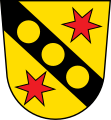
Westendorf 
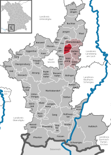
municipality in the Ostallgäu district, Bavaria
Upload media
Instance of
  • non-urban municipality in Germany
Part of
  • Verwaltungsgemeinschaft Westendorf
  • Stimmkreis Marktoberdorf (2018)
LocationOstallgäu, Swabia, Bavaria, Germany
Population
  • 1,924 (2022)
Area
  • 11.93 km² (2017)
Elevation above sea level
  • 688 m
Different from
official website
Map47° 56′ 00″ N, 10° 43′ 00″ E
Authority file
Wikidata Q549052
VIAF ID: 154271479
GND ID: 4439725-2
OpenStreetMap relation ID: 447637
Edit infobox data on Wikidata

Subcategories

This category has the following 6 subcategories, out of 6 total.

Media in category "Westendorf (Allgäu)"

The following 5 files are in this category, out of 5 total.