Category:Halblech
Jump to navigation
Jump to search
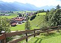
municipality of Germany .jpg) Luftaufnahme   | |||||
| Upload media | |||||
| Instance of |
| ||||
|---|---|---|---|---|---|
| Part of |
| ||||
| Location | Ostallgäu, Swabia, Bavaria, Germany | ||||
| Head of government |
| ||||
| Population |
| ||||
| Area |
| ||||
| Elevation above sea level |
| ||||
| official website | |||||
 | |||||
Subcategories
This category has the following 6 subcategories, out of 6 total.
Media in category "Halblech"
The following 41 files are in this category, out of 41 total.
-
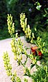 2004-08-03 Aconitum lycoctonum Ammergau.jpg 1,929 × 3,298; 477 KB
-
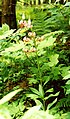 2004-08-03 Türkenbundlilien Ammergau.jpg 1,732 × 2,943; 2.4 MB
-
 Anlegestelle - panoramio (3).jpg 5,184 × 3,456; 3.16 MB
-
 Bildbaum an der Straße unterhalb von Hegratsried.jpg 720 × 1,280; 171 KB
-
 Blick vom Buchenberg - geo.hlipp.de - 14046.jpg 640 × 417; 58 KB
-
 Bundesstraße 17 bei Oberreithen.jpg 3,264 × 2,448; 2.36 MB
-

-
 Denkmal im Wald zwischen Fronreiten und Oberreithen.jpg 720 × 1,280; 154 KB
-
 Der Rothenbach bei Halblech - geo.hlipp.de - 20627.jpg 640 × 426; 137 KB
-
 Wappen von Halblech.svg 1,040 × 1,150; 122 KB
-
 Halblech - Ebenwald - Hochplatte 02.JPG 2,272 × 1,406; 670 KB
-
 Halblech - Halblechtal Ri O 04.JPG 2,448 × 3,264; 3.78 MB
-
 Halblech - Hegratsried - Buching, Trauchberg, Halblechtal 151217.jpg 4,608 × 2,592; 1.5 MB
-
 Halblech - Illasberg - Forggensee 281208 - 05.JPG 3,192 × 1,332; 1.04 MB
-
 Halblech - Wolfskopf - Trauchgau 04.JPG 1,920 × 1,080; 806 KB
-
 HALBLECH BUCHING nieder.png 480 × 360; 5 KB
-
 HALBLECH BUCHING nieder.svg 512 × 427; 21 KB
-
 Halblech Hafenfeld.jpg 2,544 × 1,908; 1.97 MB
-
 Halblech in OAL.svg 651 × 904; 1.49 MB
-
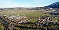
 Halblech Luftaufnahme (2019).jpg 4,056 × 3,040; 6.14 MB
-
 Halblech Luftaufnahme (2020).jpg 4,056 × 3,040; 4.99 MB
-
 Halblech Panorama Luftaufnahme (2019).jpg 4,056 × 2,094; 3.88 MB
-
 Halblech, Germany - panoramio (1).jpg 3,264 × 2,448; 1.25 MB
-
 Halblech, Germany - panoramio (27).jpg 4,963 × 3,456; 4.92 MB
-
 Halblech, Germany - panoramio (28).jpg 5,184 × 3,456; 3.08 MB
-
 Halblech, Germany - panoramio (29).jpg 5,184 × 3,456; 3.33 MB
-
 Halblech, Germany - panoramio (30).jpg 5,184 × 3,456; 2.58 MB
-
 Halblech, Germany - panoramio (31).jpg 5,184 × 3,456; 3.22 MB
-
 Halblech, Germany - panoramio.jpg 3,264 × 2,448; 1.62 MB
-
 Halblech.gif 200 × 226; 13 KB
-
 Halblech3.jpg 683 × 512; 63 KB
-
 Illasbergsee - geo.hlipp.de - 34147.jpg 640 × 480; 49 KB
-
 Kneippanlage Buching (Halblech).jpg 4,160 × 3,120; 7.61 MB
-
 Kühmoossee.jpg 4,032 × 3,024; 2.01 MB
-
 Nebellandschaft in Morgenröte.jpg 5,000 × 3,333; 1.99 MB
-
 Oberhalb von Buching - geo.hlipp.de - 34144.jpg 640 × 480; 55 KB
-
 Panoramatafel - panoramio.jpg 5,184 × 3,456; 2.96 MB
-
 Peterskapelle Luftaufnahme (2019).jpg 4,056 × 3,040; 6.31 MB
-
 Wiese am Bannwaldsee - geo.hlipp.de - 20628.jpg 640 × 426; 87 KB
-
 Zwieselried - panoramio (1).jpg 5,184 × 3,456; 3.01 MB
-
 Zwieselried - panoramio.jpg 5,184 × 3,456; 3.7 MB


.jpg)


.jpg)
.jpg)
.jpg)
.jpg)
.jpg)
.jpg)
.jpg)
.jpg)


.jpg)


.jpg)

.jpg)
