Category:Weston Rhyn
Jump to navigation
Jump to search
English: Weston Rhyn is a large village and civil parish in Shropshire, England. It lies between the towns of Chirk, in Wales, and Oswestry, in England.
Polski: Weston Rhyn – wieś w Anglii, w hrabstwie Shropshire. Leży 32 km na północny zachód od miasta Shrewsbury i 255 km na północny zachód od Londynu.

village and civil parish in Shropshire, United Kingdom  | |||||
| Upload media | |||||
| Instance of | |||||
|---|---|---|---|---|---|
| Location | Shropshire, West Midlands, England | ||||
 | |||||
Subcategories
This category has the following 6 subcategories, out of 6 total.
B
- Bronygarth (7 F)
C
- Chirk Bank (27 F)
- Chirk Viaduct (17 F)
W
- Weston Rhyn railway station (2 F)
- Weston Rhyn War Memorial (1 F)
Media in category "Weston Rhyn"
The following 200 files are in this category, out of 374 total.
(previous page) (next page)-
-
-
 'Devon Maid No.2' - geograph.org.uk - 5398173.jpg 640 × 480; 340 KB
-
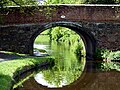
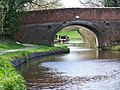
 'Emerald' passing under bridge 18W - geograph.org.uk - 5398160.jpg 640 × 480; 291 KB
-
 'Wey Otter' heading towards Chirk Bank - geograph.org.uk - 5398180.jpg 640 × 480; 307 KB
-
 A Free Churches Burial ground - geograph.org.uk - 3446289.jpg 1,600 × 1,200; 496 KB
-
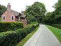
 A house called Eastwood - geograph.org.uk - 3459459.jpg 1,600 × 1,200; 477 KB
-
 A quiet way to Selattyn - geograph.org.uk - 3907351.jpg 640 × 480; 108 KB
-

-

-
 A5 south of Chirk - geograph.org.uk - 3134263.jpg 640 × 430; 58 KB
-
 A5 southbound at Moreton Bridge - geograph.org.uk - 3951538.jpg 640 × 480; 50 KB
-
 Abandoned tractor at Bronygarth - geograph.org.uk - 6199450.jpg 1,024 × 768; 301 KB
-
 Across Chirk Bridge towards Chirk - geograph.org.uk - 4285076.jpg 800 × 548; 165 KB
-
 Afon Ceiriog - geograph.org.uk - 4473095.jpg 640 × 426; 67 KB
-
 Afon Ceiriog at Chirk Bank - geograph.org.uk - 5856549.jpg 4,000 × 3,000; 2.88 MB
-
 Afon Ceiriog at Pont-Faen - geograph.org.uk - 5803951.jpg 5,184 × 3,888; 5.93 MB
-
 Albert Square, Weston Rhyn - geograph.org.uk - 4208163.jpg 800 × 457; 84 KB
-
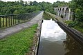
 Approach to the aqueduct - geograph.org.uk - 544468.jpg 573 × 433; 115 KB
-
 Aqueduct - geograph.org.uk - 5178297.jpg 1,024 × 683; 175 KB
-
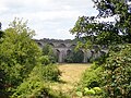
 Aqueduct and viaduct near Chirk - geograph.org.uk - 4860827.jpg 1,280 × 863; 878 KB
-
 Aqueduct and viaduct near Chirk, Shropshire - geograph.org.uk - 4860787.jpg 1,280 × 960; 900 KB
-
 Aqueduct and viaduct near Chirk, Shropshire - geograph.org.uk - 4860801.jpg 1,280 × 880; 850 KB
-
 Aqueduct, viaduct and tunnel near Chirk - geograph.org.uk - 4860823.jpg 1,280 × 933; 1.02 MB
-
 B5070 Chirk Road looking north - geograph.org.uk - 3959202.jpg 640 × 480; 52 KB
-
 B5070 passes The Bridge Inn - geograph.org.uk - 3697718.jpg 3,654 × 2,659; 1.63 MB
-
 Barn at Fron Isaf - geograph.org.uk - 5803233.jpg 5,184 × 3,888; 5.05 MB
-
 Bet that's not used much these days. - geograph.org.uk - 1816696.jpg 640 × 480; 175 KB
-

-
 Boating on the Llangollen Canal, at Gledrid - geograph.org.uk - 5856542.jpg 4,000 × 3,000; 2.86 MB
-
 Brick built villa with a great view - geograph.org.uk - 3446612.jpg 1,600 × 1,200; 530 KB
-
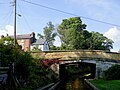
 Bridge 17W over the Llangollen Canal - geograph.org.uk - 5397342.jpg 640 × 480; 217 KB
-
 Bridge 17W, Llangollen Canal - geograph.org.uk - 4296729.jpg 3,264 × 2,448; 3.58 MB
-
 Bridge 18W, Llangollen Canal - geograph.org.uk - 4296730.jpg 3,264 × 2,448; 3.41 MB
-
 Bridge 19W on the Llangollen Canal - geograph.org.uk - 5397347.jpg 640 × 480; 280 KB
-
 Bridge 19W, Llangollen Canal - geograph.org.uk - 4296731.jpg 3,264 × 2,448; 3.67 MB
-
 Bridge at Pen-y-bont - geograph.org.uk - 3459492.jpg 1,600 × 1,200; 793 KB
-
 Bridge Inn Chirk - geograph.org.uk - 2153596.jpg 640 × 480; 94 KB
-

-
 Bridge ^ stream - geograph.org.uk - 1816691.jpg 640 × 480; 163 KB
-
 Bridle way heading north - geograph.org.uk - 3462369.jpg 1,600 × 1,200; 665 KB
-
 Bridleway to Offa's Dyke - geograph.org.uk - 5803240.jpg 5,184 × 3,888; 5.4 MB
-
 Bronygarth Road houses, Weston Rhyn - geograph.org.uk - 4208124.jpg 800 × 532; 100 KB
-
 Brookfields houses, Weston Rhyn - geograph.org.uk - 4208598.jpg 800 × 501; 125 KB
-
 Brookfields, Weston Rhyn - geograph.org.uk - 4208173.jpg 800 × 613; 135 KB
-
 Canal boats near Gledrid - geograph.org.uk - 5803940.jpg 5,184 × 3,888; 5.8 MB
-
 Canal View houses, Chirk Bank - geograph.org.uk - 4287395.jpg 800 × 586; 136 KB
-

-

-

-
 Canalside pasture north of Rhoswiel, Shropshire - geograph.org.uk - 5458370.jpg 1,280 × 894; 920 KB
-
 Canalside pasture north of Rhoswiel, Shropshire - geograph.org.uk - 5458376.jpg 1,280 × 931; 1,004 KB
-
 Cartref, on the canal towpath - geograph.org.uk - 4131495.jpg 2,000 × 1,500; 1.28 MB
-
 Cattle and the house at Fronheulog - geograph.org.uk - 3462393.jpg 1,600 × 1,200; 595 KB
-
 Celebrity in Weston Rhyn - geograph.org.uk - 4208160.jpg 625 × 800; 130 KB
-
 Chirk Aqueduct - geograph.org.uk - 4731612.jpg 640 × 428; 97 KB
-
 Chirk Aqueduct - geograph.org.uk - 5856548.jpg 4,000 × 3,000; 2.91 MB
-
 Chirk Aqueduct an Railway Viaduct - geograph.org.uk - 5464457.jpg 1,600 × 1,200; 470 KB
-
 Chirk Aqueduct and rail bridge - geograph.org.uk - 5394659.jpg 3,720 × 2,793; 5.81 MB
-
 Chirk Aqueduct and rail bridge - geograph.org.uk - 5394663.jpg 3,720 × 2,793; 5.53 MB
-
 Chirk aqueduct and railway viaduct - geograph.org.uk - 5397068.jpg 640 × 480; 235 KB
-
 Chirk aqueduct and viaduct, Shropshire - geograph.org.uk - 4678772.jpg 1,280 × 908; 840 KB
-
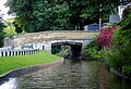
 Chirk Bank Bridge - geograph.org.uk - 5398166.jpg 640 × 480; 291 KB
-
 Chirk Bank, canal - geograph.org.uk - 5490322.jpg 1,024 × 768; 194 KB
-
 Chirk Bank, welcome sign - geograph.org.uk - 5490317.jpg 1,024 × 767; 226 KB
-
 Chirk Castle - geograph.org.uk - 5827299.jpg 4,000 × 3,000; 2.4 MB
-
 Chirk Castle above Bronygarth - geograph.org.uk - 710606.jpg 637 × 436; 54 KB
-
 Chirk Viaduct - geograph.org.uk - 5869128.jpg 1,280 × 851; 517 KB
-
 Chirk Viaduct through the trees - geograph.org.uk - 4933539.jpg 5,184 × 3,456; 6.37 MB
-
 Chirk Viaduct.jpg 1,024 × 768; 170 KB
-
 Chirkbank Bridge.jpg 800 × 600; 173 KB
-
 Chirkbank canal bridge - geograph.org.uk - 5803944.jpg 5,184 × 3,888; 3.88 MB
-
 Climbing out of Dirty Dingle, 1988 - geograph.org.uk - 5771964.jpg 1,024 × 683; 215 KB
-

-
 Cottage beside the Shropshire Union Canal - geograph.org.uk - 544466.jpg 640 × 480; 145 KB
-
 Cottage in the Ceiriog valley - geograph.org.uk - 4430942.jpg 640 × 480; 107 KB
-
 Cottages alongside the Llangollen Canal - geograph.org.uk - 4131446.jpg 2,000 × 1,500; 1.09 MB
-

-
 Converted chapel at Craignant - geograph.org.uk - 325766.jpg 640 × 480; 68 KB
-
-
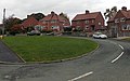
 Crossroads in Weston Rhyn - geograph.org.uk - 4245755.jpg 800 × 616; 164 KB
-
 Crossroads signpost in Weston Rhyn - geograph.org.uk - 4208271.jpg 800 × 631; 134 KB
-
 Descending towards Craignant - geograph.org.uk - 3451042.jpg 1,600 × 1,200; 439 KB
-

-
 East from Weston Rhyn crossroads - geograph.org.uk - 2153562.jpg 640 × 480; 101 KB
-

-

-

-
 End of the 30 zone in Weston Rhyn - geograph.org.uk - 4245930.jpg 800 × 608; 122 KB
-

-

-
 Essential maintenance - geograph.org.uk - 3449880.jpg 1,600 × 1,200; 544 KB
-
 Evening on the Llangollen Canal, south of Gledrid Bridge - geograph.org.uk - 3690002.jpg 1,600 × 1,200; 564 KB
-

-
 Farm buildings at Trehowell - geograph.org.uk - 5803935.jpg 5,184 × 3,888; 4.12 MB
-
 Farm track to Wern Farm - geograph.org.uk - 3459448.jpg 1,600 × 1,200; 371 KB
-

-
 Finger post, Weston Rhyn - geograph.org.uk - 3395424.jpg 640 × 480; 252 KB
-
 Floating souvenir shop - geograph.org.uk - 4131423.jpg 2,000 × 1,500; 1.31 MB
-
 Floodplain of the Afon Ceiriog - geograph.org.uk - 4468307.jpg 640 × 426; 54 KB
-
 Footpath across a grass field - geograph.org.uk - 3459485.jpg 1,600 × 1,200; 396 KB
-
 Footpath entering the old saw mill site, Weston Rhyn - geograph.org.uk - 4613524.jpg 2,048 × 1,536; 1.02 MB
-
 Fron Farm from the bridleway - geograph.org.uk - 3462358.jpg 1,600 × 1,200; 579 KB
-
 Garden Croft houses, Weston Rhyn - geograph.org.uk - 4208183.jpg 800 × 600; 108 KB
-
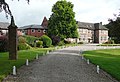
 Gateway and drive to Pentre Farm - geograph.org.uk - 5827283.jpg 4,000 × 3,000; 2.88 MB
-
 Geese landing on the Llangollen Canal - geograph.org.uk - 5398156.jpg 640 × 480; 309 KB
-
 Geese on the Llangollen Canal - geograph.org.uk - 5397353.jpg 480 × 640; 272 KB
-
 Glanaber Terrace, Weston Rhyn - geograph.org.uk - 4208127.jpg 800 × 703; 145 KB
-
 Gledrid Bridge near Chirk Bank, Shropshire - geograph.org.uk - 4852669.jpg 1,024 × 768; 764 KB
-
 Gledrid Bridge near Chirk Bank, Shropshire - geograph.org.uk - 4853893.jpg 1,024 × 768; 834 KB
-
 Gledrid Bridge near Chirk Bank, Shropshire - geograph.org.uk - 4853895.jpg 1,024 × 768; 681 KB
-
 Gledrid Bridge No. 19W, Llangollen Canal - geograph.org.uk - 2901943.jpg 640 × 480; 109 KB
-
 Gledrid Bridge on the Llangollen Canal - geograph.org.uk - 52011.jpg 640 × 480; 152 KB
-
 Gledrid Bridge, Llangollen Canal - geograph.org.uk - 5868988.jpg 1,280 × 851; 618 KB
-
 Gledrid geese a-grazing - geograph.org.uk - 4852678.jpg 1,024 × 725; 655 KB
-
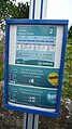 Gledrid Poachers Pocket bus stop timetable 2.JPG 2,088 × 3,712; 3.21 MB
-
 Gledrid Poachers Pocket bus stop timetable.JPG 2,088 × 3,712; 3.01 MB
-
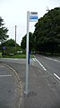 Gledrid Poachers Pocket bus stop.JPG 2,088 × 3,712; 3.33 MB
-
 Gledrid Poachers Pocket bus stops.JPG 3,712 × 2,088; 3.06 MB
-
 Gledrid Terrace - geograph.org.uk - 4892006.jpg 6,000 × 4,000; 4.28 MB
-

-
-
 Heading for Chirk - geograph.org.uk - 5397344.jpg 640 × 480; 275 KB
-
 Hedge-lined road out of Weston Rhyn - geograph.org.uk - 4245932.jpg 800 × 702; 213 KB
-
 High Street houses, Weston Rhyn - geograph.org.uk - 4208877.jpg 800 × 617; 118 KB
-
 Highfields, Quinta Terrace - geograph.org.uk - 4132947.jpg 2,000 × 1,523; 1.01 MB
-
 Holyhead 84 - geograph.org.uk - 4713703.jpg 1,024 × 683; 205 KB
-
 Holyhead 85 - geograph.org.uk - 4950892.jpg 1,024 × 768; 259 KB
-
 House surrounded by trees - geograph.org.uk - 3457927.jpg 1,600 × 1,200; 541 KB
-
 House, Upper Chirk Bank - geograph.org.uk - 4468303.jpg 640 × 426; 53 KB
-
 Houses and chapel, Weston Rhyn - geograph.org.uk - 4245937.jpg 800 × 708; 150 KB
-
 Houses at Top Fron - geograph.org.uk - 3462336.jpg 1,600 × 1,200; 615 KB
-
 Houses at Wern - geograph.org.uk - 3457965.jpg 1,600 × 1,200; 658 KB
-
 Houses in Pont-Faen - geograph.org.uk - 3446571.jpg 1,600 × 1,200; 509 KB
-
 Houses near Pentre Newydd - geograph.org.uk - 3462432.jpg 1,600 × 1,200; 511 KB
-
 Houses up the hill in Pont-Faen - geograph.org.uk - 3446582.jpg 1,600 × 1,200; 423 KB
-

-

-

-

-
 It's Snowdrop time of year - geograph.org.uk - 3907364.jpg 640 × 480; 125 KB
-
 Junction in Chirk Bank - geograph.org.uk - 4285025.jpg 800 × 653; 157 KB
-
 Junction of Bronygarth Road and High Street, Weston Rhyn - geograph.org.uk - 4130703.jpg 2,000 × 1,297; 793 KB
-

-

-
 Leaving Fron - geograph.org.uk - 3907355.jpg 640 × 480; 76 KB
-
 Level crossing at Weston Rhyn - geograph.org.uk - 3906982.jpg 640 × 448; 86 KB
-
 Llangollen Canal at Chirk Bank - geograph.org.uk - 1844662.jpg 640 × 480; 102 KB
-
 Llangollen Canal at Chirk Bank - geograph.org.uk - 2153592.jpg 600 × 450; 97 KB
-
 Llangollen Canal at Chirk Bank - geograph.org.uk - 52015.jpg 640 × 480; 131 KB
-
 Llangollen Canal at Chirk Bank - geograph.org.uk - 583045.jpg 528 × 640; 105 KB
-
 Llangollen Canal at Chirk Bank, Shropshire - geograph.org.uk - 4859424.jpg 1,280 × 810; 753 KB
-
 Llangollen Canal at Moreton Bridge - geograph.org.uk - 53713.jpg 640 × 480; 161 KB
-
 Llangollen canal at rear of Bridge Inn - geograph.org.uk - 2153588.jpg 640 × 480; 116 KB
-
 Llangollen Canal at Rhoswiel, Shropshire - geograph.org.uk - 4852524.jpg 1,024 × 768; 662 KB
-
 Llangollen Canal from Monks Bridge 21 - geograph.org.uk - 3218584.jpg 1,387 × 2,115; 1.08 MB
-

-
 Llangollen Canal near Chirk Bank, Shropshire - geograph.org.uk - 4855690.jpg 1,280 × 858; 884 KB
-
 Llangollen Canal near Chirk Bank, Shropshire - geograph.org.uk - 4859365.jpg 960 × 1,280; 848 KB
-
 Llangollen Canal near Gledrid, Shropshire - geograph.org.uk - 4852618.jpg 1,024 × 723; 626 KB
-
 Llangollen Canal near Gledrid, Shropshire - geograph.org.uk - 4853918.jpg 1,280 × 934; 936 KB
-
 Llangollen Canal near Gledrid, Shropshire - geograph.org.uk - 4853921.jpg 1,280 × 940; 1.06 MB
-
 Llangollen Canal near Gledrid, Shropshire - geograph.org.uk - 4853933.jpg 1,280 × 960; 830 KB
-
 Llangollen Canal near Weston Rhyn, Shropshire - geograph.org.uk - 4852490.jpg 1,280 × 960; 1.02 MB
-
 Llangollen Canal north of Preesgweene, Shropshire - geograph.org.uk - 5458506.jpg 937 × 1,280; 1.13 MB
-
 Llangollen Canal north of Preesgweene, Shropshire - geograph.org.uk - 5458531.jpg 1,280 × 960; 1.14 MB
-
 Llangollen Canal north of Rhoswiel, Shropshire - geograph.org.uk - 4852583.jpg 1,280 × 883; 766 KB
-

-
 Llangollen Canal, Chirk Bank - geograph.org.uk - 5948949.jpg 1,280 × 851; 466 KB
-
 Llangollen Canal, Rhoswiel - geograph.org.uk - 130758.jpg 640 × 429; 92 KB
-
 Llwybr Ceiriog - geograph.org.uk - 5805413.jpg 3,888 × 5,184; 6.7 MB
-
 Looking back towards Bronygarth - geograph.org.uk - 3449921.jpg 1,600 × 1,200; 386 KB
-
 Looking down the hill in Pont-Faen - geograph.org.uk - 3446603.jpg 1,600 × 1,200; 631 KB
-

-
 Microwave aerial near Fronheulog - geograph.org.uk - 3462410.jpg 4,608 × 3,456; 6.13 MB
-
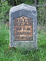
 Milestone at NGR SJ 2955 3707.jpg 917 × 1,375; 354 KB
-
 Milestone at NGR SJ 29977 35737.jpg 768 × 1,024; 355 KB
-
 Miller's Stores, Weston Rhyn - geograph.org.uk - 4208116.jpg 800 × 750; 154 KB
-
 Minor road north of Mount Wood - geograph.org.uk - 5803549.jpg 5,184 × 3,888; 5.52 MB
-

-
 Monks Bridge near Chirk Bank, Shropshire - geograph.org.uk - 4860294.jpg 1,280 × 877; 871 KB
-
 Monks Bridge near Chirk Bank, Shropshire - geograph.org.uk - 4860296.jpg 1,280 × 960; 915 KB
-
 Monks Bridge No. 21W, Llangollen Canal - geograph.org.uk - 2901933.jpg 640 × 480; 104 KB
-
 Monks Bridge south of Chirk, Wrexham - geograph.org.uk - 5458347.jpg 1,280 × 877; 1.07 MB
-
 Moo you looking at^ Weston Rhyn - geograph.org.uk - 4403926.jpg 800 × 559; 167 KB
-
 Moored narrowboats near Rhoswiel, Shropshire - geograph.org.uk - 4678705.jpg 1,024 × 708; 458 KB
-
 Moored narrowboats north of Rhoswiel, Shropshire - geograph.org.uk - 4852594.jpg 960 × 1,280; 1,013 KB
-
 Moreton Bridge south-east of Preesgweene, Shropshire - geograph.org.uk - 5458584.jpg 1,280 × 960; 1.14 MB
-
 Moreton Hall, Weston Rhyn.jpg 2,828 × 1,932; 1.82 MB
-
 Moreton-Hall.jpg 250 × 181; 15 KB
-

-
 Narrowboat on Chirk Aqueduct - geograph.org.uk - 4731611.jpg 640 × 480; 63 KB
-
 Narrowboat south of Chirk Aqueduct, Shropshire - geograph.org.uk - 4860333.jpg 1,024 × 768; 727 KB
-
 Narrowboats near Chirk Bank, Shropshire - geograph.org.uk - 4859376.jpg 1,024 × 768; 694 KB
-
 Nicholson of Newark - geograph.org.uk - 3604104.jpg 3,456 × 2,592; 2.19 MB
-
 Not so level crossing - geograph.org.uk - 1820778.jpg 640 × 480; 136 KB
-
 NW boundary of Weston Rhyn - geograph.org.uk - 4245927.jpg 800 × 613; 189 KB
-
 Oaklands Road, Chirk Bank - geograph.org.uk - 4286871.jpg 800 × 671; 139 KB
-
 Oaklands Road, Chirk Bank, from Quinta Terrace - geograph.org.uk - 4133159.jpg 2,000 × 1,372; 883 KB
-
 Offa's Dyke - down then up again - geograph.org.uk - 3907344.jpg 457 × 640; 131 KB
.jpg)
_heading_for_Chirk_-_geograph.org.uk_-_5398163.jpg)


_approaching_Gledrid_roundabout_-_geograph.org.uk_-_2248869.jpg)
_at_the_Llangollen_Canal_bridge_-_geograph.org.uk_-_2248865.jpg)


_Weston_Rhyn_-_geograph.org.uk_-_4208129.jpg)


