Category:Westruther (civil parish)
Jump to navigation
Jump to search
Scottish parish in Scottish Borders, Scotland, UK | |||||
| Upload media | |||||
| Instance of | |||||
|---|---|---|---|---|---|
| Part of |
| ||||
| Named after | |||||
| Location |
| ||||
| Population |
| ||||
| Area |
| ||||
 | |||||
Media in category "Westruther (civil parish)"
The following 200 files are in this category, out of 419 total.
(previous page) (next page)-
 "It could be anywhere" - geograph.org.uk - 6684590.jpg 1,024 × 683; 150 KB
-
 A beech on Corsbie Moor - geograph.org.uk - 6304703.jpg 1,024 × 1,024; 654 KB
-
 A blessed view on Harecleugh Hill - geograph.org.uk - 6680682.jpg 3,128 × 2,346; 1.87 MB
-
 A field by Raecleugh - geograph.org.uk - 2564281.jpg 640 × 359; 181 KB
-

-
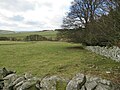
 A large field by Westruther - geograph.org.uk - 2564260.jpg 640 × 359; 222 KB
-
 A rough corner, Thornydykes - geograph.org.uk - 6683855.jpg 1,024 × 683; 259 KB
-
 A snow-covered track in Harecleugh Forest - geograph.org.uk - 6733125.jpg 1,600 × 1,200; 266 KB
-
 A trough and a tree 'sans' beasts in the Scottish Borders - geograph.org.uk - 6404179.jpg 3,128 × 2,346; 2.24 MB
-
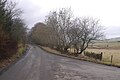
 A6089 - geograph.org.uk - 6708345.jpg 1,024 × 683; 144 KB
-

-

-
 A6089 near Whiteburn - geograph.org.uk - 4007301.jpg 1,600 × 1,200; 621 KB
-
 A697 beside Houndslow Wood - geograph.org.uk - 5409394.jpg 640 × 480; 61 KB
-
 A697 towards Coldstream - geograph.org.uk - 5408142.jpg 640 × 480; 113 KB
-
 A697 towards Greenlaw - geograph.org.uk - 5409390.jpg 640 × 480; 53 KB
-
 A697 towards Lauder - geograph.org.uk - 5409401.jpg 640 × 480; 56 KB
-
 A697 west of Houndslow - geograph.org.uk - 6223691.jpg 1,024 × 683; 276 KB
-
 A697, Hexpath - geograph.org.uk - 5409405.jpg 640 × 480; 66 KB
-
 A697, Hexpath - geograph.org.uk - 6078512.jpg 1,024 × 683; 228 KB
-
 A697, Houndslow - geograph.org.uk - 5402239.jpg 2,848 × 2,136; 1.36 MB
-
 A697, Houndslow - geograph.org.uk - 5408349.jpg 640 × 442; 46 KB
-
 A697, Houndslow - geograph.org.uk - 6223690.jpg 1,024 × 683; 302 KB
-
 A697, Whiteburn - geograph.org.uk - 5408127.jpg 640 × 480; 121 KB
-
 Across the Brunta Burn - geograph.org.uk - 5284281.jpg 1,024 × 683; 276 KB
-
 Along the Brunta Burn - geograph.org.uk - 2557606.jpg 640 × 359; 231 KB
-
 An angel on a muckpile on Bassendeanhill - geograph.org.uk - 6404783.jpg 5,184 × 3,888; 4.68 MB
-
 An old dyke - geograph.org.uk - 5283964.jpg 1,024 × 683; 536 KB
-
 An old tree at Brunta Burn - geograph.org.uk - 2758893.jpg 427 × 640; 183 KB
-
 Approaching the forest edge - geograph.org.uk - 6733107.jpg 1,600 × 1,200; 452 KB
-
 Approaching warm front - geograph.org.uk - 2752871.jpg 640 × 360; 159 KB
-
 Arable land westwards near Westruther - geograph.org.uk - 6276748.jpg 5,184 × 3,888; 6.31 MB
-
 Autumn ploughing near Hindside Hill - geograph.org.uk - 973921.jpg 640 × 480; 91 KB
-
 B6456 - geograph.org.uk - 6683640.jpg 1,024 × 683; 312 KB
-
 B6456 near Thornydykes - geograph.org.uk - 4007279.jpg 1,600 × 1,200; 202 KB
-
 B6456 near Thornydykes - geograph.org.uk - 4007282.jpg 1,600 × 1,200; 399 KB
-
 B6456 near Westruther - geograph.org.uk - 4007277.jpg 1,600 × 1,200; 381 KB
-
 B6456 through Thornydykes - geograph.org.uk - 3437608.jpg 4,608 × 3,456; 6.44 MB
-
 B6456 to Duns - geograph.org.uk - 4007298.jpg 1,600 × 1,200; 610 KB
-
 B6456 towards Westruther - geograph.org.uk - 5408140.jpg 640 × 480; 124 KB
-
 B6456 towards Westruther - geograph.org.uk - 5408152.jpg 640 × 480; 99 KB
-
 B6456 towards Westruther - geograph.org.uk - 5408210.jpg 640 × 480; 132 KB
-
 B6456, Howlet's Ha' - geograph.org.uk - 5408195.jpg 640 × 480; 60 KB
-
 B6456, Thornydykes - geograph.org.uk - 5408180.jpg 640 × 480; 115 KB
-
 B6456, Westruther - geograph.org.uk - 5408329.jpg 640 × 480; 67 KB
-
 B6456, Westruther - geograph.org.uk - 6684068.jpg 1,024 × 683; 228 KB
-
 Bales on Hare Law near Greenlaw in the Scottish Borders - geograph.org.uk - 6275877.jpg 5,184 × 3,888; 6.67 MB
-

-

-

-
 Barley stubble at Whiteburn - geograph.org.uk - 973901.jpg 640 × 480; 80 KB
-
 Barley stubble near Brownshall - geograph.org.uk - 973934.jpg 640 × 480; 88 KB
-
 Bassendean - geograph.org.uk - 6223528.jpg 1,024 × 683; 238 KB
-
 Bassendean House - geograph.org.uk - 973973.jpg 640 × 480; 67 KB
-
 Bassendeanhill - geograph.org.uk - 6404747.jpg 5,184 × 3,888; 7.77 MB
-
 Bassendeanhill strip near Gordon - geograph.org.uk - 6404079.jpg 3,128 × 2,346; 2.51 MB
-

-
 Beeches, Spottiswoode - geograph.org.uk - 2752813.jpg 640 × 360; 251 KB
-

-
 Blythe to Cambridge road - geograph.org.uk - 5283969.jpg 1,024 × 683; 346 KB
-
 Boondreigh Burn course on Harecleugh Hill - geograph.org.uk - 6680783.jpg 3,128 × 2,346; 1.38 MB
-

-
-
 Bound for Area 51, aborted near Westruther - geograph.org.uk - 6276736.jpg 3,128 × 2,346; 2.37 MB
-
 Bridge, Westruther Mains - geograph.org.uk - 6276718.jpg 5,184 × 3,888; 6.81 MB
-
 Brunta Burn - geograph.org.uk - 2552259.jpg 640 × 480; 304 KB
-
 Brunta burnside trees near Pyatshaw in the Scottish Borders - geograph.org.uk - 6407795.jpg 5,184 × 3,888; 6.12 MB
-
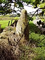 Bruntaburn Mill Standing Stone - geograph.org.uk - 905444.jpg 480 × 640; 155 KB
-

-
 By the Way... - geograph.org.uk - 6720731.jpg 1,600 × 1,200; 531 KB
-
 Bypassing Crawlaw - geograph.org.uk - 3291945.jpg 640 × 360; 190 KB
-
 Cairn on Harecleugh Hill - geograph.org.uk - 6681331.jpg 3,128 × 2,346; 2.41 MB
-

-
-
 Cattle grid and barley, Westruther - geograph.org.uk - 2564270.jpg 640 × 359; 233 KB
-
 Cattle, Wedderlie - geograph.org.uk - 6684091.jpg 1,024 × 683; 137 KB
-
 Change of surface - change of vehicle in Harecleugh Forest - geograph.org.uk - 6680591.jpg 3,128 × 2,346; 2.58 MB
-
 Church at Bassendean - geograph.org.uk - 974348.jpg 640 × 480; 53 KB
-
 Close up, Elizabethan postbox, Houndslow - geograph.org.uk - 5402237.jpg 1,151 × 1,949; 515 KB
-
 Complex minor junction near Pyatshaw in the Scottish Borders - geograph.org.uk - 6407763.jpg 3,128 × 2,346; 2.92 MB
-
 Construction traffic - geograph.org.uk - 3084003.jpg 640 × 360; 206 KB
-
 Contractor's car park - geograph.org.uk - 3291952.jpg 640 × 360; 190 KB
-
 Corbie Moor - geograph.org.uk - 6707884.jpg 1,024 × 683; 170 KB
-

-

-
 Corsbie Moor - geograph.org.uk - 6304697.jpg 1,024 × 576; 274 KB
-
 Corsbie Moor - geograph.org.uk - 6304698.jpg 1,024 × 576; 280 KB
-
 Cottage on the A697, Houndslow - geograph.org.uk - 5408352.jpg 640 × 480; 58 KB
-
 Country road and summer sun at Bassendean - geograph.org.uk - 5047215.jpg 1,024 × 682; 259 KB
-
 Crawlaw bypass - geograph.org.uk - 3083982.jpg 640 × 360; 190 KB
-

-

-

-
 Dilapidated ducking stool on Harecleugh Hill - geograph.org.uk - 6680743.jpg 3,128 × 2,346; 2.08 MB
-

-
 Disused pit on Harecleugh Hill - geograph.org.uk - 6681133.jpg 3,128 × 2,346; 2.19 MB
-

-
 Downstream view off Westruther Mains bridge - geograph.org.uk - 6276722.jpg 3,128 × 2,346; 2.58 MB
-

-
 Driveway, Jordanlaw - geograph.org.uk - 6683859.jpg 1,024 × 683; 352 KB
-
 Drystane dyke stile near Westruther in the Scottish Borders - geograph.org.uk - 6276742.jpg 3,128 × 2,346; 2.87 MB
-
 Dyke, Twin Law - geograph.org.uk - 6684554.jpg 1,024 × 683; 168 KB
-
 Dyke, Twin Law - geograph.org.uk - 6684555.jpg 1,024 × 683; 145 KB
-

-

-
 East gate to Bassendean House - geograph.org.uk - 938725.jpg 640 × 480; 120 KB
-
 Easter Bassendean Farm - geograph.org.uk - 1820961.jpg 640 × 413; 126 KB
-

-
 Electronically fenced horse grazing on Bassendeanhill - geograph.org.uk - 6404744.jpg 5,184 × 3,888; 6.79 MB
-
 Elizabethan postbox, Houndslow - geograph.org.uk - 5402233.jpg 1,304 × 866; 283 KB
-
 End of a very short quad track in Harecleugh Forest - geograph.org.uk - 6697578.jpg 3,128 × 2,346; 2.02 MB
-

-
 Entering Thorneydykes - geograph.org.uk - 5408170.jpg 640 × 480; 110 KB
-
 Entering Westruther - geograph.org.uk - 5408303.jpg 640 × 480; 95 KB
-
 Entrance and cottage at Broomiebank - geograph.org.uk - 1458631.jpg 640 × 480; 73 KB
-
-
 Estate road, Spottiswoode - geograph.org.uk - 4007290.jpg 1,600 × 1,200; 645 KB
-
 Evelaw fields - geograph.org.uk - 2848479.jpg 640 × 360; 202 KB
-
 Farm buildings off the B6456 - geograph.org.uk - 5408134.jpg 640 × 480; 95 KB
-
 Farm buildings, Broomiebank - geograph.org.uk - 5408338.jpg 640 × 480; 46 KB
-
 Farm road leading off the B6456 - geograph.org.uk - 1131995.jpg 640 × 480; 141 KB
-
 Farm road, Wedderlie - geograph.org.uk - 3083974.jpg 640 × 360; 192 KB
-
 Farm track - geograph.org.uk - 3083959.jpg 640 × 360; 199 KB
-
 Farmland at Bassendean - geograph.org.uk - 1821001.jpg 427 × 640; 163 KB
-
 Farmland at Bassendean - geograph.org.uk - 4007249.jpg 1,600 × 1,200; 340 KB
-
 Farmland at Bruntaburn - geograph.org.uk - 5042475.jpg 1,024 × 682; 192 KB
-
 Farmland at Hindside Hill - geograph.org.uk - 973925.jpg 640 × 480; 93 KB
-
 Farmlands on Corsbie Moor - geograph.org.uk - 1838344.jpg 640 × 480; 51 KB
-
 Feeding the Boondreigh Burn - geograph.org.uk - 6733131.jpg 1,600 × 1,200; 370 KB
-

-
 Field at Bassendeanhill near Gordon in the Scottish Borders - geograph.org.uk - 6388284.jpg 5,184 × 3,888; 4.88 MB
-
 Field boundary on Bassendeanhill - geograph.org.uk - 6404779.jpg 5,184 × 3,888; 6.67 MB
-
 Field by the Brunta Burn - geograph.org.uk - 5284280.jpg 1,024 × 683; 419 KB
-
 Field entrance near Boomiebank - geograph.org.uk - 5408336.jpg 640 × 480; 79 KB
-
 Field entrance off the B6456 - geograph.org.uk - 5408157.jpg 640 × 414; 70 KB
-
 Field opposite Howlet's Ha' - geograph.org.uk - 6683857.jpg 1,024 × 683; 135 KB
-

-
 Field won from the moor - geograph.org.uk - 3083963.jpg 640 × 360; 193 KB
-
 Fields at Pyatshaw - geograph.org.uk - 2360173.jpg 640 × 480; 75 KB
-
 Fields near Spottiswoode Loch - geograph.org.uk - 1104134.jpg 640 × 480; 78 KB
-

-
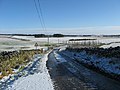
 Flass snowscape - geograph.org.uk - 6733138.jpg 1,600 × 1,200; 175 KB
-
 Flight pool - geograph.org.uk - 2752852.jpg 640 × 360; 224 KB
-
 Forest break on Harecleugh Hill - geograph.org.uk - 6680717.jpg 3,128 × 2,346; 2.24 MB
-

-

-

-
 Forest ride with vestigial track in Harecleugh Forest - geograph.org.uk - 6680615.jpg 3,128 × 2,346; 2.05 MB
-

-
 Gate and fence - geograph.org.uk - 3083540.jpg 640 × 360; 205 KB
-
 Gate in the Scottish Borders - geograph.org.uk - 6404141.jpg 3,128 × 2,346; 2.7 MB
-
 Gate latch - geograph.org.uk - 2757092.jpg 640 × 360; 239 KB
-
 Gate on Harelaw Moor near Greenlaw in the Scottish Borders - geograph.org.uk - 6275906.jpg 5,184 × 3,888; 5.84 MB
-
 Gates, Hyndberry - geograph.org.uk - 2757083.jpg 640 × 360; 197 KB
-
 Gateway to Houndslow on the A697 near Greenlaw - geograph.org.uk - 6404777.jpg 5,184 × 3,888; 5.65 MB
-

-
 George VI postbox, Westruther - geograph.org.uk - 5402245.jpg 1,230 × 2,500; 617 KB
-

-
 Grass field, Raecleugh - geograph.org.uk - 5284282.jpg 1,024 × 683; 287 KB
-
 Grassland, Houndslow - geograph.org.uk - 5408343.jpg 640 × 557; 58 KB
-
 Graveyard, Westruther Old Kirk - geograph.org.uk - 5408327.jpg 640 × 480; 82 KB
-
 Grazing beside woodland, Westertoun - geograph.org.uk - 5408211.jpg 640 × 480; 55 KB
-
 Grazing land at Hynsidehill Farm - geograph.org.uk - 1838356.jpg 640 × 480; 55 KB
-
 Grazing near Morven - geograph.org.uk - 5408198.jpg 640 × 480; 70 KB
-
 Grazing off the B6456 - geograph.org.uk - 5408137.jpg 640 × 480; 60 KB
-
 Grazing off the B6456 - geograph.org.uk - 5408147.jpg 640 × 480; 50 KB
-
 Grazing south east of Houndslow - geograph.org.uk - 5408357.jpg 640 × 480; 64 KB
-
 Grazing, Houndslow - geograph.org.uk - 5408347.jpg 640 × 480; 69 KB
-
 Grazing, Thornydykes - geograph.org.uk - 5408172.jpg 640 × 480; 65 KB
-
 Grazing, Westertoun - geograph.org.uk - 5408300.jpg 640 × 480; 42 KB
-
 Grazing, Whiteburn - geograph.org.uk - 5408125.jpg 640 × 480; 57 KB
-
 Hare Law - geograph.org.uk - 2752859.jpg 640 × 360; 183 KB
-

-
 Harecleugh Forest track north of crossroads - geograph.org.uk - 6395180.jpg 5,184 × 3,888; 5.64 MB
-
 Harecleugh track in a snow shower in the Scottish Borders - geograph.org.uk - 6394965.jpg 5,184 × 3,888; 5.57 MB
-

-
 Harvest at Bassendean - geograph.org.uk - 974561.jpg 640 × 480; 62 KB
-
 Heading north east on the B6456 - geograph.org.uk - 5408162.jpg 640 × 480; 119 KB
-
 Hedgeline on Bassendeanhill in the Scottish Borders - geograph.org.uk - 6404105.jpg 3,128 × 2,346; 2.66 MB
-
 Hexpath picnic area - geograph.org.uk - 5409402.jpg 640 × 480; 88 KB
-
 Hillside grazing near Boomiebank - geograph.org.uk - 5408333.jpg 640 × 480; 46 KB
-
 Horse grazing on stubble on Bassendeanhill - geograph.org.uk - 6404761.jpg 5,184 × 3,888; 6.65 MB
-
 Houndslow - geograph.org.uk - 6223686.jpg 1,024 × 683; 320 KB
-
 Houndslow Strip - geograph.org.uk - 2752976.jpg 640 × 360; 203 KB
-
 House in Westruther - geograph.org.uk - 5402251.jpg 640 × 480; 71 KB
-
 Houses on the A697, Houndslow - geograph.org.uk - 5408354.jpg 640 × 480; 57 KB
-
 Houses, Thornydykes - geograph.org.uk - 5408166.jpg 640 × 480; 66 KB
-

-
 Inside the fight - geograph.org.uk - 2752837.jpg 640 × 480; 341 KB
-
 Inside the remains of Bassendean Kirk - geograph.org.uk - 1820991.jpg 640 × 427; 157 KB
-
 Junction at Houndslow - geograph.org.uk - 1458622.jpg 640 × 539; 57 KB
-
 Junction of the B6456 and A697 - geograph.org.uk - 4007295.jpg 1,600 × 1,200; 410 KB
-
 King George V Post Box - geograph.org.uk - 1194320.jpg 640 × 427; 116 KB
-
 Lammermuir moorland - geograph.org.uk - 3083530.jpg 640 × 360; 206 KB
-
 Lammermuir moorland - geograph.org.uk - 3083537.jpg 640 × 360; 205 KB
-
 Lammermuir moorland - geograph.org.uk - 3083545.jpg 640 × 360; 209 KB
-
 Lammermuir moorland - geograph.org.uk - 3092342.jpg 640 × 360; 230 KB
-
 Left turn at junction in Harecleugh Forest - geograph.org.uk - 6681112.jpg 3,128 × 2,346; 1.8 MB
-
 Looking up the course of Harecleugh Burn - geograph.org.uk - 6680606.jpg 3,128 × 2,346; 2.06 MB
-
 Mid-winter, mid-afternoon - geograph.org.uk - 6733134.jpg 1,200 × 1,600; 724 KB


&filefrom=Midden%2C+Crawlaw+-+geograph.org.uk+-+3083993.jpg#mw-category-media)