Category:Westvlietweg 123, Leidschendam
Jump to navigation
Jump to search
| Object location | | View all coordinates using: OpenStreetMap |
|---|
 | |||||
| Upload media | |||||
| Instance of | |||||
|---|---|---|---|---|---|
| Location | Leidschendam, Leidschendam-Voorburg, South Holland, Netherlands | ||||
| Street address |
| ||||
| Located on street |
| ||||
| Heritage designation |
| ||||
 | |||||
Nederlands: Vliet en Hove
|
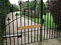
This is a category about rijksmonument number 510320
|
| Address |
|
Media in category "Westvlietweg 123, Leidschendam"
The following 3 files are in this category, out of 3 total.
-
 Leidschendam - Vliet en Hove - tuinhek RM 510320.jpg 3,648 × 2,736; 6.09 MB
-
 Leidschendam - Westvlietweg 123 - Vliet en Hove RM 510320.jpg 2,736 × 3,648; 4.95 MB
-


