Category:Wetlands in North Lanarkshire
Jump to navigation
Jump to search
Council areas (municipalities) of Scotland: Aberdeen · Aberdeenshire · Angus · Argyll and Bute · Clackmannanshire · Dumfries and Galloway · East Ayrshire · East Dunbartonshire · East Lothian · East Renfrewshire · Falkirk · Fife · Highland · Inverclyde · Midlothian · Moray · North Lanarkshire · Perth and Kinross · Renfrewshire · Scottish Borders · South Ayrshire · South Lanarkshire · West Dunbartonshire · West Lothian
Media in category "Wetlands in North Lanarkshire"
The following 35 files are in this category, out of 35 total.
-
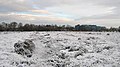 Abronhill Peat Bog - geograph.org.uk - 1625248.jpg 640 × 360; 69 KB
-
 Bog and bing - geograph.org.uk - 325288.jpg 480 × 640; 74 KB
-
 Bog and Bracken - geograph.org.uk - 1716119.jpg 1,024 × 768; 646 KB
-

-
 Bog Beside Avon Water - geograph.org.uk - 147362.jpg 640 × 480; 168 KB
-
 Bog off Forestfield Road - geograph.org.uk - 1075175.jpg 640 × 359; 80 KB
-
 Bogs, Easterton - geograph.org.uk - 1492647.jpg 640 × 480; 136 KB
-
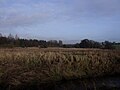
 Bulrush Marsh - geograph.org.uk - 123483.jpg 640 × 447; 127 KB
-
 Chapelton Haugh - geograph.org.uk - 1538515.jpg 640 × 480; 82 KB
-
 Cotton Grass and Peat Bog - geograph.org.uk - 474144.jpg 640 × 480; 116 KB
-
 Depression in the field - geograph.org.uk - 1613192.jpg 640 × 480; 90 KB
-
 Emerald Green Bog at Gray Mare - geograph.org.uk - 162105.jpg 640 × 480; 174 KB
-
 Flood Plain, Luggie Water. - geograph.org.uk - 1613197.jpg 640 × 480; 51 KB
-
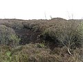
 Gorse, bog and hill - geograph.org.uk - 1716318.jpg 1,024 × 768; 640 KB
-
 Heathfield Marshland - geograph.org.uk - 123489.jpg 640 × 455; 104 KB
-
 Laigh boggy ground - geograph.org.uk - 1716106.jpg 1,024 × 768; 610 KB
-
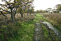 Little used track, Blackrig - geograph.org.uk - 1516073.jpg 640 × 427; 125 KB
-
 Little used track, Blackrig - geograph.org.uk - 1516080.jpg 640 × 427; 116 KB
-
 Marsh in a Valley - geograph.org.uk - 1752461.jpg 1,024 × 768; 672 KB
-

-
 Marshy area north of Blackhill - geograph.org.uk - 1307683.jpg 640 × 480; 79 KB
-
 Peat Bog and Cotton Grass - geograph.org.uk - 474154.jpg 640 × 480; 102 KB
-
 Raised bog, Shotts - geograph.org.uk - 1269514.jpg 640 × 480; 104 KB
-
 Rough grassland by Roughdike - geograph.org.uk - 1219890.jpg 640 × 480; 98 KB
-
 Rough grazing near Jersay - geograph.org.uk - 1219529.jpg 640 × 359; 65 KB
-
 Rough grazing, Caldercruix - geograph.org.uk - 1293236.jpg 640 × 480; 98 KB
-
 Rough grazing, Salsburgh - geograph.org.uk - 1515987.jpg 640 × 427; 72 KB
-
 Roughrigg - geograph.org.uk - 1492440.jpg 640 × 447; 122 KB
-
 Sheep by Penty - geograph.org.uk - 1219504.jpg 640 × 480; 124 KB
-
 Small wetland - geograph.org.uk - 1396368.jpg 640 × 480; 132 KB
-
 The First Lamb - geograph.org.uk - 1762817.jpg 1,024 × 768; 685 KB
-
 Wet farmland, West Badallan - geograph.org.uk - 1131487.jpg 640 × 480; 100 KB
-
 Wet field, Blackrig - geograph.org.uk - 1516067.jpg 640 × 426; 85 KB
-
 Wet fields, Penty - geograph.org.uk - 327203.jpg 640 × 480; 59 KB
-
 Wetland flowers, Caldercruix - geograph.org.uk - 1074283.jpg 640 × 480; 101 KB


