Category:Wheatley Hill
Jump to navigation
Jump to search
English: Wheatley Hill is a village in County Durham, in England. It is situated to the west of Peterlee, near Thornley and Wingate.
village and civil parish in County Durham, United Kingdom  | |||||
| Upload media | |||||
| Instance of | |||||
|---|---|---|---|---|---|
| Location | County Durham, North East England, England | ||||
 | |||||
Subcategories
This category has the following 2 subcategories, out of 2 total.
O
- Old Wingate (2 F)
W
- Wingate Quarry (4 F)
Media in category "Wheatley Hill"
The following 37 files are in this category, out of 37 total.
-

-
 A181 eastbound - geograph.org.uk - 5631466.jpg 640 × 480; 85 KB
-
 A181 lay-by - geograph.org.uk - 5631465.jpg 640 × 480; 67 KB
-
 Access to Old Wingate Farm - geograph.org.uk - 2970536.jpg 2,048 × 1,536; 755 KB
-
 Burn Plantation - geograph.org.uk - 36528.jpg 640 × 427; 73 KB
-
 Eastern part of Wheatley Hill - geograph.org.uk - 2970552.jpg 2,048 × 1,536; 562 KB
-
 Fire station, Wheatley Hill - geograph.org.uk - 6370759.jpg 1,999 × 1,187; 2.32 MB
-

-
 Footpath north from Byron Street Wheatley Hill - geograph.org.uk - 2152776.jpg 2,048 × 1,536; 698 KB
-
 Footpath up Marley Banks - geograph.org.uk - 1176024.jpg 480 × 640; 164 KB
-
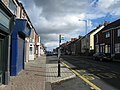 Front Street, Wheatley Hill - geograph.org.uk - 2098998.jpg 640 × 480; 76 KB
-
 Model Aircraft Landing Strip - geograph.org.uk - 5893394.jpg 1,024 × 768; 199 KB
-
 Parish Rooms and Heritage Centre - geograph.org.uk - 2970566.jpg 2,048 × 1,536; 595 KB
-
 Post Office Wheatley.JPG 1,800 × 2,400; 1.68 MB
-
 Quarry face at Old Wingate - geograph.org.uk - 6371815.jpg 2,000 × 1,157; 2.15 MB
-
 The A181 towards the Wheatley Hill bypass - geograph.org.uk - 3576852.jpg 3,648 × 2,736; 3.04 MB
-
 The B1279 road near Greenhills - geograph.org.uk - 1891780.jpg 3,088 × 2,056; 3.48 MB
-
 The Nimmo public house - geograph.org.uk - 2970562.jpg 2,048 × 1,536; 634 KB
-
 The Nimmo, Wheatley Hill - geograph.org.uk - 2098979.jpg 640 × 480; 68 KB
-
 The road from Thornley to Wheatley Hill - geograph.org.uk - 2970546.jpg 2,048 × 1,536; 585 KB
-
 Track approaching Wheatley Hill - geograph.org.uk - 1176912.jpg 640 × 461; 93 KB
-
 Wheatley Hill - geograph.org.uk - 279751.jpg 640 × 480; 132 KB
-
 Wheatley Hill fire station - geograph.org.uk - 288210.jpg 640 × 427; 192 KB
-
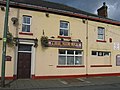
 Wheatley Hill Workingmens Club - geograph.org.uk - 2152761.jpg 2,048 × 1,536; 595 KB
-
 Windmill on Crowshouse Moor - geograph.org.uk - 245892.jpg 640 × 480; 86 KB
-
 Wingate Grange Farm - geograph.org.uk - 2970525.jpg 2,048 × 1,536; 622 KB
-
 Wingate Lane - geograph.org.uk - 1176914.jpg 640 × 480; 91 KB
-
 Wingate Lane - geograph.org.uk - 1183667.jpg 640 × 480; 104 KB
-
 Wingate Lane entering Wheatley Hill - geograph.org.uk - 6371884.jpg 2,000 × 1,296; 2.19 MB
-
 Field boundary to Crowshouse Moor - geograph.org.uk - 409554.jpg 640 × 480; 62 KB
-
 Green Lane Nurseries - geograph.org.uk - 474170.jpg 640 × 480; 122 KB
-
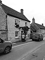
 Harry's Bar, Thornely - geograph.org.uk - 419436.jpg 640 × 480; 73 KB
-
 Ludworth Road Cemetery - geograph.org.uk - 409541.jpg 640 × 480; 109 KB
-
 St George's Primary School, Wheatley Hill - geograph.org.uk - 409501.jpg 640 × 480; 120 KB
-
 Thornley Gospel Hall. - geograph.org.uk - 419434.jpg 640 × 480; 105 KB
-
 Traffic calming measures on the B1279 - geograph.org.uk - 409599.jpg 640 × 480; 58 KB
-
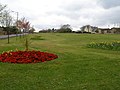 Village green at Thornley - geograph.org.uk - 409487.jpg 640 × 480; 103 KB


