Category:White Cloud Mountains
Jump to navigation
Jump to search
mountain range in the US state of Idaho   | |||||
| Upload media | |||||
| Instance of | |||||
|---|---|---|---|---|---|
| Location | Custer County, Idaho | ||||
| Width |
| ||||
| Length |
| ||||
| Mountain range | |||||
| Highest point | |||||
| Area |
| ||||
| Elevation above sea level |
| ||||
 | |||||
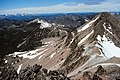
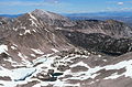
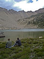
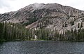
English: The White Cloud Mountains — a mountain range of the Rocky Mountains, located in Custer County, central Idaho.
Subcategories
This category has the following 3 subcategories, out of 3 total.
C
- Castle Peak (Idaho) (4 F)
J
- Jimmy Smith Lake (6 F)
Media in category "White Cloud Mountains"
The following 69 files are in this category, out of 69 total.
-
 4th July Lake.JPG 2,816 × 2,112; 4.56 MB
-
 Above Pettit Lake.jpg 1,500 × 1,000; 349 KB
-
 Baker Lake, White Cloud Mountains, Idaho.JPG 2,816 × 2,112; 2.44 MB
-
 Blackmon Peak White Cloud Mountains Idaho.JPG 2,816 × 2,112; 2.36 MB
-
 Born Lakes, White Cloud Mountains, Idaho.JPG 2,816 × 2,112; 2.5 MB
-
 Boulder Peaks Labelled.jpg 823 × 886; 256 KB
-
 Calkins Peak, White Cloud Peaks ID.jpg 3,157 × 2,083; 3.24 MB
-
 Calkins Watson WCP 7.jpg 2,816 × 2,112; 883 KB
-
 Castle Peak ID.jpg 3,152 × 2,090; 3.37 MB
-
 Chamberlain Basin, White Cloud Mountains, Idaho.jpg 2,816 × 2,037; 4.36 MB
-
 Climbing above Crater Lake, White Cloud Peaks ID.jpg 3,142 × 2,102; 3.61 MB
-
 Crater Lake, White Cloud Peaks ID 2.jpg 3,128 × 2,103; 3.7 MB
-
 Crater Lake, White Cloud Peaks ID 3.jpg 2,079 × 3,009; 3.23 MB
-
 Crater Lake, White Cloud Peaks ID 4.jpg 3,132 × 2,099; 3.09 MB
-
 Crater Lake, White Cloud Peaks ID.jpg 3,152 × 2,086; 3.86 MB
-
 D. O. Lee Peak, White Clouds Mtns.jpg 2,816 × 2,112; 3.21 MB
-
 Farley Lake Sawtooth NRA.jpg 1,187 × 800; 693 KB
-
 Fireweed SNRA.JPG 2,048 × 1,536; 2.79 MB
-
 Fisher Creek Trail.JPG 2,816 × 2,112; 4.62 MB
-
 Fourth of July Lake - panoramio.jpg 3,876 × 2,042; 6.75 MB
-
 Fourth of July Lake SNRA 1.JPG 1,600 × 1,200; 419 KB
-
 Fourth of July Lake SNRA 2.JPG 1,600 × 1,200; 404 KB
-
 Frog Lake wetlands.JPG 1,600 × 1,200; 401 KB
-
 Frog Lake.JPG 2,816 × 2,112; 2.05 MB
-
 Gunsight Lake Idaho.jpg 3,148 × 2,083; 3.84 MB
-
 Hatchet Lake, White Cloud Mountains, Idaho.jpg 2,816 × 2,112; 3.51 MB
-
 Headwall Lake, White Cloud Mountains, Idaho.JPG 2,816 × 2,112; 2.58 MB
-
 High in the Sawtooths.jpg 1,024 × 768; 660 KB
-
 Hiking in the White Cloud Peaks of central Idaho.jpg 2,863 × 2,040; 6.35 MB
-
 Hiking to Fourth of July Lake, White Cloud Peaks ID.jpg 2,851 × 2,045; 6.88 MB
-
 Hourglass Lake, White Cloud Mountains, Idaho.JPG 2,816 × 2,112; 2.47 MB
-
 Hummock Lake, White Cloud Mountains, Idaho.JPG 2,816 × 2,112; 2.3 MB
-
 Leaving Quiet Lake.jpg 800 × 600; 707 KB
-
 Lonesome Lake Peak.jpg 1,080 × 1,342; 610 KB
-
 Looking down on Crater Lake, White Cloud Peaks ID.jpg 3,156 × 2,103; 3.38 MB
-
 Looking down on Fourth of July Lake and the distant Sawtooths.jpg 3,134 × 2,086; 3.65 MB
-
 Looking northwest towards the Sawtooths and Stanley Basin ID.jpg 3,154 × 2,100; 3.27 MB
-
 Meadow near Fourth of July Lake 1.JPG 1,600 × 1,200; 416 KB
-
 NE from ridge above Washington Lake, White Cloud Peaks ID.jpg 3,161 × 2,081; 3.03 MB
-
 Sawtooth Valley and White Clouds 2.JPG 2,816 × 2,112; 3.19 MB
-
 Sawtooth Valley and White Clouds 3.JPG 2,816 × 2,112; 3.39 MB
-
 Sawtooth Valley and White Clouds.JPG 2,816 × 2,112; 2.89 MB
-
 Scoop Lake, Custer County, Idaho.JPG 2,816 × 2,112; 2.33 MB
-
 Shallow L with Devil's Staircase on horizon.jpg 600 × 800; 443 KB
-
 Shelf Lake, White Cloud Mountains, Idaho.JPG 2,816 × 2,112; 2.34 MB
-
 Sliderock Lake White Cloud Mountains Idaho.jpg 2,816 × 1,809; 3.68 MB
-
 Small Lake Above Washington Lake.JPG 2,816 × 2,112; 1.6 MB
-
 Snowmelt stream.JPG 1,600 × 1,200; 458 KB
-
 Spring in SNRA 1.JPG 1,600 × 1,200; 397 KB
-
 Spring in SNRA 2.JPG 1,600 × 1,200; 413 KB
-
 Tarn, White Cloud Peaks ID.jpg 3,136 × 2,106; 3.46 MB
-
 The Devils Staircase - White Clouds Wilderness.jpg 3,024 × 4,032; 4 MB
-
 Tin Cup Lake Idaho 2.jpg 3,154 × 2,069; 3.3 MB
-
 Tin Cup Lake Idaho.jpg 3,157 × 2,078; 2.02 MB
-
 USA Region West relief White Cloud Mountains location map.jpg 1,867 × 2,091; 1.05 MB
-
 Warm Springs Creek Sawtooth NRA.JPG 2,816 × 2,112; 4.04 MB
-
 Warm Springs Creek.JPG 2,816 × 2,112; 2.72 MB
-
 Warm Springs Meadow.JPG 2,816 × 2,112; 2.18 MB
-
 Washington Lake SNRA 1.JPG 1,600 × 1,200; 402 KB
-
 Washington Lake SNRA 2.JPG 1,600 × 1,200; 431 KB
-
 White Cloud Peaks ID.jpg 3,123 × 2,107; 3.09 MB
-
 White Cloud Peaks Labeled.JPG 2,816 × 2,112; 1.45 MB
-
 White Cloud Peaks, central ID 1.jpg 3,160 × 2,087; 3.2 MB
-
 White Cloud Peaks, Sawtooth National Recreation Area ID.jpg 3,131 × 2,093; 3.06 MB
-
 White Cloud Peaks, Sawtooth National Recreation Area.jpg 3,154 × 2,092; 3.67 MB
-
 White Clouds from Sawtooths.JPG 2,816 × 2,112; 2.79 MB
-
 White Clouds.JPG 2,816 × 2,112; 2.23 MB
-
 Yellow Belly Lake Sawtooth NRA.JPG 1,547 × 1,097; 382 KB
-
 Yellow Belly Lake.JPG 2,816 × 2,112; 1.69 MB


