Category:Whitewell, Lancashire
Jump to navigation
Jump to search
English: Whitewell is a hamlet within the Ribble Valley borough of Lancashire, England, in the Forest of Bowland Area of Outstanding Natural Beauty. Historically, it lay on the border of the former West Riding of Yorkshire. It stands above a picturesque bend in the River Hodder.
hamlet in Bowland Forest, Lancashire, England  | |||||
| Upload media | |||||
| Instance of | |||||
|---|---|---|---|---|---|
| Location | Bowland Forest Low, Ribble Valley, Lancashire, North West England, England | ||||
 | |||||
Subcategories
This category has the following 2 subcategories, out of 2 total.
I
- The Inn at Whitewell (12 F)
M
Media in category "Whitewell, Lancashire"
The following 45 files are in this category, out of 45 total.
-
 Approaching Laund Wood, Whitewell - geograph.org.uk - 2966293.jpg 640 × 480; 146 KB
-
 Footbridge on the concessionary footpath - geograph.org.uk - 1573386.jpg 640 × 480; 102 KB
-
 Footpath and Lime Kiln near Whitewell - geograph.org.uk - 2555378.jpg 640 × 426; 390 KB
-

-
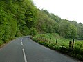
 From the road to Whitewell - geograph.org.uk - 111720.jpg 640 × 480; 92 KB
-
 Higher Whitewell - geograph.org.uk - 697970.jpg 640 × 480; 76 KB
-
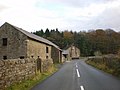 Higher Whitewell Farm - geograph.org.uk - 1573378.jpg 640 × 480; 61 KB
-
 Higher Whitewell Farm - geograph.org.uk - 2918453.jpg 640 × 480; 133 KB
-
 Higher Whitewell Farm - geograph.org.uk - 2918455.jpg 640 × 480; 142 KB
-
 Higher Whitewell Farm, Name plaque - geograph.org.uk - 2918456.jpg 640 × 480; 205 KB
-
 House and Road at Higher Whitewell (geograph 4130949).jpg 4,000 × 3,000; 2.26 MB
-
 Laund Wood, Whitewell - geograph.org.uk - 2974981.jpg 640 × 480; 188 KB
-
 Laund Wood, Whitewell - geograph.org.uk - 2974987.jpg 640 × 480; 177 KB
-
 Lime kiln - geograph.org.uk - 414335.jpg 640 × 480; 97 KB
-
 Old lime kiln - geograph.org.uk - 402414.jpg 640 × 480; 143 KB
-
 Pedestrian gate, Whitewell - geograph.org.uk - 2975023.jpg 640 × 480; 223 KB
-
 Raven Scar - geograph.org.uk - 740049.jpg 640 × 427; 90 KB
-
 River Hodder above The Inn at Whitewell - geograph.org.uk - 1573394.jpg 640 × 480; 100 KB
-

-
 River Hodder and Whitewell fields - geograph.org.uk - 2856114.jpg 1,650 × 2,200; 800 KB
-
 River Hodder at Whitewell - geograph.org.uk - 4975.jpg 486 × 640; 147 KB
-
 River Hodder below The Inn at Whitewell - geograph.org.uk - 1573360.jpg 640 × 480; 105 KB
-
 River Hodder below The Inn at Whitewell - geograph.org.uk - 1573366.jpg 640 × 480; 110 KB
-
 Road approaching Whitewell - geograph.org.uk - 2958377.jpg 640 × 480; 183 KB
-
 Small Bridge At Dinkling Green - geograph.org.uk - 1736719.jpg 800 × 600; 354 KB
-

-
 Stepping Stones over the River Hodder - Whitewell - geograph.org.uk - 2519462.jpg 4,000 × 3,000; 4.46 MB
-
 Submerged stepping stones - geograph.org.uk - 1003533.jpg 480 × 640; 69 KB
-
 The Hodder at Whitewell - geograph.org.uk - 3073773.jpg 4,000 × 3,000; 5.11 MB
-
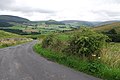
 The road to Whitewell - geograph.org.uk - 1939034.jpg 1,024 × 768; 141 KB
-
 The road to Whitewell - geograph.org.uk - 3073761.jpg 3,595 × 2,399; 4.63 MB
-
 The Way West to Whitewell - geograph.org.uk - 2995395.jpg 640 × 480; 76 KB
-
 Whitewell - geograph.org.uk - 414207.jpg 640 × 480; 102 KB
-
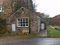
 Whitewell Social Hall - geograph.org.uk - 1573371.jpg 640 × 480; 103 KB
-
 Whitewell Social Hall - geograph.org.uk - 1573376.jpg 640 × 480; 84 KB
-
 Whitewell Social Hall - geograph.org.uk - 414332.jpg 640 × 480; 99 KB
-
 Fallen Tree - geograph.org.uk - 424457.jpg 640 × 426; 466 KB
-
 Fancy Tent - geograph.org.uk - 175684.jpg 640 × 480; 64 KB
-

-
 Hell Hole - geograph.org.uk - 684672.jpg 640 × 427; 123 KB
-
 Raven Scar Plantation - geograph.org.uk - 699489.jpg 640 × 480; 64 KB
-
 River Hodder - geograph.org.uk - 402397.jpg 640 × 480; 230 KB
-
 River Hodder - geograph.org.uk - 402405.jpg 640 × 480; 253 KB
-
 Road Junction at Whitewell - geograph.org.uk - 699475.jpg 640 × 480; 82 KB
-
 The Hodder Valley - geograph.org.uk - 92255.jpg 640 × 427; 85 KB


.jpg)


