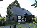
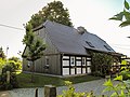
Category:Wiesa, Sonnenweg 26
Jump to navigation
Jump to search
| Object location | | View all coordinates using: OpenStreetMap |
|---|
house in Kodersdorf, Germany .jpg) | |||||
| Upload media | |||||
| Instance of | |||||
|---|---|---|---|---|---|
| Location | Kodersdorf, Q879194, Görlitz, Saxony, Germany | ||||
| Street address |
| ||||
| Heritage designation | |||||
 | |||||
| (Wikidata) |
Media in category "Wiesa, Sonnenweg 26"
The following 5 files are in this category, out of 5 total.
-
 Wiesa, Sonnenweg 26 (1).jpg 4,416 × 3,312; 5.19 MB
-
 Wiesa, Sonnenweg 26 (2 retuschiert).jpg 4,416 × 3,312; 9.76 MB
-
 Wiesa, Sonnenweg 26 (2).jpg 4,416 × 3,312; 3.38 MB
-
 Wiesa, Sonnenweg 26 (2)a.jpg 4,416 × 3,312; 7.38 MB
-
 Wiesa, Sonnenweg 26 (3).jpg 4,416 × 3,312; 6.8 MB
.jpg)
.jpg)
a.jpg)
.jpg)