Category:Wigginton, North Yorkshire
Jump to navigation
Jump to search
village and civil parish in York, North Yorkshire, England  | |||||
| Upload media | |||||
| Instance of | |||||
|---|---|---|---|---|---|
| Location | City of York, North Yorkshire, Yorkshire and the Humber, England | ||||
 | |||||
English: Wigginton is a village and civil parish in the unitary authority of the City of York in North Yorkshire, England. It is situated north of York. According to the 2001 census the parish had a population of 3,714. Prior to 1996 it had been part of the Ryedale district.
Subcategories
This category has the following 9 subcategories, out of 9 total.
B
F
- Farms in Wigginton CP (9 F)
- Fields in Wigginton CP (10 F)
P
- Public footpaths in Wigginton CP (11 F)
S
W
- Westfield Beck (7 F)
Media in category "Wigginton, North Yorkshire"
The following 13 files are in this category, out of 13 total.
-
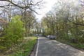
 Bull Lane - geograph.org.uk - 3930701.jpg 427 × 640; 93 KB
-
 Bull Lane heading north - geograph.org.uk - 2487766.jpg 1,600 × 1,200; 408 KB
-
 Looking north on Bull Lane - geograph.org.uk - 3930703.jpg 640 × 427; 89 KB
-
 Moor Lane - geograph.org.uk - 3930706.jpg 640 × 427; 145 KB
-
-
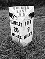
 Old Milestone by the B1363, Wigginton parish (geograph 6050627).jpg 600 × 449; 365 KB
-
 Pampas Grass - geograph.org.uk - 262744.jpg 640 × 480; 104 KB
-

-
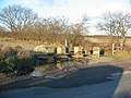
 Wigginton duck pond - geograph.org.uk - 2384731.jpg 1,600 × 1,200; 721 KB
-
 Wigginton Pond - geograph.org.uk - 5503165.jpg 1,600 × 1,200; 665 KB
-
 Wigginton village pond.jpg 640 × 480; 156 KB
-
 York City Football Club training ground - geograph.org.uk - 5503149.jpg 1,600 × 1,200; 441 KB
-


.jpg)
.jpg)


