Category:Wigmore, Herefordshire
Jump to navigation
Jump to search
a village located in Herefordshire, United Kingdom  | |||||
| Upload media | |||||
| Instance of | |||||
|---|---|---|---|---|---|
| Location | Herefordshire, West Midlands, England | ||||
 | |||||
Cymraeg: Pentref yn Swydd Henffordd, Gorllewin Canolbarth Lloegr, Lloegr ydy Wigmore. (→Wigmore, Swydd Henffordd)
Français : Wigmore est un village anglais situé dans le comté d' Herefordshire dans les marches galloises, à à l'ouest de Ludlow. Il y a sur le village un château construit par William Fitzosbern datant du XIème siècle. (→Wigmore (Herefordshire))
Nederlands: Wigmore is een dorp en Civil parish in het noordwesten van Herefordshire, Engeland. Het ligt op ongeveer 8 mijl ten westen van Ludlow (Welsh Marches). Anno 2008 telt het dorp 1626 inwoners. Aan de rand van het dorp bevindt zich een kasteel dat in het bezit was van de Mortimers. (→Wigmore)
Polski: Wigmore – wieś w Anglii, w hrabstwie Herefordshire. Leży 31 km na północ od miasta Hereford i 209 km na północny zachód od Londynu. Miejscowość liczy 1626 mieszkańców. (→Wigmore (Herefordshire))

Subcategories
This category has the following 3 subcategories, out of 3 total.
Media in category "Wigmore, Herefordshire"
The following 200 files are in this category, out of 202 total.
(previous page) (next page)-

-
 A cottage and 'The Compasses Hotel' - geograph.org.uk - 992180.jpg 640 × 480; 83 KB
-

-
 A4110 at Gotherment - geograph.org.uk - 2559184.jpg 640 × 480; 59 KB
-
 A4110 at Gotherment - geograph.org.uk - 5679891.jpg 1,600 × 901; 578 KB
-
 A4110 at Wigmore - geograph.org.uk - 1173202.jpg 640 × 473; 75 KB
-
 A4110 enters Wigmore from the south - geograph.org.uk - 2559175.jpg 640 × 480; 70 KB
-
 A4110 heading north from Wigmore - geograph.org.uk - 2559180.jpg 640 × 480; 87 KB
-
 A4110 in Wigmore - geograph.org.uk - 3740579.jpg 3,237 × 2,481; 1,023 KB
-
 A4110 south of Wigmore - geograph.org.uk - 2559172.jpg 640 × 480; 52 KB
-
 A4110, south of Wigmore - geograph.org.uk - 4701081.jpg 1,024 × 684; 374 KB
-
 Abandoned digger in Barnett Wood - geograph.org.uk - 4183579.jpg 3,872 × 2,592; 4.87 MB
-
 Abandoned dumper - geograph.org.uk - 4299067.jpg 3,872 × 2,592; 4.87 MB
-
 Abandoned horse boxes in the woods - geograph.org.uk - 4299015.jpg 3,872 × 2,592; 4.83 MB
-
 Approaching Wigmore Castle - geograph.org.uk - 3565988.jpg 640 × 480; 114 KB
-
 Arable land north of Wigmore - geograph.org.uk - 1181668.jpg 640 × 480; 126 KB
-
 Barnett and Oakley Hill Woods, between Lingen and Wigmore.. - geograph.org.uk - 6132888.jpg 4,048 × 2,029; 2.92 MB
-
 Barnett Woods Perimeter Signs - geograph.org.uk - 5697546.jpg 1,000 × 667; 581 KB
-
 Brass Cross inside St. James' Church (Chancel ^ Wigmore) - geograph.org.uk - 6332526.jpg 3,648 × 2,736; 2.94 MB
-
 Brick barn by A4110, on southern edge of Wigmore - geograph.org.uk - 4274295.jpg 1,024 × 768; 168 KB
-
 Brinshope - geograph.org.uk - 5217835.jpg 800 × 534; 174 KB
-
 Brinshope - geograph.org.uk - 802779.jpg 640 × 480; 80 KB
-
 Butterflies by Wigmore Castle - geograph.org.uk - 6332648.jpg 3,648 × 2,056; 3.79 MB
-
 Butterflies by Wigmore Castle - geograph.org.uk - 6332651.jpg 3,648 × 2,056; 3.64 MB
-
 Butterflies by Yew Tree House (Wigmore) - geograph.org.uk - 6332654.jpg 3,648 × 2,056; 3.59 MB
-
 Butterfly by Yew Tree House (Wigmore) - geograph.org.uk - 6332658.jpg 3,648 × 2,056; 3.43 MB
-
 Butterfly by Yew Tree House (Wigmore) - geograph.org.uk - 6332659.jpg 3,648 × 2,056; 3.41 MB
-
 Butterfly by Yew Tree House (Wigmore) - geograph.org.uk - 6332663.jpg 3,648 × 2,056; 3.59 MB
-
 Castle Garage, Wigmore - geograph.org.uk - 6299335.jpg 1,024 × 768; 241 KB
-
 Course of the Roman road. - geograph.org.uk - 1181658.jpg 640 × 480; 102 KB
-
 Court House, Wigmore - geograph.org.uk - 6299447.jpg 1,024 × 768; 308 KB
-
 Cross of the Tree - geograph.org.uk - 6299889.jpg 1,024 × 768; 263 KB
-
 Entrance to Woodhampton Farm - geograph.org.uk - 1176115.jpg 640 × 475; 149 KB
-
 Entrance, Wigmore Rolls - geograph.org.uk - 5352208.jpg 1,024 × 683; 543 KB
-
 Fallen tree near Barnett Wood - geograph.org.uk - 1175400.jpg 640 × 480; 178 KB
-
 Farm gateway at Leinthall Barns Farm - geograph.org.uk - 1181528.jpg 640 × 480; 66 KB
-
 Farm track near Wigmore - geograph.org.uk - 4186921.jpg 3,872 × 2,592; 4.78 MB
-
 Farm track near Woodhampton Farm - geograph.org.uk - 1175410.jpg 640 × 480; 123 KB
-
 Farmland above Wigmore - geograph.org.uk - 6299487.jpg 1,024 × 768; 339 KB
-
 Farmland and forest, Deepmoor - geograph.org.uk - 2010529.jpg 640 × 480; 111 KB
-
 Farmland at Barn Farm - geograph.org.uk - 1174529.jpg 640 × 480; 110 KB
-
 Farmland east of Paysure Wood - geograph.org.uk - 1180801.jpg 640 × 480; 68 KB
-
 Farmland near White House Farm - geograph.org.uk - 6299494.jpg 1,024 × 768; 214 KB
-
 Farmland west of Wigmore - geograph.org.uk - 1173214.jpg 640 × 480; 66 KB
-
 Field near Woodhampton Wood - geograph.org.uk - 1175402.jpg 640 × 480; 126 KB
-
 Field, Deepmoor - geograph.org.uk - 2010526.jpg 640 × 480; 138 KB
-
 Flowers at Wigmore Castle (East Tower) - geograph.org.uk - 6332557.jpg 3,648 × 2,736; 4.84 MB
-
 Footpath crossing A4110 at Brinshope - geograph.org.uk - 4274299.jpg 1,024 × 768; 83 KB
-
 Ford Street (Wigmore) - geograph.org.uk - 5686171.jpg 3,264 × 2,448; 1.93 MB
-
 Ford Street (Wigmore) - geograph.org.uk - 6332371.jpg 3,648 × 2,056; 3.53 MB
-
 Ford Street - 1 - geograph.org.uk - 1173184.jpg 640 × 480; 95 KB
-
 Ford Street - 2 - geograph.org.uk - 1173188.jpg 640 × 480; 80 KB
-

-
 Ford Street, Wigmore - geograph.org.uk - 5631567.jpg 1,600 × 899; 687 KB
-
 Gatley Hill (Viewed from Wigmore Castle (East Tower)) - geograph.org.uk - 6332559.jpg 3,648 × 2,056; 3.35 MB
-
 Giant upside down dragonfly - geograph.org.uk - 727111.jpg 640 × 484; 129 KB
-
 Grassland, Woodhampton - geograph.org.uk - 2011013.jpg 640 × 480; 107 KB
-
 Grave of Rev Alexander Clogie - geograph.org.uk - 6299465.jpg 768 × 1,024; 206 KB
-
 Green Hill (Wigmore) - geograph.org.uk - 5730916.jpg 3,264 × 2,448; 2.29 MB
-
 Green lane, Knoll Hill - geograph.org.uk - 2010533.jpg 640 × 480; 159 KB
-
 Gully, Wigmore Rolls - geograph.org.uk - 5351690.jpg 1,024 × 683; 542 KB
-
 Herefordshire grassland - geograph.org.uk - 801271.jpg 640 × 391; 61 KB
-

-
 Houses in Wigmore - geograph.org.uk - 6299412.jpg 1,024 × 768; 216 KB
-

-
 Kissing Gate at end of Castle Street - geograph.org.uk - 1248475.jpg 640 × 480; 142 KB
-
 Knoll Hill - geograph.org.uk - 3304203.jpg 1,600 × 1,200; 1.56 MB
-
 Lane at Barnett Wood - 2 - geograph.org.uk - 1175306.jpg 640 × 480; 121 KB
-
 Lane at Barnett Wood - 3 - geograph.org.uk - 1175308.jpg 640 × 480; 182 KB
-
 Lane at Barnett Wood - geograph.org.uk - 1175290.jpg 640 × 480; 135 KB
-
 Lane south from Limebrook - geograph.org.uk - 2587602.jpg 640 × 480; 103 KB
-
 Lane to Ballsgate Common - 2 - geograph.org.uk - 1176687.jpg 640 × 480; 190 KB
-
 Lane to Ballsgate Common - geograph.org.uk - 1176682.jpg 640 × 480; 118 KB
-
 Lane to Lower Lye - geograph.org.uk - 1176654.jpg 640 × 480; 122 KB
-
 Lane to Wigmore - geograph.org.uk - 1175297.jpg 640 × 480; 154 KB
-
 Lane to Wigmore - geograph.org.uk - 1181613.jpg 640 × 480; 74 KB
-

-

-
 Leinthall Moor - geograph.org.uk - 2011054.jpg 640 × 359; 75 KB
-

-
 Logging road, Wigmore Rolls - geograph.org.uk - 5352117.jpg 1,024 × 683; 525 KB
-
 Looking out of the woods - geograph.org.uk - 5351704.jpg 1,024 × 683; 475 KB
-
 Lugg weir - 1 - geograph.org.uk - 1176748.jpg 640 × 479; 185 KB
-
 Lugg weir - 3 - geograph.org.uk - 1176765.jpg 640 × 480; 163 KB
-
 Maize, Wigmore - geograph.org.uk - 2011049.jpg 640 × 480; 148 KB
-
 Moor View (Wigmore) - geograph.org.uk - 6332394.jpg 3,648 × 2,736; 4.36 MB
-
 Oaks, Brinshope - geograph.org.uk - 5217834.jpg 800 × 534; 182 KB
-

-
 Old quarry in Barnett Wood - geograph.org.uk - 1175301.jpg 640 × 480; 169 KB
-
 Old sign near Wigmore Castle - geograph.org.uk - 4299077.jpg 3,872 × 2,592; 4.83 MB
-
 Ongar Street passes Dickendale - geograph.org.uk - 3740440.jpg 3,686 × 2,523; 1.38 MB
-
 Ornamental pond at Brinshope - geograph.org.uk - 802789.jpg 640 × 480; 90 KB
-
 Out for a pheasant stroll, southwest of Barn Farm - geograph.org.uk - 3740554.jpg 3,045 × 2,289; 1.95 MB
-
 Overlooking Wigmore - geograph.org.uk - 1173217.jpg 640 × 480; 102 KB
-

-
 Path at St. James' Church (Wigmore) - geograph.org.uk - 6332539.jpg 3,648 × 2,736; 4.77 MB
-
 Path near Wigmore Castle - geograph.org.uk - 4299052.jpg 3,872 × 2,592; 3.75 MB
-
 Path to School Lane (Wigmore) - geograph.org.uk - 6332660.jpg 3,648 × 2,056; 3.65 MB
-
 Path to the Old School (Wigmore) - geograph.org.uk - 6332668.jpg 3,648 × 2,056; 3.44 MB
-
 Path to Wigmore Castle - geograph.org.uk - 6332540.jpg 3,648 × 2,736; 4.81 MB
-
 Path to Wigmore Castle - geograph.org.uk - 6332543.jpg 3,648 × 2,056; 3.76 MB
-
 Path, Lawn Bank Coppice - geograph.org.uk - 5352204.jpg 1,024 × 683; 508 KB
-
 Path, Wigmore Rolls - geograph.org.uk - 5352134.jpg 1,024 × 683; 567 KB
-
 Path, Wigmore Rolls - geograph.org.uk - 5352202.jpg 1,024 × 683; 565 KB
-
 Path, Wigmore Rolls - geograph.org.uk - 5352207.jpg 1,024 × 683; 462 KB
-
 Pond, Brinshope - geograph.org.uk - 4701083.jpg 1,024 × 684; 269 KB
-
 Preaching cross - geograph.org.uk - 6298748.jpg 768 × 1,024; 357 KB
-
 Public footpath meets Barnett Wood - geograph.org.uk - 1175311.jpg 640 × 480; 202 KB
-
 Redundant post box - geograph.org.uk - 2011028.jpg 480 × 640; 82 KB
-
 Road junction, Wigmore Rolls - geograph.org.uk - 5351695.jpg 1,024 × 683; 380 KB
-
 Road passing through woodland - geograph.org.uk - 6299504.jpg 1,024 × 768; 401 KB
-
 Road through Wigmore - geograph.org.uk - 6299477.jpg 1,024 × 768; 261 KB
-
 Road, Wigmore Rolls - geograph.org.uk - 5351699.jpg 1,024 × 683; 578 KB
-
 Road, Wigmore Rolls - geograph.org.uk - 5351705.jpg 1,024 × 683; 468 KB
-
 School Street Wigmore - geograph.org.uk - 1248473.jpg 640 × 480; 85 KB
-
 Several shades of green - geograph.org.uk - 802775.jpg 640 × 480; 104 KB
-
 Sheep pasture and pond at Wigmore Hall - geograph.org.uk - 1173222.jpg 640 × 480; 122 KB
-
 Sheep pasture near Barn Farm - geograph.org.uk - 1174419.jpg 640 × 480; 97 KB
-
 Sheep pasture near Wigmore Hall - geograph.org.uk - 1174388.jpg 640 × 480; 101 KB
-
 Sheep pasture on Woodhampton Farm - geograph.org.uk - 1175408.jpg 640 × 480; 104 KB
-
 Sheep pasture west of Wigmore Hall - geograph.org.uk - 1174397.jpg 640 × 480; 117 KB
-
 Sign at Wigmore Castle (Lodging Tower) - geograph.org.uk - 6332587.jpg 3,648 × 2,736; 4.6 MB
-
 Sign at Wigmore Castle - geograph.org.uk - 6332542.jpg 3,648 × 2,736; 4 MB
-
 Sign at Wigmore Castle - geograph.org.uk - 6332553.jpg 3,648 × 2,736; 4.27 MB
-
 Sign at Wigmore Glacial Lake - geograph.org.uk - 5730946.jpg 3,264 × 2,448; 2.21 MB
-
 Silver Will - geograph.org.uk - 802769.jpg 640 × 410; 93 KB
-
 Site of Wigmore Glacial Lake - geograph.org.uk - 5730935.jpg 3,264 × 2,448; 1.68 MB
-
 Site of Wigmore Glacial Lake - geograph.org.uk - 5730941.jpg 3,264 × 2,448; 1.9 MB
-
 Snowdrifts on Barnett Road - geograph.org.uk - 5697566.jpg 1,000 × 667; 538 KB
-
 Spring near Wigmore - geograph.org.uk - 387690.jpg 640 × 480; 123 KB
-
 St. Giles Church (Downton on the Rock) - geograph.org.uk - 6332645.jpg 2,048 × 1,152; 1.06 MB
-
 St. James' Church (Bell Tower ^ Wigmore) - geograph.org.uk - 6332601.jpg 3,648 × 2,736; 3.87 MB
-
 St. James' Church (Bell Tower ^ Wigmore) - geograph.org.uk - 6332671.jpg 2,056 × 3,648; 3.67 MB
-
 St. James' Church (Bell Tower ^ Wigmore) - geograph.org.uk - 6332673.jpg 3,648 × 2,736; 4.77 MB
-
 St. James' Church (Porch ^ Wigmore) - geograph.org.uk - 6332538.jpg 2,736 × 3,648; 3.27 MB
-
 St. James' Church (South Aisle ^ Wigmore) - geograph.org.uk - 6332519.jpg 3,648 × 2,736; 3.35 MB
-
 St. James' Church (South Aisle ^ Wigmore) - geograph.org.uk - 6332530.jpg 2,736 × 3,648; 3.89 MB
-
 St. James' Church (War Memorial ^ Wigmore) - geograph.org.uk - 6332521.jpg 2,736 × 3,648; 3.06 MB
-
 Stream in woodland - geograph.org.uk - 6299501.jpg 1,024 × 768; 437 KB
-
 The Millennium Gardens Wigmore - geograph.org.uk - 1248507.jpg 640 × 480; 137 KB
-
 The Oak, Wigmore - geograph.org.uk - 6299342.jpg 1,024 × 768; 234 KB
-
 The Old School ^ St. James' Church (Porch ^ Wigmore) - geograph.org.uk - 6332513.jpg 3,648 × 2,736; 4.78 MB
-
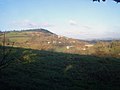
 The Village of Wigmore - geograph.org.uk - 5730536.jpg 3,264 × 2,448; 1.88 MB
-
 The Village of Wigmore - geograph.org.uk - 6066157.jpg 3,648 × 2,056; 2.71 MB
-
 Timber-framed houses - geograph.org.uk - 6299363.jpg 1,024 × 768; 235 KB
-
 Track north of Higher Deerfold Farm - geograph.org.uk - 3740420.jpg 4,000 × 3,000; 2.04 MB
-
 Track to Lower Woodbatch - geograph.org.uk - 6299877.jpg 1,024 × 768; 294 KB
-
 Track to Wigmore Castle - geograph.org.uk - 2101180.jpg 3,456 × 2,592; 3.87 MB
-
 Tree-lined road - geograph.org.uk - 6299878.jpg 1,024 × 768; 435 KB
-
 Un-named lane north of Haven Farm - geograph.org.uk - 3740132.jpg 3,188 × 2,419; 1.24 MB
-
 Un-named lane south of Barnett Wood - geograph.org.uk - 3740449.jpg 3,468 × 2,523; 1.74 MB
-
 Un-named lane south of Lowerhouse Farm - geograph.org.uk - 3740570.jpg 3,658 × 2,519; 1.46 MB
-
 Un-named lane southwest of Allcock's Bridge - geograph.org.uk - 3743388.jpg 3,436 × 2,441; 1.01 MB
-
 Vale of Wigmore and the Ludlow Anticlyne - geograph.org.uk - 5352166.jpg 1,024 × 683; 361 KB
-
 View from Wigmore Castle (Keep) - geograph.org.uk - 5730599.jpg 3,264 × 2,448; 1.83 MB
-
 View from Wigmore Castle (Lodging Tower) - geograph.org.uk - 5730506.jpg 3,264 × 2,448; 2.23 MB
-
 View over Wigmore Castle - geograph.org.uk - 3566032.jpg 640 × 480; 115 KB
-
 View to a distant Black Mixen - geograph.org.uk - 6299511.jpg 1,024 × 768; 191 KB
-
 View to Lawn Bank Coppice - geograph.org.uk - 5679889.jpg 1,600 × 901; 660 KB
-
 View to the wooded Wigmore Rolls - geograph.org.uk - 6299508.jpg 1,024 × 768; 220 KB
-
 War memorial in Wigmore church - geograph.org.uk - 6299449.jpg 768 × 1,024; 179 KB
-
 White House Farm - geograph.org.uk - 5352172.jpg 1,024 × 683; 349 KB
-
 Wigmore (1294528).jpg 1,000 × 718; 121 KB
-
 Wigmore - geograph.org.uk - 2011035.jpg 640 × 480; 99 KB
-
 Wigmore Castle (East Tower) - geograph.org.uk - 6332555.jpg 3,648 × 2,736; 4.79 MB
-
 Wigmore Castle (East Tower) - geograph.org.uk - 6332630.jpg 3,648 × 2,736; 5.01 MB
-
 Wigmore Castle (East Tower) - geograph.org.uk - 6332632.jpg 3,648 × 2,736; 4.9 MB
-
 Wigmore Castle (Gatehouse) - geograph.org.uk - 6332638.jpg 2,736 × 3,648; 4.78 MB
-
 Wigmore Castle (North-East Tower) - geograph.org.uk - 6332576.jpg 3,648 × 2,736; 4.87 MB
-
 Wigmore Castle (North-East Tower) - geograph.org.uk - 6332591.jpg 3,648 × 2,736; 5.01 MB
-
 Wigmore Castle (South-West Tower) - geograph.org.uk - 6332634.jpg 2,736 × 3,648; 5.14 MB
-
 Wigmore Castle - geograph.org.uk - 6298745.jpg 1,024 × 768; 322 KB
-
 Wigmore Castle - geograph.org.uk - 6299482.jpg 768 × 1,024; 329 KB
-
 Wigmore Castle - geograph.org.uk - 6299486.jpg 1,024 × 768; 359 KB
-
 Wigmore Castle - geograph.org.uk - 6332570.jpg 3,648 × 2,056; 3.67 MB
-
 Wigmore Castle and St. James' Church - geograph.org.uk - 6332596.jpg 3,648 × 2,736; 4.07 MB
-
 Wigmore Church and village - geograph.org.uk - 387691.jpg 640 × 480; 106 KB
-
 Wigmore from the church roof - geograph.org.uk - 4299046.jpg 3,872 × 2,592; 4.06 MB
-
 Wigmore High School - geograph.org.uk - 6332364.jpg 3,648 × 2,056; 3.05 MB
-
 Wigmore Rolls (Viewed from Wigmore Castle) - geograph.org.uk - 5730592.jpg 3,264 × 2,448; 2.31 MB
-
 Wigmore Rolls - geograph.org.uk - 3304340.jpg 1,600 × 1,200; 1.59 MB
-
 Wigmore Rolls - geograph.org.uk - 5352129.jpg 1,024 × 683; 458 KB
-
 Wigmore Rolls Trig Point S7901 - geograph.org.uk - 3304348.jpg 1,600 × 1,200; 1.75 MB
-
 Wigmore schools - 1 - geograph.org.uk - 1173198.jpg 640 × 480; 89 KB
-
 Wigmore schools - 2 - geograph.org.uk - 1173199.jpg 640 × 480; 102 KB
-
 Wigmore village - 2 - geograph.org.uk - 1173210.jpg 640 × 480; 130 KB
-
 Wigmore village - geograph.org.uk - 1173205.jpg 640 × 480; 109 KB
-
 Wigmore, The path to the castle - geograph.org.uk - 4624384.jpg 3,678 × 2,456; 4.81 MB
-
 Wigmore, The track to St. James' Church from the A4110 - geograph.org.uk - 4624343.jpg 3,682 × 2,450; 4.97 MB
-
 Window inside St. James' Church (South Aisle ^ Wigmore) - geograph.org.uk - 6332536.jpg 2,736 × 3,648; 4.02 MB
-
 Woodhampton Farm - geograph.org.uk - 1175414.jpg 640 × 480; 114 KB
-
 Woodhampton Wood - geograph.org.uk - 1175407.jpg 640 × 480; 101 KB
-
 Woodhampton Wood - geograph.org.uk - 2205348.jpg 640 × 480; 142 KB
-
 Woodland on Tucknell Bank - geograph.org.uk - 6299496.jpg 1,024 × 768; 404 KB
-
 Young trees, Wigmore Rolls - geograph.org.uk - 5352143.jpg 1,024 × 683; 535 KB
-
 Barnett Wood - geograph.org.uk - 315054.jpg 640 × 480; 162 KB
-

-
 Mortimer Trail Loop Walk - geograph.org.uk - 387686.jpg 640 × 480; 104 KB
-
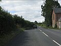
 The A4110 road through Wigmore - geograph.org.uk - 220025.jpg 640 × 480; 130 KB
-


_-_geograph.org.uk_-_6332526.jpg)


_-_geograph.org.uk_-_6332654.jpg)
_-_geograph.org.uk_-_6332658.jpg)
_-_geograph.org.uk_-_6332659.jpg)
_-_geograph.org.uk_-_6332663.jpg)


_-_geograph.org.uk_-_6332557.jpg)

_-_geograph.org.uk_-_5686171.jpg)
_-_geograph.org.uk_-_6332371.jpg)


)_-_geograph.org.uk_-_6332559.jpg)


_-_geograph.org.uk_-_5730916.jpg)


_-_geograph.org.uk_-_6332528.jpg)


_-_geograph.org.uk_-_6332394.jpg)

.jpg)


_-_geograph.org.uk_-_5779286.jpg)
_-_geograph.org.uk_-_6332539.jpg)

_-_geograph.org.uk_-_6332660.jpg)
_-_geograph.org.uk_-_6332668.jpg)


_-_geograph.org.uk_-_6332587.jpg)


_-_geograph.org.uk_-_6332645.jpg)
_-_geograph.org.uk_-_6332601.jpg)
_-_geograph.org.uk_-_6332671.jpg)
_-_geograph.org.uk_-_6332673.jpg)
_-_geograph.org.uk_-_6332538.jpg)
_-_geograph.org.uk_-_6332519.jpg)
_-_geograph.org.uk_-_6332530.jpg)
_-_geograph.org.uk_-_6332521.jpg)


_-_geograph.org.uk_-_6332513.jpg)


_-_geograph.org.uk_-_5730599.jpg)
_-_geograph.org.uk_-_5730506.jpg)


.jpg)

_-_geograph.org.uk_-_6332555.jpg)
_-_geograph.org.uk_-_6332630.jpg)
_-_geograph.org.uk_-_6332632.jpg)
_-_geograph.org.uk_-_6332638.jpg)
_-_geograph.org.uk_-_6332576.jpg)
_-_geograph.org.uk_-_6332591.jpg)
_-_geograph.org.uk_-_6332634.jpg)


_-_geograph.org.uk_-_5730592.jpg)


_-_geograph.org.uk_-_6332536.jpg)


.jpg)