Category:Wigton
Jump to navigation
Jump to search
town in Cumbria, England  | |||||
| Upload media | |||||
| Instance of | |||||
|---|---|---|---|---|---|
| Location | Allerdale, Cumbria, North West England, England | ||||
| Population |
| ||||
 | |||||
English: Wigton is a small market town and civil parish on the edge of the Lake District, the administrative county of Cumbria in England, and traditionally in Cumberland. It is the bustling and thriving centre of the Solway Plain, situated between the Caldbeck Fells and the Solway coast. It is served by Wigton railway station on the Cumbrian Coast Line, and the A596 road to Workington and (via the A595 road) to Carlisle.
Subcategories
This category has the following 3 subcategories, out of 3 total.
C
W
- Wigton railway station (5 F)
Media in category "Wigton"
The following 200 files are in this category, out of 228 total.
(previous page) (next page)-
 153351 entering Wigton station - May 2017 - geograph.org.uk - 5412270.jpg 1,500 × 1,103; 1.97 MB
-
 156480 at Wigton - November 2017 - geograph.org.uk - 5614397.jpg 1,250 × 1,009; 1.05 MB
-
 37425 approaching Wigton station - June 2016 - geograph.org.uk - 5003996.jpg 1,250 × 1,087; 1.31 MB
-
 A little piece of Eden in Wigton - geograph.org.uk - 4206665.jpg 1,024 × 768; 163 KB
-
 A596 towards Carlisle - geograph.org.uk - 5004625.jpg 640 × 480; 77 KB
-
 A596 towards Carlisle - geograph.org.uk - 5004631.jpg 640 × 480; 71 KB
-

-
 Armoury Cottages, George Street, Wigton - geograph.org.uk - 4206034.jpg 1,024 × 768; 110 KB
-
 ATS Wigton - geograph.org.uk - 960497.jpg 640 × 426; 51 KB
-
 B5302 West Road nears Wiza Bridge - geograph.org.uk - 4404973.jpg 640 × 480; 35 KB
-
 B5305 Lowmoor Road - geograph.org.uk - 4404969.jpg 640 × 481; 63 KB
-
 Barber's shop detail - geograph.org.uk - 4214061.jpg 850 × 1,280; 204 KB
-
 Black Beck flowing towards West Road bridge - geograph.org.uk - 6299373.jpg 1,024 × 683; 322 KB
-
 Black-A-Moor Hotel, Wigton - May 2017 (1) - geograph.org.uk - 5411990.jpg 1,195 × 1,500; 1.75 MB
-
 Black-A-Moor Hotel, Wigton - May 2017 (2) - geograph.org.uk - 5411994.jpg 1,313 × 1,500; 1.91 MB
-
 Bowness - panoramio.jpg 2,560 × 1,920; 340 KB
-
 Brookfields, Wigton - geograph.org.uk - 4206681.jpg 1,024 × 768; 182 KB
-
 Burnfoot House, Wigton - geograph.org.uk - 286399.jpg 640 × 468; 78 KB
-

-
 Bus stop and shelter on Syke Road - geograph.org.uk - 5122185.jpg 640 × 480; 87 KB
-

-
 Cardunock - panoramio (1).jpg 3,264 × 2,448; 2 MB
-
 Cardunock - panoramio (2).jpg 3,264 × 2,448; 1.96 MB
-
 Cardunock - panoramio (3).jpg 3,264 × 2,448; 1.84 MB
-
 Cardunock - panoramio (4).jpg 3,264 × 2,448; 2.02 MB
-
 Cardunock - panoramio.jpg 3,264 × 2,448; 1.98 MB
-
 Cattle pasture, north of Longhead Farm - geograph.org.uk - 4206640.jpg 1,024 × 614; 156 KB
-
 Chapel, Wigton Cemetery - geograph.org.uk - 5004542.jpg 3,648 × 2,736; 1.81 MB
-
 Chapters at the English lakes (1913) (14778707311).jpg 2,368 × 1,848; 1.03 MB
-
 Coach Garage, Burnfoot, Wigton - geograph.org.uk - 286388.jpg 640 × 434; 52 KB
-

-
 Convent, Burnfoot, Wigton - geograph.org.uk - 286402.jpg 640 × 437; 62 KB
-
 Cows - panoramio (4).jpg 2,560 × 1,920; 470 KB
-
 Crop field, Spittal Farm - geograph.org.uk - 5004632.jpg 640 × 480; 84 KB
-
 Crown Hotel, High Street. Wigton - geograph.org.uk - 806989.jpg 480 × 640; 148 KB
-
 Cutting the grass - Wigton station - May 2017 - geograph.org.uk - 5412241.jpg 1,500 × 1,085; 2.37 MB
-

-
 Elizabeth II postbox on Cross Lane, Wigton - geograph.org.uk - 5002772.jpg 1,396 × 2,881; 775 KB
-
 Elizabeth II postbox on South End, Wigton - geograph.org.uk - 5122830.jpg 1,032 × 1,636; 551 KB
-
 Elizabeth II postbox, Wigton Post Office - geograph.org.uk - 5125269.jpg 1,055 × 2,156; 521 KB
-
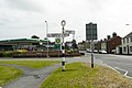
 Entering Wigton - geograph.org.uk - 5122186.jpg 640 × 476; 85 KB
-
 Entrance to Grange Gardens, Cross Lane, Wigton - geograph.org.uk - 4206120.jpg 1,024 × 614; 122 KB
-

-
 Field gateway from B5302 at field drain junction - geograph.org.uk - 6300247.jpg 1,024 × 683; 231 KB
-
 Folly. - geograph.org.uk - 119496.jpg 640 × 530; 71 KB
-
 Ford at Wigton - geograph.org.uk - 4387996.jpg 3,872 × 2,592; 4.49 MB
-
 Forest Hall Farm - geograph.org.uk - 60319.jpg 640 × 480; 93 KB
-

-

-
 Former "Kildare Hotel", Wigton - May 2017 (1) - geograph.org.uk - 5412057.jpg 1,084 × 1,500; 1.56 MB
-
 Former "Kildare Hotel", Wigton - May 2017 (2) - geograph.org.uk - 5412062.jpg 994 × 1,500; 1.32 MB
-
 Former "Station Hotel", Wigton - May 2017 (1) - geograph.org.uk - 5412261.jpg 1,500 × 1,001; 1.75 MB
-
 Former "Station Hotel", Wigton - May 2017 (2) - geograph.org.uk - 5412266.jpg 1,267 × 1,500; 2.22 MB
-

-
 Former "White Swan Inn", Wigton - May 2017 - geograph.org.uk - 5412040.jpg 899 × 1,500; 1.04 MB
-
 Former HSBC Bank, Wigton - May 2017 - geograph.org.uk - 5412030.jpg 1,222 × 1,500; 1.31 MB
-
 Former United Reformed Church - geograph.org.uk - 2472054.jpg 640 × 427; 282 KB
-

-
 George Moore Memorial Fountain, Wigton - geograph.org.uk - 4213131.jpg 851 × 1,280; 263 KB
-
 George Moore Memorial Fountain, Wigton - geograph.org.uk - 4213132.jpg 851 × 1,280; 278 KB
-
 George Street, Wigton - geograph.org.uk - 2200741.jpg 3,072 × 1,728; 1.44 MB
-
 George VI postbox on South End, Wigton - geograph.org.uk - 5125238.jpg 843 × 1,680; 379 KB
-
 Gravestones in Wigton Cemetery - geograph.org.uk - 4206201.jpg 1,024 × 768; 115 KB
-
 Grazing off the A596 - geograph.org.uk - 5004629.jpg 640 × 480; 66 KB
-
 Greenacres, Wigton - geograph.org.uk - 4207109.jpg 1,024 × 614; 108 KB
-
 Hare ^ Hounds pub, Wigton - May 2017 (1) - geograph.org.uk - 5412101.jpg 1,294 × 1,500; 1.55 MB
-
 Hare ^ Hounds pub, Wigton - May 2017 (2) - geograph.org.uk - 5412105.jpg 1,500 × 669; 758 KB
-
 Hare ^ Hounds pub, Wigton - May 2017 (3) - geograph.org.uk - 5412106.jpg 1,270 × 1,500; 1.53 MB
-
 Heading south west from Wigton - geograph.org.uk - 5122216.jpg 640 × 480; 91 KB
-
 High Street, Wigton - geograph.org.uk - 4213134.jpg 851 × 1,280; 205 KB
-
 High Street, Wigton - geograph.org.uk - 5122191.jpg 640 × 480; 55 KB
-
 Highmoor Tower, Wigton - geograph.org.uk - 3369358.jpg 433 × 640; 66 KB
-
 Hope House, Burnfoot, Wigton - geograph.org.uk - 286406.jpg 640 × 437; 91 KB
-
 Hopes Auction Mart - geograph.org.uk - 2480544.jpg 640 × 428; 226 KB
-
 House at the end of the road - geograph.org.uk - 6222138.jpg 1,024 × 683; 152 KB
-
 House on Cross Lane, Wigton - geograph.org.uk - 5002775.jpg 3,648 × 2,736; 1.69 MB
-
 House on South End, Wigton - geograph.org.uk - 5122190.jpg 640 × 480; 66 KB
-
 House on southeast side of Brookfields - geograph.org.uk - 6299389.jpg 1,024 × 683; 207 KB
-
 House on Station Hill - geograph.org.uk - 5004618.jpg 640 × 480; 52 KB
-
 House on the north side of Station Hill, Wigton - geograph.org.uk - 4206162.jpg 1,024 × 768; 122 KB
-
 Houses in Highfield Gardens, Wigton - geograph.org.uk - 4206145.jpg 1,024 × 768; 108 KB
-
 Houses in Standingstone Heights, Wigton - geograph.org.uk - 4206095.jpg 1,024 × 615; 122 KB
-
 Houses on Brindlefield, Wigton - geograph.org.uk - 5122187.jpg 640 × 423; 47 KB
-
 Houses on the north side of Cross Lane, Wigton - geograph.org.uk - 4206127.jpg 1,024 × 768; 121 KB
-

-
 Houses on West Road, Western Bank - geograph.org.uk - 5122208.jpg 640 × 480; 63 KB
-
 Houses on West Road, Wigton - geograph.org.uk - 5122204.jpg 640 × 480; 62 KB
-
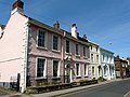
 Houses, High Street Wigton - geograph.org.uk - 2480549.jpg 640 × 427; 262 KB
-
 HSBC Bank, Wigton - geograph.org.uk - 960484.jpg 426 × 640; 48 KB
-
 Huntington's Garage, South End - geograph.org.uk - 2480824.jpg 640 × 428; 246 KB
-
 Icon of Wigton - geograph.org.uk - 2472074.jpg 482 × 640; 322 KB
-
 Industry in Wigton - geograph.org.uk - 4206050.jpg 1,024 × 768; 138 KB
-
 Innovia factory, Wigton - geograph.org.uk - 6422654.jpg 1,024 × 768; 82 KB
-
 Innovia Films Ltd, Wigton - geograph.org.uk - 4207154.jpg 1,024 × 768; 121 KB
-

-
 King Street (B5302), Wigton - geograph.org.uk - 2904973.jpg 816 × 612; 125 KB
-

-
 Kings Arms Hotel, Wigton - geograph.org.uk - 806983.jpg 480 × 640; 152 KB
-
 Lamp, pump and throstle - geograph.org.uk - 2472035.jpg 640 × 426; 237 KB
-
 Lidl supermarket - geograph.org.uk - 2480556.jpg 640 × 483; 53 KB
-
 Market Place, Wigton - geograph.org.uk - 2472063.jpg 640 × 426; 256 KB
-
 Market Place, Wigton - geograph.org.uk - 4213921.jpg 1,280 × 851; 254 KB
-
 Memorial Fountain, Market Square, Wigton - geograph.org.uk - 806057.jpg 466 × 622; 146 KB
-
 Memorial fountain, Wigton - geograph.org.uk - 5122198.jpg 640 × 480; 75 KB
-

-
 Moss - panoramio (1).jpg 3,648 × 2,736; 3.81 MB
-
-
 Northern end, Meetinghouse Lane, Wigton - geograph.org.uk - 4207148.jpg 1,024 × 768; 114 KB
-
 Old Boundary Marker (geograph 6425084).jpg 640 × 960; 179 KB
-
 Old photograph - The Kings' Arms - Wigton station - May 2017 - geograph.org.uk - 5412248.jpg 1,500 × 1,022; 1.35 MB
-
 Ordnance Survey 1GL Bolt - geograph.org.uk - 5721129.jpg 640 × 373; 99 KB
-
 Outbuilding - geograph.org.uk - 2480827.jpg 640 × 428; 271 KB
-
-
 Post box on Cross Lane, Wigton - geograph.org.uk - 4206152.jpg 1,024 × 768; 116 KB
-
 Proctors Row - geograph.org.uk - 2480540.jpg 640 × 480; 287 KB
-

-
 Railway access road, Wigton - geograph.org.uk - 5004626.jpg 640 × 480; 84 KB
-
 Railway bridge over Station Road - geograph.org.uk - 5004628.jpg 640 × 480; 80 KB
-
 Railway towards Carlisle - geograph.org.uk - 5004621.jpg 640 × 480; 75 KB
-
 Raised footpath, north side, A596, Wigton - geograph.org.uk - 4206063.jpg 1,024 × 768; 171 KB
-
 Raised pavement, Cross Lane, Wigton - geograph.org.uk - 4206085.jpg 1,024 × 768; 139 KB
-
 Road bridge - geograph.org.uk - 476213.jpg 640 × 480; 230 KB
-
 Road junction with pinfold - geograph.org.uk - 2480823.jpg 640 × 426; 250 KB
-
 Road junction, Wigton - geograph.org.uk - 5004623.jpg 640 × 480; 76 KB
-
 Roadside barn at Dockray - geograph.org.uk - 476224.jpg 640 × 480; 197 KB
-
 Roadworks on Cross Lane, Wigton - geograph.org.uk - 4206078.jpg 1,024 × 768; 120 KB
-
 Shop at Western Bank in Wigton - geograph.org.uk - 1946844.jpg 640 × 480; 42 KB
-

-

-
 Site of "Crown ^ Mitre Hotel", Wigton - May 2017 - geograph.org.uk - 5412077.jpg 1,500 × 925; 1.52 MB
-
 Skiddaw View, West Road, Wigton, from the west - geograph.org.uk - 4207111.jpg 1,024 × 615; 119 KB
-
 Skiddaw View, Western Bank - geograph.org.uk - 2480558.jpg 640 × 427; 277 KB
-
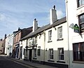
 Smart townhouses in West Street - geograph.org.uk - 2472154.jpg 640 × 480; 289 KB
-
 South End, Wigton - geograph.org.uk - 5125240.jpg 3,510 × 2,113; 1.41 MB
-
 South Lodge, Syke Road - geograph.org.uk - 6295412.jpg 1,024 × 683; 188 KB
-
 St Mary's Church - geograph.org.uk - 6428872.jpg 3,264 × 1,836; 2.4 MB
-
 St Mary's Church, Wigton - geograph.org.uk - 5122193.jpg 640 × 480; 74 KB
-
 St Ursula's School, Wigton - geograph.org.uk - 960503.jpg 640 × 426; 68 KB
-
 Standingstone Cottage - geograph.org.uk - 6222200.jpg 1,024 × 683; 134 KB
-
 Start of the Speet Gill Trail - geograph.org.uk - 2480835.jpg 640 × 480; 377 KB
-
 Station Hill - geograph.org.uk - 5004619.jpg 640 × 480; 68 KB
-
 Station Villa and Windmill at Wigton - geograph.org.uk - 126839.jpg 640 × 480; 68 KB
-
 Stony Banks - geograph.org.uk - 2480554.jpg 640 × 480; 333 KB
-
 Stony Banks, Wigton - geograph.org.uk - 4203030.jpg 1,280 × 851; 303 KB
-
 Stop Look Listen. - geograph.org.uk - 119381.jpg 640 × 375; 60 KB
-
 Strictly no tipping - geograph.org.uk - 776504.jpg 640 × 480; 371 KB
-
 Syke Road, Wigton - geograph.org.uk - 4455483.jpg 640 × 480; 73 KB
-
 Terraced houses, George Street, Wigton - geograph.org.uk - 4207139.jpg 1,024 × 768; 116 KB
-
 The Chapel, Wigton Cemetery - geograph.org.uk - 4206189.jpg 1,024 × 768; 113 KB
-
 The former Friends School, Wigton, 1826 - 1985 - geograph.org.uk - 4206698.jpg 1,024 × 768; 214 KB
-
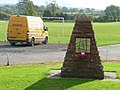
 The George Moore Monument, Wigton - geograph.org.uk - 960488.jpg 426 × 640; 57 KB
-
 The Glasshouse, Wigton - geograph.org.uk - 4214124.jpg 1,280 × 851; 224 KB
-
 The Grange, Cross Lane, Wigton - geograph.org.uk - 4206108.jpg 1,024 × 768; 134 KB
-
-
 The Innovation Centre, Innovia Films - geograph.org.uk - 2480555.jpg 640 × 480; 321 KB
-
 The Lion public house, Wigton - geograph.org.uk - 5122195.jpg 640 × 480; 71 KB
-
 The Lion, High Street, Wigton - geograph.org.uk - 806987.jpg 640 × 480; 224 KB
-
 The Lion, High Street, Wigton - June 2017 (2) - geograph.org.uk - 5434945.jpg 690 × 1,500; 869 KB
-
 The Lion, High Street, Wigton - June 2017 - geograph.org.uk - 5434941.jpg 774 × 1,500; 1,007 KB
-
 The Stocksman - geograph.org.uk - 2480548.jpg 640 × 429; 214 KB
-
 The Throstles Nest, Wigton - May 2017 - geograph.org.uk - 5412308.jpg 1,500 × 904; 1.07 MB
-
 Thomlinson Junior School - geograph.org.uk - 2480535.jpg 640 × 426; 305 KB
-
 Throstle Nest, King Street, Wigton - geograph.org.uk - 805797.jpg 640 × 480; 262 KB
-
 Tiny Tots Nursery, Wigton - geograph.org.uk - 4207147.jpg 1,024 × 768; 128 KB
-
 Track to Spittal Farm - geograph.org.uk - 5004633.jpg 640 × 480; 108 KB
-
 Trees at the junction, Standingstone - geograph.org.uk - 4206075.jpg 1,024 × 768; 127 KB
-
 Victoria Place, High Street, Wigton - geograph.org.uk - 4207136.jpg 1,024 × 768; 127 KB
-
 Victoria, King Street, Wigton - geograph.org.uk - 806037.jpg 640 × 480; 224 KB
-
 View across fields to the Auction Mart - geograph.org.uk - 2480551.jpg 640 × 480; 323 KB
-

-
 Waiting shelter on Wigton Station - geograph.org.uk - 5941419.jpg 1,024 × 683; 152 KB
-
 War memorial, Wigton Cemetery - geograph.org.uk - 4206183.jpg 1,024 × 768; 151 KB
-
 Water pump - Water Street, Wigton - geograph.org.uk - 4213040.jpg 850 × 1,280; 281 KB
-
 Wigton Baths - geograph.org.uk - 2480552.jpg 640 × 479; 289 KB
-
 Wigton Bowling Club, West Road, Wigton - geograph.org.uk - 4207127.jpg 1,024 × 615; 115 KB
-
 Wigton Cemetery - geograph.org.uk - 124564.jpg 640 × 480; 69 KB
-
 Wigton fire station - geograph.org.uk - 1908292.jpg 640 × 427; 249 KB
-
 Wigton from the west - geograph.org.uk - 3176943.jpg 3,264 × 2,448; 2.99 MB
-
 Wigton High Street - geograph.org.uk - 4455490.jpg 640 × 480; 59 KB
-
 Wigton industry - geograph.org.uk - 6422661.jpg 1,024 × 768; 139 KB
-
 Wigton Market Hall - geograph.org.uk - 2472041.jpg 640 × 426; 236 KB
-
 Wigton Martyrs' session records.png 1,680 × 1,263; 2 MB
-
 Wigton Memorial Garden - geograph.org.uk - 2480538.jpg 640 × 427; 249 KB
-
 Wigton Memorial Garden - geograph.org.uk - 4207146.jpg 1,024 × 615; 104 KB
-
 Wigton Post Office - geograph.org.uk - 5125275.jpg 3,648 × 2,736; 1.43 MB
-
 Wigton railway station, Cumbria - geograph.org.uk - 3565853.jpg 1,024 × 768; 169 KB
-
 Wigton railway station, south side - geograph.org.uk - 4206058.jpg 1,024 × 768; 141 KB
-
 Wigton Signal Box - geograph.org.uk - 5267079.jpg 640 × 452; 71 KB
-
 Wigton Swimming Pool - geograph.org.uk - 4214312.jpg 1,280 × 851; 279 KB
-
 Wigton used to have a grand railway station - geograph.org.uk - 4365788.jpg 3,946 × 2,148; 4.33 MB
-
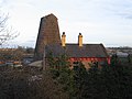 Wigton Windmill - geograph.org.uk - 126842.jpg 640 × 480; 79 KB
-
 Wigton, St Mary - geograph.org.uk - 6360711.jpg 4,608 × 3,456; 5.35 MB
-
 Windmill at Wigton - geograph.org.uk - 126841.jpg 480 × 640; 58 KB
-
 Wiza Beck - geograph.org.uk - 5004630.jpg 640 × 480; 88 KB
-
 Wiza Beck, near Wigton - geograph.org.uk - 1805425.jpg 3,296 × 2,472; 1.92 MB
-
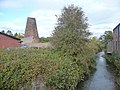 Wiza Beck, Wigton - geograph.org.uk - 4207149.jpg 1,024 × 768; 162 KB
-
 Wiza Beck, Wigton - geograph.org.uk - 58613.jpg 480 × 360; 24 KB
-
 Bank Farm, near Wigton - geograph.org.uk - 60316.jpg 640 × 480; 100 KB
-
 Carlisle to Barrow Railway - geograph.org.uk - 476220.jpg 640 × 480; 231 KB
-
 Crossroads - geograph.org.uk - 522638.jpg 640 × 480; 193 KB


_-_geograph.org.uk_-_5411990.jpg)
_-_geograph.org.uk_-_5411994.jpg)


_-_geograph.org.uk_-_5122207.jpg)
.jpg)
.jpg)
.jpg)
.jpg)


_(14778707311).jpg)


.jpg)


_-_geograph.org.uk_-_5412286.jpg)
_-_geograph.org.uk_-_5412291.jpg)
_-_geograph.org.uk_-_5412057.jpg)
_-_geograph.org.uk_-_5412062.jpg)
_-_geograph.org.uk_-_5412261.jpg)
_-_geograph.org.uk_-_5412266.jpg)


_-_geograph.org.uk_-_5412101.jpg)
_-_geograph.org.uk_-_5412105.jpg)
_-_geograph.org.uk_-_5412106.jpg)


_-_geograph.org.uk_-_4207107.jpg)


,_Wigton_-_geograph.org.uk_-_2904973.jpg)


.jpg)


.jpg)


_-_geograph.org.uk_-_5434945.jpg)


