Category:Willesley St Thomas' Church
Jump to navigation
Jump to search
| Object location | | View all coordinates using: OpenStreetMap |
|---|
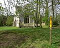
church building in Ashby-de-la-Zouch, North West Leicestershire, Leicestershire, UK  | |||||
| Upload media | |||||
| Instance of | |||||
|---|---|---|---|---|---|
| Location | Ashby-de-la-Zouch, North West Leicestershire, Leicestershire, East Midlands, England | ||||
| Heritage designation |
| ||||
 | |||||
Media in category "Willesley St Thomas' Church"
This category contains only the following file.
-
 Willesley Church.jpg 640 × 511; 139 KB