Category:Wilstone
Jump to navigation
Jump to search
English: Wilstone is the name of an English village and a reservoir approximately two miles north-west of Tring, Hertfordshire. The village lies within the civil parish of Tring Rural, close to the boundary with Buckinghamshire.
village in Hertfordshire, United Kingdom  | |||||
| Upload media | |||||
| Instance of | |||||
|---|---|---|---|---|---|
| Location | Tring Rural, Dacorum, Hertfordshire, East of England, England | ||||
 | |||||
Subcategories
This category has the following 4 subcategories, out of 4 total.
Media in category "Wilstone"
The following 81 files are in this category, out of 81 total.
-

-

-

-
 A More Mature Hedgerow - geograph.org.uk - 1221763.jpg 640 × 480; 244 KB
-

-
 All that remains of a once living tree - geograph.org.uk - 1221775.jpg 480 × 640; 273 KB
-
-

-

-
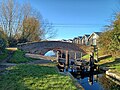
 Aylesbury Arm, Lock No 7 - geograph.org.uk - 1443001.jpg 640 × 480; 59 KB
-

-
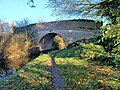
 Aylesbury Arm, Wilstone Lock (No 8) - geograph.org.uk - 1442999.jpg 640 × 480; 77 KB
-

-
 Black Poplar, Watery Lane - geograph.org.uk - 606821.jpg 618 × 640; 192 KB
-
 Clearance work on the Wendover Arm - geograph.org.uk - 603873.jpg 640 × 477; 114 KB
-

-
-

-
-

-
 Cottage in Wilston, Hertfordshire (O51633).jpg 768 × 521; 114 KB
-
 Cottage, Wilstone - geograph.org.uk - 414721.jpg 640 × 449; 165 KB
-
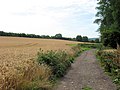
 Ears of Wheat just before harvesting - geograph.org.uk - 1440344.jpg 640 × 480; 90 KB
-

-

-
 Footbridge across stream, Watery Lane - geograph.org.uk - 606846.jpg 640 × 480; 200 KB
-

-
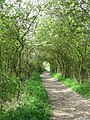
 Footpath off Watery Lane - geograph.org.uk - 606840.jpg 573 × 640; 194 KB
-

-
 Grand Union Canal - geograph.org.uk - 23085.jpg 640 × 480; 136 KB
-
 Hawthorn in bloom in Wilstone Cemetery - geograph.org.uk - 1217372.jpg 2,448 × 3,264; 5.26 MB
-

-

-

-
 Lych Gate and Yew Tunnel, Wilstone Cemetery - geograph.org.uk - 1217365.jpg 2,448 × 3,264; 4.02 MB
-
 Lychgate close-up, Wilstone Cemetery - geograph.org.uk - 716794.jpg 480 × 640; 185 KB
-
 Marshy ground alongside Watery Lane - geograph.org.uk - 606842.jpg 448 × 640; 175 KB
-
 Misty morning on the Wendover Arm - geograph.org.uk - 603838.jpg 640 × 477; 69 KB
-
 New footbridge on Wendover Arm - geograph.org.uk - 603796.jpg 640 × 477; 87 KB
-
 New footbridge on Wendover Arm - geograph.org.uk - 603831.jpg 640 × 477; 96 KB
-
 New footbridge on Wendover Arm - geograph.org.uk - 603861.jpg 640 × 465; 96 KB
-

-

-

-
-

-

-
 The County Boundary Footpath and Hedge - geograph.org.uk - 1221753.jpg 480 × 640; 182 KB
-
 The Footpath from Wilstone Reservoir - geograph.org.uk - 1251594.jpg 1,944 × 2,592; 3.1 MB
-

-
 The haze hangs in the vale - geograph.org.uk - 603856.jpg 640 × 477; 67 KB
-
 The mist clears from Aylesbury Vale - geograph.org.uk - 603850.jpg 640 × 477; 68 KB
-
 The Old Forge, Wilstone - geograph.org.uk - 1228236.jpg 640 × 480; 74 KB
-

-

-
 This Stretch Limo has got the Hump - geograph.org.uk - 1608736.jpg 640 × 480; 62 KB
-

-

-

-

-
-
-
 Tring Rural - Lock Number 4 - 20231125124645.jpg 4,000 × 3,000; 4.84 MB
-
 Tring Rural - Lock Number 4 - 20231125124726.jpg 4,000 × 3,000; 5.36 MB
-

-

-

-
 View from the towpath - geograph.org.uk - 603879.jpg 640 × 477; 70 KB
-
 View from the Wendover Arm - geograph.org.uk - 603961.jpg 640 × 477; 119 KB
-
 War Grave, Wilstone Cemetery - geograph.org.uk - 1217382.jpg 477 × 640; 175 KB
-

-
 Wendover Arm, new footbridge No 4 - geograph.org.uk - 527514.jpg 640 × 480; 125 KB
-
 Wendover Arm, new footbridge no 4A - geograph.org.uk - 527530.jpg 640 × 480; 102 KB
-
-
 Wilstone Cemetery - geograph.org.uk - 716807.jpg 640 × 480; 187 KB
-
 Wilstone Cemetery Lychgate - geograph.org.uk - 716790.jpg 640 × 480; 158 KB
-
 Wilstone Cemetery, near Tring - geograph.org.uk - 1217346.jpg 3,264 × 2,448; 4.79 MB
-

-

-
 Wilstone Village Hall on Fete Day - geograph.org.uk - 1342447.jpg 640 × 384; 49 KB
-
 Yew Avenue, Wilstone Cemetery - geograph.org.uk - 716801.jpg 480 × 640; 210 KB


_at_Wilstone_-_geograph.org.uk_-_1608731.jpg)
_-_geograph.org.uk_-_1442993.jpg)
_-_geograph.org.uk_-_1442994.jpg)

_-_geograph.org.uk_-_1442998.jpg)
_-_geograph.org.uk_-_1442999.jpg)
_-_geograph.org.uk_-_1442995.jpg)


.jpg)


_And_Lock_Number_6_Adjoining_On_East_-_20231125123629.jpg)
_And_Lock_Number_6_Adjoining_On_East_-_20231125123705.jpg)
_And_Lock_Number_8_Adjoining_On_East_-_20231125122812.jpg)
_And_Lock_Number_8_Adjoining_On_East_-_20231125122834.jpg)
_And_Lock_Number_8_Adjoining_On_East_-_20231125122906.jpg)


