Category:Winklebury
Jump to navigation
Jump to search
suburb of Basingstoke, Hampshire, England  | |||||
| Upload media | |||||
| Instance of | |||||
|---|---|---|---|---|---|
| Part of | |||||
| Location | Basingstoke and Deane, Hampshire, South East England, England | ||||
 | |||||
Winklebury is a ward of Basingstoke and Deane and a suburb of Basingstoke.
Subcategories
This category has the following 14 subcategories, out of 14 total.
B
- Beech Way, Basingstoke (18 F)
C
- Corfe Walk, Basingstoke (26 F)
E
- Elmwood Way, Basingstoke (16 F)
F
- Fort Hill Community School (34 F)
H
- Hawthorn Way, Basingstoke (14 F)
K
- Kenilworth Road, Basingstoke (46 F)
R
- Roman Road, Winklebury (26 F)
T
- Tintagel Close, Basingstoke (12 F)
W
- Warwick Road, Basingstoke (21 F)
- Watson Way, Winklebury (22 F)
- Wellington Terrace, Basingstoke (11 F)
- Wilmott Way, Winklebury (13 F)
- Winklebury Camp, Basingstoke (7 F)
- Winklebury Way, Winklebury (49 F)
Media in category "Winklebury"
The following 200 files are in this category, out of 367 total.
(previous page) (next page)-
 'Semis' in Tiverton Road - geograph.org.uk - 796376.jpg 640 × 455; 54 KB
-
 A bit of space - geograph.org.uk - 716324.jpg 640 × 473; 101 KB
-
 A colourful Ashwood Way - geograph.org.uk - 1033635.jpg 640 × 470; 84 KB
-
 A few saplings - geograph.org.uk - 1066310.jpg 640 × 472; 109 KB
-
 Access road to Winklebury Estate - geograph.org.uk - 1008615.jpg 640 × 480; 95 KB
-
 Access turning for Winklebury Centre - geograph.org.uk - 1065883.jpg 640 × 490; 76 KB
-
 All weather play area - geograph.org.uk - 1015312.jpg 640 × 473; 55 KB
-
 Approach to former school (geograph 6803687).jpg 1,024 × 768; 360 KB
-
 Approaching Ashwood Way roundabout - geograph.org.uk - 1008593.jpg 640 × 478; 79 KB
-
 Arundel Gardens - geograph.org.uk - 1081016.jpg 478 × 640; 52 KB
-
 Arundel Gardens - geograph.org.uk - 660903.jpg 640 × 457; 88 KB
-
 Arundel Gardens - geograph.org.uk - 660906.jpg 640 × 480; 92 KB
-
 Arundel Gardens - geograph.org.uk - 660931.jpg 640 × 460; 52 KB
-
 Arundel Gardens - geograph.org.uk - 661049.jpg 640 × 458; 55 KB
-
 Ashwood Centre - geograph.org.uk - 1761969.jpg 640 × 480; 83 KB
-
 Ashwood Park - geograph.org.uk - 1033586.jpg 640 × 478; 71 KB
-
 Ashwood Park - geograph.org.uk - 1033605.jpg 640 × 475; 74 KB
-
 Ashwood Park car park - geograph.org.uk - 1033567.jpg 640 × 477; 108 KB
-
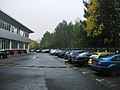
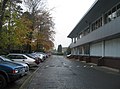
 Ashwood Park offices - geograph.org.uk - 1033568.jpg 640 × 472; 59 KB
-
 Ashwood Park offices - geograph.org.uk - 1033582.jpg 640 × 469; 65 KB
-
 Ashwood Park offices - geograph.org.uk - 1033627.jpg 640 × 469; 74 KB
-
 Ashwood Road - geograph.org.uk - 1290284.jpg 640 × 471; 55 KB
-

-
 Ashwood Way - geograph.org.uk - 1008604.jpg 640 × 473; 86 KB
-
 Ashwood Way - geograph.org.uk - 1033644.jpg 640 × 482; 126 KB
-
 Ashwood Way - geograph.org.uk - 701951.jpg 640 × 478; 90 KB
-
 Ashwood Way - geograph.org.uk - 743638.jpg 640 × 490; 83 KB
-
 Ashwood Way roundabout - geograph.org.uk - 701928.jpg 640 × 467; 46 KB
-
 Augustus Drive - geograph.org.uk - 1746431.jpg 640 × 480; 66 KB
-
 Augustus Drive - geograph.org.uk - 660936.jpg 640 × 471; 60 KB
-
 Augustus Drive - geograph.org.uk - 816732.jpg 640 × 473; 83 KB
-
 Augustus Drive - geograph.org.uk - 816733.jpg 640 × 478; 69 KB
-
 Augustus Drive Housing - geograph.org.uk - 816730.jpg 640 × 466; 67 KB
-
 Autumn colour - Ashwood Way - geograph.org.uk - 1033630.jpg 490 × 640; 106 KB
-
 Autumn colours - Winklebury - geograph.org.uk - 1008609.jpg 480 × 640; 149 KB
-
 Avenue of trees - geograph.org.uk - 660037.jpg 640 × 480; 132 KB
-
 Avenue with no leaves - geograph.org.uk - 1033663.jpg 479 × 640; 125 KB
-
 Aylings Close - geograph.org.uk - 796446.jpg 640 × 480; 125 KB
-
 Aylings Close - geograph.org.uk - 796449.jpg 640 × 453; 66 KB
-
 Aylings Close - geograph.org.uk - 796452.jpg 640 × 480; 116 KB
-
 Baden Gardens - geograph.org.uk - 1761252.jpg 640 × 480; 100 KB
-
 Basketball courts - Winklebury - geograph.org.uk - 1015349.jpg 640 × 477; 59 KB
-
 Beckett Close - geograph.org.uk - 796460.jpg 640 × 468; 60 KB
-
 Beckett Close - Worting - geograph.org.uk - 792873.jpg 640 × 480; 66 KB
-
 Beckett Close- Worting - geograph.org.uk - 792870.jpg 640 × 480; 75 KB
-
 Between The Trees - geograph.org.uk - 816747.jpg 480 × 640; 119 KB
-
 Bin in the snow - geograph.org.uk - 1237035.jpg 640 × 476; 61 KB
-
 Blackthorn Way - geograph.org.uk - 653835.jpg 640 × 480; 133 KB
-
 Blue Garages - geograph.org.uk - 1054081.jpg 640 × 473; 85 KB
-

-
 Bungalow on Willow Way - geograph.org.uk - 991313.jpg 640 × 474; 60 KB
-
 Bury Road view - geograph.org.uk - 680846.jpg 640 × 490; 81 KB
-
 Bus stop on Kingsclere Road - geograph.org.uk - 1746435.jpg 640 × 480; 84 KB
-
 Carbonel Close - geograph.org.uk - 796458.jpg 640 × 480; 75 KB
-
 Carbonel Close - geograph.org.uk - 796459.jpg 640 × 472; 77 KB
-
 Castle Hill Junior School - geograph.org.uk - 1066318.jpg 640 × 475; 66 KB
-
 Castle Hill playing fields - geograph.org.uk - 1066313.jpg 640 × 421; 48 KB
-
 Cedar Way - geograph.org.uk - 667487.jpg 640 × 499; 47 KB
-
 Cedar Way - geograph.org.uk - 701942.jpg 640 × 466; 51 KB
-
 Children's playground - geograph.org.uk - 1081085.jpg 640 × 461; 66 KB
-
 Claudius Drive - Augustus Drive - geograph.org.uk - 816736.jpg 640 × 472; 80 KB
-
 Coming off the ring road - geograph.org.uk - 1236980.jpg 640 × 475; 42 KB
-
 Corner of Hastings Close - geograph.org.uk - 796390.jpg 640 × 476; 83 KB
-
 Corner of the playground - geograph.org.uk - 1020216.jpg 640 × 468; 91 KB
-
 Cul-de-Sac - geograph.org.uk - 627641.jpg 640 × 480; 75 KB
-
 Curves in Ashwood Way - geograph.org.uk - 1033645.jpg 640 × 476; 107 KB
-
 Cut through off Napoleon Drive - geograph.org.uk - 1761290.jpg 640 × 480; 95 KB
-
 Cycle Path and Underpass - geograph.org.uk - 632017.jpg 480 × 640; 79 KB
-
 Cycle path to the Houndmills Estate - geograph.org.uk - 667457.jpg 640 × 476; 104 KB
-

-
 Cycleway into Winklebury - geograph.org.uk - 1761933.jpg 640 × 480; 85 KB
-
 Cycleway leaving Winklebury - geograph.org.uk - 869730.jpg 640 × 480; 86 KB
-
 Daffodils in Winklebury - geograph.org.uk - 1283468.jpg 640 × 475; 137 KB
-
 Disused car park - geograph.org.uk - 1283227.jpg 640 × 474; 71 KB
-
 Dorchester Close - geograph.org.uk - 796407.jpg 640 × 462; 70 KB
-
 Dorchester Close - geograph.org.uk - 796411.jpg 640 × 449; 82 KB
-
 Dudley Close - geograph.org.uk - 796357.jpg 640 × 476; 97 KB
-
 Dunsford Crescent - geograph.org.uk - 1541423.jpg 640 × 466; 57 KB
-
 Dunsford Crescent - geograph.org.uk - 1761242.jpg 640 × 480; 78 KB
-

-
 Edge of town - geograph.org.uk - 623201.jpg 640 × 480; 70 KB
-
 Empty school playground - geograph.org.uk - 1020213.jpg 640 × 469; 65 KB
-
 End house in Oaklands Way - geograph.org.uk - 1081094.jpg 640 × 477; 82 KB
-
 End of Dover Close - geograph.org.uk - 1040198.jpg 640 × 461; 76 KB
-
 End of Napoleon Drive - geograph.org.uk - 1761283.jpg 640 × 480; 62 KB
-
 End of Oaklands Way - geograph.org.uk - 1081096.jpg 640 × 454; 50 KB
-

-
 Entrance to Aylings Close - geograph.org.uk - 796453.jpg 640 × 480; 92 KB
-
 Estate footpath - geograph.org.uk - 716331.jpg 640 × 458; 83 KB
-

-
 Firs Way - geograph.org.uk - 660918.jpg 640 × 454; 52 KB
-
 Firs Way - geograph.org.uk - 660925.jpg 640 × 455; 51 KB
-
 Firs Way housing - geograph.org.uk - 660928.jpg 640 × 453; 52 KB
-

-
 Footbridge over ring road - geograph.org.uk - 1060161.jpg 640 × 480; 101 KB
-
 Footbridge Ramp - geograph.org.uk - 1215145.jpg 640 × 483; 88 KB
-
 Footbridge ramp - geograph.org.uk - 1746461.jpg 640 × 480; 119 KB
-

-
 Footpath along Winklebury playing fields - geograph.org.uk - 660310.jpg 640 × 471; 105 KB
-
 Footpath and footbridge - geograph.org.uk - 660040.jpg 640 × 480; 101 KB
-
 Footpath between the houses - geograph.org.uk - 1081074.jpg 640 × 480; 88 KB
-
 Footpath by Winklebury Juniors - geograph.org.uk - 1006151.jpg 640 × 480; 96 KB
-
 Footpath in the woods - geograph.org.uk - 742492.jpg 640 × 474; 125 KB
-
 Footpath in woodlands - geograph.org.uk - 658155.jpg 640 × 494; 155 KB
-
 Footpath into the estate - geograph.org.uk - 1081038.jpg 464 × 640; 73 KB
-
 Footpath ramp - geograph.org.uk - 660379.jpg 640 × 480; 117 KB
-
 Footpath Ramp - Newbury Road roundabout - geograph.org.uk - 667461.jpg 640 × 480; 118 KB
-
 Footpath to Augustus Drive - geograph.org.uk - 1081029.jpg 640 × 471; 81 KB
-
 Footpath to the Leisure Park - geograph.org.uk - 1082989.jpg 640 × 480; 60 KB
-
 Footpath to the shops - geograph.org.uk - 1761647.jpg 600 × 800; 117 KB
-
 Footpath to Winklebury Centre - geograph.org.uk - 1085113.jpg 640 × 480; 118 KB
-
 Footpath within the Winklebury Estate - geograph.org.uk - 674905.jpg 640 × 477; 66 KB
-
 Four in a row - geograph.org.uk - 1066377.jpg 640 × 478; 82 KB
-
 Garages for Winklebury flats - geograph.org.uk - 2436171.jpg 640 × 480; 64 KB
-
 Gateway to Winklebury - geograph.org.uk - 609628.jpg 640 × 480; 122 KB
-
 Going Down - geograph.org.uk - 816749.jpg 640 × 480; 121 KB
-
 Grand 'semis' in Tiverton Road - geograph.org.uk - 796396.jpg 640 × 462; 83 KB
-
 Green space amongst the houses - geograph.org.uk - 1033533.jpg 640 × 468; 68 KB
-
 Green space off Ludlow Close - geograph.org.uk - 1282101.jpg 640 × 480; 285 KB
-
 Greenway Footpath - geograph.org.uk - 1016963.jpg 640 × 480; 128 KB
-

-
 Hadrians Way - geograph.org.uk - 816735.jpg 640 × 464; 74 KB
-
 Hampton Court - geograph.org.uk - 730430.jpg 640 × 471; 73 KB
-
 Hastings Close - geograph.org.uk - 796387.jpg 640 × 459; 62 KB
-
 Hazelwood Close - far end - geograph.org.uk - 667454.jpg 640 × 477; 79 KB
-
 Hazelwood Close - geograph.org.uk - 667453.jpg 640 × 472; 59 KB
-
 Hazelwood Drive - geograph.org.uk - 627663.jpg 640 × 480; 53 KB
-
 Hazelwood Drive - geograph.org.uk - 667451.jpg 640 × 452; 72 KB
-
 Heavy snow in the fort - geograph.org.uk - 1151024.jpg 640 × 480; 93 KB
-
 Hill Fort Boundary - geograph.org.uk - 853221.jpg 640 × 484; 86 KB
-
 Hillcrest Walk - geograph.org.uk - 1037511.jpg 464 × 640; 109 KB
-
 Hillcrest Walk - geograph.org.uk - 1066323.jpg 480 × 640; 82 KB
-
 Hillcrest Walk - geograph.org.uk - 622687.jpg 480 × 640; 122 KB
-
 Hillcrest Walk - geograph.org.uk - 653688.jpg 640 × 480; 125 KB
-
 House in Wayside Road (geograph 6803670).jpg 1,024 × 768; 302 KB
-
 House over footpath - geograph.org.uk - 680924.jpg 640 × 551; 86 KB
-
 Houses in Firs Way - geograph.org.uk - 1081102.jpg 640 × 445; 53 KB
-
 Houses off Kenilworth Road - geograph.org.uk - 5498632.jpg 640 × 480; 97 KB
-
 Houses off Kenilworth Road - geograph.org.uk - 5498637.jpg 640 × 499; 72 KB
-
 Houses off Kenilworth Road - geograph.org.uk - 5498642.jpg 640 × 488; 73 KB
-
 Houses on Roman Road - geograph.org.uk - 686324.jpg 640 × 452; 81 KB
-
 Housing in Hazelwood Close - geograph.org.uk - 816748.jpg 640 × 460; 78 KB
-
 Housing in Tiberius Close - geograph.org.uk - 1081065.jpg 640 × 452; 77 KB
-
 Housing in Tiberius Close - geograph.org.uk - 816729.jpg 640 × 474; 85 KB
-
 Housing in Tiverton Road - geograph.org.uk - 796352.jpg 640 × 459; 117 KB
-
 Housing off Hillcrest Walk - geograph.org.uk - 681804.jpg 640 × 480; 126 KB
-
 Housing off Willoughby Way - geograph.org.uk - 680079.jpg 640 × 470; 50 KB
-
 Improving the open space - geograph.org.uk - 1748788.jpg 640 × 480; 61 KB
-
 Is this rural urban fringe^ - geograph.org.uk - 658258.jpg 640 × 492; 163 KB
-
 Kids Play Area - Winklebury - geograph.org.uk - 852512.jpg 640 × 457; 73 KB
-
 Kids Playground - geograph.org.uk - 1054071.jpg 640 × 477; 114 KB
-
 Kids playground - Winklebury - geograph.org.uk - 1015300.jpg 640 × 444; 88 KB
-
 Kingsclere Road roundabout - geograph.org.uk - 1746471.jpg 640 × 480; 67 KB
-
 Laburnum Way - geograph.org.uk - 1008556.jpg 640 × 477; 63 KB
-
 Laburnum Way - housing - geograph.org.uk - 667830.jpg 640 × 451; 47 KB
-
 Laburnum Way garages - geograph.org.uk - 667493.jpg 640 × 457; 34 KB
-
 Laburnum Way garages - geograph.org.uk - 667506.jpg 640 × 465; 40 KB
-
 Laburnum Way Housing - geograph.org.uk - 1008546.jpg 640 × 471; 59 KB
-
 Last houses in Hazelwood Close - geograph.org.uk - 1761311.jpg 640 × 480; 84 KB
-
 Leafy school grounds - geograph.org.uk - 1015289.jpg 640 × 450; 62 KB
-
 Lilac Way - geograph.org.uk - 1008553.jpg 640 × 466; 67 KB
-
 Lilac Way corner housing - geograph.org.uk - 667831.jpg 640 × 475; 73 KB
-
 Lilac way, Winklebury - geograph.org.uk - 279535.jpg 640 × 427; 92 KB
-
 Link to the outside world - geograph.org.uk - 1014097.jpg 640 × 474; 70 KB
-
 Local Playground - geograph.org.uk - 623197.jpg 640 × 480; 78 KB
-
 Local rubbish tip - geograph.org.uk - 1270867.jpg 640 × 480; 117 KB
-
 Lone Car - Winklebury playing fields - geograph.org.uk - 661020.jpg 640 × 470; 61 KB
-
 Lone cyclist - geograph.org.uk - 1541469.jpg 640 × 480; 68 KB
-
 Long shadows on Dunsford Crescent - geograph.org.uk - 1541433.jpg 640 × 488; 60 KB
-
 Look right - geograph.org.uk - 1283454.jpg 640 × 475; 87 KB
-
 Looking Along Augustus Drive - geograph.org.uk - 816731.jpg 640 × 466; 70 KB
-
 Looking down Ashwood Way - geograph.org.uk - 1033640.jpg 640 × 471; 72 KB
-
 Looking down Green Way (geograph 6803690).jpg 1,024 × 768; 340 KB
-
 Looking down Napoleon Drive - geograph.org.uk - 1761247.jpg 640 × 480; 106 KB
-
 Looking into Hazelwood Drive - geograph.org.uk - 1761305.jpg 640 × 480; 90 KB
-
 Looking north along Pendennis Close - geograph.org.uk - 681868.jpg 640 × 480; 58 KB
-
 Looking south down Dover Close - geograph.org.uk - 1040196.jpg 640 × 458; 80 KB
-
 Looking south down Sycamore Way - geograph.org.uk - 667836.jpg 640 × 471; 46 KB
-
 Looking towards Basingstoke station - geograph.org.uk - 660056.jpg 640 × 480; 68 KB
-
 Looking towards Macmillan - geograph.org.uk - 1162045.jpg 640 × 473; 80 KB
-
 Looking towards Pendennis Court - geograph.org.uk - 1058374.jpg 640 × 467; 75 KB
-

-

-
 Ludlow Close housing - geograph.org.uk - 1282104.jpg 593 × 464; 230 KB
-
 Main line to London - geograph.org.uk - 1067012.jpg 640 × 470; 99 KB
-
 Many Down - geograph.org.uk - 1080818.jpg 640 × 460; 39 KB
-
 Napoleon Drive - geograph.org.uk - 1761243.jpg 640 × 480; 73 KB
-
 Napoleon Drive - geograph.org.uk - 1761278.jpg 640 × 480; 72 KB
-
 Neat houses in Ludlow Close - geograph.org.uk - 1282095.jpg 620 × 459; 148 KB
-
 New decorations for the estate - geograph.org.uk - 1242548.jpg 640 × 469; 73 KB
-
 New fencing and shrub bed - geograph.org.uk - 1242558.jpg 640 × 465; 78 KB
-
 New footpath and woodlands - geograph.org.uk - 1541440.jpg 640 × 482; 118 KB
-
 Newbury Road - A339 - geograph.org.uk - 1015277.jpg 640 × 474; 40 KB
-
 Newbury Road roundabout - geograph.org.uk - 1087608.jpg 640 × 418; 36 KB
-
 Newbury Road, Basingstoke - geograph.org.uk - 1215149.jpg 640 × 462; 69 KB
-
 No longer trading - geograph.org.uk - 1272710.jpg 640 × 467; 50 KB
-
 No more Peter Green - geograph.org.uk - 660947.jpg 640 × 454; 43 KB
-
 No sign of the cycle path - geograph.org.uk - 1236972.jpg 640 × 494; 59 KB
-
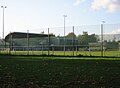
 North Hants FA - football grandstand - geograph.org.uk - 1270466.jpg 640 × 477; 70 KB
-
 North Hants FA - Winklebury - geograph.org.uk - 1015372.jpg 640 × 472; 53 KB


.jpg)


.jpg)


.jpg)


