Category:Wintzenheim
Jump to navigation
Jump to search
commune in Haut-Rhin, France  .svg)  | |||||
| Upload media | |||||
| Pronunciation audio | |||||
|---|---|---|---|---|---|
| Instance of | |||||
| Located in protected area | |||||
| Location |
| ||||
| Population |
| ||||
| Area |
| ||||
| official website | |||||
 | |||||
Subcategories
This category has the following 20 subcategories, out of 20 total.
*
- Valued images of Wintzenheim (2 F)
B
- Blue sky in Wintzenheim (4 F)
E
F
- Ferme Saint-Gilles (1 F)
G
- Gare de Logelbach (1 F)
H
J
L
M
- Maps of Wintzenheim (3 F)
P
- Château du Pflixbourg (43 F)
Media in category "Wintzenheim"
The following 74 files are in this category, out of 74 total.
-
 43. Fontaine de la Dame. (1).jpg 4,000 × 3,000; 5.36 MB
-

-
 Autel forestier, au-dessus des grottes-chapelles.jpg 1,704 × 2,272; 2.11 MB
-
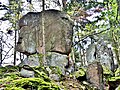
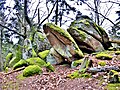
 Bloc étrange.jpg 3,000 × 4,000; 3.54 MB
-
 Blocs fendus, couchés.jpg 3,000 × 4,000; 3.66 MB
-
 Borne pflixbourg.JPG 550 × 756; 264 KB
-
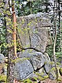
 Chaos rocheux du rocher Turenne.jpg 4,000 × 3,000; 3.46 MB
-
 Croix ancienne avec inscriptions illisibles.jpg 2,272 × 1,704; 2.14 MB
-
 Fontaine de la Dame. (2).jpg 4,000 × 3,000; 4.34 MB
-
 Fontaine de la Dame. Sculpture à côté de la source.jpg 4,000 × 3,000; 3.45 MB
-
 Fontaine de la Dame. Sculpture, près de la source.jpg 4,000 × 3,000; 3.98 MB
-
 Fontaine de la Vierge, sur la place centrale. Wintzenheim.jpg 2,170 × 1,628; 1.54 MB
-
 Fontaine. Wintzenheim.jpg 1,936 × 1,476; 1.41 MB
-
 Informations sur le rocher Turenne.jpg 4,000 × 3,000; 1.58 MB
-
 La boule.rocheuse.jpg 4,000 × 3,000; 3.27 MB
-
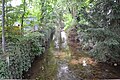
 La Logelbach depuis la rue des Prés 0015.JPG 4,608 × 3,072; 3.51 MB
-
 La Logelbach vue de la cours de l’École Steiner 0007.JPG 3,072 × 4,608; 3.57 MB
-
 La Logelbach vue de la cours de l’École Steiner 0008.JPG 4,608 × 3,072; 3.47 MB
-
 La Logelbach vue de la cours de l’École Steiner 0009.JPG 4,608 × 3,072; 3.46 MB
-
 La Logelbach vue de la rue Adolphe Hirn 0005.JPG 3,072 × 4,608; 3.58 MB
-
 La Logelbach vue de la rue Adolphe Hirn 0006.JPG 3,072 × 4,608; 3.53 MB
-
 La Logelbach vue depuis la cours de l’École Steiner 0010.JPG 3,072 × 4,608; 3.58 MB
-
 La Logelbach vue depuis la route d’Eguisheim 0011.JPG 4,608 × 3,072; 3.53 MB
-
 La Logelbach vue depuis la route d’Eguisheim 0012.jpg 3,072 × 4,608; 3.57 MB
-
 La Logelbach vue depuis la route d’Eguisheim 0013.JPG 4,608 × 3,072; 3.55 MB
-
 La Logelbach vue depuis la route d’Eguisheim 0014.JPG 3,072 × 4,608; 3.54 MB
-
 La tête du géant. (3).jpg 3,000 × 4,000; 3.22 MB
-
 Le chaos de bout de crête.jpg 4,000 × 3,000; 2.89 MB
-
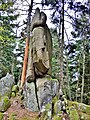 Le géant de pierre.jpg 3,000 × 4,000; 3.69 MB
-
 Les géants de pierre.jpg 3,000 × 4,000; 2.91 MB
-
 Looking East at Comar - panoramio - Francois Schnell.jpg 1,600 × 370; 165 KB
-
 Looking East at Comar - panoramio.jpg 1,600 × 1,200; 366 KB
-
 Looking North from Hohlandsburg castle - panoramio.jpg 1,600 × 788; 204 KB
-
 Looking SE - panoramio.jpg 1,600 × 843; 186 KB
-
 Looking SE at Hohlandsburg castle - panoramio.jpg 1,600 × 561; 111 KB
-
 Looking SW from Hohlandsburg castle - panoramio.jpg 1,600 × 549; 98 KB
-
 Looking West at Pflixburg castle-ruin - panoramio.jpg 1,200 × 1,600; 715 KB
-
 Looking West from Hohlandsburg castle - panoramio - Francois Schnell.jpg 1,600 × 982; 148 KB
-
 Looking West from Hohlandsburg castle - panoramio.jpg 1,600 × 728; 87 KB
-
 Looking West Hohlandsburg castle - panoramio.jpg 1,536 × 411; 64 KB
-
 Menhirs naturels.jpg 3,000 × 4,000; 3.04 MB
-
 Monument aux morts des Première et Seconde Guerres mondiales (Wintzenheim).jpg 3,600 × 4,500; 4.44 MB
-
 Panorama sur Wintezenheim depuis les grottes-chapelles.jpg 2,127 × 1,593; 1.4 MB
-
 Panorama sur Wintzenheim, depuis le gîte Romain.jpg 2,272 × 1,704; 2.14 MB
-
 Plixbourg tower (looking SE) - panoramio.jpg 1,600 × 421; 175 KB
-
 Poissonrouge.jpg 661 × 425; 189 KB
-
 Population - Municipality code 68374.svg 475 × 355; 13 KB
-
 Rocher Jeanne et Monique. Saint-Gilles.jpg 2,272 × 1,704; 2.19 MB
-
 Rocher semblable à une tête de géant. (2).jpg 4,000 × 3,000; 3.75 MB
-
 Rocher Turenne. (1).jpg 4,000 × 3,000; 3.94 MB
-
 Rocher Turenne. (2).jpg 4,000 × 3,000; 3.62 MB
-
 Rocher Turenne. (3).jpg 4,000 × 3,000; 3.72 MB
-
 Rocher Turenne. (4).jpg 4,000 × 3,000; 3.89 MB
-
 Rocher Turenne. (5).jpg 4,000 × 3,000; 3.35 MB
-
 Rocher Turenne. (6).jpg 4,000 × 3,000; 3.52 MB
-
 Rocher Turenne. (7).jpg 4,000 × 3,000; 1.74 MB
-
 Rocher Turenne. (8).jpg 4,000 × 3,000; 3.94 MB
-
 Rocher Turenne. (9).jpg 4,000 × 3,000; 3.83 MB
-
 Rochers auxc alentours du rocher Turenne.jpg 4,000 × 3,000; 4.2 MB
-
 Rochers couchés géants.jpg 4,000 × 3,000; 3.43 MB
-
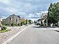 Rue Clémenceau. Wintzenheim.jpg 2,220 × 1,664; 1.4 MB
-
 Sentier des roches. Saint-Gilles.jpg 2,272 × 1,704; 2.06 MB
-
 Sentier à Wintzenheim.jpg 2,592 × 1,944; 1.13 MB
-
 Statuettes,, dans un mur. Wintzenheim.jpg 1,883 × 1,560; 1.13 MB
-
 Vue depuis le château du Hohlandsbourg (654 m) - ville (Colmar).jpg 4,288 × 3,216; 1.34 MB
-
 Vue depuis le château du Hohlandsbourg (654 m) - ville (Wintzenheim).jpg 4,288 × 3,216; 2.57 MB
-
 Vue depuis le château du Hohlandsbourg (654 m).jpg 4,288 × 3,216; 1.48 MB
-
 Vue du Château du Hohlandsbourg (654 m) - Ville (Colmar).jpg 2,592 × 1,944; 525 KB
-
 Blason de la ville de Wintzenheim (68).svg 600 × 660; 24 KB
-
 Wintzenheim Prieuré Saint Gilles.jpg 2,977 × 1,925; 1.48 MB
-
 Wintzenheim, straatzicht1 Rue Clemenceau foto2 2013-07-24 09.46.jpg 4,416 × 3,312; 9.07 MB
-
 Wintzenheim, straatzicht2 Rue Clemenceau foto3 2013-07-24 09.57.jpg 4,416 × 3,312; 7.34 MB
-
 Wintzenheim, vu de la route des chapelles des bois (2).jpg 2,272 × 1,704; 1.56 MB
-
 Wintzenheim, vu de la route des chapelles des bois.jpg 2,272 × 1,704; 1.55 MB
.jpg)


.jpg)


.jpg)


.jpg)


.jpg)
.jpg)
.jpg)
.jpg)
.jpg)
.jpg)
.jpg)
.jpg)
.jpg)
.jpg)


_-_ville_(Colmar).jpg)
_-_ville_(Wintzenheim).jpg)
.jpg)
_-_Ville_(Colmar).jpg)


.jpg)

_-_panoramio.jpg)