Category:Wo Che Estate
Jump to navigation
Jump to search
public housing estate in Sha Tin, Hong Kong  | |||||
| Upload media | |||||
| Instance of | |||||
|---|---|---|---|---|---|
| Location |
| ||||
 | |||||
中文:禾輋邨
Subcategories
This category has the following 17 subcategories, out of 17 total.
2
- 2007 in Wo Che Estate (1 F)
- 2010 in Wo Che Estate (2 F)
- 2013 in Wo Che Estate (1 F)
- 2014 in Wo Che Estate (1 F)
- 2017 in Wo Che Estate (5 F)
- 2018 in Wo Che Estate (5 F)
- 2021 in Wo Che Estate (1 F)
- 2022 in Wo Che Estate (1 F)
E
- ELCHK Wo Che Lutheran School (2 F)
K
- King Wo House (7 F)
S
- Shatin Pui Ying College (5 F)
W
- Wo Che Bus Terminus (6 F)
- Wo Che Plaza (15 F)
- Wo Che Post Office (1 F)
Media in category "Wo Che Estate"
The following 56 files are in this category, out of 56 total.
-
 Belair Gardens, Shatin (Hong Kong).jpg 3,676 × 2,519; 3.64 MB
-
 Dragon boat racing.jpg 2,092 × 1,572; 982 KB
-
 Fung Wo Lane Road site in June 2021.jpg 3,000 × 4,000; 1.56 MB
-
 HK Cityone Shatin Overview.jpg 2,176 × 1,632; 3.58 MB
-
 HK SA WoCheNurserySchool.JPG 2,560 × 1,920; 1.62 MB
-
 HK SAHK Woche Hostel RecreationCentre.JPG 3,264 × 2,448; 1.8 MB
-
 HK ShaTin JockeyClubSwimmingPool MainPool.jpg 1,600 × 1,200; 1.46 MB
-
 HK Shatin WoCheEst.jpg 1,024 × 1,280; 246 KB
-
 HK Wo Che Estate Phase 2 200807.jpg 2,096 × 1,572; 3.3 MB
-
 HK Wo Che EstateBusTerminus 20070828.jpg 1,600 × 1,200; 1.43 MB
-
 HK Wo Che Estateoverview1 20070828.jpg 1,600 × 1,200; 1.55 MB
-
 HK WoCheEstate Overview.JPG 1,280 × 960; 146 KB
-
 HKWoCheEstoverview 20070828.jpg 1,600 × 1,200; 1.79 MB
-
 Lek Yuen Estate, Luk Chuen House (Hong Kong).jpg 3,556 × 2,371; 3.09 MB
-
 Shatin.jpg 2,592 × 1,944; 1.03 MB
-
 Shatin2.jpg 2,592 × 1,944; 978 KB
-
 ShaTinJockeyClubSwimmingPool MianPool.jpg 1,280 × 1,024; 245 KB
-
 Sheng Kung Hui Tsang Shiu Tim Secondary School.jpg 6,000 × 4,000; 12.55 MB
-
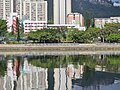
 Shing Mun River Bank.jpg 2,816 × 2,112; 2.5 MB
-
 SKH Tsang Shiu Tim Secondary School in December 2023.jpg 4,000 × 3,000; 3.45 MB
-
 Tai Po Road Shatin Section 202006.jpg 2,272 × 1,704; 3.5 MB
-
 Tak Hau Street Road site in June 2021.jpg 3,000 × 4,000; 1.21 MB
-
 Tak Hau Street, Wo Che Estate in December 2023.jpg 4,000 × 3,000; 3.85 MB
-
 Tak Hau Street, Wo Che Estate part 2 in December 2023.jpg 4,000 × 3,000; 3.24 MB
-
 The Little Flowers School 2010.jpg 2,816 × 2,112; 4.19 MB
-
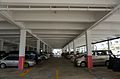 Wo Che Car Park.jpg 5,923 × 3,892; 9.84 MB
-
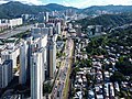
 Wo Che Estate 2010.jpg 2,073 × 1,554; 2.89 MB
-
 Wo Che Estate 2016.jpg 1,600 × 1,200; 1.6 MB
-
 Wo Che Estate 25-02-2022.jpg 4,032 × 3,024; 3.08 MB
-
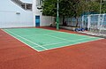 Wo Che Estate Badminton Court.jpg 5,881 × 3,826; 15.95 MB
-
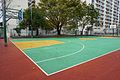 Wo Che Estate Basketball Court.jpg 6,000 × 4,000; 9.53 MB
-
 Wo Che Estate Bicycle Parking Space.jpg 5,904 × 3,881; 12.34 MB
-
 Wo Che Estate bus stop 09-01-2023(2).jpg 4,032 × 3,024; 5.43 MB
-
 Wo Che Estate bus stop 09-01-2023(3).jpg 4,032 × 3,024; 5.19 MB
-
 Wo Che Estate bus stop 09-01-2023(4).jpg 4,032 × 3,024; 6.09 MB
-
 Wo Che Estate bus stop 09-01-2023.jpg 4,032 × 3,024; 4.65 MB
-
 Wo Che Estate Covered Walkway.jpg 6,000 × 4,000; 8.97 MB
-
 Wo Che Estate Gym Zone (2).jpg 5,436 × 3,516; 16.02 MB
-
 Wo Che Estate Gym Zone (3).jpg 5,420 × 3,462; 12.53 MB
-
 Wo Che Estate Gym Zone (4).jpg 6,000 × 4,000; 16.53 MB
-
 Wo Che Estate Gym Zone.jpg 5,953 × 3,941; 15.92 MB
-
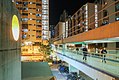 Wo Che Estate Night view 201801.jpg 1,600 × 1,067; 1.79 MB
-
 Wo Che Estate Phase 1 200807.jpg 2,245 × 1,670; 3.5 MB
-
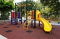 Wo Che Estate Playground (2).jpg 5,718 × 3,702; 14.63 MB
-
 Wo Che Estate Playground (3) and Sitting Area.jpg 6,000 × 4,000; 10.81 MB
-
 Wo Che Estate Playground (4).jpg 5,959 × 3,941; 19.41 MB
-
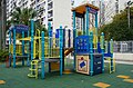 Wo Che Estate Playground.jpg 5,394 × 3,540; 12.54 MB
-
 Wo Che Estate Table Tennis Zone.jpg 1,514 × 1,000; 1.16 MB
-
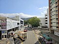
 Wo Che Market after renovation.jpg 6,000 × 4,000; 10.1 MB
-
 Wo Che Market.JPG 3,648 × 2,736; 1.77 MB
-
 Wo Che Street public housing estate proposed site.JPG 3,648 × 2,736; 5.92 MB
-
 Wo Che Street Road site in June 2021.jpg 3,000 × 4,000; 2.32 MB
-
 WoCheEst BusTerminal.jpg 1,280 × 1,024; 218 KB
-
 WoCheEst FoodCourt.jpg 1,280 × 1,024; 293 KB
-
 WoCheEst FootBridge.jpg 1,280 × 1,024; 258 KB
-
 WoCheEstate FoodCourt 20070828.jpg 1,600 × 1,200; 1.51 MB
.jpg)


.jpg)


.jpg)
.jpg)
.jpg)


.jpg)
.jpg)
.jpg)


.jpg)
_and_Sitting_Area.jpg)
.jpg)


