Category:World Bank maps
Jump to navigation
Jump to search
Media in category "World Bank maps"
The following 18 files are in this category, out of 18 total.
-
 2005IBRD loans and IDA credits.png 1,425 × 625; 61 KB
-
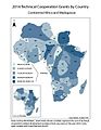 Africa Technical Cooperation Grants.jpg 612 × 792; 87 KB
-

-
 European GNI PPP Per Capita 2017.png 1,360 × 1,278; 740 KB
-
 GDP per capita, PPP (current international $) World bank, 2016.png 6,300 × 3,095; 1.62 MB
-
 Geographies of Tor.png 3,508 × 2,244; 432 KB
-
 ICSID.png 1,357 × 628; 48 KB
-
 International Centre for Settlement of Investment Disputes.png 1,357 × 628; 48 KB
-
 International Development Association.png 1,357 × 628; 47 KB
-
 Maprl.png 600 × 375; 10 KB
-
 Urban population in slums.png 1,080 × 558; 243 KB
-
 Women in workforce.png 1,080 × 551; 277 KB
-
 World Bank income groups.png 1,427 × 628; 72 KB
-
 World Bank income groups.svg 940 × 477; 1.64 MB
-
 World Bank region Natural Earth en.png 6,617 × 3,143; 384 KB
-
 World Bank region Natural Earth zhs.png 6,617 × 3,143; 363 KB
-
 World Bank region Natural Earth zht.png 6,617 × 3,143; 335 KB
-
 World Bank region World Natural Earth.svg 992 × 471; 2.68 MB


_World_bank,_2016.png)


