Category:Wormhill
Jump to navigation
Jump to search
village and civil parish in High Peak, Derbyshire, England  | |||||
| Upload media | |||||
| Instance of | |||||
|---|---|---|---|---|---|
| Location | High Peak, Derbyshire, East Midlands, England | ||||
 | |||||
Subcategories
This category has the following 9 subcategories, out of 9 total.
C
- Chee Tor Tunnels (25 F)
E
- East Buxton Lime (11 F)
M
- St Margaret's Church, Wormhill (16 F)
- Millers Dale North Viaduct (26 F)
- Millers Dale South Viaduct (22 F)
- Monk's Dale (36 F)
P
W
- Wormhill Hall (5 F)
Media in category "Wormhill"
The following 200 files are in this category, out of 398 total.
(previous page) (next page)-
 A limestone barn between Tunstead and Hargatewall - geograph.org.uk - 3475744.jpg 3,418 × 2,734; 2.16 MB
-
 A new Maerz Kiln, under construction - geograph.org.uk - 1550690.jpg 480 × 640; 73 KB
-
 A path marker down to Chee Dale - geograph.org.uk - 5068691.jpg 3,456 × 2,304; 5.01 MB
-
 A scattering of snow - geograph.org.uk - 5279523.jpg 4,896 × 3,672; 6.95 MB
-
 A wet weir on the Wye - geograph.org.uk - 4303523.jpg 1,024 × 768; 195 KB
-
 A6 near Tom Thorn Farm - geograph.org.uk - 6305123.jpg 1,024 × 769; 97 KB
-
 A6 northbound near Tomthorn - geograph.org.uk - 6305120.jpg 1,024 × 770; 85 KB
-
 Another view of Heath Farm near Smalldale - geograph.org.uk - 6400067.jpg 5,028 × 3,580; 4.55 MB
-
 At Dale Head between Hay Dale and Peter Dale - geograph.org.uk - 3091527.jpg 4,321 × 2,881; 2.64 MB
-
 At Wormhill Hill looking towards Hill Top Farm - geograph.org.uk - 3475530.jpg 3,512 × 2,509; 1.95 MB
-
 At Wormhill Springs - geograph.org.uk - 2829541.jpg 1,952 × 2,608; 2.25 MB
-
 Bagshawe Arms Farm, Wormhill - geograph.org.uk - 3475541.jpg 3,386 × 2,540; 1.65 MB
-
 Barn and distant quarry - geograph.org.uk - 1765582.jpg 640 × 480; 53 KB
-
 Barn To South South East Of Knotlow Farmhouse.jpg 4,000 × 3,000; 4.86 MB
-
 Barn To The North West Of Old Hall Farmhouse.jpg 4,000 × 3,000; 6.56 MB
-
 Barn To The West Of Old Hall Farmhouse.jpg 4,000 × 3,000; 6.95 MB
-
 Barn, field and badger sett, near Wormhill - geograph.org.uk - 4397837.jpg 4,912 × 3,264; 6.69 MB
-
 Bibbington crag - geograph.org.uk - 1864045.jpg 640 × 480; 83 KB
-
 Bibbington Crag - geograph.org.uk - 1864049.jpg 640 × 507; 97 KB
-
 Birthplace of James Brindley - geograph.org.uk - 2606300.jpg 2,464 × 3,296; 1.12 MB
-
 Blackwell Cottages - geograph.org.uk - 2013342.jpg 3,888 × 2,592; 5.68 MB
-
 Blackwell Cottages - geograph.org.uk - 4957046.jpg 640 × 480; 100 KB
-
 Blackwell Mill cottages - geograph.org.uk - 2489421.jpg 1,024 × 768; 409 KB
-
 Blackwell Mill Cottages - geograph.org.uk - 2942522.jpg 2,247 × 1,499; 2.52 MB
-
 Blackwell Mill Cottages - geograph.org.uk - 5493825.jpg 4,875 × 3,157; 1.65 MB
-
 Blackwell Mill Cottages - geograph.org.uk - 5493843.jpg 5,184 × 3,456; 1.94 MB
-
 Blackwell Mill cottages - geograph.org.uk - 5686952.jpg 2,000 × 1,333; 2.76 MB
-
 Blackwell Mill Cottages with Tunstead Limeworks Beyond - geograph.org.uk - 2829572.jpg 1,952 × 2,608; 922 KB
-
 Blackwell Mill Cottages, Wye Dale near Buxton - geograph.org.uk - 6421784.jpg 5,184 × 2,920; 6.33 MB
-
 Blast shelter - geograph.org.uk - 3625818.jpg 3,511 × 2,575; 3.77 MB
-
 Blast shelter above Old Moor Quarry - Tunstead - geograph.org.uk - 3475683.jpg 2,734 × 3,418; 1.96 MB
-
 Blast shelter above Tunstead Quarry - geograph.org.uk - 6406549.jpg 4,864 × 3,641; 4.63 MB
-
 Blast shelter at Tunstead Quarry - geograph.org.uk - 3526680.jpg 800 × 533; 128 KB
-
 Bole Hill - geograph.org.uk - 254136.jpg 640 × 480; 101 KB
-
 Bole Hill - geograph.org.uk - 5723552.jpg 640 × 427; 52 KB
-
 Bole Hill tumulus - geograph.org.uk - 1716199.jpg 1,229 × 922; 166 KB
-
 Border Collie on the Chase - geograph.org.uk - 4847320.jpg 4,493 × 3,305; 4.1 MB
-
 Bowling Green Farm, Smalldale - geograph.org.uk - 4053512.jpg 2,591 × 1,851; 1.75 MB
-
 Bracket fungi in Hay Dale - geograph.org.uk - 5790893.jpg 3,800 × 4,925; 3.28 MB
-
 Bridleway near Wormhill - geograph.org.uk - 1271192.jpg 640 × 480; 158 KB
-
 Bridleway towards Wormhill - geograph.org.uk - 1271178.jpg 640 × 480; 160 KB
-
 Cattle grazing near the head of Flag Dale - geograph.org.uk - 3475668.jpg 3,646 × 2,430; 1.72 MB
-
 Cattle in a field near Old Moor quarry, Tunstead - geograph.org.uk - 2486967.jpg 1,203 × 902; 320 KB
-
 Cattle on Wormhill Moor - geograph.org.uk - 1893048.jpg 640 × 480; 61 KB
-
 Chapel in Peak Dale - geograph.org.uk - 5836626.jpg 5,184 × 3,888; 5.34 MB
-
 Chapelsteads Farmhouse.jpg 4,000 × 3,000; 4.99 MB
-
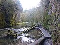 Chee Dale - geograph.org.uk - 5609755.jpg 1,800 × 1,350; 582 KB
-
 Chee Dale - geograph.org.uk - 6160665.jpg 1,600 × 1,200; 714 KB
-
 Chee Dale stepping stones - geograph.org.uk - 5609764.jpg 1,800 × 1,350; 501 KB
-

-
 Chee Dale, a railway-sleeper footbridge - geograph.org.uk - 6151503.jpg 480 × 640; 133 KB
-
 Chee Dale, a small weir across the Wye - geograph.org.uk - 6151512.jpg 479 × 640; 125 KB
-

-
 Chee Dale, along the riverside path - geograph.org.uk - 6147752.jpg 480 × 640; 149 KB
-
 Chee Dale, Chee Tor №2 Tunnel - geograph.org.uk - 6147730.jpg 640 × 480; 91 KB
-

-
 Chee Dale, footbridge over the Wye - geograph.org.uk - 6151469.jpg 480 × 640; 126 KB
-

-

-
 Chee Dale, mossy bark on a leaning tree - geograph.org.uk - 6151466.jpg 640 × 480; 125 KB
-

-

-

-

-

-
 Chee Dale, the vertical face of Chee Tor - geograph.org.uk - 6151498.jpg 480 × 640; 109 KB
-
 Chee Tor - geograph.org.uk - 5494421.jpg 5,174 × 2,935; 1.71 MB
-
 Chee Tor No.2 Tunnel eastern portal - geograph.org.uk - 4786524.jpg 640 × 426; 94 KB
-
 Chee Tor No.2 Tunnel western portal - geograph.org.uk - 4786518.jpg 640 × 426; 107 KB
-
 Chee Tor Tunnel - geograph.org.uk - 5259512.jpg 5,184 × 3,888; 5.39 MB
-
 Chee Tor Tunnel western portal - geograph.org.uk - 4786521.jpg 640 × 426; 74 KB
-
 Chee Tor Tunnel, western Portal - geograph.org.uk - 4797327.jpg 640 × 426; 98 KB
-
 Cottage at Dale Head, being renovated - geograph.org.uk - 4442805.jpg 3,648 × 2,736; 4.62 MB
-
 Cottage To The North East Of The Vicarage, Wormhill.jpg 4,000 × 3,000; 7.04 MB
-
 Cottages at Blackwell Mill - geograph.org.uk - 3074186.jpg 800 × 600; 166 KB
-
 Cyclists, The Monsal Trail - geograph.org.uk - 4786514.jpg 640 × 426; 110 KB
-
 Derbyshire UK parish map highlighting Wormhill.svg 888 × 1,308; 2.35 MB
-
 Derelict building - geograph.org.uk - 4485449.jpg 3,648 × 2,736; 6.03 MB
-
 Detail of well dressing, Wormhill - geograph.org.uk - 3125956.jpg 1,600 × 1,200; 609 KB
-
 Dipper in Chee Dale - geograph.org.uk - 4397816.jpg 1,595 × 1,595; 767 KB
-
 Dipper on River Wye - geograph.org.uk - 5609748.jpg 1,800 × 1,350; 438 KB
-
 Disused rail-over-road bridge at Miller's Dale - geograph.org.uk - 5834661.jpg 5,184 × 3,888; 7.13 MB
-
 Dove Holes Quarry - geograph.org.uk - 5870663.jpg 683 × 1,024; 119 KB
-
 Dry Stone Wall - geograph.org.uk - 4918109.jpg 3,648 × 2,736; 4.85 MB
-

-
 Dusted with Snow - geograph.org.uk - 5279525.jpg 4,896 × 3,672; 6.75 MB
-
 East Buxton Lime Kiln - geograph.org.uk - 4797559.jpg 426 × 640; 104 KB
-
 East Buxton Lime Kiln - geograph.org.uk - 4797560.jpg 426 × 640; 101 KB
-
 Elm Tree House.jpg 4,000 × 3,000; 5.54 MB
-
 Empty Handed.jpg 4,016 × 6,016; 10.98 MB
-
 Entrance to Peter Dale - geograph.org.uk - 1902238.jpg 640 × 426; 70 KB
-
 Farm and field, Wormhill - geograph.org.uk - 3125944.jpg 1,600 × 1,200; 682 KB
-
 Farm building - geograph.org.uk - 3625665.jpg 3,648 × 2,736; 2.94 MB
-
 Farm buildings and dandelions north of Flag Dale - geograph.org.uk - 3475553.jpg 2,632 × 3,509; 1.81 MB
-
 Farm track above Great Rocks Dale - geograph.org.uk - 335794.jpg 640 × 426; 93 KB
-
 Farm track above Mosley Farm - geograph.org.uk - 335827.jpg 640 × 426; 108 KB
-
 Farm track north of Flag Dale heading westwards - geograph.org.uk - 3475556.jpg 3,648 × 2,736; 2.32 MB
-
 Farmland beside Knot Low - geograph.org.uk - 2489427.jpg 1,152 × 864; 321 KB
-

-
 Fields and Walls by Waterswallows Road - geograph.org.uk - 4357491.jpg 3,793 × 2,783; 1.97 MB
-
 Fields at the head of Flag Dale - geograph.org.uk - 280517.jpg 640 × 480; 102 KB
-
 Fields near Waterswallows Road - geograph.org.uk - 4357484.jpg 4,000 × 3,000; 2.49 MB
-
 Fields near Wormhill - geograph.org.uk - 4397829.jpg 4,912 × 3,264; 5.34 MB
-
 Fields Surrounding Wibbersley Farm - geograph.org.uk - 4357580.jpg 2,665 × 1,871; 1.11 MB
-
 Fields, dry stone walls and Tunstead Quarry - geograph.org.uk - 4397827.jpg 4,912 × 3,264; 5.91 MB
-
 Fields, Farm and dry stone walls, Wormhill - geograph.org.uk - 3125966.jpg 1,600 × 1,200; 513 KB
-
 Flag Dale - geograph.org.uk - 3526690.jpg 800 × 533; 94 KB
-
 Flag Dale Viewed from the Pennine Bridleway - geograph.org.uk - 2606255.jpg 3,296 × 2,472; 1.06 MB
-
 Footbridge on a path near Peak Dale - geograph.org.uk - 5837587.jpg 4,330 × 3,247; 7.02 MB
-
 Footpath and footbridge near Tunstead Quarry - geograph.org.uk - 5836642.jpg 5,184 × 3,888; 7.18 MB
-
 Footpath between Chee Dale and Wormhill - geograph.org.uk - 1859365.jpg 3,296 × 2,472; 1.16 MB
-
 Footpath from Wormhill - geograph.org.uk - 1902252.jpg 640 × 426; 102 KB
-
 Footpath in Monk's Dale - geograph.org.uk - 2967873.jpg 800 × 600; 146 KB
-
 Footpath in Peak Dale - geograph.org.uk - 5837463.jpg 5,184 × 3,888; 7.74 MB
-
 Footpath junction above Chee Dale - geograph.org.uk - 5609751.jpg 1,800 × 1,350; 817 KB
-
 Footpath to Hargatewall leaving Tunstead - geograph.org.uk - 6160649.jpg 1,600 × 1,200; 856 KB
-
 Footpath to Tunstead Limestone Works - geograph.org.uk - 4485576.jpg 3,648 × 2,736; 5.09 MB
-
 Former Midland Hotel, near Peak Forest station - geograph.org.uk - 5264643.jpg 1,600 × 1,200; 560 KB
-
 Former Railway Viaduct - geograph.org.uk - 4797895.jpg 640 × 426; 106 KB
-
 Former railway viaduct near Topley Pike - geograph.org.uk - 5834296.jpg 3,888 × 5,184; 7.63 MB
-
 From the Blackwell path - geograph.org.uk - 5068791.jpg 3,456 × 2,304; 4.73 MB
-
 Frozen dewpond above Great Rocks Dale - geograph.org.uk - 335784.jpg 640 × 427; 110 KB
-
 Glabe Farm - geograph.org.uk - 5779344.jpg 5,152 × 3,864; 5.27 MB
-
 Glebe Farm - geograph.org.uk - 2854208.jpg 640 × 424; 213 KB
-
 Gorsey Nook - geograph.org.uk - 2304567.jpg 2,048 × 1,536; 531 KB
-
 Great Rocks Dale - geograph.org.uk - 2754796.jpg 3,296 × 2,472; 1.39 MB
-
 Great Rocks Dale - geograph.org.uk - 5493847.jpg 3,456 × 4,704; 2.05 MB
-
 Hargate Hall - geograph.org.uk - 2027939.jpg 2,816 × 2,112; 1.71 MB
-
 Hargate Hall - geograph.org.uk - 5809082.jpg 5,017 × 3,636; 3.42 MB
-
 Hargate Lodge - geograph.org.uk - 6160642.jpg 1,600 × 1,200; 585 KB
-
 Hassop Farm - geograph.org.uk - 1010006.jpg 640 × 426; 86 KB
-
 Hassop Farmhouse 2.jpg 4,000 × 3,000; 7.07 MB
-
 Hassop Farmhouse.jpg 4,000 × 3,000; 5.89 MB
-
 Hay Dale - geograph.org.uk - 3625609.jpg 2,736 × 3,648; 4.09 MB
-
 Hay Dale - geograph.org.uk - 4076597.jpg 3,444 × 2,583; 4.21 MB
-
 Hay Dale - geograph.org.uk - 4917632.jpg 3,404 × 2,384; 4.97 MB
-
 Hay Dale National Nature Reserve - geograph.org.uk - 2356714.jpg 2,272 × 1,277; 913 KB
-
 Hay Dale National Nature Reserve - geograph.org.uk - 4442801.jpg 3,648 × 2,736; 4.85 MB
-
 Hayward Farm - geograph.org.uk - 4485550.jpg 3,648 × 2,736; 4.96 MB
-
 Hayward Farm at Hargatewall - geograph.org.uk - 3475761.jpg 3,639 × 2,426; 2.34 MB
-
 Heath Farm - geograph.org.uk - 3526713.jpg 800 × 533; 87 KB
-
 Hill pasture north of Buxton, Derbyshire - geograph.org.uk - 4388348.jpg 1,024 × 688; 443 KB
-
 Hillside near Tunstead - geograph.org.uk - 5836634.jpg 4,874 × 3,655; 5.36 MB
-
 House on a quarry edge - geograph.org.uk - 1893031.jpg 640 × 455; 72 KB
-
 House on the northern edge of Tunstead - geograph.org.uk - 3475737.jpg 2,640 × 3,520; 1.68 MB
-
 House To The East Of Bateman's Farm.jpg 4,000 × 3,000; 4.95 MB
-
 Houses and gardens at Smalldale - geograph.org.uk - 1892850.jpg 640 × 480; 82 KB
-
 Houses at Small Knowle End - geograph.org.uk - 1893043.jpg 640 × 480; 67 KB
-
 In Chee Tor No.2 Tunnel - geograph.org.uk - 4786519.jpg 640 × 426; 25 KB
-
 In Dove Holes Dale - limestone railway wagons - geograph.org.uk - 4053492.jpg 1,942 × 2,428; 1.51 MB
-
 In Hay Dale - geograph.org.uk - 5790902.jpg 5,184 × 3,888; 6.25 MB
-
 In the farmyard - Mosley Farm - geograph.org.uk - 2489400.jpg 1,152 × 864; 308 KB
-
 In the Grounds of Hargate Hall - geograph.org.uk - 2027934.jpg 2,816 × 2,112; 2.89 MB
-
 In The Rusher Cutting Tunnel - geograph.org.uk - 4786509.jpg 640 × 426; 16 KB
-
 Information board by the Monsal Trail - geograph.org.uk - 4797554.jpg 640 × 426; 108 KB
-
 James Brindley Memorial - geograph.org.uk - 6226495.jpg 1,600 × 1,200; 869 KB
-
 James Brindley Memorial - geograph.org.uk - 6226499.jpg 1,600 × 1,200; 919 KB
-
 Junction of paths at Hassop Farm, Wormhill - geograph.org.uk - 3475548.jpg 3,648 × 2,736; 2.43 MB
-
 Knot Low - geograph.org.uk - 5324398.jpg 1,800 × 1,350; 371 KB
-
 Knotlow Farmhouse And Attached Outbuilding.jpg 4,000 × 3,000; 4.94 MB
-
 Lane and Limestone Way Intersection in Monk's Dale - geograph.org.uk - 4847289.jpg 4,608 × 3,456; 4.29 MB
-
 Lane and Pennine Bridleway near Tunstead - geograph.org.uk - 2606261.jpg 3,296 × 2,472; 1.14 MB
-
 Lay-by view towards farm - geograph.org.uk - 1365877.jpg 640 × 480; 109 KB
-
 Lime workings at Tunstead Quarry - geograph.org.uk - 2486953.jpg 1,152 × 864; 291 KB
-
 Limestone outcrops in Peter Dale - geograph.org.uk - 3667769.jpg 4,320 × 3,240; 5.62 MB
-
 Limestone wall and tree west of Wormhill - geograph.org.uk - 6406560.jpg 3,626 × 4,826; 4.11 MB
-
 Limestone Way in Hay Dale - geograph.org.uk - 3667739.jpg 4,320 × 3,240; 5.53 MB
-
 Limestone workings near Wibbersley Farm - geograph.org.uk - 4053701.jpg 1,942 × 2,428; 2.15 MB
-
 Longridge Lane, Dove Holes - geograph.org.uk - 3883104.jpg 2,590 × 1,850; 1.94 MB
-
 Looking across Open Countryside - geograph.org.uk - 948863.jpg 640 × 480; 62 KB
-
 Looking South from Tunstead - geograph.org.uk - 2606284.jpg 3,296 × 2,472; 1.08 MB
-
 Looking west to Wormhill Moor - geograph.org.uk - 4053557.jpg 2,592 × 1,944; 2.33 MB
-
 Low stone walls and stile - geograph.org.uk - 1765571.jpg 640 × 480; 102 KB
-
 Millers Dale, station remains 1993 - geograph.org.uk - 5382627.jpg 2,359 × 1,200; 2.53 MB
-
 Millers Dale, station remains 1993 - geograph.org.uk - 5382644.jpg 2,348 × 1,164; 2.3 MB
-
 Millers Dale, station remains 2007 - geograph.org.uk - 5382697.jpg 2,338 × 1,441; 2.7 MB
-
 Millers Dale-The Wriggly Tin - geograph.org.uk - 5458317.jpg 1,600 × 1,093; 490 KB
-
-
 Minor road on Wormhill Moor - geograph.org.uk - 3526704.jpg 800 × 533; 120 KB
-
 Monsal Trail - geograph.org.uk - 2854890.jpg 640 × 424; 259 KB
-
 Monsal Trail - geograph.org.uk - 2854934.jpg 640 × 424; 315 KB
-
 Monsal Trail - geograph.org.uk - 2854978.jpg 640 × 424; 310 KB
-
 Monsal Trail - geograph.org.uk - 2855132.jpg 640 × 424; 309 KB
-
 Monsal Trail signpost to Chee Dale - geograph.org.uk - 4303515.jpg 768 × 1,024; 185 KB
-

-
 Monsal Trail, between the Chee Tor Tunnels - geograph.org.uk - 5834357.jpg 4,628 × 3,471; 5.82 MB
-
 Monsal Trail, former lime kilns near Miller's Dale - geograph.org.uk - 5834394.jpg 5,184 × 3,888; 6.68 MB
-
 Monsal Trail, former lime kilns near Miller's Dale - geograph.org.uk - 5834396.jpg 4,960 × 3,720; 7.46 MB
-
 Monsal Trail, Miller's Dale viaducts - geograph.org.uk - 5834665.jpg 5,184 × 3,888; 5.22 MB
-
 Monsal Trail, view from Lime Kilns near Miller's Dale - geograph.org.uk - 5834408.jpg 3,888 × 5,184; 6.41 MB
-

-

-
 Monsal Trail, western portal of Rusher Cutting Tunnel - geograph.org.uk - 5834315.jpg 5,184 × 3,888; 6.91 MB
-
 Mosley Farm - geograph.org.uk - 1765479.jpg 640 × 480; 89 KB
-
 Mossy cliffs in Peter dale. - geograph.org.uk - 5289346.jpg 640 × 427; 90 KB
-
 Near the top of Peter Dale - geograph.org.uk - 2140130.jpg 640 × 480; 68 KB
-
 Near Wormhill - geograph.org.uk - 1414113.jpg 640 × 480; 84 KB
-
 Nearly derelict - geograph.org.uk - 1765561.jpg 640 × 480; 70 KB
-
 Neglected Trough near Buxton Bridge - geograph.org.uk - 4847360.jpg 4,608 × 3,456; 4.01 MB
-
 Old and New - geograph.org.uk - 3053770.jpg 3,264 × 2,448; 1.4 MB


