Category:Wrestlingworth
Jump to navigation
Jump to search
village in Bedfordshire, England, UK  L'église Saint-Pierre de Wrestlingworth. | |||||
| Upload media | |||||
| Instance of |
| ||||
|---|---|---|---|---|---|
| Location | Wrestlingworth and Cockayne Hatley, Central Bedfordshire, Bedfordshire, East of England, England | ||||
 | |||||
English: Wrestlingworth is a village and former civil parish in the English county of Bedfordshire, six miles east-north-east of Biggleswade.
Subcategories
This category has the following 2 subcategories, out of 2 total.
P
W
- Wrestlingworth War Memorial (1 F)
Media in category "Wrestlingworth"
The following 46 files are in this category, out of 46 total.
-
 Church Lane, Westlingworth - geograph.org.uk - 3332746.jpg 480 × 640; 73 KB
-
 Driveway to New England Farm - geograph.org.uk - 409128.jpg 640 × 480; 64 KB
-
 Farmland - geograph.org.uk - 390284.jpg 640 × 481; 75 KB
-
 Garden centre - geograph.org.uk - 372713.jpg 640 × 481; 57 KB
-
 House dated 1829 in Church Lane, Wrestlingworth - geograph.org.uk - 4290959.jpg 4,320 × 3,240; 4.27 MB
-
 Houses on Eyeworth Road, Wrestlingworth - geograph.org.uk - 5555507.jpg 2,048 × 1,536; 1.4 MB
-
 I came by the Scenic Route - geograph.org.uk - 555270.jpg 640 × 473; 71 KB
-
 Ivy Cottage, Church Lane, Westlingworth - geograph.org.uk - 3332749.jpg 640 × 480; 142 KB
-
 Nissen Shed near Wrestlingworth - geograph.org.uk - 553214.jpg 640 × 480; 142 KB
-

-
 Potton Woods - geograph.org.uk - 372717.jpg 640 × 481; 59 KB
-
 Public bridleway, Wrestlingworth, Beds - geograph.org.uk - 175011.jpg 640 × 480; 417 KB
-
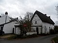 Thatched house in Church Lane, Wrestlingworth - geograph.org.uk - 4290952.jpg 4,320 × 3,240; 4.03 MB
-
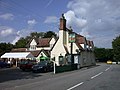 The Chequers PH, Wrestlingworth - geograph.org.uk - 554549.jpg 640 × 480; 92 KB
-
 The Chequers Pub, Wrestlingworth - geograph.org.uk - 3479944.jpg 4,320 × 3,240; 2.9 MB
-
 Two horses with but a single thought - geograph.org.uk - 554622.jpg 640 × 480; 114 KB
-
 Water Tower - geograph.org.uk - 372722.jpg 640 × 481; 83 KB
-
 Water Tower - geograph.org.uk - 372723.jpg 361 × 480; 43 KB
-
 Wheeltracks across the field in TL2648 - geograph.org.uk - 554940.jpg 640 × 480; 116 KB
-
 Wrestlingworth footpath - geograph.org.uk - 4999477.jpg 640 × 480; 55 KB
-
 Wrestlingworth Memorial Hall - geograph.org.uk - 4999362.jpg 640 × 480; 49 KB
-
 Wrestlingworth, centre of village - geograph.org.uk - 3878623.jpg 640 × 463; 127 KB
-
 Wrestlingworth, Church Lane - geograph.org.uk - 5728423.jpg 1,024 × 1,024; 1.25 MB
-
 Wrestlingworth, church path in early April - geograph.org.uk - 5728412.jpg 819 × 1,024; 1.16 MB
-
 Wrestlingworth, daffodils at Church Farm - geograph.org.uk - 5728568.jpg 1,024 × 768; 867 KB
-
 Wrestlingworth, school, church and thatch - geograph.org.uk - 5728561.jpg 1,024 × 768; 981 KB
-
 Wrestlingworth, south-east from the crossroads - geograph.org.uk - 5728408.jpg 1,024 × 768; 1.06 MB
-
 Wrestlingworth, St Peter - geograph.org.uk - 5728417.jpg 1,024 × 768; 1.06 MB
-
 B1042 Wrestlingworth Road, Potton, Beds - geograph.org.uk - 175016.jpg 640 × 480; 342 KB
-

-
 Bridleway - geograph.org.uk - 390283.jpg 640 × 481; 71 KB
-
 Bridleway from Tadlow to Hook's Mill - geograph.org.uk - 554932.jpg 640 × 480; 86 KB
-

-
 Farmland S of Wrestlingworth, Beds - geograph.org.uk - 63735.jpg 600 × 450; 225 KB
-

-
 Footpath, Wrestlingworth, Beds - geograph.org.uk - 190353.jpg 640 × 480; 477 KB
-
 Guilden Morden Road, Wrestlingworth, Beds - geograph.org.uk - 104797.jpg 640 × 480; 309 KB
-

-
 Lone dwelling near Eyeworth - geograph.org.uk - 622867.jpg 640 × 464; 80 KB
-
 Manor Farm, near Wrestlingworth - geograph.org.uk - 622868.jpg 640 × 478; 46 KB
-
 Public footpath, Wrestlingworth, Beds - geograph.org.uk - 171187.jpg 640 × 480; 285 KB
-
 Ruins of Hooks Mill Farm - geograph.org.uk - 554509.jpg 640 × 480; 98 KB
-
 Sutton Road, Eyeworth, Beds - geograph.org.uk - 62344.jpg 600 × 450; 251 KB
-
 Trees for sale - geograph.org.uk - 372715.jpg 640 × 481; 68 KB
-

-
 Yellow crop - geograph.org.uk - 390290.jpg 640 × 481; 90 KB


