Category:Wyke, Bradford
Jump to navigation
Jump to search
suburb of Bradford, West Yorkshire, England, UK | |||||
| Upload media | |||||
| Instance of | |||||
|---|---|---|---|---|---|
| Location | Bradford, West Yorkshire, Yorkshire and the Humber, England | ||||
| Different from | |||||
 | |||||
English: Wyke is a village in the county of West Yorkshire, England, which forms part of the Ward in Bradford Metropolitan District with the same name.
Subcategories
This category has the following 8 subcategories, out of 8 total.
Media in category "Wyke, Bradford"
The following 78 files are in this category, out of 78 total.
-
 A View South East from near Royd Hall - geograph.org.uk - 5653682.jpg 5,152 × 3,864; 3.64 MB
-
 Access Track to Horse Close - geograph.org.uk - 5653677.jpg 5,152 × 3,864; 6.23 MB
-
 Allotments - Worthing Head Road - geograph.org.uk - 2704757.jpg 640 × 480; 100 KB
-

-

-
 Bridge MRB-44 - Station Road - geograph.org.uk - 1254984.jpg 640 × 480; 247 KB
-
 Caldervale Railway Line, Wyke - geograph.org.uk - 6417445.jpg 2,000 × 1,220; 3.14 MB
-
 Chemical works, Wyke - geograph.org.uk - 1269826.jpg 640 × 403; 70 KB
-

-
 Cow Close Lane, Wyke - geograph.org.uk - 1269813.jpg 640 × 480; 176 KB
-
 Creative Stitch - Drakes Fold - geograph.org.uk - 1723442.jpg 640 × 480; 81 KB
-
 Direction stone, Judy Woods (geograph 6494644).jpg 2,000 × 1,220; 3.34 MB
-
 Disused railway at Bailiff Bridge - geograph.org.uk - 2936065.jpg 2,000 × 1,500; 1.79 MB
-

-

-
 Farm at Cow Close, Wyke - geograph.org.uk - 1269848.jpg 640 × 480; 109 KB
-
 Field east of Low Wood - geograph.org.uk - 2531281.jpg 1,024 × 768; 166 KB
-
 Footbridge over disused railway, Bailiff Bridge - geograph.org.uk - 2936073.jpg 2,000 × 1,500; 1.51 MB
-
 Footpath - Balme Street - geograph.org.uk - 2704766.jpg 480 × 640; 47 KB
-
 Footpath - Corrance Road - geograph.org.uk - 2856099.jpg 480 × 640; 81 KB
-
 Footpath - end of Worthing Head Road - geograph.org.uk - 2704753.jpg 480 × 640; 84 KB
-
 Footpath - Garden Field - geograph.org.uk - 2704750.jpg 480 × 640; 102 KB
-
 Footpath - Hudson View - geograph.org.uk - 2704740.jpg 480 × 640; 88 KB
-
 Footpath - St Mary's Close - geograph.org.uk - 2866874.jpg 480 × 640; 76 KB
-
 Footpath - The Hudson - geograph.org.uk - 2704737.jpg 480 × 640; 63 KB
-
 Footpath - Whitehall Road - geograph.org.uk - 2867201.jpg 480 × 640; 92 KB
-
 Footpath - Worthing Street - geograph.org.uk - 2704760.jpg 480 × 640; 116 KB
-
 Footpath - Worthing Street - geograph.org.uk - 2704761.jpg 480 × 640; 57 KB
-
 Footpath - Wyke Lane - geograph.org.uk - 2856113.jpg 480 × 640; 100 KB
-
 Footpath off Lower Wyke Lane, Wyke - geograph.org.uk - 1978527.jpg 2,000 × 1,500; 1.06 MB
-
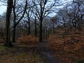 In Old Hanna Wood - geograph.org.uk - 5653665.jpg 5,152 × 3,864; 7.46 MB
-
 Knowl, Wyke - geograph.org.uk - 1269798.jpg 640 × 480; 148 KB
-
 Lillies 2 Rose - Drakes Fold - geograph.org.uk - 1723441.jpg 640 × 480; 80 KB
-
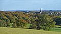
 Looking across the fields to Wyke - geograph.org.uk - 6417034.jpg 2,000 × 1,331; 3.72 MB
-
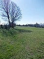
 Lower Wyke Green (3050351865).jpg 2,421 × 1,614; 3.52 MB
-
 Lower Wyke Green - geograph.org.uk - 908107.jpg 640 × 480; 104 KB
-
 Lower Wyke Green, Wyke - geograph.org.uk - 187880.jpg 472 × 640; 102 KB
-
 Meadowlands - Tabbs Lane - geograph.org.uk - 1310985.jpg 640 × 480; 257 KB
-
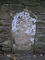
 Milestone, Bradford Road, Wyke.jpg 1,522 × 2,000; 759 KB
-
 Milestone, Whitehall Road.jpg 1,200 × 1,600; 524 KB
-
 Nufarm factory, Wyke - geograph.org.uk - 5685236.jpg 1,024 × 768; 65 KB
-
-

-
 Ponies grazing - off Whitehall Road - geograph.org.uk - 2867190.jpg 640 × 385; 67 KB
-
 Recreation Ground - Carr Lane - geograph.org.uk - 2572041.jpg 640 × 480; 67 KB
-
 Royds Hall Beck - geograph.org.uk - 379815.jpg 640 × 480; 168 KB
-

-

-
 Sowden Lane, Wyke (22372351227).jpg 2,883 × 3,205; 10.18 MB
-
 Stancey's Garth, Lower Wyke - geograph.org.uk - 378901.jpg 640 × 480; 86 KB
-
 Track on Delph Hill - geograph.org.uk - 5653660.jpg 5,152 × 3,864; 6.34 MB
-
 Transmission line west of Oakenshaw - geograph.org.uk - 5621298.jpg 1,024 × 768; 118 KB
-

-

-
 View Eastwards towards Wyke - geograph.org.uk - 5889608.jpg 5,184 × 3,456; 7.56 MB
-
 View from Bridge MRB-44, Station Road, Wyke - geograph.org.uk - 3424568.jpg 1,600 × 1,200; 659 KB
-
 Waterfall in Judywoods.jpg 600 × 402; 63 KB
-
 Woodside Farm and fields, from the woods - geograph.org.uk - 2531259.jpg 1,024 × 768; 198 KB
-
 Wyke (4002356920).jpg 2,560 × 1,440; 3.37 MB
-
 Wyke Beck (3022463251).jpg 2,560 × 1,920; 6.55 MB
-

-
 Wyke Green (4006392980).jpg 1,847 × 1,847; 3.88 MB
-
 Wyke Lane Mine - geograph.org.uk - 378948.jpg 480 × 640; 129 KB
-
 Car park, Wyke - geograph.org.uk - 526769.jpg 640 × 455; 66 KB
-
 Escroft Close - Westfield Lane - geograph.org.uk - 1391199.jpg 640 × 480; 263 KB
-
 Footpath - Lower Wyke Lane - geograph.org.uk - 1723692.jpg 640 × 480; 87 KB
-
 Footpath - Lower Wyke Lane - geograph.org.uk - 1723693.jpg 480 × 640; 97 KB
-
 Footpath - Lower Wyke Lane, Wyke - geograph.org.uk - 772280.jpg 537 × 640; 50 KB
-

-
 High Fernley - geograph.org.uk - 379792.jpg 640 × 434; 95 KB
-
 Low Wood, Wyke - geograph.org.uk - 379802.jpg 640 × 473; 91 KB
-
 Recreation Ground - Wyke Lane - geograph.org.uk - 1391243.jpg 640 × 480; 207 KB
-
 Shaft off Wyke Lane, Wyke - geograph.org.uk - 250159.jpg 640 × 479; 100 KB
-

-

-
 View Towards Lightcliffe - geograph.org.uk - 905558.jpg 640 × 480; 157 KB
-
 Wyke Common - geograph.org.uk - 378922.jpg 640 × 435; 88 KB
-
 Wyke Common - geograph.org.uk - 378926.jpg 640 × 485; 114 KB


.jpg)


.jpg)


.jpg)


.jpg)
.jpg)

.jpg)


