Category:Wynford Eagle
Jump to navigation
Jump to search
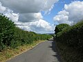
English: Wynford Eagle is a hamlet and small parish in Dorset, anciently in the hundred of Tollerford, and now in the District of West Dorset, 1.4 miles to the south west of Maiden Newton and 7.5 miles to the north west of Dorchester.
village and civil parish in Dorset, United Kingdom  | |||||
| Upload media | |||||
| Instance of | |||||
|---|---|---|---|---|---|
| Location | Dorset, South West England, England | ||||
 | |||||
Subcategories
This category has the following 2 subcategories, out of 2 total.
M
- Manor Farm, Wynford Eagle (2 F)
S
Media in category "Wynford Eagle"
The following 63 files are in this category, out of 63 total.
-
 A white road - geograph.org.uk - 4468332.jpg 800 × 533; 230 KB
-
 Approach to Wynford Eagle - geograph.org.uk - 1869184.jpg 640 × 480; 69 KB
-
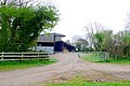 Barns near Wynford Eagle - geograph.org.uk - 1259778.jpg 640 × 428; 91 KB
-
 Barns, Manor Farm, Wynford Eagle - geograph.org.uk - 6264547.jpg 1,024 × 684; 224 KB
-
-
 Bridleway above Compton Valence - geograph.org.uk - 3224475.jpg 640 × 480; 104 KB
-
 Brooms Farm - geograph.org.uk - 5200425.jpg 640 × 427; 72 KB
-

-
 Collin's Wood - geograph.org.uk - 1259782.jpg 640 × 428; 67 KB
-
 Collin's Wood - geograph.org.uk - 6263886.jpg 1,024 × 768; 362 KB
-
 Cottage Roofs at Wynford Eagle - geograph.org.uk - 5264362.jpg 640 × 427; 113 KB
-
 Country Stream - geograph.org.uk - 1268595.jpg 640 × 442; 94 KB
-
 Countryside near Tollerford - geograph.org.uk - 1259781.jpg 640 × 428; 75 KB
-
 Countryside near Wynford Eagle - geograph.org.uk - 1268591.jpg 640 × 428; 104 KB
-
 Descending Shatcombe Lane - geograph.org.uk - 2363542.jpg 640 × 473; 116 KB
-
 Disused pits, Blanchard's Plantation - geograph.org.uk - 4843584.jpg 640 × 427; 51 KB
-
 Downland near Wynford Eagle - geograph.org.uk - 622518.jpg 640 × 323; 63 KB
-
 Downs above Wynford Eagle - geograph.org.uk - 5657297.jpg 1,024 × 683; 400 KB
-
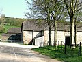 Farm buildings - Wynford Eagle - geograph.org.uk - 2363573.jpg 640 × 480; 115 KB
-
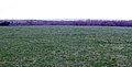
 Field, Wynford Eagle - geograph.org.uk - 4468340.jpg 800 × 533; 209 KB
-
 Footpath to Wynford Wood - geograph.org.uk - 622529.jpg 640 × 480; 119 KB
-
 Fore Hill Plantation - geograph.org.uk - 4468320.jpg 800 × 533; 185 KB
-
 Green lane, Wynford Eagle - geograph.org.uk - 4468337.jpg 800 × 533; 179 KB
-
 Greenford Lane - geograph.org.uk - 5036900.jpg 640 × 480; 64 KB
-
 Homemade sign, Wynford Eagle - geograph.org.uk - 4468348.jpg 800 × 533; 274 KB
-

-
 Jubilee Trail south of Wynford Eagle - geograph.org.uk - 5036914.jpg 640 × 427; 72 KB
-

-
 Looking towards Colin's Wood - geograph.org.uk - 4468316.jpg 800 × 533; 181 KB
-
 Lots of cows - geograph.org.uk - 550588.jpg 640 × 480; 59 KB
-
 Manor Farm - Wynford Eagle - geograph.org.uk - 462495.jpg 640 × 480; 138 KB
-

-

-
 Passing through Wynford Eagle - geograph.org.uk - 3835393.jpg 640 × 480; 67 KB
-

-
 Road near Wynford Eagle - geograph.org.uk - 1268593.jpg 640 × 428; 80 KB
-
 Shatcombe Lane - geograph.org.uk - 5657303.jpg 1,024 × 683; 362 KB
-
 Shatcombe Lane descends to Wynford Eagle - geograph.org.uk - 6263874.jpg 1,024 × 768; 229 KB
-
 Sign Post near Notton Hill Barn - geograph.org.uk - 1572772.jpg 640 × 434; 173 KB
-
 Slobbery nose - geograph.org.uk - 550591.jpg 640 × 480; 64 KB
-
 Small copse near Wynford Eagle - geograph.org.uk - 1572770.jpg 640 × 437; 100 KB
-

-
 The Manor, Wynford Eagle - geograph.org.uk - 6263884.jpg 1,024 × 684; 296 KB
-
 This way, please^ - geograph.org.uk - 550585.jpg 640 × 480; 65 KB
-
 Toller Porcorum, Shatcombe Lane - geograph.org.uk - 550579.jpg 640 × 480; 84 KB
-
 Track to Ferndown Farm - geograph.org.uk - 6263864.jpg 1,024 × 684; 230 KB
-
 Tree on Shatcombe Lane - geograph.org.uk - 1259772.jpg 640 × 481; 71 KB
-
 Tree-lined road, Wynford Eagle - geograph.org.uk - 6264566.jpg 1,024 × 768; 407 KB
-
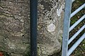
 Trig pillar - geograph.org.uk - 529308.jpg 493 × 623; 115 KB
-

-
 Uphill road out of Wynford Eagle - geograph.org.uk - 1869202.jpg 640 × 480; 81 KB
-
 Valley floor near Tollerford - geograph.org.uk - 4468256.jpg 800 × 533; 263 KB
-

-
 Winter cereals - geograph.org.uk - 5657308.jpg 1,024 × 683; 395 KB
-
 Wynford Eagle - geograph.org.uk - 3391393.jpg 4,320 × 3,240; 5.07 MB
-
 Wynford Eagle church - geograph.org.uk - 6263880.jpg 1,024 × 768; 331 KB
-
 Wynford Eagle to Compton road - geograph.org.uk - 4468344.jpg 800 × 533; 214 KB
-
 Wynford Eagle, cows - geograph.org.uk - 550581.jpg 640 × 480; 82 KB
-
 Wynford Eagle, red telephone box - geograph.org.uk - 4422878.jpg 640 × 481; 58 KB
-

-
 Wynford Wood - geograph.org.uk - 1259776.jpg 640 × 428; 67 KB
-
 Wynford Wood from High Hill - geograph.org.uk - 4848940.jpg 640 × 427; 43 KB
-
 Wynford Woods - geograph.org.uk - 1259777.jpg 640 × 428; 76 KB


