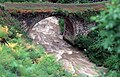
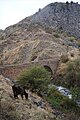
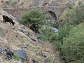
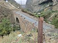
Category:XIe century bridge on Azat river (Garni)
Jump to navigation
Jump to search
| Object location | | View all coordinates using: OpenStreetMap |
|---|
cultural heritage monument of Armenia  | |||||
| Upload media | |||||
| Instance of | |||||
|---|---|---|---|---|---|
| Made from material | |||||
| Location | Garni, Kotayk Province, Armenia | ||||
| Heritage designation | |||||
| Inception |
| ||||
 | |||||
|
This is a category about a monument in Armenia identified by the ID 6.21/20
|
Media in category "XIe century bridge on Azat river (Garni)"
The following 33 files are in this category, out of 33 total.
-
 AZAT RIVER BRIGE 3.JPG 4,608 × 3,456; 5.93 MB
-
 AZAT RIVER BRIGE 4.JPG 4,608 × 3,456; 6.38 MB
-
 AZAT RIVER BRIGE 5.JPG 4,608 × 3,456; 5.74 MB
-
 Azat river Gorge Garni 03.JPG 4,000 × 3,000; 4.26 MB
-
 Azat(River) Bridge.jpg 590 × 377; 104 KB
-
 Bridge on Azat river, Garni, Kotayk region (1).jpg 5,184 × 3,456; 2.92 MB
-
 Bridge on Azat river, Garni, Kotayk region (2).jpg 5,184 × 3,456; 4.02 MB
-
 Bridge on Azat river, Garni, Kotayk region (3).jpg 3,456 × 5,184; 3.96 MB
-
 Bridge on Azat river, Garni, Kotayk region (4).jpg 5,184 × 3,456; 4.17 MB
-
 Bridge on Azat river, Garni, Kotayk region (5).jpg 5,184 × 3,456; 4.22 MB
-
 Bridge on Azat river, Garni, Kotayk region (6).jpg 5,184 × 3,456; 3.4 MB
-
 Bridge on Azat river, Garni, Kotayk region (7).jpg 5,184 × 3,456; 3.87 MB
-
 Bridge on Azat river, Garni, Kotayk region (8).jpg 5,184 × 3,456; 4.17 MB
-
 Bridge on Azat River.JPG 3,072 × 2,048; 4.52 MB
-
 Bridge, Garni 01.jpg 7,152 × 5,368; 17.02 MB
-
 Bridge, Garni 02.jpg 7,152 × 5,368; 16.86 MB
-
 Garni village, bridge.jpg 7,152 × 5,368; 34.97 MB
-
 Garnii kamurj 1.jpg 1,280 × 960; 372 KB
-
 Garnii kamurj.jpg 1,280 × 960; 395 KB
-
 Pont médiéval de Garni après la restauration de 2012 (1).jpg 3,240 × 4,320; 4.91 MB
-
 Pont médiéval de Garni après la restauration de 2012 (2).jpg 4,320 × 3,240; 5.91 MB
-
 WikiConference Yerevan 2013 167.JPG 4,912 × 3,264; 5.25 MB
-
 WikiConference Yerevan 2013 168.JPG 4,912 × 3,264; 4.22 MB
-
 WikiConference Yerevan 2013 169.JPG 3,264 × 4,912; 4.41 MB
-
 WikiConference Yerevan 2013 178.JPG 3,264 × 4,912; 7.72 MB
-
 XIe century bridge on Azat river (Garni) - 2.JPG 4,320 × 3,240; 7.68 MB
-
 XIe century bridge on Azat river (Garni) - 3.JPG 3,240 × 4,320; 7.29 MB
-
 XIe century bridge on Azat river (Garni) - 4.JPG 4,320 × 3,240; 7.2 MB
-
 XIe century bridge on Azat river (Garni).JPG 4,320 × 3,240; 7.06 MB
-
 Армения Гарни мост.jpg 4,608 × 3,456; 7.22 MB
-
 Գառնի կամուրջ.JPG 2,272 × 1,704; 3.94 MB
-
 Կամուրջ Ազատ գետ վրա, Հավուց թառ վանքի ճանապարհին.jpg 1,080 × 778; 246 KB
-
 Կամուրջ Ազատ գետի վրա․ 11-րդ, վերանորոգված.JPG 3,648 × 2,736; 5.9 MB


_Bridge.jpg)
.jpg)
.jpg)
.jpg)
.jpg)
.jpg)
.jpg)
.jpg)
.jpg)


.jpg)
.jpg)


_-_2.JPG)
_-_3.JPG)
_-_4.JPG)
.JPG)


