Category:Xert
Jump to navigation
Jump to search
human settlement in Vinaròs, Castellón Province, Valencian Community, Spain | |||||
| Upload media | |||||
| Instance of | |||||
|---|---|---|---|---|---|
| Part of | |||||
| Patron saint | |||||
| Location | Baix Maestrat, Castellón, Valencian Community, Spain | ||||
| Capital |
| ||||
| Official language |
| ||||
| Head of government |
| ||||
| Population |
| ||||
| Area |
| ||||
| Elevation above sea level |
| ||||
| Different from | |||||
| official website | |||||
 | |||||
Español: Municipio de la provincia de Castellón, situado en la comarca del Bajo Maestrazgo, Comunidad Valenciana, España.
Subcategories
This category has the following 9 subcategories, out of 9 total.
A
- Anroig, Xert (3 F)
C
- Coats of arms of Xert (6 F)
- Cuisine of Xert (12 F)
M
T
- Torre el Molinar (Xert) (1 F)
- Town hall of Xert (2 F)
Media in category "Xert"
The following 39 files are in this category, out of 39 total.
-
"Font de l'Aubelló" (Xert).jpg 3,072 × 2,304; 2.67 MB
-
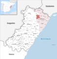
Localització de Xert respecte del Baix Maestrat.png 400 × 400; 45 KB
-
Localització de Xert respecte del País Valencià.png 238 × 400; 27 KB
-
Aceite de Oliva de la Cooperativa Clot d'en Simó (Xert, Castellón).JPG 3,072 × 2,304; 2.62 MB
-
Antic local de les escoles de La Barcella (Xert).JPG 3,072 × 2,304; 2.76 MB
-
Barranc de La Barsella, Xert.jpg 3,072 × 2,304; 2.66 MB
-
Barranco la espandela - panoramio.jpg 3,264 × 2,448; 1.43 MB
-
Bassa del Mas dels Doménech, La Barcella.jpg 3,072 × 2,304; 2.64 MB
-
Bassa dels Noguerets, Xert.jpg 3,072 × 2,304; 2.55 MB
-
Camp de fútbol Les Forques (Xert, Castelló).JPG 3,072 × 2,304; 2.53 MB
-
Campanar de la Església de Xert.JPG 3,072 × 2,304; 2.74 MB
-
Campanar de la Església parroquial de Xert.JPG 3,072 × 2,304; 2.46 MB
-
Capella de la Mare de Déu del Pilar d'Enroig (Xert).JPG 3,072 × 2,304; 2.43 MB
-
ElMolinar Chert.jpg 500 × 246; 44 KB
-
Enlace cv 132 con n 232 - panoramio.jpg 3,264 × 2,448; 1.6 MB
-
Església Nova de Xert.JPG 3,072 × 2,304; 2.5 MB
-
FAuvelló Chert.jpg 500 × 333; 22 KB
-
Font de l'Aubelló (Xert).JPG 3,072 × 2,304; 2.81 MB
-
Fontanals15.JPG 953 × 599; 131 KB
-
Hacia cher - panoramio.jpg 3,264 × 2,448; 1.78 MB
-
Hacia el puerto - panoramio.jpg 3,264 × 2,448; 1.46 MB
-
Karte Gemeinde Xert 2022.png 5,000 × 5,142; 2.11 MB
-
Llavadors de la "Font de l'Aubelló" (Xert).jpg 3,072 × 2,304; 2.69 MB
-
Mas de L'Aubaga, Xert.jpg 3,072 × 1,728; 2.24 MB
-
Microreserva de flora, Torresseta del monte Turmell, Xert.jpg 5,184 × 3,888; 6.93 MB
-
Morral Roig, Serra del Monte Turmell (Xert).jpg 3,072 × 2,304; 2.54 MB
-
MTN25-0545c4-1999-Anroig.jpg 7,736 × 5,425; 8.26 MB
-
MTN25-0545c4-2007-Anroig.jpg 7,613 × 5,189; 8.85 MB
-
MTN25-0546c3-2013-Traiguera.jpg 7,535 × 5,210; 20.68 MB
-
Palau dels Condes de Pestagua (Xert).jpg 3,072 × 2,304; 2.52 MB
-
Paraje de huertos familiares, anexos al casco urbano de Xert (España).jpg 3,072 × 2,304; 2.61 MB
-
Peiró, creu de terme (Xert).jpg 3,072 × 2,304; 2.56 MB
-
Pinaret Chert.jpg 484 × 316; 49 KB
-
Plaza urbana, Xert.jpg 3,072 × 2,304; 2.48 MB
-
Puente medieval sobre el barranco del Molinar (Xert, Castellón).JPG 3,072 × 2,304; 2.6 MB
-
Rebaño de ovejas, Xert, Castellón.JPG 3,072 × 2,304; 2.65 MB
-
VAérea Chert.jpg 500 × 378; 56 KB
-
Xert viejo86.jpg 428 × 640; 81 KB


