Category:Yapton
Jump to navigation
Jump to search
English: Yapton is a village and civil parish in the Arun District of West Sussex, England. It is three miles (4.8 km) to the north-west of Bognor Regis at the intersection of the B2132 and B2233 roads. The civil parish covers an area of and has a population of 3522 persons (2001 census).
village in the United Kingdom  | |||||
| Upload media | |||||
| Instance of | |||||
|---|---|---|---|---|---|
| Location | Arun, West Sussex, South East England, England | ||||
| Area |
| ||||
| Said to be the same as | Yapton (Wikimedia duplicated page, civil parish) | ||||
| official website | |||||
 | |||||
Subcategories
This category has the following 8 subcategories, out of 8 total.
Media in category "Yapton"
The following 200 files are in this category, out of 221 total.
(previous page) (next page)-
 19 Burndell Road, Yapton 01.jpg 4,000 × 3,000; 6.99 MB
-
 19 Burndell Road, Yapton 02.jpg 2,967 × 1,801; 3.33 MB
-
 A look into Yapton church - geograph.org.uk - 3959516.jpg 600 × 800; 115 KB
-
 A look out of Yapton church - geograph.org.uk - 3959517.jpg 800 × 600; 92 KB
-

-
 A259 - geograph.org.uk - 4742601.jpg 640 × 426; 52 KB
-
 A259 heading west - geograph.org.uk - 2666180.jpg 640 × 428; 51 KB
-

-
 Arable Field near Bilsham - geograph.org.uk - 117619.jpg 640 × 480; 74 KB
-
 B2132, Yapton - geograph.org.uk - 4995259.jpg 1,015 × 1,552; 264 KB
-
 B2132, Yapton Lane - geograph.org.uk - 4760804.jpg 640 × 426; 45 KB
-
 B2233 - geograph.org.uk - 5569558.jpg 640 × 426; 39 KB
-
 Barnham Glasshouses - geograph.org.uk - 32957.jpg 640 × 480; 82 KB
-
 Barnham Rife - geograph.org.uk - 2785836.jpg 640 × 480; 130 KB
-
 Barnham Rife - geograph.org.uk - 2785850.jpg 640 × 480; 102 KB
-
 Bend in Church Lane - geograph.org.uk - 1243307.jpg 640 × 480; 99 KB
-
 Bend in North End Road - geograph.org.uk - 1245863.jpg 640 × 480; 79 KB
-
 Bend on footpath - geograph.org.uk - 4392939.jpg 800 × 533; 102 KB
-
 Bend on the B2132 at Bilsham - geograph.org.uk - 3960589.jpg 800 × 600; 154 KB
-
 Bend on the B2233 Yapton Road - geograph.org.uk - 3101659.jpg 3,264 × 2,448; 3.84 MB
-
 Bilsham Road enters Yapton - geograph.org.uk - 2783602.jpg 640 × 428; 117 KB
-
 Bilsham Road, Yapton, West Sussex - geograph.org.uk - 2352314.jpg 3,072 × 1,728; 1.7 MB
-
 Binsted Brook - geograph.org.uk - 2128961.jpg 480 × 640; 112 KB
-
 Bridleway over railway line - geograph.org.uk - 3100461.jpg 3,264 × 2,448; 5.49 MB
-
 Burndell Road, Yapton - geograph.org.uk - 1245884.jpg 640 × 480; 64 KB
-
 Burnt Out Car, Long Barn - geograph.org.uk - 2127640.jpg 640 × 480; 96 KB
-
 Bus stop A259 Flansham Lane - geograph.org.uk - 2842069.jpg 2,048 × 1,536; 666 KB
-
 Bus stop, Worms Lane - geograph.org.uk - 4742603.jpg 640 × 426; 79 KB
-
 Bus stops and traffic on the B2132 - geograph.org.uk - 3960587.jpg 800 × 600; 133 KB
-
 Business premises in Ford Lane - geograph.org.uk - 1243234.jpg 640 × 480; 71 KB
-
 Canal Bridge, Yapton - geograph.org.uk - 1294165.jpg 640 × 488; 105 KB
-
 Canal Bridge, Yapton - geograph.org.uk - 138587.jpg 640 × 425; 137 KB
-

-
 Cautionary sign in Main Road, Yapton - geograph.org.uk - 1245872.jpg 640 × 480; 109 KB
-
 Chaenomeles 'Whitice' (5547659803).jpg 480 × 640; 137 KB
-
 Choisya ternata White Dazzler (wallygrom) 001.jpg 480 × 640; 198 KB
-
 Church Lane - geograph.org.uk - 1243286.jpg 640 × 480; 70 KB
-
 Cottages on Main Road, Yapton - geograph.org.uk - 5070394.jpg 1,024 × 768; 134 KB
-
 Cottages on the south side of Main Road, Yapton - geograph.org.uk - 5070403.jpg 1,024 × 768; 135 KB
-
 Day nursery in Main Road - geograph.org.uk - 1245885.jpg 640 × 480; 65 KB
-
 Dead buzzard on the line at Ford - geograph.org.uk - 2936321.jpg 1,200 × 1,600; 417 KB
-
 Diverted path - geograph.org.uk - 2845602.jpg 2,048 × 1,536; 664 KB
-
 Down Close - geograph.org.uk - 1243253.jpg 640 × 465; 69 KB
-
 Drain with reeds - geograph.org.uk - 2961297.jpg 2,048 × 1,536; 679 KB
-

-
 Drove Lane - geograph.org.uk - 2026431.jpg 2,048 × 1,536; 689 KB
-
 Entering Yapton, B2233 - geograph.org.uk - 5569560.jpg 640 × 426; 79 KB
-

-

-
 Entrance on Grevatt's Lane West - geograph.org.uk - 3960569.jpg 800 × 600; 80 KB
-

-
 Farm gateway on footpath - geograph.org.uk - 3960497.jpg 800 × 600; 179 KB
-
 Field boundary at Bilsham - geograph.org.uk - 3960513.jpg 800 × 600; 153 KB
-
 Flansham Lane - geograph.org.uk - 4742599.jpg 640 × 401; 65 KB
-
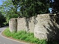 Flint wall on the bend in Church Lane - geograph.org.uk - 5070346.jpg 1,024 × 768; 364 KB
-
 Flint wall. Church Lane, Yapton - geograph.org.uk - 5070335.jpg 1,024 × 768; 285 KB
-
 Footbridge by the golf course - geograph.org.uk - 4244434.jpg 4,320 × 3,240; 5.28 MB
-
 Footbridge not open to the public - geograph.org.uk - 2961287.jpg 2,048 × 1,536; 666 KB
-
 Footbridge over drainage channel - geograph.org.uk - 3959565.jpg 800 × 600; 250 KB
-
 Footpath 147 to Hoe Farm - geograph.org.uk - 3626622.jpg 3,264 × 2,448; 4.25 MB
-
 Footpath 153 crosses Golf Course - geograph.org.uk - 2845621.jpg 2,048 × 1,536; 652 KB
-
 Footpath 153 on bridge - geograph.org.uk - 2845613.jpg 2,048 × 1,536; 693 KB
-
 Footpath 165 south of the A259 - geograph.org.uk - 3624709.jpg 3,264 × 2,448; 4.04 MB
-
 Footpath 326 - geograph.org.uk - 2803362.jpg 2,048 × 1,536; 705 KB
-
 Footpath 330 - geograph.org.uk - 2803355.jpg 2,048 × 1,536; 702 KB
-
 Footpath 359 - geograph.org.uk - 1876577.jpg 1,536 × 2,048; 644 KB
-
 Footpath by allotments by Bilsham Road - geograph.org.uk - 3960501.jpg 800 × 600; 161 KB
-
 Footpath going north from Ford Road - geograph.org.uk - 3959553.jpg 800 × 600; 187 KB
-
 Footpath going west from Hoe Lane - geograph.org.uk - 4392937.jpg 800 × 533; 142 KB
-
 Footpath junction - geograph.org.uk - 2961324.jpg 2,048 × 1,536; 690 KB
-

-
 Footpath to Ford Lane - geograph.org.uk - 5070344.jpg 1,024 × 768; 286 KB
-
 Footpath to rear of houses in Hoe Lane - geograph.org.uk - 4593193.jpg 4,608 × 3,456; 4.33 MB
-
 Footpath to Yapton church off Ford lane - geograph.org.uk - 3100361.jpg 3,264 × 2,448; 3.73 MB
-
 Ford Lane, east of North End - geograph.org.uk - 3523579.jpg 640 × 427; 25 KB
-
 Fore^ - geograph.org.uk - 4244442.jpg 4,320 × 3,240; 5.49 MB
-
-
 Garages, Carter Close - geograph.org.uk - 733375.jpg 479 × 640; 99 KB
-
 Glasshouse by the railway line - geograph.org.uk - 4760803.jpg 640 × 426; 40 KB
-
 Green triangle - geograph.org.uk - 4244445.jpg 4,320 × 3,240; 5.25 MB
-
 Grevatt's Lane - geograph.org.uk - 4746515.jpg 640 × 426; 32 KB
-

-
 Hoe Lane becomes a private road - geograph.org.uk - 2783515.jpg 640 × 428; 108 KB
-
-
 House and pond at Hobbs Farm - geograph.org.uk - 3960600.jpg 800 × 600; 244 KB
-
 House at the parish boundary - geograph.org.uk - 2779711.jpg 640 × 428; 85 KB
-
 Junction of Burndell and Downview Roads - geograph.org.uk - 1245888.jpg 640 × 480; 109 KB
-

-

-

-

-
 Junction of Lake and Yapton Lanes - geograph.org.uk - 2859222.jpg 1,024 × 768; 189 KB
-

-

-
 Junction on public footpath 166 - geograph.org.uk - 1874455.jpg 2,048 × 1,536; 726 KB
-
 Lake Barn, Barnham - geograph.org.uk - 2462430.jpg 1,600 × 761; 348 KB
-
 Lake Lane joins the B2132 - geograph.org.uk - 2779805.jpg 640 × 428; 130 KB
-
 Land north of Hoe Farm - geograph.org.uk - 2845558.jpg 2,048 × 1,536; 676 KB
-

-
 Level crossing on Maypole Lane - geograph.org.uk - 2859216.jpg 1,024 × 768; 211 KB
-
 Level crossing on North End Road Barnham - geograph.org.uk - 3100370.jpg 3,264 × 2,448; 4.07 MB
-
 Long Barn - geograph.org.uk - 2127636.jpg 640 × 480; 88 KB
-

-

-

-
 Looking east along railway from footpath - geograph.org.uk - 3959560.jpg 600 × 800; 135 KB
-

-
 Looking eastwards along Church Lane - geograph.org.uk - 1245832.jpg 640 × 422; 99 KB
-

-

-
-

-

-

-

-

-
 Looking into Bilsham Lane from the B2132 - geograph.org.uk - 3960604.jpg 800 × 600; 128 KB
-
 Looking into Briar Close - geograph.org.uk - 3960482.jpg 800 × 600; 118 KB
-
 Looking into St Marys Meadow - geograph.org.uk - 3960489.jpg 800 × 600; 126 KB
-

-

-
 Looking west along railway from footpath - geograph.org.uk - 3959562.jpg 600 × 800; 142 KB
-
 Mature oak next to Yapton allotments - geograph.org.uk - 2182632.jpg 640 × 480; 30 KB
-
 Maypole Inn, Maypole Lane - geograph.org.uk - 194955.jpg 454 × 640; 122 KB
-
 Maypole Lane heading for the Maypole inn - geograph.org.uk - 3100365.jpg 3,264 × 2,448; 5.21 MB
-
 Mid section of Briar Close - geograph.org.uk - 1243268.jpg 640 × 480; 91 KB
-
 Mid section of Church Lane - geograph.org.uk - 1245839.jpg 640 × 480; 79 KB
-
 Mid section of North End Road - geograph.org.uk - 1245846.jpg 640 × 480; 81 KB
-

-
 New road layout at Yapton^ - geograph.org.uk - 2779761.jpg 640 × 428; 108 KB
-
 North End Road Yapton - geograph.org.uk - 3100353.jpg 3,264 × 2,448; 4.18 MB
-
 Old Canal Bridge, Yapton 01.jpg 4,000 × 3,000; 4.49 MB
-
 Old Canal Bridge, Yapton 02.jpg 4,000 × 3,000; 4.31 MB
-
 Old Canal Bridge, Yapton 03.jpg 4,000 × 3,000; 4.81 MB
-
 Old Petrol Pumps, Yapton - geograph.org.uk - 138591.jpg 640 × 437; 98 KB
-
 Old railway covered van - geograph.org.uk - 2026244.jpg 2,048 × 1,536; 725 KB
-
 On to Hoe Lane - geograph.org.uk - 4593190.jpg 4,608 × 3,456; 4.85 MB
-
 Ordnance Survey Trig Pillar S4111 - geograph.org.uk - 2890204.jpg 3,264 × 2,448; 3.45 MB
-
 Path between drainage channel and trees - geograph.org.uk - 3960545.jpg 600 × 800; 120 KB
-
 Path near cattle - geograph.org.uk - 2961328.jpg 2,048 × 1,536; 698 KB
-
 Path through crops to Ford Lane - geograph.org.uk - 3959550.jpg 800 × 600; 118 KB
-
 Path to Westfield Trig Point - geograph.org.uk - 2845580.jpg 2,048 × 1,536; 681 KB
-
 Peregrine House on Ford Lane - geograph.org.uk - 3959552.jpg 800 × 600; 128 KB
-
 Playing field and Yapton and Ford Village Hall - geograph.org.uk - 5070384.jpg 1,024 × 768; 190 KB
-

-
 Postbox in Burndell Road - geograph.org.uk - 1245928.jpg 640 × 480; 96 KB
-
 Postbox in Main Road, Yapton - geograph.org.uk - 1245864.jpg 640 × 480; 110 KB
-
 Power line near Hoe Farm - geograph.org.uk - 845122.jpg 480 × 640; 90 KB
-

-
 Public footpath 166 - geograph.org.uk - 1874449.jpg 2,048 × 1,536; 703 KB
-
 Public footpath 167 - geograph.org.uk - 1874458.jpg 2,048 × 1,536; 658 KB
-
 Public footpath 360 - geograph.org.uk - 1876585.jpg 2,048 × 1,536; 696 KB
-
 Pumping Station - geograph.org.uk - 4392946.jpg 800 × 533; 153 KB
-
 Railway east of Barnham - geograph.org.uk - 2779797.jpg 640 × 480; 105 KB
-
 Railway view - geograph.org.uk - 3523589.jpg 640 × 427; 46 KB
-
 Road sign in Main Road, Yapton - geograph.org.uk - 1245896.jpg 640 × 480; 78 KB
-

-
 Route to Bilsham - geograph.org.uk - 2026413.jpg 2,048 × 1,536; 654 KB
-
 Route to Grevatt's Lane - geograph.org.uk - 2026272.jpg 2,048 × 1,536; 683 KB
-
 Seat by Yapton Village Hall - geograph.org.uk - 1243249.jpg 640 × 480; 45 KB
-
 Shop and houses, Yapton - geograph.org.uk - 5098813.jpg 1,024 × 768; 186 KB
-
 Shops in Main Road, Yapton - geograph.org.uk - 1245882.jpg 640 × 480; 73 KB
-
 Shoulders and Cucumber Cottage - geograph.org.uk - 4999126.jpg 1,024 × 768; 124 KB
-

-
 Site of Former Portsmouth-Arundel Canal - geograph.org.uk - 733384.jpg 479 × 640; 164 KB
-
 Snakes Alive^ - geograph.org.uk - 4593185.jpg 4,608 × 3,456; 4.91 MB
-

-
 South Barn, Drove Lane, Yapton - geograph.org.uk - 2935694.jpg 2,784 × 4,176; 1.77 MB
-
 South Barn, near Yapton - geograph.org.uk - 138598.jpg 479 × 640; 165 KB
-
 St. Mary, Yapton, north side - geograph.org.uk - 4999139.jpg 1,024 × 768; 241 KB
-
 St. Mary, Yapton, south side - geograph.org.uk - 5070362.jpg 1,024 × 768; 218 KB
-
 St. Mary. Yapton. Interior looking east - geograph.org.uk - 5070358.jpg 1,024 × 768; 146 KB
-

-
 Start of footpath 154 - geograph.org.uk - 2845545.jpg 2,048 × 1,536; 692 KB
-
 Start of Footpath 2988 - geograph.org.uk - 2845537.jpg 2,048 × 1,536; 681 KB
-

-

-

-
 The Homestead - geograph.org.uk - 1245852.jpg 640 × 480; 66 KB
-
 The Lamb Inn, Bilsham Road - geograph.org.uk - 1874434.jpg 2,048 × 1,536; 698 KB
-
 The Lamb, Yapton - geograph.org.uk - 117606.jpg 640 × 480; 89 KB
-
 The Maypole Inn, Yapton - geograph.org.uk - 5108880.jpg 1,024 × 770; 238 KB
-
 The old canal bridge, north of Burndell Road, Yapton - geograph.org.uk - 2978764.jpg 4,176 × 2,784; 3.81 MB
-
 The Olive Branch, Yapton - geograph.org.uk - 2399266.jpg 1,280 × 856; 209 KB
-
 The way to Yapton from the south - geograph.org.uk - 3960605.jpg 768 × 1,024; 300 KB
-
 The west end of Grevatt's Lane West - geograph.org.uk - 3960586.jpg 800 × 600; 96 KB
-
-
 Track going south from pumping station - geograph.org.uk - 4392948.jpg 800 × 533; 141 KB
-
 Track to Barnham - geograph.org.uk - 2961306.jpg 2,048 × 1,536; 650 KB
-
 Track to Bilsham Road - geograph.org.uk - 2026259.jpg 2,048 × 1,536; 702 KB
-

-
 Twitten in Yapton - geograph.org.uk - 3959521.jpg 600 × 800; 255 KB
-
 Twitten off Church Road - geograph.org.uk - 3960484.jpg 600 × 800; 187 KB
-

-
 Unusual postbox in Burndell Road - geograph.org.uk - 1245892.jpg 640 × 480; 84 KB
-
 View along Main Road, Yapton (May 2019).jpg 3,600 × 2,400; 1.59 MB
-

-
 View over lake from railway crossing - geograph.org.uk - 3959564.jpg 800 × 600; 222 KB
-
 West Coastway Line - geograph.org.uk - 2127643.jpg 640 × 480; 101 KB
-
 Worms Lane - geograph.org.uk - 4742605.jpg 640 × 426; 67 KB


_sight_in_Main_Road,_Yapton_-_geograph.org.uk_-_1245875.jpg)


.jpg)
_001.jpg)


.jpg)


