Category:Yardley Gobion
Jump to navigation
Jump to search
Cymraeg: Pentref a phlwyf yn Swydd Northampton ydy Yardley Gobion; saif yn Nwyrain Canolbarth Lloegr.
English: Yardley Gobion is a village in the south of the English county of Northamptonshire off a by-pass of the A508 Northampton to Milton Keynes road.
Español: Yardley Gobion es un pueblo y una parroquia civil del distrito de South Northamptonshire, en el condado de Northamptonshire (Inglaterra).
Nederlands: Yardley Gobion is een plaats en civil parish in het bestuurlijke gebied South Northamptonshire, in het Engelse graafschap Northamptonshire met 1.374 inwoners.
Polski: Yardley Gobion – wieś w Anglii, w hrabstwie Northamptonshire, w dystrykcie South Northamptonshire. Leży 16 km na południe od miasta Northampton i 84 km na północny zachód od Londynu. W 2007 miejscowość liczyła 1374 mieszkańców.
village and civil parish in Northamptonshire, United Kingdom  | |||||
| Upload media | |||||
| Instance of | |||||
|---|---|---|---|---|---|
| Location | West Northamptonshire, Northamptonshire, East Midlands, England | ||||
| Population |
| ||||
| Area |
| ||||
 | |||||
 | |||||


Media in category "Yardley Gobion"
The following 68 files are in this category, out of 68 total.
-
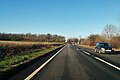 A5 northbound - geograph.org.uk - 5647262.jpg 640 × 428; 85 KB
-
 A5 northbound - geograph.org.uk - 5647272.jpg 640 × 428; 143 KB
-
 A5 northbound at Oakley spinney - geograph.org.uk - 4873192.jpg 640 × 481; 74 KB
-
 A508 approaches junction with Grafton Road - geograph.org.uk - 3913054.jpg 3,564 × 2,435; 1.26 MB
-
 A508 approaches junction with Yardley Road - geograph.org.uk - 3913041.jpg 3,838 × 2,531; 1.06 MB
-
 An ancient oak tree - geograph.org.uk - 2965145.jpg 640 × 426; 77 KB
-
 Boats moored beside the Grand Union Canal - geograph.org.uk - 4562323.jpg 2,000 × 1,500; 563 KB
-
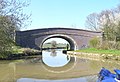 Bridge 59 - geograph.org.uk - 2069961.jpg 640 × 437; 81 KB
-
 Bridge 59, Grand Junction Canal - geograph.org.uk - 2738816.jpg 4,000 × 3,000; 4.95 MB
-
 Bridge 60 - geograph.org.uk - 2953379.jpg 640 × 427; 91 KB
-
 Bridge 60, Grand Junction Canal - geograph.org.uk - 2738813.jpg 4,000 × 3,000; 4.66 MB
-
 Bridge 61 at Yardley Wharf - geograph.org.uk - 2953367.jpg 640 × 427; 78 KB
-
 Bridge 61, Grand Junction Canal - geograph.org.uk - 2738812.jpg 4,000 × 3,000; 4.49 MB
-
 Bridge 62 over the Grand Union - geograph.org.uk - 2953363.jpg 640 × 427; 101 KB
-
 Bridge 62, Grand Junction Canal - geograph.org.uk - 2738811.jpg 4,000 × 3,000; 4.72 MB
-

-

-
 Chestnut Road, Yardley Gobion - geograph.org.uk - 6323668.jpg 1,280 × 851; 327 KB
-
 Drive down to Old Wharf Farm - geograph.org.uk - 2680968.jpg 640 × 480; 110 KB
-
 Eastfield Crescent - geograph.org.uk - 5071636.jpg 4,902 × 3,270; 2.77 MB
-
 Farmland north-east of Yardley Gobion - geograph.org.uk - 6323647.jpg 1,280 × 851; 287 KB
-
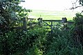 Gate on the path to Queens Oak - geograph.org.uk - 2965118.jpg 640 × 426; 104 KB
-
 Grand Union Canal near Yardley Gobion - geograph.org.uk - 4745829.jpg 800 × 487; 143 KB
-

-
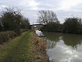 Grand Union Canal Walk - geograph.org.uk - 5627933.jpg 640 × 480; 69 KB
-
 Grand Union Canal, Bridge Number 59 - geograph.org.uk - 3661774.jpg 640 × 480; 75 KB
-
 Grand Union Canal, Bridge Number 60 - geograph.org.uk - 3663319.jpg 640 × 480; 78 KB
-
 Grand Union Canal, Bridge Number 61 - geograph.org.uk - 3661813.jpg 640 × 480; 79 KB
-
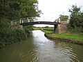 Grand Union Canal, Bridge Number 62 - geograph.org.uk - 3663324.jpg 640 × 480; 81 KB
-
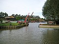 Grand Union Canal, Kingfisher Marina - geograph.org.uk - 3663317.jpg 640 × 480; 72 KB
-
 Grand Union Canal, Yardley Gobion - geograph.org.uk - 6323628.jpg 1,280 × 851; 248 KB
-
 High Street, Yardley Gobion - geograph.org.uk - 6323679.jpg 1,280 × 851; 542 KB
-

-
 Joining the A508 - geograph.org.uk - 2681022.jpg 640 × 480; 46 KB
-
 Kingfisher Marina - geograph.org.uk - 2953374.jpg 640 × 427; 58 KB
-

-
 Milestone 24 - geograph.org.uk - 4796775.jpg 640 × 480; 148 KB
-
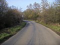 Moorend Road - geograph.org.uk - 2680996.jpg 640 × 480; 84 KB
-
 On the path to Moor End - geograph.org.uk - 2965102.jpg 480 × 640; 110 KB
-
 OS Benchmark 650 - geograph.org.uk - 1349393.jpg 480 × 640; 127 KB
-
 Path to Moor End - geograph.org.uk - 2965107.jpg 640 × 427; 111 KB
-
 Path to Potterespury - geograph.org.uk - 2965198.jpg 640 × 426; 117 KB
-
 Path towards Queens Oak - geograph.org.uk - 2965135.jpg 480 × 640; 151 KB
-
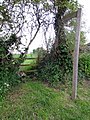 Path towards the canal - geograph.org.uk - 2953382.jpg 480 × 640; 152 KB
-
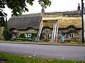 Rethatching a cottage in Yardley Gobion - geograph.org.uk - 256622.jpg 640 × 480; 118 KB
-

-
 Rudolf Steiner School - geograph.org.uk - 2965147.jpg 640 × 428; 81 KB
-
 Telephone Exchange, Yardley Gobion - geograph.org.uk - 2237854.jpg 3,072 × 2,304; 1.78 MB
-
 The Coffee Pot cafe - geograph.org.uk - 6148148.jpg 1,600 × 900; 335 KB
-
 The Green - geograph.org.uk - 2680976.jpg 640 × 480; 83 KB
-
 The path to Moor End - geograph.org.uk - 2965156.jpg 640 × 426; 94 KB
-

-
 View across the River Tove valley - geograph.org.uk - 4745835.jpg 800 × 571; 153 KB
-
 Water tower - geograph.org.uk - 2680984.jpg 640 × 480; 47 KB
-
 Waymarker on an overgrown path - geograph.org.uk - 2965114.jpg 640 × 427; 139 KB
-
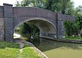 Yardley Bridge No 60 - geograph.org.uk - 4745814.jpg 800 × 565; 139 KB
-

-
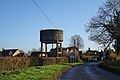 Yardley Gobion Water Tower - geograph.org.uk - 6334682.jpg 1,600 × 1,067; 432 KB
-
 Yardley Gobion-Moorend Road - geograph.org.uk - 6334686.jpg 1,600 × 1,042; 509 KB
-
 Yardley Road - geograph.org.uk - 5071445.jpg 5,184 × 3,456; 7.56 MB
-
 Yardley Wharf - geograph.org.uk - 531217.jpg 640 × 428; 100 KB
-
 Bridge 60, GUC, Yardley Wharf - geograph.org.uk - 250373.jpg 640 × 378; 103 KB
-
 Grafton Fields - geograph.org.uk - 439046.jpg 640 × 438; 41 KB
-
 Grafton Regis - geograph.org.uk - 453146.jpg 640 × 480; 123 KB
-
 Millennium Signpost, Yardley Gobion - geograph.org.uk - 531227.jpg 428 × 640; 90 KB
-
 Straw Bales near Yardley Gobion - geograph.org.uk - 533634.jpg 640 × 428; 113 KB
-

-
 Yardley Gobion - geograph.org.uk - 453127.jpg 640 × 480; 163 KB


