Category:Yatton
Jump to navigation
Jump to search

village and civil parish in North Somerset, Somerset, England  Церковь святой Марии в Яттоне | |||||
| Upload media | |||||
| Instance of | |||||
|---|---|---|---|---|---|
| Location | North Somerset, Somerset, South West England, England | ||||
| Official language | |||||
| Currency | |||||
| Population |
| ||||
 | |||||
Subcategories
This category has the following 7 subcategories, out of 7 total.
Media in category "Yatton"
The following 200 files are in this category, out of 407 total.
(previous page) (next page)-
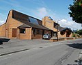
 'Smart' factory, Horsecastle - geograph.org.uk - 6494852.jpg 1,024 × 768; 148 KB
-

-
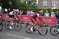 2018 Tour of Britain stage 3 156 Rick Zabel and 182 Nils Eekhoff in Yatton.JPG 1,366 × 910; 559 KB
-
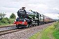
 7029 & 4930 'GW 150 Special'.jpg 3,510 × 2,341; 8.22 MB
-
 A clearing on Cadbury Hill - geograph.org.uk - 5744121.jpg 2,304 × 1,704; 1.66 MB
-
 A Clevedon train leaves Yatton - geograph.org.uk - 6076334.jpg 1,024 × 684; 255 KB
-
 A Clevedon train waits at Yatton - geograph.org.uk - 6076361.jpg 1,024 × 583; 105 KB
-
 A footbridge near Wemberham Cottage - geograph.org.uk - 6422586.jpg 2,472 × 3,296; 1.91 MB
-
 A line of trees - geograph.org.uk - 4992165.jpg 640 × 426; 54 KB
-
 A line of trees - geograph.org.uk - 5232821.jpg 640 × 426; 65 KB
-
 A mast in a bend in the Congresbury Yeo - geograph.org.uk - 6421671.jpg 3,296 × 2,472; 1.99 MB
-
 A roundabout at Horsecastle - geograph.org.uk - 3505455.jpg 640 × 480; 102 KB
-
 A sprint across the Congresbury Yeo - geograph.org.uk - 6422574.jpg 3,296 × 2,472; 1.89 MB
-
 A stony sluice - geograph.org.uk - 6421677.jpg 3,296 × 2,472; 1.96 MB
-
 A Wellingtonia on Cadbury Hill - geograph.org.uk - 5745342.jpg 1,704 × 2,304; 2.11 MB
-
 A wet winter - geograph.org.uk - 6422580.jpg 3,296 × 2,472; 1.96 MB
-
 An arcing sluice - geograph.org.uk - 6421685.jpg 3,296 × 2,472; 1.81 MB
-
 An attractive rural farm building in Kennmoor Road - geograph.org.uk - 3605695.jpg 3,648 × 2,736; 2.92 MB
-
 An isolated pair of hawthorn trees beside a rhyne - geograph.org.uk - 3622257.jpg 1,824 × 1,368; 713 KB
-
 An old road - geograph.org.uk - 5744099.jpg 2,304 × 1,704; 1.64 MB
-
 Awaiting the river - geograph.org.uk - 6421673.jpg 3,296 × 2,472; 1.95 MB
-
 B3133 bend near Hope Farm - geograph.org.uk - 5813450.jpg 1,024 × 768; 148 KB
-
 B3133 High Street, Yatton - geograph.org.uk - 5813452.jpg 1,024 × 770; 151 KB
-
 B3133 High Street, Yatton - geograph.org.uk - 5813457.jpg 1,024 × 768; 133 KB
-

-
 Barberry Farm - geograph.org.uk - 6417074.jpg 1,024 × 768; 245 KB
-

-
 Barn, Bridge Field Farm - geograph.org.uk - 5319507.jpg 640 × 317; 44 KB
-
 Barn, Bridge Field Farm - geograph.org.uk - 5631448.jpg 640 × 363; 48 KB
-

-
 Betfred, Yatton - geograph.org.uk - 2731286.jpg 640 × 480; 83 KB
-
 Biddle Street Rhyne - geograph.org.uk - 5232814.jpg 640 × 287; 35 KB
-

-
 Blackditch Rhyne - geograph.org.uk - 4080441.jpg 800 × 531; 120 KB
-
 Blackditch Rhyne - geograph.org.uk - 4080595.jpg 1,024 × 680; 292 KB
-
 Blackditch Rhyne - geograph.org.uk - 6417042.jpg 1,024 × 768; 144 KB
-
 Blackditch Rhyne - geograph.org.uk - 6417047.jpg 1,024 × 791; 163 KB
-
 Blind Lane - geograph.org.uk - 2420182.jpg 640 × 350; 50 KB
-
 Blow the gate^ - geograph.org.uk - 6422583.jpg 3,296 × 2,472; 1.9 MB
-
 Bowling green, Yatton Bowling Club - geograph.org.uk - 2958562.jpg 640 × 372; 51 KB
-
 Bridge over the Congresbury Yeo - geograph.org.uk - 98549.jpg 640 × 480; 132 KB
-
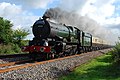
 Britannia at Yatton Horsecastle Somerset, England - panoramio.jpg 4,956 × 3,213; 12.88 MB
-
 Broad Gauge Horsebox at Yatton - geograph.org.uk - 6076443.jpg 1,024 × 773; 295 KB
-
 Brockley Way - geograph.org.uk - 6416313.jpg 1,024 × 768; 181 KB
-
 Brockley Way, Claverham - geograph.org.uk - 6335927.jpg 800 × 600; 163 KB
-
 Brockley Way, Claverham - geograph.org.uk - 6335935.jpg 800 × 600; 135 KB
-
 Brunel Way, Yatton - geograph.org.uk - 2591624.jpg 640 × 480; 85 KB
-

-
 Bus stops on Claverham Road - geograph.org.uk - 2422081.jpg 640 × 447; 80 KB
-
 Cadbury Hill stock pond - geograph.org.uk - 5744126.jpg 2,304 × 1,704; 1.6 MB
-
 Catholic Church of St Dunstan, Yatton.jpg 3,892 × 2,605; 6.62 MB
-
 Cattle grazing notice - geograph.org.uk - 5745259.jpg 2,304 × 1,704; 1.57 MB
-

-
 Cattle grazing, Hillsea - geograph.org.uk - 5631445.jpg 640 × 426; 52 KB
-
 Cereal crop near Claverham Green Farm - geograph.org.uk - 6335933.jpg 800 × 600; 142 KB
-
 Chapel Lane - geograph.org.uk - 6416336.jpg 1,024 × 784; 219 KB
-
 Chestnut Drive - geograph.org.uk - 6416348.jpg 1,024 × 768; 104 KB
-
 Chestnut Farm - geograph.org.uk - 6416842.jpg 1,024 × 843; 183 KB
-
 Church Road bungalows, Yatton - geograph.org.uk - 2958611.jpg 640 × 432; 69 KB
-
 Church Road, Yatton - geograph.org.uk - 87087.jpg 640 × 426; 154 KB
-
 Churchyard cross - St Mary's Church, Yatton - geograph.org.uk - 5618941.jpg 5,184 × 2,920; 4.93 MB
-
 Claverham Cricket Club - geograph.org.uk - 5744093.jpg 2,304 × 1,704; 1.6 MB
-
 Claverham Drove - geograph.org.uk - 4080627.jpg 800 × 531; 162 KB
-
 Claverham Drove - geograph.org.uk - 4080631.jpg 800 × 531; 122 KB
-
 Claverham Drove - geograph.org.uk - 4080635.jpg 800 × 531; 123 KB
-
 Claverham Drove - geograph.org.uk - 6335932.jpg 800 × 600; 150 KB
-
 Claverham Drove - geograph.org.uk - 6416899.jpg 1,024 × 768; 239 KB
-
 Claverham Drove - geograph.org.uk - 6416901.jpg 1,024 × 768; 203 KB
-
 Claverham Drove - geograph.org.uk - 6417049.jpg 1,024 × 757; 247 KB
-
 Claverham Drove north of Yatton - geograph.org.uk - 4145988.jpg 800 × 573; 165 KB
-
 Claverham Road - geograph.org.uk - 114173.jpg 640 × 426; 136 KB
-
 Claverham Road looking west - geograph.org.uk - 2413692.jpg 1,000 × 667; 267 KB
-

-
 Claverham Road, Yatton - geograph.org.uk - 6335312.jpg 800 × 600; 115 KB
-
 Claverham Road, Yatton - geograph.org.uk - 6335338.jpg 800 × 600; 130 KB
-
 Claverham Road, Yatton - geograph.org.uk - 6335341.jpg 800 × 600; 121 KB
-

-
 Clump of trees - geograph.org.uk - 5631452.jpg 640 × 426; 56 KB
-
 Co-operative Food Store, Yatton - geograph.org.uk - 4633537.jpg 1,024 × 768; 132 KB
-
 Community Speed Watch Area in Yatton - geograph.org.uk - 3934183.jpg 800 × 506; 172 KB
-

-
 Congresbury Moor - Information Board - geograph.org.uk - 95817.jpg 640 × 480; 153 KB
-

-

-

-
 Cottages at Laurel Farm - geograph.org.uk - 6416367.jpg 1,024 × 768; 189 KB
-
 Cottages in Church Rd, Yatton - geograph.org.uk - 2138866.jpg 4,000 × 3,000; 2.31 MB
-
 Crossroads - geograph.org.uk - 87055.jpg 640 × 426; 135 KB
-
 Crossroads on North End Road - geograph.org.uk - 4080433.jpg 1,024 × 680; 275 KB
-
 Crossroads signpost north of Yatton - geograph.org.uk - 4145946.jpg 640 × 602; 104 KB
-
 Crossway Farm buildings - geograph.org.uk - 4146123.jpg 800 × 632; 164 KB
-
 Cycling around the bend, Yatton - geograph.org.uk - 2958895.jpg 640 × 465; 80 KB
-
 Cycling into Yatton - geograph.org.uk - 2958940.jpg 640 × 536; 81 KB
-
 Dairy Close, Yatton - geograph.org.uk - 2591797.jpg 640 × 480; 88 KB
-
 Dark waters - geograph.org.uk - 6419586.jpg 3,296 × 2,472; 1.91 MB
-
 Decoy Pool Drove - geograph.org.uk - 3605712.jpg 2,346 × 3,128; 2.23 MB
-

-
 Drain on Kenn Moor - geograph.org.uk - 6416898.jpg 1,024 × 768; 187 KB
-
 Easterly Elms - geograph.org.uk - 6416896.jpg 1,024 × 819; 200 KB
-
 Eastern Drove - geograph.org.uk - 6416897.jpg 1,024 × 768; 236 KB
-
 Eastern end of the ramparts - geograph.org.uk - 5745326.jpg 2,304 × 1,704; 1.77 MB
-

-
 Edge of the hill fort above Croft Castle - Feb 2012 - panoramio.jpg 4,000 × 3,000; 4.22 MB
-
 Elborough Avenue, Yatton - geograph.org.uk - 2731228.jpg 610 × 640; 93 KB
-
 End of the 30 zone in Yatton - geograph.org.uk - 3934174.jpg 800 × 536; 167 KB
-

-

-

-
 Factory premises in Kennmoor Road - geograph.org.uk - 3605689.jpg 3,648 × 2,736; 2.15 MB
-
 Farm bridges over Wemberham Lane Rhyne - geograph.org.uk - 6495080.jpg 1,024 × 768; 254 KB
-
 Farmland beside Claverham Drove - geograph.org.uk - 4080437.jpg 800 × 531; 115 KB
-
 Farmland near Gwynne's Hill - geograph.org.uk - 1051350.jpg 640 × 480; 222 KB
-
 Farmland, Somerset Levels - geograph.org.uk - 4992174.jpg 640 × 426; 42 KB
-
 Farmland, Yatton - geograph.org.uk - 4992136.jpg 640 × 365; 36 KB
-
 Field near Yatton - geograph.org.uk - 5232803.jpg 640 × 353; 42 KB
-
 Firewood 4 Sale - geograph.org.uk - 4080611.jpg 800 × 531; 135 KB
-
 Flooding, Somerset Levels - geograph.org.uk - 4992200.jpg 640 × 363; 37 KB
-
 Footbridge across a rhyne - geograph.org.uk - 3622253.jpg 1,368 × 1,824; 736 KB
-
-
 Footpath junction at Wemberham House - geograph.org.uk - 6421681.jpg 3,296 × 2,472; 1.91 MB
-

-
 Former commercial buildings on Wemberham Lane - geograph.org.uk - 6495941.jpg 1,024 × 762; 166 KB
-

-
 From Henley Lane - geograph.org.uk - 5744097.jpg 1,704 × 2,304; 1.69 MB
-
 Frost Hill near Yatton - geograph.org.uk - 2958954.jpg 640 × 497; 102 KB
-

-
 Grade II listed Church House, Yatton - geograph.org.uk - 2958600.jpg 640 × 480; 96 KB
-
-
 Grade II listed Rock House, Yatton - geograph.org.uk - 2958797.jpg 640 × 582; 99 KB
-

-
 Grazing and drain near Yatton - geograph.org.uk - 4360222.jpg 640 × 444; 45 KB
-
 Grazing marsh - geograph.org.uk - 5319534.jpg 640 × 426; 58 KB
-
 Grazing west of Yatton - geograph.org.uk - 4360225.jpg 640 × 378; 40 KB
-
 Grazing, Hillsea - geograph.org.uk - 4367618.jpg 640 × 448; 45 KB
-
 Grove Farm - geograph.org.uk - 6416326.jpg 1,024 × 736; 159 KB
-
 Ham Lane north of Yatton - geograph.org.uk - 4145832.jpg 800 × 499; 106 KB
-
 Happy Hours, Hereward House, Yatton - geograph.org.uk - 2592005.jpg 640 × 442; 65 KB
-
 Henley Lane car park - geograph.org.uk - 5744128.jpg 2,304 × 1,704; 1.61 MB
-
 Henley Wood reservoir - geograph.org.uk - 5744111.jpg 2,304 × 1,704; 1.66 MB
-
 Heritage estate agents, Yatton - geograph.org.uk - 2958683.jpg 635 × 640; 105 KB
-
 High Street (B3133), Yatton - geograph.org.uk - 6335336.jpg 800 × 603; 137 KB
-
 High Street office space to let, Yatton - geograph.org.uk - 2958722.jpg 640 × 579; 125 KB
-

-
 High Street, Claverham - geograph.org.uk - 6335924.jpg 800 × 600; 128 KB
-
 High Street, Yatton - geograph.org.uk - 87080.jpg 640 × 426; 161 KB
-
 Hillsea - geograph.org.uk - 3241246.jpg 640 × 301; 42 KB
-
 Hillsea - geograph.org.uk - 5319488.jpg 640 × 356; 26 KB
-
 Holding the fort - geograph.org.uk - 5744116.jpg 1,704 × 2,304; 1.94 MB
-
 Home Farm - geograph.org.uk - 6416856.jpg 1,024 × 768; 181 KB
-
 Horsecastle Chapel, Yatton - geograph.org.uk - 2590845.jpg 640 × 507; 71 KB
-
 House on High Street, Yatton - geograph.org.uk - 4634013.jpg 1,024 × 768; 173 KB
-
 House on the High Street, Yatton - geograph.org.uk - 4634023.jpg 1,024 × 768; 193 KB
-
 Houses in North End, Yatton - geograph.org.uk - 2138725.jpg 4,000 × 3,000; 1.74 MB
-
 Houses on Claverham Road, Yatton - geograph.org.uk - 6335339.jpg 800 × 496; 132 KB
-
 Houses on High Street, Claverham - geograph.org.uk - 6335922.jpg 800 × 542; 120 KB
-
 Hugh llewelyn 158 798 (7808320226).jpg 3,872 × 2,592; 2.47 MB
-
 Hugh llewelyn 158 951 (6636834799).jpg 3,872 × 2,592; 2.3 MB
-
 Hugh llewelyn 220 001 (7783071404).jpg 3,490 × 2,165; 4.35 MB
-
 Hugh llewelyn 43 029 (7783067934).jpg 3,872 × 2,592; 2.42 MB
-
 Hugh llewelyn 43 042 (5830060718).jpg 3,872 × 2,592; 2.4 MB
-
 Hugh llewelyn 59 205 (5829362031).jpg 3,872 × 2,592; 2.25 MB
-
 Hugh llewelyn 6024 (5363454683).jpg 3,872 × 2,592; 2.13 MB
-
 Hugh llewelyn 6024 (5363552365).jpg 3,872 × 2,592; 2.35 MB
-
 Hugh llewelyn 66 623 (5568131294).jpg 3,872 × 2,592; 1.82 MB
-
 Hugh llewelyn 67 005 (5568132286).jpg 3,872 × 2,592; 1.85 MB
-

-
 Humpback bridge, Yatton - geograph.org.uk - 1052010.jpg 640 × 480; 55 KB
-
 Inside St Mary, Yatton (a) - geograph.org.uk - 5471232.jpg 480 × 640; 62 KB
-
 Inside St Mary, Yatton (b) - geograph.org.uk - 5471236.jpg 480 × 640; 44 KB
-
 Inside St Mary, Yatton (c) - geograph.org.uk - 5471238.jpg 480 × 640; 56 KB
-
 Inside St Mary, Yatton (d) - geograph.org.uk - 5471242.jpg 480 × 640; 69 KB
-
 Inside St Mary, Yatton (e) - geograph.org.uk - 5471243.jpg 480 × 640; 46 KB
-
 Inside St Mary, Yatton (f) - geograph.org.uk - 5471245.jpg 480 × 640; 76 KB
-
 Inside St Mary, Yatton (g) - geograph.org.uk - 5471240.jpg 480 × 640; 77 KB
-

-
 J.L.Hill, Yatton - geograph.org.uk - 2958749.jpg 586 × 640; 90 KB
-
 Jewson Yatton - geograph.org.uk - 2591209.jpg 640 × 410; 56 KB
-
 Jones Close, Horsecastle, Yatton - geograph.org.uk - 2591472.jpg 640 × 361; 56 KB
-
 Kenn Moor - geograph.org.uk - 2312075.jpg 800 × 600; 254 KB
-
 Kenn Moor - geograph.org.uk - 4080621.jpg 800 × 531; 152 KB
-
 Kenn Moor and Blackditch Rhyne - geograph.org.uk - 3737079.jpg 3,264 × 2,448; 3.67 MB
-

-

-
 Kennmoor Road - geograph.org.uk - 6417065.jpg 1,024 × 760; 157 KB
-
 Kennmoor Road looking North - geograph.org.uk - 3605685.jpg 2,346 × 3,128; 1.63 MB
-
 Kingston Bridge, near Yatton - geograph.org.uk - 2136776.jpg 3,296 × 2,472; 1.83 MB
-
 Lady Florence Stalling Almshouse, Yatton - geograph.org.uk - 2138861.jpg 4,000 × 3,000; 2.14 MB
-
 Lake, North Somerset - geograph.org.uk - 4992214.jpg 640 × 426; 51 KB
-
 Lane from Lyne Down to Kempley - geograph.org.uk - 1051330.jpg 640 × 480; 157 KB
-
 Lestrem House, Yatton - geograph.org.uk - 2958921.jpg 640 × 473; 89 KB
-
 Lillypool Drove - geograph.org.uk - 6417052.jpg 1,024 × 768; 273 KB
-
 Little River - geograph.org.uk - 4497350.jpg 640 × 480; 96 KB
-
 Little River north of Yatton - geograph.org.uk - 3934274.jpg 800 × 608; 141 KB
-
 Lloyds TSB, Yatton - geograph.org.uk - 2518402.jpg 640 × 448; 79 KB
-
 LMS Stanier Class '7P' (BR Class '8P') or 'Coronation' 4-6-2 No. 6233.jpg 6,000 × 4,000; 6.67 MB
-
 LNER Peppercorn Class "A1" 4-6-2 No.60163 - 24853798249.jpg 3,734 × 2,487; 6.14 MB
-
 Localised flooding - geograph.org.uk - 4992156.jpg 640 × 303; 37 KB
-
 Looking down from Henley Wood - geograph.org.uk - 5744103.jpg 2,304 × 1,704; 1.56 MB
-
 Lower Claverham - geograph.org.uk - 6335929.jpg 800 × 600; 201 KB
-
 Macquarie Farm Close, Yatton - geograph.org.uk - 2591932.jpg 640 × 580; 92 KB


,_Yatton_-_geograph.org.uk_-_6335336.jpg)


.jpg)
.jpg)
.jpg)
.jpg)
.jpg)
.jpg)
.jpg)
.jpg)
.jpg)
.jpg)


_-_geograph.org.uk_-_5471232.jpg)
_-_geograph.org.uk_-_5471236.jpg)
_-_geograph.org.uk_-_5471238.jpg)
_-_geograph.org.uk_-_5471242.jpg)
_-_geograph.org.uk_-_5471243.jpg)
_-_geograph.org.uk_-_5471245.jpg)
_-_geograph.org.uk_-_5471240.jpg)


_or_%27Coronation%27_4-6-2_No._6233.jpg)


