Category:Yukon River
Jump to navigation
Jump to search
river in the Yukon Territory, Canada and Alaska, United States of America   | |||||
| Upload media | |||||
| Instance of | |||||
|---|---|---|---|---|---|
| Location | |||||
| Length |
| ||||
| Origin of the watercourse | |||||
| Mouth of the watercourse | |||||
| Drainage basin | |||||
| Tributary |
| ||||
| Lake on watercourse |
| ||||
 | |||||
Subcategories
This category has the following 25 subcategories, out of 25 total.
.
B
C
- Christ Church Mission (3 F)
F
- Five Finger Rapids (51 F)
- Frozen Yukon River (17 F)
G
- George Black Ferry (6 F)
L
- Lake Laberge (19 F)
M
P
R
- Rampart Dam (11 F)
S
- Schwatka Lake (11 F)
T
- Teslin Lake (3 F)
W
Y
- Yukon River in Whitehorse (48 F)
Media in category "Yukon River"
The following 200 files are in this category, out of 376 total.
(previous page) (next page)-

-

-

-
 Yukon River Basin USGS.jpg 745 × 511; 47 KB
-
 Bw Yukon River drainage basin.png 542 × 292; 14 KB
-
 Yukon River drainage basin.gif 563 × 290; 80 KB
-

-
-
 1901. Calico Bluff-Yukon River. - NARA - 297229.jpg 3,000 × 2,982; 4.95 MB
-
 1901. Rock formation, Yukon River. - NARA - 297228.jpg 3,000 × 2,940; 4.5 MB
-
 1901. Showing rock formation-Northern Bank-Yukon River. - NARA - 297225.jpg 2,998 × 3,000; 4.26 MB
-
 2015-08-20 Canoeing the Yukon River - Whitehorse to Carmarcks 1442.jpg 5,472 × 3,648; 8.3 MB
-
 2015-08-20 Canoeing the Yukon River - Whitehorse to Carmarcks 1486.jpg 5,472 × 3,648; 4.83 MB
-
 2015-08-20 Canoeing the Yukon River - Whitehorse to Carmarcks 1508.jpg 5,472 × 3,648; 4.64 MB
-
 2015-08-21 Canoeing the Yukon River - Whitehorse to Carmarcks 1585.jpg 5,472 × 3,648; 5.43 MB
-
 2015-08-21 Canoeing the Yukon River - Whitehorse to Carmarcks 1592.jpg 5,472 × 3,648; 6.24 MB
-
 2015-08-21 Canoeing the Yukon River - Whitehorse to Carmarcks 1599.jpg 5,472 × 3,648; 5.14 MB
-

-
 A swim in the Yukon.jpg 2,112 × 2,816; 1.08 MB
-

-

-
-
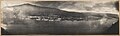
 Aerial view of Dawson City at midnight, June, 1901 (AL+CA 8020).jpg 768 × 598; 73 KB
-
 Aerial view of Eagle, Alaska, ca. 1899 - DPLA - 5e4d59df4609b27b42ce6bd30e9b26f3.jpg 13,126 × 3,908; 3.81 MB
-

-
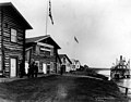
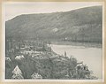
 Aerial view of the village of Rampart on the Yukon river.jpg 1,962 × 1,569; 77 KB
-
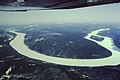
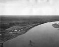
 Aerial view of the Yukon river.jpg 1,500 × 878; 79 KB
-

-
-
 Alaska - Nulato - NARA - 23942231.jpg 4,008 × 2,973; 3.03 MB
-
 Alaska and its resources (1870) (14781985031).jpg 3,199 × 1,712; 1.62 MB
-
 Alaska and its resources (1870) (14785125055).jpg 2,848 × 1,520; 1.45 MB
-
 Alaska sept 20 2010.jpg 4,400 × 3,400; 3.94 MB
-
 Alaska's Yukon Delta.jpg 4,587 × 3,101; 10.7 MB
-
 Alaska’s Yukon Delta ESA232737.tiff 4,587 × 3,101; 37.35 MB
-
 Along the Yukon River, I think. - NARA - 297199.jpg 3,000 × 2,945; 4.16 MB
-
 Along Yukon. - NARA - 297187.jpg 3,000 × 2,952; 3.95 MB
-
 Along Yukon. - NARA - 297203.jpg 2,910 × 3,000; 4.64 MB
-
 Along Yukon. - NARA - 297214.jpg 2,976 × 3,000; 3.95 MB
-
 Along Yukon. Buildings on a hillside in forest on riverbank. - NARA - 297227.jpg 2,955 × 3,000; 4.03 MB
-
 Anvik waterfront, Alaska, ca. 1899 - DPLA - f1be6c19320d779c93782f11de122b70.jpg 12,976 × 3,923; 4.1 MB
-

-

-

-

-
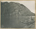
 Boat at Calico Bluff, Alaska, ca. 1899 - DPLA - 9c96cf9bb342de6c7998122f26c14683.jpg 5,752 × 4,589; 3.36 MB
-

-
-
-

-
-

-

-
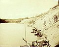
 Boat on bank at Calico Bluff, Alaska, ca. 1899 - DPLA - b8cf708c715dbdc2c962da18bd569606.jpg 5,882 × 4,651; 2.85 MB
-

-
-

-
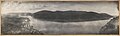
 Broad expanse of the Yukon River, 1890-1900 (AL+CA 4183).jpg 768 × 517; 35 KB
-
 Brooks Range (40) from aeroplane.jpg 2,520 × 1,680; 2.43 MB
-

-

-
 Buildings on a bluff. - NARA - 297191.jpg 2,958 × 3,000; 4.37 MB
-
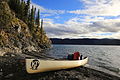
 Canoeing the Yukon River.jpg 1,050 × 689; 152 KB
-
 Canoes and dogs on a river bank. - NARA - 297217.jpg 3,059 × 3,000; 4.47 MB
-

-
 Carmacks Banner.jpg 16,810 × 2,407; 22.33 MB
-
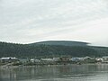
 Carmacks Yukon.jpg 2,428 × 1,084; 1.55 MB
-
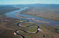
 Channel leading to oxbow lake in the Yukon flats.jpg 3,000 × 4,563; 558 KB
-
 CharleyRiverAtYukon1.jpg 640 × 409; 76 KB
-
 Cheezecake, Yukoni jõe hüdrograaf.jpg 512 × 364; 39 KB
-
 Circle Alaska 1949 FWS.jpg 1,050 × 853; 422 KB
-
-

-
 CirclevillageAlaska.jpg 3,072 × 2,304; 3.96 MB
-

-
 Cloudy view of the Yukon River (27495385226).jpg 7,266 × 3,303; 14.04 MB
-
 ConfluenceofYukonandStewart.jpg 1,072 × 603; 312 KB
-

-
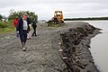
 Cribbing (14015982189).jpg 2,801 × 3,999; 2.25 MB
-
 Cribbing (14015986719).jpg 2,800 × 3,998; 4.51 MB
-
 Cribbing (14016200309).jpg 2,801 × 3,999; 4.89 MB
-

-
 Crowley (tugboat), Tanana River.jpg 1,600 × 1,200; 1.27 MB
-

-

-

-

-

-

-

-

-

-
 Dave's two-moose boat (14209468185).jpg 3,674 × 2,237; 4.6 MB
-
 Dawson , Yukon Territory, and the Yukon River (CURTIS 572).jpeg 768 × 621; 73 KB
-

-
 Dawson at midnight, June 21, 1899, Yukon Territory (HEGG 540).jpeg 768 × 526; 160 KB
-
 Dawson City - Yukon Territory (12448750913).jpg 3,888 × 2,592; 3.77 MB
-
 Dawson City 1988.jpg 2,100 × 1,500; 980 KB
-
 Dawson City across the Yukon River, ca. 1899 - DPLA - 6596bcdf739ae3799f006b5086f1248b.jpg 13,054 × 3,907; 4.52 MB
-
 Dawson City from the river in 1988.jpg 2,107 × 1,494; 1.12 MB
-
 Dawson City from the Yukon River, 1898 (AL+CA 7106).jpg 596 × 600; 87 KB
-
 Dawson City from Yukon River.jpg 3,264 × 2,448; 1.74 MB
-
 Dawson City Lookout Yukon River 3264px.jpg 3,264 × 2,448; 2.06 MB
-
 Dawson City Rivers Lookout 3264px.jpg 3,264 × 2,448; 2.53 MB
-
 Dawson City Yukon Ferry.jpg 1,497 × 959; 704 KB
-
 Dawson City Yukon River Closeup 3264px.jpg 3,264 × 2,448; 1.7 MB
-

-
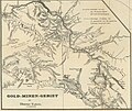
 Discovery-map-klondike.jpg 671 × 890; 160 KB
-
 Emil Brass, Im Reiche der Pelze, Seite 173, Eingeborene Fellhändler am Yucon (Alaska).jpg 1,461 × 1,084; 2.57 MB
-
 Fish-wheel on Yukon River. Same source as photo ^966. - NARA - 297810.jpg 3,000 × 2,025; 3.36 MB
-
 Fish-wheel on Yukon River. Same source as photo ^966. - NARA - 297811.jpg 3,000 × 2,042; 3.52 MB
-

-
 Fishing village on the Yukon River, Alaska, 1909 (AL+CA 2855).jpg 768 × 539; 56 KB
-
 Five Finger Rapids, Yukon River, ca 1898 (CURTIS 1340).jpeg 768 × 562; 52 KB
-
 Fivefingers-Yukon-Canada2009.jpg 743 × 557; 189 KB
-
 Flat on west side of Yukon river below Dawson (5926022651).jpg 3,070 × 899; 321 KB
-
-
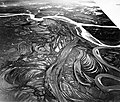
 Flying over the meanders of the mighty Yukon to Arctic Village.jpg 2,048 × 1,536; 246 KB
-
 FMIB 34525 Fish Wheel, Yukon River, Alaska.jpeg 713 × 495; 76 KB
-
 FMIB 34854 Native Salmon Fishery, Yukon River.jpeg 540 × 399; 53 KB
-
 FMIB 34858 Native Method of Curing Salmon, Yukon River.jpeg 552 × 399; 77 KB
-
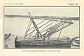
 FMIB 35010 Native Fish Wheel, Yukon River.jpeg 710 × 445; 43 KB
-
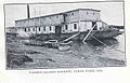 FMIB 35024 Pioneer salmon cannery, Yukon River, 1918.jpeg 696 × 447; 71 KB
-
 FMIB 35037 Native Salmon Wheel, Yukon River.jpeg 707 × 475; 59 KB
-
 FMIB 35038 Native Method of Curing Salmon, Yukon River, 1918.jpeg 701 × 487; 79 KB
-
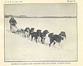 FMIB 35043 Bureau's Alaska Fur Warden and Dog Team, Yukon River.jpeg 721 × 578; 49 KB
-
 FMIB 35127 Native Village, Yukon Delta, in Winter.jpeg 803 × 670; 40 KB
-

-
 FMIB 41291 Rock Island, at lower entrance to the Ramparts, Yukon River.jpeg 1,330 × 955; 282 KB
-

-

-

-
-

-

-

-

-

-
-
 FMIB 41321 Yukon River pike (Esox lucius).jpeg 1,325 × 553; 169 KB
-
 FMIB 41322 Characteristic view of the Yukon River below Nulato.jpeg 1,242 × 693; 223 KB
-
 FMIB 41323 Characteristic view of the Yukon in the locality of the Ramparts.jpeg 1,177 × 798; 258 KB
-

-

-

-
-
 FMIB 41355 Andreafski, Yukon River.jpeg 1,138 × 489; 113 KB
-

-

-

-

-

-
-

-

-

-

-
 FMIB 44012 Yukon River, Miles Canon and Rapids.jpeg 917 × 594; 259 KB
-
 FMIB 44013 Yukon River, Miles Canon and Rapids.jpeg 924 × 635; 243 KB
-
 FMIB 44015 View looking up the Yukon from Kitl-ah-gon.jpeg 947 × 600; 212 KB
-
 FMIB 44016 View down the Yukon from Kitl-ah-gon.jpeg 923 × 588; 202 KB
-

-
 FMIB 44021 -Yukon River-.jpeg 918 × 594; 252 KB
-
 FMIB 44023 View down the Yukon River from the site of Selkirk.jpeg 912 × 647; 220 KB
-

-

-

-

-

-
 Fort Gibbons on Yukon - NARA - 297230.jpg 2,991 × 3,000; 3.91 MB
-
 Fort Selkirk on the Yukon River, Yukon Territory, 1898 (HEGG 587).jpeg 768 × 550; 114 KB
-

-
 Frozen Yukon (8176961780).jpg 1,616 × 1,212; 717 KB
-
 GAL-i.jpg 768 × 512; 43 KB
-
 Glacier Silt Makes the Yukon Milky.jpg 1,280 × 989; 396 KB
-
 Prying the Raft off a Bar by Lt. Charles Gloster, U. S. Army, 1883.JPG 3,480 × 1,840; 862 KB
-
 Hootalinqua on the Yukon River, ca. 1899 - DPLA - 46a535085f7ef84badc883e42bef17cb.jpg 6,243 × 4,921; 3.24 MB
-

-

-
 Ice fog on the Yukon River (11291925256).jpg 2,611 × 1,600; 1.15 MB
-
 Ice fog on the Yukon River (11291929706).jpg 2,498 × 1,600; 1.42 MB
-
 Ice fog on the Yukon River (8717073078).jpg 2,400 × 1,600; 966 KB
-

-

-

-
 Ingakslugwat Hills.jpg 640 × 444; 106 KB
-
 International Boundary Across the Yukon River, 1897 (AL+CA 222).jpg 768 × 463; 90 KB
-
 Isle in the river (7041402391).jpg 3,648 × 2,221; 6.64 MB
-
 Junction of the Yukon and Koyukuk Rivers, Alaska.jpg 3,177 × 2,706; 5.96 MB
-
 K5 11468 (6112989884).jpg 4,875 × 3,229; 10.71 MB
-
 Kaltag Alaska.jpg 1,050 × 722; 651 KB
-
 Klondike camp Yukon head.jpg 640 × 416; 96 KB
-

-

-

-

-

-

-

-


%27_(11245023125).jpg)
_-_Alaska_mit_der_Dampfer-und_Landverbindungen_von_San_Francisco_-_btv1b53058507j_(1_of_2)_(cropped).jpg)


._THE_VIEW_IS_SOUTH..._-_NARA_-_550540.jpg)
.jpg)


_(14781985031).jpg)
_(14785125055).jpg)


.jpeg)
.jpeg)
.jpg)
.jpg)

.jpg)
.jpeg)
.jpeg)
.jpg)
.jpg)
.jpg)
.jpg)

.jpg)
.jpg)
.jpg)
.jpg)
_from_aeroplane.jpg)
.jpeg)
.jpg)


.jpg)


.jpeg)
.jpeg)

.jpeg)
.jpg)

.jpg)
.jpg)
.jpg)
.jpg)
.jpg)
,_Tanana_River.jpg)
.jpg)
.jpg)
.jpg)
.jpg)
.jpg)
.jpg)
.jpg)
.jpg)
.jpg)
.jpg)
.jpeg)
.jpeg)
.jpeg)
.jpg)


.jpg)


.jpg)

.jpg)


.jpg)
.jpg)
.jpeg)

.jpg)


.jpeg)


_in_the_middle_section_of_the_river.jpeg)


.jpeg)
.jpeg)
.jpg)


.jpeg)

.jpg)
.jpg)
.jpg)
.jpg)
.jpg)
.jpeg)

.jpg)
.jpg)

.jpg)


.jpeg)
.jpeg)
.jpg)
.jpg)
.jpg)
.jpeg)
.jpeg)
.jpg)
.jpg)