Category:Zeche Gotthilf
Jump to navigation
Jump to search
| Object location | | View all coordinates using: OpenStreetMap |
|---|
 | |||||
| Upload media | |||||
| Instance of | |||||
|---|---|---|---|---|---|
| Location | Herdecke, Ennepe-Ruhr-Kreis, Arnsberg Government Region, North Rhine-Westphalia, Germany | ||||
 | |||||
Media in category "Zeche Gotthilf"
The following 6 files are in this category, out of 6 total.
-
 Gotthilf Zeche Herdecke.jpg 5,411 × 3,555; 8.1 MB
-
 Herdecke - Im Schiffwinkel - Zeche Gotthilf 01 ies.jpg 3,744 × 5,616; 7.98 MB
-
 Herdecke - Im Schiffwinkel - Zeche Gotthilf 02 ies.jpg 5,616 × 3,744; 9.15 MB
-
 Herdecke - Im Schiffwinkel - Zeche Gotthilf 03 ies.jpg 3,744 × 5,616; 7.82 MB
-
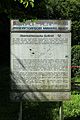
 Herdecke, Im Schiffwinkel südl. Nr. 39, ehem. Steinkohlenzeche Gotthilf, Info-Tafel.jpg 2,214 × 2,931; 1.56 MB
-


