Category:Ziguinchor Region
Jump to navigation
Jump to search
region of Senegal  | |||||
| Upload media | |||||
| Instance of | |||||
|---|---|---|---|---|---|
| Location | Senegal | ||||
| Located in or next to body of water | |||||
| Capital | |||||
| Population |
| ||||
| Area |
| ||||
 | |||||
Media in category "Ziguinchor Region"
The following 17 files are in this category, out of 17 total.
-
 20130609-DSC 8907 (9087382188).jpg 4,928 × 3,264; 1.88 MB
-
 20130609-IMG 2441 (9085303383).jpg 3,264 × 2,448; 1.65 MB
-
 20130609-IMG 2442 (9085358465).jpg 3,264 × 2,448; 1.65 MB
-
-
 ISS015-E-8454 - View of Senegal.jpg 3,032 × 2,008; 1.38 MB
-
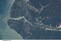 ISS026-E-7210 - View of Senegal.jpg 4,256 × 2,913; 1.07 MB
-
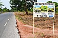 Landmine warning sign near Ziguinchor, Senegal.jpg 4,326 × 2,865; 1.93 MB
-
 Map of the departments of the Ziguinchor region of Senegal.png 1,153 × 1,082; 130 KB
-
 Map-ziguinchor.svg 634 × 718; 320 KB
-
 Plage d'Abéné.jpg 4,160 × 3,120; 2.42 MB
-
 Road in Gambia 0004.jpg 3,072 × 2,304; 4.01 MB
-
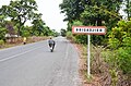
 Route de Cabrousse.jpg 1,500 × 2,000; 1.17 MB
-
 Senegal Ziguinchor.png 582 × 417; 8 KB
-
 Ziguinchor arrondissements.png 1,056 × 816; 18 KB
-
 Ziguinchor banner.jpg 3,264 × 467; 1.31 MB
-
 Ziguinchor departments big print.png 1,056 × 816; 32 KB
-
ZIGUINCHOR.ogg 57 s; 830 KB
.jpg)
.jpg)
.jpg)


