Category:Zschaitz-Ottewig
Jump to navigation
Jump to search
former municipality of Germany   | |||||
| Upload media | |||||
| Instance of |
| ||||
|---|---|---|---|---|---|
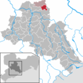
| Location | Mittelsachsen, Saxony, Germany | ||||
| Population |
| ||||
| Area |
| ||||
| Elevation above sea level |
| ||||
| official website | |||||
 | |||||
Subcategories
This category has the following 3 subcategories, out of 3 total.
Media in category "Zschaitz-Ottewig"
The following 5 files are in this category, out of 5 total.
-
 00721-Ottewig-1898-Gasthof zum heiteren Blick-Brück & Sohn Kunstverlag.jpg 1,507 × 1,000; 607 KB
-
 03278-Lüttewitz-1903-Dorfansicht, Geschäftshaus Max Wittig-Brück & Sohn Kunstverlag.jpg 1,517 × 1,000; 417 KB
-

-
 03280-Lüttewitz-1903-Rittergut, Schule-Brück & Sohn Kunstverlag.jpg 1,540 × 1,000; 473 KB
-
 Zschaitz-Ottewig in FG.png 299 × 299; 8 KB


