Category:Zuiderlingedijk 89, Spijk
Jump to navigation
Jump to search
| Object location | | View all coordinates using: OpenStreetMap |
|---|
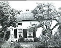
_-_Zuiderlingedijk_Heukelum_89_-_Boerderij.jpg) | |||||
| Upload media | |||||
| Instance of |
| ||||
|---|---|---|---|---|---|
| Location | Spijk, West Betuwe, Gelderland, Netherlands | ||||
| Street address |
| ||||
| Located on street |
| ||||
| Heritage designation |
| ||||
 | |||||
Nederlands: Het Wapen van Leiden
|
This is a category about rijksmonument number 21997
|
| Address |
|
Media in category "Zuiderlingedijk 89, Spijk"
The following 12 files are in this category, out of 12 total.
-
 Aanzicht - Spijk - 20203305 - RCE.jpg 1,200 × 800; 234 KB
-
 Exterieur ACHTERGEVEL - Spijk - 20300142 - RCE.jpg 1,188 × 1,200; 366 KB
-
 Exterieur GEVELSTEEN - Spijk - 20300144 - RCE.jpg 1,200 × 1,197; 406 KB
-
 Exterieur LINKER ZIJGEVEL - Spijk - 20300140 - RCE.jpg 1,186 × 1,200; 414 KB
-
 Exterieur OVERZICHT - Spijk - 20301257 - RCE.jpg 1,200 × 1,200; 280 KB
-
 Exterieur OVERZICHT ACHTERGEVEL - Spijk - 20300141 - RCE.jpg 1,192 × 1,200; 464 KB
-
 Exterieur VOORGEVEL - Spijk - 20301258 - RCE.jpg 1,198 × 1,200; 294 KB
-
 Spijk (Lingewaal) - Zuiderlingedijk Heukelum 89 - Boerderij.jpg 3,888 × 2,592; 6.95 MB
-
 Spijk RM Zuiderlingedijk 89 Het wapen van Leiden.jpg 3,463 × 3,432; 4.79 MB
-
 Spijk RM Zuiderlingedijk 89.jpg 4,417 × 2,749; 4.37 MB
-
 Voor- en zijgevel kleur - Spijk - 20475205 - RCE.jpg 1,200 × 953; 118 KB
-


