Commons:Wiki4Alps/Broc

From Wikimedia Commons, the free media repository
Jump to navigation Jump to search
KGS-Nr Upload Foto   Object Other Cov. Cat. Type Address Town Coordinates
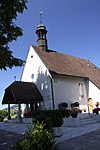
9946 Upload a file Kapelle Notre-Dame des Marches Kapelle Notre-Dame des Marches No images A G Route des Marches 14 [[:Category:|]]
46° 35′ 33.82″ N, 7° 06′ 06.25″ E Kartographer map based on OpenStreetMap.View all coordinates using: OpenStreetMapinfo


12369 Upload a file Alphütte No images B G Bataille 8 [[:Category:|]]
46° 36′ 27.32″ N, 7° 06′ 50.64″ E Kartographer map based on OpenStreetMap.View all coordinates using: OpenStreetMapinfo


12370 Upload a file Château d’En-Bas No images B G Rue du Prieuré 19 [[:Category:|]]
46° 36′ 08.9″ N, 7° 05′ 37.45″ E Kartographer map based on OpenStreetMap.View all coordinates using: OpenStreetMapinfo


10656 Upload a file Electrobroc No images B S Route du Lac [[:Category:|]]
46° 36′ 33.12″ N, 7° 06′ 09.44″ E Kartographer map based on OpenStreetMap.View all coordinates using: OpenStreetMapinfo


12371 Upload a file Glockenturm No images B G Rue du Prieuré 21 [[:Category:|]]
46° 36′ 06.61″ N, 7° 05′ 38.27″ E Kartographer map based on OpenStreetMap.View all coordinates using: OpenStreetMapinfo


12374 Upload a file Herrenhaus No images B G Rue du Château 11 [[:Category:|]]
46° 36′ 05.85″ N, 7° 06′ 07.69″ E Kartographer map based on OpenStreetMap.View all coordinates using: OpenStreetMapinfo


12372 Upload a file Kirche Saint-Othmar No images B G Rue des Écoles 4 [[:Category:|]]
46° 36′ 18.06″ N, 7° 05′ 57.88″ E Kartographer map based on OpenStreetMap.View all coordinates using: OpenStreetMapinfo


12375 Upload a file Priorat No images B G Rue du Prieuré 23 [[:Category:|]]
46° 36′ 07.38″ N, 7° 05′ 38.83″ E Kartographer map based on OpenStreetMap.View all coordinates using: OpenStreetMapinfo


12373 Upload a file Religiöse Einrichtung No images B G Ruelle du Hôme 17 [[:Category:|]]
46° 36′ 06.94″ N, 7° 06′ 24.74″ E Kartographer map based on OpenStreetMap.View all coordinates using: OpenStreetMapinfo


1964 Upload a file Schloss Montsalvens No images B G En Bataille [[:Category:|]]
46° 36′ 32.32″ N, 7° 06′ 55.12″ E Kartographer map based on OpenStreetMap.View all coordinates using: OpenStreetMapinfo


1962 Upload a file Schokoladenfabrik Cailler mit Bahnhof Schokoladenfabrik Cailler mit Bahnhof No images B G Rue Jules Bellet [[:Category:|]]
46° 36′ 25.12″ N, 7° 06′ 30.26″ E Kartographer map based on OpenStreetMap.View all coordinates using: OpenStreetMapinfo