Commons:Wiki4Alps/Hinterland
Jump to navigation
Jump to search
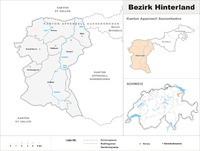
Map of Hinterland

<< Wiki4Alps << Appenzell Ausserrhoden
List of the cultural heritage of the district of Hinterland in the Canton Appenzell Ausserrhoden
[edit]
List of Monuments in the district of Hinterland in the Canton Appenzell Ausserrhoden.
Update: 15 April 2014
List
[edit]| KGS-Nr | Upload | Foto | Object | Other | Cov. | Cat. | Type | Address | Town | Coordinates | |||
|---|---|---|---|---|---|---|---|---|---|---|---|---|---|
| 10418 | 
|
Altes Rathaus | A | G | Schwänberg 2683 | Herisau |
| ||||||
| 460 | 
|
Eisenbahnbrücke SOB | A | G | östlich vom Gübsensee | Herisau |
| ||||||
| 8500 | 
|
Historisches Museum | A | S | Platz | Herisau |
| ||||||
| 435 | 
|
Kantonales Regierungsgebäude | A | G | Obstmarkt 3/5 | Herisau |
| ||||||
| 434 | 
|
Reformierte Kirche | A | G | Platz | Herisau |
| ||||||
| 443 | 
|
Rosenburg | A | G | oberhalb Tüfenau | Herisau |
| ||||||
| 11802 | 
|
Rutenkaminhaus | A | G | Schwänberg 2690 | Herisau |
| ||||||
| 9037 | 
|
Schwarzes Haus | A | G | Cilanderstrasse 5 | Herisau |
| ||||||
| 8787 | Staatsarchiv Appenzell Ausserrhoden | A | S | Obstmarkt 1 | Herisau |
| |||||||
| 10513 | 
|
Urnäschbrücke im Kubel | A | G | Sturzenegg/Weitenau | Herisau |
| ||||||
| 445 | 
|
Walsersches Doppelhaus | A | G | Platz 1/2 | Herisau |
| ||||||
| 432 | 
|
Wetterhaus | A | G | Platz 12 | Herisau |
| ||||||
| 9094 | 
|
Zeughaus Ebnet | A | G | Schützenstrasse 1 | Herisau |
| ||||||
| 11487 | Bauernhaus | B | G | Ädelswil 2430 | Herisau |
| |||||||
| 11490 | Bauernhaus | B | G | Baldenwil 2607 | Herisau |
| |||||||
| 14858 | Bauernhaus | B | G | Dietelswil 2410 | Herisau |
| |||||||
| 11543 | Bauernhaus | B | G | Dietelswil 2411 | Herisau |
| |||||||
| 14859 | Bauernhaus | B | G | Dietelswil 2412 | Herisau |
| |||||||
| 11545 | Bauernhaus | B | G | Engelen 2138 | Herisau |
| |||||||
| 14860 | Bauernhaus | B | G | Halden 2274 | Herisau |
| |||||||
| 11546 | Bauernhaus | B | G | Hinterhof 2261 | Herisau |
| |||||||
| 14861 | Bauernhaus | B | G | Mösli 2654 | Herisau |
| |||||||
| 11548 | Bauernhaus | B | G | Mösli 2663 | Herisau |
| |||||||
| 11549 | Bauernhaus | B | G | Schochenberg 2832 | Herisau |
| |||||||
| 14862 | Bauernhaus | B | G | Schwellbrunnerstrasse 2422 | Herisau |
| |||||||
| 11552 | Bauernhaus | B | G | Sturzenegg 2154 | Herisau |
| |||||||
| 11541 | Bauernhaus | B | G | Ufem Berg 2176 | Herisau |
| |||||||
| 442 | Burgruine Rosenberg | B | F/G | Rosenberg | Herisau |
| |||||||
| 444 | Burgruine Urstein | B | F/G | Urstein | Herisau |
| |||||||
| 11553 | Ehemalige Mühle | B | G | Zellersmüli 2807 | Herisau |
| |||||||
| 448 | Ehemalige Villa Buff am Niescberg (1907/08) | B | G | Nieschbergstrasse 2346 | Herisau |
| |||||||
| 14863 | Gasthaus mit Bäckerei | B | G | Buechschachen 2227 | Herisau |
| |||||||
| 14864 | Turbinenhäuschen | B | G | Schwänberg 2692 | Herisau |
| |||||||
| 440 | Wirtshaus Bären (1789) | B | G | Sturzenegg 2156 | Herisau |
| |||||||
| 441 | Wissenbach-Holzbrücke (1782) | B | G | Schwänberg | Herisau |
| |||||||
| 14865 | Wohnhaus | B | G | Hinterhof 2140 | Herisau |
| |||||||
| 14866 | Wohnhaus | B | G | Mösli 2664 | Herisau |
| |||||||
| 14867 | Wohnhaus | B | G | Schochenberg 2827 | Herisau |
| |||||||
| 14868 | Wohnheim | B | G | Baldenwil 2599 | Herisau |
| |||||||
| 11362 | Bauernhaus | B | G | Auen 335 | Hundwil |
| |||||||
| 11368 | Bauernhaus | B | G | Schmitten 95 | Hundwil |
| |||||||
| 11370 | Bauernhaus | B | G | Sonder 168 | Hundwil |
| |||||||
| 11364 | Fabrikantenhaus | B | G | Bleiche 86 | Hundwil |
| |||||||
| 464 | Heidenhaus (1568) | B | G | Tobel 72 | Hundwil |
| |||||||
| 11365 | Kleinbauernhaus | B | G | Gapf 88 | Hundwil |
| |||||||
| 465 | Roothus | B | G | Unteres Moos 101 | Hundwil |
| |||||||
| 11371 | Wohnhaus | B | G | Spitzböhl 464 | Hundwil |
| |||||||
| 14885 | Bauernhaus | B | G | Blatten 165 | Schönengrund |
| |||||||
| 11414 | Bauernhaus | B | G | Scheibe 156 | Schönengrund |
| |||||||
| 484 | Ehemaliges Bad Bruggli | B | G | Bruggli 111 | Schönengrund |
| |||||||
| 483 | _318.JPG)
|
Reformierte Kirche (1720) | B | G | Dorf 1 | Schönengrund |
| ||||||
| 14886 | Bauernhaus | B | G | Brisig 212 | Schwellbrunn |
| |||||||
| 488 | Bauernhaus | B | G | Brisig 213 | Schwellbrunn |
| |||||||
| 14887 | Bauernhaus | B | G | Brisig 789 | Schwellbrunn |
| |||||||
| 14888 | Bauernhaus | B | G | Dietenberg 457 | Schwellbrunn |
| |||||||
| 11422 | Bauernhaus | B | G | Nord 612 | Schwellbrunn |
| |||||||
| 14889 | Bauernhaus | B | G | Rotschwendi 194 | Schwellbrunn |
| |||||||
| 11421 | Bauernhaus (1737) | B | G | Vordere Au 487 | Schwellbrunn |
| |||||||
| 11423 | Gasthaus Untere Mühle | B | G | Untere Mühle 505 | Schwellbrunn |
| |||||||
| 11424 | Wohnhaus | B | G | Sonder 617 | Schwellbrunn |
| |||||||
| 489 | 
|
Reformierte Kirche (1648, 1877) | B | G | Dorf 1 | Schwellbrunn |
| ||||||
| 8572 | 
|
Appenzeller Volkskunde-Museum | A | S | Dorf 821 | Stein |
| ||||||
| 10495 | 
|
Eisensteg Zweibruggen | A | G | Blatten | Stein |
| ||||||
| 9074 | 
|
Gmündertobel-Brücke | A | G | Steinerstrasse | Stein |
| ||||||
| 10513 |
|
Urnäschbrücke im Kubel | A | G | Sturzenegg/Weitenau | Stein |
| ||||||
| 11451 | Bauernhaus | B | G | Oberhaus 1 | Stein |
| |||||||
| 11452 | Bauernhaus | B | G | Horgenbühl 121 | Stein |
| |||||||
| 11453 | Bauernhaus | B | G | Schmitten 480 | Stein |
| |||||||
| 500 | Bauernhaus Burg | B | G | Sonder 238 | Stein |
| |||||||
| 10497 | Gedeckte Sitterbrücke | B | G | Zweibruggen | Stein |
| |||||||
| 14895 | Gedeckte Urnäschbrücke | B | G | Kubel | Stein |
| |||||||
| 11454 | Heidenhaus Rain | B | G | Horgenbühl 121 | Stein |
| |||||||
| 11446 | 
|
Reformierte Kirche (1749) | B | G | Dorf 14 | Stein |
| ||||||
| 11457 | Wirtshaus Sonder | B | G | Sonder 249 | Stein |
| |||||||
| 8507 | 
|
Appenzeller Brauchtumsmuseum | A | S | Dorfplatz 8 | Urnäsch |
| ||||||
| 552 | 
|
Wohnhaus mit Mühle | A | G | Müllstatt 1017/1019 | Urnäsch |
| ||||||
| 11491 | 
|
Bauernhaus | B | G | Ebni 696 | Urnäsch |
| ||||||
| 11492 | Bauernhaus | B | G | Hinterfür 980 | Urnäsch |
| |||||||
| 11493 | Bauernhaus | B | G | Letz 731 | Urnäsch |
| |||||||
| 11494 | Bauernhaus | B | G | Ruppen 477 | Urnäsch |
| |||||||
| 11495 | Bauernhaus | B | G | Schafhölzli 520 | Urnäsch |
| |||||||
| 549 | Bauernhaus | B | G | Rain 632 | Urnäsch |
| |||||||
| 550 | Bauernhaus (1708) | B | G | Eggrüti 674 | Urnäsch |
| |||||||
| 11499 | Bauernhaus | B | G | Rossweid 978 | Urnäsch |
| |||||||
| 14910 | Gasthaus Rossfall | B | G | Rossfall 424 | Urnäsch |
| |||||||
| 11496 | Heidenhaus | B | G | Schwaderau 469 | Urnäsch |
| |||||||
| 11400 | Tätschdachhaus | B | G | Dürrenbach 366 | Urnäsch |
| |||||||
| 11399 | Weberhöckli | B | G | Unterdorfstrasse 60 | Urnäsch |
| |||||||
| 11498 | Wohnhaus | B | G | Untere Egg 521 | Urnäsch |
| |||||||
| 14914 | Bauernhaus | B | G | Brunnhalden 25 | Waldstatt |
| |||||||
| 11508 | Bauernhaus | B | G | Brunnhalden 27 | Waldstatt |
| |||||||
| 14915 | Bauernhaus | B | G | Oberwaldstatt 6 | Waldstatt |
| |||||||
| 563 | Bauernhaus | B | G | Oberwaldstatt 7 | Waldstatt |
| |||||||
| 560 | Bauernhaus | B | G | Rüti 1 | Waldstatt |
| |||||||
| 11509 | Bauernhaus | B | G | Tätschenberg 1 | Waldstatt |
| |||||||
| 14916 | Bauernhaus | B | G | Urnäscherstrasse 80 | Waldstatt |
| |||||||
| 566 | Bauernhaus | B | G | Urnäscherstrasse 90 | Waldstatt |
| |||||||
| 565 | Reformierte Kirche (1720) | B | G | Dorfstrasse 27 | Waldstatt |
|