Commons:Wiki4Alps/Prättigau-Davos

From Wikimedia Commons, the free media repository
Jump to navigation Jump to search

<< Wiki4Alps << Graubünden

List of the cultural heritage of the district of Prättigau-Davos in the Canton Graubünden

[edit]
Map of Prättigau-Davos

List of Monuments in the district of Prättigau-Davos in the Canton Graubünden.

Update: 15 April 2014

List

[edit]
KGS-Nr Upload Foto   Object Other Cov. Cat. Type Address Town Coordinates
8961 Upload a file Archiv der Landschaft Davos im Rathaus No images A S Berglistutz 1, Davos Platz Davos
46° 47′ 36.48″ N, 9° 49′ 17.29″ E Kartographer map based on OpenStreetMap.View all coordinates using: OpenStreetMapinfo


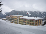
9049 Upload a file Berghotel Schatzalp (ehemaliges Sanatorium) Berghotel Schatzalp (ehemaliges Sanatorium) No images A G Schatzalp 878 Davos
46° 48′ 04.63″ N, 9° 48′ 50.84″ E Kartographer map based on OpenStreetMap.View all coordinates using: OpenStreetMapinfo


2968 Upload a file Grosses Jenatschhaus (ehemaliges Pfrundhaus) Grosses Jenatschhaus (ehemaliges Pfrundhaus) No images A G Museumstrasse 1a, Davos Dorf Davos
46° 48′ 29.37″ N, 9° 50′ 35.46″ E Kartographer map based on OpenStreetMap.View all coordinates using: OpenStreetMapinfo


8482 Upload a file Kirchner Museum Kirchner Museum No images A G/S Promenade 82, Davos Platz Davos
46° 48′ 00.54″ N, 9° 49′ 36.28″ E Kartographer map based on OpenStreetMap.View all coordinates using: OpenStreetMapinfo


2969 Upload a file Ehemaliges Grand Hotel Belvédère Ehemaliges Grand Hotel Belvédère No images A G Promenade 89, Davos Platz Davos
46° 48′ 02.38″ N, 9° 49′ 36.65″ E Kartographer map based on OpenStreetMap.View all coordinates using: OpenStreetMapinfo


10458 Upload a file Waldfriedhof Waldfriedhof No images A G Wildboden, Davos Frauenkirch Davos
46° 46′ 16.95″ N, 9° 48′ 25.16″ E Kartographer map based on OpenStreetMap.View all coordinates using: OpenStreetMapinfo


2967 Upload a file Zürcher Höhenklinik No images A G Klinikstrasse 6 / Clavadel 681 Davos
46° 46′ 07.53″ N, 9° 48′ 54.49″ E Kartographer map based on OpenStreetMap.View all coordinates using: OpenStreetMapinfo


10735 Upload a file Alte Evangelische Kirche Alte Evangelische Kirche No images B G Hauptstrasse, Davos Monstein Davos
46° 42′ 43.13″ N, 9° 46′ 15.24″ E Kartographer map based on OpenStreetMap.View all coordinates using: OpenStreetMapinfo


2978 Upload a file Alte Post No images B G Promenade 43, Davos Platz Davos
46° 47′ 36.53″ N, 9° 49′ 13.98″ E Kartographer map based on OpenStreetMap.View all coordinates using: OpenStreetMapinfo


10041 Upload a file Aufnahmegebäude RhB No images B G Talstrasse 4, Davos Platz Davos
46° 47′ 30.26″ N, 9° 49′ 15.46″ E Kartographer map based on OpenStreetMap.View all coordinates using: OpenStreetMapinfo


2980 Upload a file Bergbaumuseum No images B G Schmelzboden 3, Davos Monstein Davos
46° 42′ 47.59″ N, 9° 45′ 31.14″ E Kartographer map based on OpenStreetMap.View all coordinates using: OpenStreetMapinfo


12440 Upload a file Englische Kirche Englische Kirche No images B G Scalettastrasse 1, Davos Platz Davos
46° 48′ 05.54″ N, 9° 49′ 43.43″ E Kartographer map based on OpenStreetMap.View all coordinates using: OpenStreetMapinfo


12443 Upload a file Evangelische Kirche Glaris Evangelische Kirche Glaris No images B G Ortolfistrasse, Davos Glaris Davos
46° 44′ 27.42″ N, 9° 46′ 35.58″ E Kartographer map based on OpenStreetMap.View all coordinates using: OpenStreetMapinfo


10042 Upload a file Evangelische Kirche St. Johann Evangelische Kirche St. Johann No images B G Berglistutz, Davos Platz Davos
46° 47′ 35.7″ N, 9° 49′ 20.17″ E Kartographer map based on OpenStreetMap.View all coordinates using: OpenStreetMapinfo


12441 Upload a file Evangelische Pauluskirche Evangelische Pauluskirche No images B G Bahnhofstrasse, Davos Platz Davos
46° 47′ 27.1″ N, 9° 49′ 08.4″ E Kartographer map based on OpenStreetMap.View all coordinates using: OpenStreetMapinfo


2972 Upload a file Hotel Seehof (ehemaliges Haus Schlegel/Sprecher) Hotel Seehof (ehemaliges Haus Schlegel/Sprecher) No images B G Promenade 159, Davos Dorf Davos
46° 48′ 32.44″ N, 9° 50′ 20.8″ E Kartographer map based on OpenStreetMap.View all coordinates using: OpenStreetMapinfo


2970 Upload a file Kirchner Museum No images B A Promenade 82, Davos Dorf Davos
46° 48′ 00.5″ N, 9° 49′ 36″ E Kartographer map based on OpenStreetMap.View all coordinates using: OpenStreetMapinfo


12442 Upload a file Neue evangelische Kirche St. Peter Neue evangelische Kirche St. Peter No images B G Kirchenstrasse, Davos Monstein Davos
46° 42′ 51.91″ N, 9° 46′ 07.68″ E Kartographer map based on OpenStreetMap.View all coordinates using: OpenStreetMapinfo


2974 Upload a file Rathaus Rathaus No images B G Berglistutz 1, Davos Platz Davos
46° 47′ 36.06″ N, 9° 49′ 18.77″ E Kartographer map based on OpenStreetMap.View all coordinates using: OpenStreetMapinfo


2975 Upload a file Reformierte Kirche Frauenkirch Reformierte Kirche Frauenkirch No images B G Chilchweg, Davos Frauenkirch Davos
46° 46′ 07.61″ N, 9° 47′ 55.32″ E Kartographer map based on OpenStreetMap.View all coordinates using: OpenStreetMapinfo


2973 Upload a file Reformierte Kirche St. Theodul Reformierte Kirche St. Theodul No images B G Dorfstrasse, Davos Dorf Davos
46° 48′ 32.44″ N, 9° 50′ 22.99″ E Kartographer map based on OpenStreetMap.View all coordinates using: OpenStreetMapinfo


10736 Upload a file Reformierte Kirche Sertig Reformierte Kirche Sertig No images B G Sertigerstrasse, Sertig Davos
46° 43′ 31.37″ N, 9° 50′ 51.97″ E Kartographer map based on OpenStreetMap.View all coordinates using: OpenStreetMapinfo


3420 Upload a file Reformierte Kirche Wiesen No images B G Hauptstrasse, Davos Wiesen Davos
46° 42′ 13.25″ N, 9° 42′ 51.91″ E Kartographer map based on OpenStreetMap.View all coordinates using: OpenStreetMapinfo


2976 Upload a file Schulhaus von R. Gabarel Schulhaus von R. Gabarel No images B G Schulhausweg 5, Davos Frauenkirch Davos
46° 46′ 08.54″ N, 9° 47′ 50.64″ E Kartographer map based on OpenStreetMap.View all coordinates using: OpenStreetMapinfo


13004 Upload a file Schweizerhaus (Dokumentationsbibliothek) Schweizerhaus (Dokumentationsbibliothek) No images B S Promenade 88, Davos Platz Davos
46° 48′ 04.32″ N, 9° 49′ 45.48″ E Kartographer map based on OpenStreetMap.View all coordinates using: OpenStreetMapinfo


3421 Upload a file Wiesener Viadukt der Rhätischen Bahn Wiesener Viadukt der Rhätischen Bahn No images B G Davos Wiesen Davos
46° 41′ 40.31″ N, 9° 42′ 46.76″ E Kartographer map based on OpenStreetMap.View all coordinates using: OpenStreetMapinfo


3004 Upload a file Türmlihaus Türmlihaus No images A G Hauptstrasse 12 Fideris
46° 54′ 55.2″ N, 9° 44′ 33.17″ E Kartographer map based on OpenStreetMap.View all coordinates using: OpenStreetMapinfo


10401 Upload a file Wohnhaus No images A G Madinis 41 Fideris
46° 54′ 57.75″ N, 9° 44′ 47.7″ E Kartographer map based on OpenStreetMap.View all coordinates using: OpenStreetMapinfo


3005 Upload a file Haus Valär (alte Post) No images B G Platz 60 Fideris
46° 54′ 53.89″ N, 9° 44′ 31.27″ E Kartographer map based on OpenStreetMap.View all coordinates using: OpenStreetMapinfo


3006 Upload a file Haus von Planta (Badwirtschaft) Haus von Planta (Badwirtschaft) No images B G Platz 103 Fideris
46° 54′ 53.1″ N, 9° 44′ 27.06″ E Kartographer map based on OpenStreetMap.View all coordinates using: OpenStreetMapinfo


3007 Upload a file Reformierte Kirche Reformierte Kirche No images B G Platz Fideris
46° 54′ 49.93″ N, 9° 44′ 25.44″ E Kartographer map based on OpenStreetMap.View all coordinates using: OpenStreetMapinfo


10742 Upload a file Evangelische Kirche Evangelische Kirche No images B G Bei der Kirche Furna
46° 56′ 13.06″ N, 9° 40′ 44.08″ E Kartographer map based on OpenStreetMap.View all coordinates using: OpenStreetMapinfo


3028 Upload a file Altes Rathaus Altes Rathaus No images B G Landstrasse 27 Grüsch
46° 58′ 55.63″ N, 9° 38′ 52.58″ E Kartographer map based on OpenStreetMap.View all coordinates using: OpenStreetMapinfo


12449 Upload a file Grosshaus Grosshaus No images B G Grosshus 414 Grüsch
46° 58′ 52.39″ N, 9° 38′ 55.82″ E Kartographer map based on OpenStreetMap.View all coordinates using: OpenStreetMapinfo


3027 Upload a file Haus zum Rosengarten (Ott) mit Kultarchiv Haus zum Rosengarten (Ott) mit Kultarchiv No images B G/S Haus zum Rosengarten 17 Grüsch
46° 58′ 56.21″ N, 9° 38′ 51.14″ E Kartographer map based on OpenStreetMap.View all coordinates using: OpenStreetMapinfo


12448 Upload a file Hotel Krone Hotel Krone No images B G Landstrasse 28 Grüsch
46° 58′ 54.7″ N, 9° 38′ 51.97″ E Kartographer map based on OpenStreetMap.View all coordinates using: OpenStreetMapinfo


12465 Upload a file Häusergruppe am Platz No images B G Platz Jenaz
46° 55′ 43.18″ N, 9° 42′ 50.76″ E Kartographer map based on OpenStreetMap.View all coordinates using: OpenStreetMapinfo


3053 Upload a file Reformierte Kirche Reformierte Kirche No images A G Am Platz Klosters-Serneus
46° 52′ 13.09″ N, 9° 52′ 55.52″ E Kartographer map based on OpenStreetMap.View all coordinates using: OpenStreetMapinfo


3056 Upload a file Haus Florin No images B G Serneusstrasse 56, Serneus Klosters-Serneus
46° 53′ 24.29″ N, 9° 50′ 20.54″ E Kartographer map based on OpenStreetMap.View all coordinates using: OpenStreetMapinfo


12397 Upload a file Chesa Grischuna No images B G Bahnhofstrasse 12 Klosters-Serneus
46° 52′ 04.26″ N, 9° 52′ 57″ E Kartographer map based on OpenStreetMap.View all coordinates using: OpenStreetMapinfo


12396 Upload a file Haus Jann No images B G Schneusstrasse 54, Serneus Klosters-Serneus
46° 53′ 24.04″ N, 9° 50′ 21.37″ E Kartographer map based on OpenStreetMap.View all coordinates using: OpenStreetMapinfo


3054 Upload a file Nutli Hüschi (Heimatmuseum) Nutli Hüschi (Heimatmuseum) No images B G Talstrasse Klosters-Serneus
46° 52′ 10.6″ N, 9° 53′ 06.04″ E Kartographer map based on OpenStreetMap.View all coordinates using: OpenStreetMapinfo


12395 Upload a file Wohnhaus No images B G Ussedorfweg 3 Klosters-Serneus
46° 53′ 23.86″ N, 9° 50′ 15.22″ E Kartographer map based on OpenStreetMap.View all coordinates using: OpenStreetMapinfo


13010 Upload a file Wohnhaus No images B G Serneusstrasse 68 Klosters-Serneus
46° 53′ 23.5″ N, 9° 50′ 17.09″ E Kartographer map based on OpenStreetMap.View all coordinates using: OpenStreetMapinfo


13011 Upload a file Wohnhaus No images B G Serneusstrasse 63 Klosters-Serneus
46° 53′ 23.6″ N, 9° 50′ 19.46″ E Kartographer map based on OpenStreetMap.View all coordinates using: OpenStreetMapinfo


9046 Upload a file Zentrale Küblis der Bündner Kraftwerke Zentrale Küblis der Bündner Kraftwerke No images A G Büdemji 65b Küblis
46° 54′ 49.18″ N, 9° 46′ 54.65″ E Kartographer map based on OpenStreetMap.View all coordinates using: OpenStreetMapinfo


3057 Upload a file Reformierte Kirche St. Niklaus Reformierte Kirche St. Niklaus No images B G Dorfstrasse 32 Küblis
46° 54′ 51.01″ N, 9° 46′ 37.38″ E Kartographer map based on OpenStreetMap.View all coordinates using: OpenStreetMapinfo


10744 Upload a file Schlössli No images B G Dorfstrasse 28 Küblis
46° 54′ 52.6″ N, 9° 46′ 37.45″ E Kartographer map based on OpenStreetMap.View all coordinates using: OpenStreetMapinfo


10489 Upload a file Ruine Castels Ruine Castels No images A G Putz Luzein
46° 55′ 28.97″ N, 9° 44′ 42.23″ E Kartographer map based on OpenStreetMap.View all coordinates using: OpenStreetMapinfo


3080 Upload a file von Sprecherhaus am Landsgemeindeplatz ("Bsatzig") von Sprecherhaus am Landsgemeindeplatz ("Bsatzig") No images A G Rathausgasse 66 Luzein
46° 55′ 16.22″ N, 9° 45′ 51.66″ E Kartographer map based on OpenStreetMap.View all coordinates using: OpenStreetMapinfo


12467 Upload a file Dörrhaus, von Sprecher-Stammhaus (Brigadierhaus) Dörrhaus, von Sprecher-Stammhaus (Brigadierhaus) No images B G Luzeinerstrasse 66 Luzein
46° 55′ 17.26″ N, 9° 45′ 48.38″ E Kartographer map based on OpenStreetMap.View all coordinates using: OpenStreetMapinfo


12466 Upload a file Grosshus, von Sprecherhaus Grosshus, von Sprecherhaus No images B G Oberdorf 68 Luzein
46° 55′ 16.5″ N, 9° 45′ 48.71″ E Kartographer map based on OpenStreetMap.View all coordinates using: OpenStreetMapinfo


13013 Upload a file Haus Nebel Haus Nebel No images B G Putz Luzein
46° 55′ 32.12″ N, 9° 44′ 27.42″ E Kartographer map based on OpenStreetMap.View all coordinates using: OpenStreetMapinfo


3081 Upload a file Reformierte Kirche und Stadionhügel Reformierte Kirche und Stadionhügel No images B F/G Cresta Luzein
46° 55′ 09.19″ N, 9° 46′ 02.71″ E Kartographer map based on OpenStreetMap.View all coordinates using: OpenStreetMapinfo


3191 Upload a file Evangelische Kirche Evangelische Kirche No images B G Hauptstrasse Saas im Prättigau
46° 54′ 39.2″ N, 9° 48′ 18.97″ E Kartographer map based on OpenStreetMap.View all coordinates using: OpenStreetMapinfo


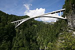
3243 Upload a file Salginatobelbrücke Salginatobelbrücke No images A G Crausch Schiers
46° 58′ 54.38″ N, 9° 43′ 06.06″ E Kartographer map based on OpenStreetMap.View all coordinates using: OpenStreetMapinfo


10785 Upload a file Evangelische Kirche St. Johann und frühmittelalterliche Nekropole Evangelische Kirche St. Johann und frühmittelalterliche Nekropole No images B G Platz Schiers
46° 58′ 12.79″ N, 9° 41′ 17.77″ E Kartographer map based on OpenStreetMap.View all coordinates using: OpenStreetMapinfo


3244 Upload a file Reformierte Kirche Schuders Reformierte Kirche Schuders No images B G Unter der Kirche, Schuders Schiers
46° 59′ 27.89″ N, 9° 44′ 17.95″ E Kartographer map based on OpenStreetMap.View all coordinates using: OpenStreetMapinfo


3256 Upload a file Burg Fracstein Burg Fracstein No images A G Seewis im Prättigau
46° 58′ 33.07″ N, 9° 36′ 53.99″ E Kartographer map based on OpenStreetMap.View all coordinates using: OpenStreetMapinfo


12491 Upload a file Alp Fasons, Sennerei Alp Fasons, Sennerei No images B G Alp Fasons Seewis im Prättigau
47° 02′ 49.81″ N, 9° 40′ 16.46″ E Kartographer map based on OpenStreetMap.View all coordinates using: OpenStreetMapinfo


3257 Upload a file Burgruine Solavers Burgruine Solavers No images B G Seewis im Prättigau
46° 59′ 00.2″ N, 9° 38′ 39.7″ E Kartographer map based on OpenStreetMap.View all coordinates using: OpenStreetMapinfo


10792 Upload a file Gemeindehaus (Salis-Schloss) Gemeindehaus (Salis-Schloss) No images B G Schlössli 131 Seewis im Prättigau
46° 59′ 19.36″ N, 9° 38′ 12.08″ E Kartographer map based on OpenStreetMap.View all coordinates using: OpenStreetMapinfo


3258 Upload a file Reformierte Kirche Reformierte Kirche No images B G Prada Seewis im Prättigau
46° 59′ 22.88″ N, 9° 38′ 23.39″ E Kartographer map based on OpenStreetMap.View all coordinates using: OpenStreetMapinfo


10405 Upload a file Haus mit Stallscheune No images A G Berawis/Berenwies 68, Mittel Ascharina St. Antönien
46° 57′ 38.96″ N, 9° 48′ 37.98″ E Kartographer map based on OpenStreetMap.View all coordinates using: OpenStreetMapinfo


3301 Upload a file Evangelische Kirche Evangelische Kirche No images B G Hauptstrasse St. Antönien
46° 58′ 09.95″ N, 9° 48′ 50.08″ E Kartographer map based on OpenStreetMap.View all coordinates using: OpenStreetMapinfo