Commons:Wiki4Alps/Riviera-Pays-d'Enhaut

From Wikimedia Commons, the free media repository
Jump to navigation Jump to search

<< Wiki4Alps << Vaud

List of the cultural heritage of the district of Riviera-Pays-d'Enhaut in the Canton Vaud

[edit]
Map of Riviera-Pays-d'Enhaut

List of Monuments in the district of Riviera-Pays-d'Enhaut in the Canton Vaud.

Update: 15 April 2014

List

[edit]
KGS-Nr Upload Foto   Object Other Cov. Cat. Type Address Town Coordinates
5956 Upload a file Château de Blonay Château de Blonay No images A G Chemin du Ressat Blonay
46° 28′ 10.42″ N, 6° 53′ 24.11″ E Kartographer map based on OpenStreetMap.View all coordinates using: OpenStreetMapinfo


VD01 Upload a file Les Ciernes-Picat (abri mésolithique) No images A F Château-d’Oex


5976 Upload a file Musée du Vieux Pays d'Enhaut No images B S Les Bossons Château-d’Oex
46° 28′ 34.21″ N, 7° 08′ 07.4″ E Kartographer map based on OpenStreetMap.View all coordinates using: OpenStreetMapinfo


14583 Upload a file Cure No images B G Route de la Ville d'Œx Château-d’Oex
46° 28′ 27.31″ N, 7° 07′ 47.43″ E Kartographer map based on OpenStreetMap.View all coordinates using: OpenStreetMapinfo


5977 Upload a file Église réformée Saint-Donat (sur le site d'un château médiéval) Église réformée Saint-Donat (sur le site d'un château médiéval) No images B G Chemin du Temple 9 Château-d’Oex
46° 28′ 21.43″ N, 7° 07′ 45.8″ E Kartographer map based on OpenStreetMap.View all coordinates using: OpenStreetMapinfo


14582 Upload a file Cure No images B G Vers la Chapelle, L'Etivaz Château-d’Oex
46° 25′ 28.14″ N, 7° 08′ 49.98″ E Kartographer map based on OpenStreetMap.View all coordinates using: OpenStreetMapinfo


5975 Upload a file Temple No images B G Vers la Chapelle, L'Etivaz Château-d’Oex
46° 25′ 29.84″ N, 7° 08′ 56.01″ E Kartographer map based on OpenStreetMap.View all coordinates using: OpenStreetMapinfo


6502 Upload a file Villa Kenwin Villa Kenwin No images A G Chemin du Vallon 19 La Tour-de-Peilz
46° 26′ 49.2″ N, 6° 52′ 41.52″ E Kartographer map based on OpenStreetMap.View all coordinates using: OpenStreetMapinfo


6504 Upload a file Château de la Becque avec écurie No images B G Route de Saint-Maurice 74 La Tour-de-Peilz
46° 26′ 56.77″ N, 6° 51′ 38.84″ E Kartographer map based on OpenStreetMap.View all coordinates using: OpenStreetMapinfo


14622 Upload a file Château de Sully No images B G Route de Chailly 144 La Tour-de-Peilz
46° 26′ 58.01″ N, 6° 52′ 31.54″ E Kartographer map based on OpenStreetMap.View all coordinates using: OpenStreetMapinfo


14620 Upload a file La Doges, Maison de maître avec son rural, sa tour, ses pavillons d'entrée et son parc No images B G Chemin des Bulesses 154 La Tour-de-Peilz
46° 27′ 23.37″ N, 6° 52′ 27.63″ E Kartographer map based on OpenStreetMap.View all coordinates using: OpenStreetMapinfo


14621 Upload a file La Faraz, Maison de maître et son parc No images B G Chemin des Vignes 46 La Tour-de-Peilz
46° 27′ 16.84″ N, 6° 52′ 10.17″ E Kartographer map based on OpenStreetMap.View all coordinates using: OpenStreetMapinfo


14619 Upload a file Église réformée Saint-Théodule No images B G Place du Temple La Tour-de-Peilz
46° 27′ 12.83″ N, 6° 51′ 25.23″ E Kartographer map based on OpenStreetMap.View all coordinates using: OpenStreetMapinfo


14615 Upload a file Résidence Rive-Reine avec annexe No images B G Route de Saint-Maurice 54 La Tour-de-Peilz
46° 26′ 58.59″ N, 6° 51′ 34.28″ E Kartographer map based on OpenStreetMap.View all coordinates using: OpenStreetMapinfo


6499 Upload a file Château, tour, remparts et fossés Château, tour, remparts et fossés No images B G Rue du Château 11 La Tour-de-Peilz
46° 27′ 09.54″ N, 6° 51′ 17.14″ E Kartographer map based on OpenStreetMap.View all coordinates using: OpenStreetMapinfo


10680 Upload a file Le musée Suisse du Jeu Le musée Suisse du Jeu No images B S Rue du Château 11 La Tour-de-Peilz
46° 27′ 09.9″ N, 6° 51′ 16.99″ E Kartographer map based on OpenStreetMap.View all coordinates using: OpenStreetMapinfo


14618 Upload a file Villa Ma Maison avec parc et dépendance No images B G Route de Saint-Maurice 178 La Tour-de-Peilz
46° 26′ 54.64″ N, 6° 52′ 05.09″ E Kartographer map based on OpenStreetMap.View all coordinates using: OpenStreetMapinfo


14617 Upload a file Ensemble résidentiel de Bellaria No images B G Avenue de Sully 82–136 La Tour-de-Peilz
46° 27′ 03.02″ N, 6° 52′ 02.17″ E Kartographer map based on OpenStreetMap.View all coordinates using: OpenStreetMapinfo


8716 Upload a file Audiorama, Musée national suisse de l'audiovisuel No images A S Avenue de Chillon 74 Montreux
46° 25′ 29.57″ N, 6° 55′ 28.38″ E Kartographer map based on OpenStreetMap.View all coordinates using: OpenStreetMapinfo


6242 Upload a file Gare CFF Montreux Gare CFF Montreux No images A G Avenue des Alpes 74 Montreux
46° 26′ 09.13″ N, 6° 54′ 37.3″ E Kartographer map based on OpenStreetMap.View all coordinates using: OpenStreetMapinfo


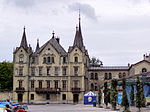
6250 Upload a file Château des Crêtes Château des Crêtes No images A G Avenue des Bosquets-de-Julie 13 Montreux
46° 26′ 42.68″ N, 6° 53′ 26.92″ E Kartographer map based on OpenStreetMap.View all coordinates using: OpenStreetMapinfo


6240 Upload a file Château du Chatelard Château du Chatelard No images A G Chemin Planchamp-Dessous 1 Montreux
46° 26′ 50.5″ N, 6° 53′ 56.72″ E Kartographer map based on OpenStreetMap.View all coordinates using: OpenStreetMapinfo


6244 Upload a file Ensemble ancien Grand-Hôtel, Hôtel des Alpes Ensemble ancien Grand-Hôtel, Hôtel des Alpes No images A G Avenue de Chillon 78, Territet Montreux
46° 25′ 32.2″ N, 6° 55′ 25.39″ E Kartographer map based on OpenStreetMap.View all coordinates using: OpenStreetMapinfo


6243 Upload a file Hôtel Montreux-Palace et ses annexes Hôtel Montreux-Palace et ses annexes No images A G Avenue des Alpes 100 Montreux
46° 26′ 19.18″ N, 6° 54′ 24.16″ E Kartographer map based on OpenStreetMap.View all coordinates using: OpenStreetMapinfo


6251 Upload a file Ile et Villa Salagnon Ile et Villa Salagnon No images A G Chemin de l'Île de Salagnon Montreux
46° 26′ 25.69″ N, 6° 52′ 58.87″ E Kartographer map based on OpenStreetMap.View all coordinates using: OpenStreetMapinfo


6266 Upload a file Marché Couvert Marché Couvert No images A G Place du Marché Montreux
46° 25′ 56.17″ N, 6° 54′ 35.14″ E Kartographer map based on OpenStreetMap.View all coordinates using: OpenStreetMapinfo


6246 Upload a file Palace Hôtel Palace Hôtel No images A G Rue du Panorama 2, Caux Montreux
46° 25′ 55.81″ N, 6° 56′ 14.89″ E Kartographer map based on OpenStreetMap.View all coordinates using: OpenStreetMapinfo


6241 Upload a file Villa Karma Villa Karma No images A G Rue du Lac 171, Clarens Montreux
46° 26′ 44.2″ N, 6° 52′ 42.42″ E Kartographer map based on OpenStreetMap.View all coordinates using: OpenStreetMapinfo


8956 Upload a file Archives communales No images B S Avenue Alexandre-Vinet 8, Clarens Montreux
46° 26′ 29.86″ N, 6° 53′ 43.94″ E Kartographer map based on OpenStreetMap.View all coordinates using: OpenStreetMapinfo


6247 Upload a file Grand-Hôtel des Narcisses Grand-Hôtel des Narcisses No images B G Route de Villard 2, Chamby Montreux
46° 26′ 59.09″ N, 6° 54′ 49.47″ E Kartographer map based on OpenStreetMap.View all coordinates using: OpenStreetMapinfo


6260 Upload a file Hôtel du Righi vaudois et son Park No images B G Route de Champ-Fleuri 3, Glion Montreux
46° 26′ 01.61″ N, 6° 55′ 27.91″ E Kartographer map based on OpenStreetMap.View all coordinates using: OpenStreetMapinfo


6262 Upload a file Hôtel Eden No images B G Rue du Théâtre 11 Montreux
46° 25′ 49.55″ N, 6° 54′ 36.29″ E Kartographer map based on OpenStreetMap.View all coordinates using: OpenStreetMapinfo


6263 Upload a file Hôtel Excelsior No images B G Rue de Bon-Port 27 Montreux
46° 25′ 45.44″ N, 6° 55′ 10.74″ E Kartographer map based on OpenStreetMap.View all coordinates using: OpenStreetMapinfo


6264 Upload a file Hôtel National avec les arcades et ses dépendances No images B G Chemin du National 2 Montreux
46° 25′ 49.21″ N, 6° 54′ 52.26″ E Kartographer map based on OpenStreetMap.View all coordinates using: OpenStreetMapinfo


6265 Upload a file Hôtel Suisse et Majestic No images B G Avenue des Alpes 45 Montreux
46° 26′ 08.7″ N, 6° 54′ 34.99″ E Kartographer map based on OpenStreetMap.View all coordinates using: OpenStreetMapinfo


14674 Upload a file Hôtel Villa Germaine No images B G Rue de Collogne 1, Territet Montreux
46° 25′ 19.93″ N, 6° 55′ 32.25″ E Kartographer map based on OpenStreetMap.View all coordinates using: OpenStreetMapinfo


6261 Upload a file Hôtel Victoria No images B G Route de Caux 16, Glion Montreux
46° 25′ 53.83″ N, 6° 55′ 35.72″ E Kartographer map based on OpenStreetMap.View all coordinates using: OpenStreetMapinfo


6270 Upload a file Institut Monte Rosa et Villa La Châtelaine No images B G Avenue de Chillon 57, Territet Montreux
46° 25′ 20.6″ N, 6° 55′ 30.56″ E Kartographer map based on OpenStreetMap.View all coordinates using: OpenStreetMapinfo


6254 Upload a file Église catholique Église catholique No images B G Rue de l'Église catholique 14 Montreux
46° 25′ 50.59″ N, 6° 54′ 46.01″ E Kartographer map based on OpenStreetMap.View all coordinates using: OpenStreetMapinfo


6269 Upload a file Église St. John's No images B G Avenue de Chillon 92, Territet Montreux
46° 25′ 36.34″ N, 6° 55′ 23.09″ E Kartographer map based on OpenStreetMap.View all coordinates using: OpenStreetMapinfo


8958 Upload a file Musée historique de Montreux et de sa région No images B S Rue de la Gare 40 Montreux
46° 26′ 02.83″ N, 6° 54′ 48.78″ E Kartographer map based on OpenStreetMap.View all coordinates using: OpenStreetMapinfo


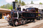
6248 Upload a file Chemin de fer Blonay–Chamby Chemin de fer Blonay–Chamby No images B X Route de Chaulin Montreux
46° 27′ 15.97″ N, 6° 54′ 43.73″ E Kartographer map based on OpenStreetMap.View all coordinates using: OpenStreetMapinfo


10683 Upload a file Musée du chemin de fer du Blonay–Chamby Musée du chemin de fer du Blonay–Chamby No images B S Route de Chaulin Montreux
46° 27′ 16.16″ N, 6° 54′ 43.91″ E Kartographer map based on OpenStreetMap.View all coordinates using: OpenStreetMapinfo


6267 Upload a file Pavillon des Sports du Palace No images B G Grand-Rue 85 Montreux
46° 26′ 15.61″ N, 6° 54′ 25.45″ E Kartographer map based on OpenStreetMap.View all coordinates using: OpenStreetMapinfo


6268 Upload a file Église reformée Saint-Vincent et ancien ossuaire Église reformée Saint-Vincent et ancien ossuaire No images B G Rue du Temple Montreux
46° 25′ 52.97″ N, 6° 55′ 07.68″ E Kartographer map based on OpenStreetMap.View all coordinates using: OpenStreetMapinfo


14670 Upload a file Funiculaire des Avants–Sonloup (arrivée) No images B G Sonloup Montreux
46° 27′ 25.7″ N, 6° 56′ 20.07″ E Kartographer map based on OpenStreetMap.View all coordinates using: OpenStreetMapinfo


6256 Upload a file Funiculaire des Avants–Sonloup (départ) No images B G Les Avants Montreux
46° 27′ 14.22″ N, 6° 56′ 38.55″ E Kartographer map based on OpenStreetMap.View all coordinates using: OpenStreetMapinfo


14671 Upload a file Funiculaire Territet–Glion (gare de Glion) No images B G Glion Montreux
46° 25′ 55.17″ N, 6° 55′ 26.01″ E Kartographer map based on OpenStreetMap.View all coordinates using: OpenStreetMapinfo


6257 Upload a file Funiculaire Territet–Glion (gare de Territet) No images B G Territet Montreux
46° 25′ 36.7″ N, 6° 55′ 24.37″ E Kartographer map based on OpenStreetMap.View all coordinates using: OpenStreetMapinfo


14672 Upload a file Funiculaire Territet–Mont Fleuri (gare de Mont Fleuri) No images B G Route du Pré Montreux
46° 25′ 33.26″ N, 6° 55′ 44.54″ E Kartographer map based on OpenStreetMap.View all coordinates using: OpenStreetMapinfo


6258 Upload a file Funiculaire Territet–Mont Fleuri (gare de Territet) No images B G Territet Montreux
46° 25′ 36.44″ N, 6° 55′ 24.38″ E Kartographer map based on OpenStreetMap.View all coordinates using: OpenStreetMapinfo


6259 Upload a file Clinique de Valmont No images B G Route de Valmont 22, Glion Montreux
46° 25′ 34.25″ N, 6° 55′ 51.56″ E Kartographer map based on OpenStreetMap.View all coordinates using: OpenStreetMapinfo


6272 Upload a file Villa Florentine No images B G Grand-Rue 83 Montreux
46° 26′ 14.1″ N, 6° 54′ 28.12″ E Kartographer map based on OpenStreetMap.View all coordinates using: OpenStreetMapinfo


6253 Upload a file Villa Ormond No images B G Rue du Lac 18, Clarens Montreux
46° 26′ 28.46″ N, 6° 54′ 05.08″ E Kartographer map based on OpenStreetMap.View all coordinates using: OpenStreetMapinfo


6271 Upload a file Villa Toscane No images B G Rue du Lac 2, Vernex Montreux
46° 26′ 25.91″ N, 6° 54′ 11.61″ E Kartographer map based on OpenStreetMap.View all coordinates using: OpenStreetMapinfo


6252 Upload a file Quartier des villas du Bochet No images B G Rue du Lac, Clarens Montreux
46° 26′ 29.4″ N, 6° 53′ 17.48″ E Kartographer map based on OpenStreetMap.View all coordinates using: OpenStreetMapinfo


14675 Upload a file Emsemble résidentiel de Bon-Port No images B G Avenue de la Riviéra 10–22 Montreux
46° 25′ 49.92″ N, 6° 55′ 03.77″ E Kartographer map based on OpenStreetMap.View all coordinates using: OpenStreetMapinfo


14669 Upload a file Chemin de fer Blonay-Chamby (Gare de Blonay) No images B G Place de la Gare, Chaulin Montreux
46° 27′ 56.27″ N, 6° 53′ 44.88″ E Kartographer map based on OpenStreetMap.View all coordinates using: OpenStreetMapinfo


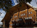
6457 Upload a file Le Grand Chalet Le Grand Chalet No images A G Le Borjoz Rossinière
46° 27′ 56.52″ N, 7° 05′ 04.09″ E Kartographer map based on OpenStreetMap.View all coordinates using: OpenStreetMapinfo


6456 Upload a file La Maison de la Place La Maison de la Place No images A G La Place Rossinière
46° 28′ 01.02″ N, 7° 04′ 56.6″ E Kartographer map based on OpenStreetMap.View all coordinates using: OpenStreetMapinfo


10351 Upload a file Cure No images B G La Cure Rossinière
46° 28′ 04.58″ N, 7° 04′ 59.74″ E Kartographer map based on OpenStreetMap.View all coordinates using: OpenStreetMapinfo


6458 Upload a file Pont de la Tine No images B G Le Revers Rossinière
46° 27′ 58.03″ N, 7° 03′ 00.65″ E Kartographer map based on OpenStreetMap.View all coordinates using: OpenStreetMapinfo


6459 Upload a file Église réformée Sainte-Marie-Madeleine No images B G Le Vas Rossinière
46° 28′ 06.31″ N, 7° 04′ 59.12″ E Kartographer map based on OpenStreetMap.View all coordinates using: OpenStreetMapinfo


6464 Upload a file Église réformée Saint-Nicolas de Myre Église réformée Saint-Nicolas de Myre No images A G Le Château Rougemont
46° 29′ 15.32″ N, 7° 12′ 22.54″ E Kartographer map based on OpenStreetMap.View all coordinates using: OpenStreetMapinfo


6463 Upload a file Ruines du château du Vanel No images B F/G Le Vanel Rougemont
46° 29′ 14.5″ N, 7° 13′ 38.17″ E Kartographer map based on OpenStreetMap.View all coordinates using: OpenStreetMapinfo


14734 Upload a file Archives communales No images B S Route de la Croisette 16 Rougemont
46° 29′ 26.17″ N, 7° 12′ 37.99″ E Kartographer map based on OpenStreetMap.View all coordinates using: OpenStreetMapinfo


14733 Upload a file Cure No images B G Le Pra Rougemont
46° 29′ 14.88″ N, 7° 12′ 12.34″ E Kartographer map based on OpenStreetMap.View all coordinates using: OpenStreetMapinfo


6461 Upload a file Château et ses dépendances Château et ses dépendances No images B G Le Château Rougemont
46° 29′ 14.32″ N, 7° 12′ 22.61″ E Kartographer map based on OpenStreetMap.View all coordinates using: OpenStreetMapinfo


10352 Upload a file Habitation No images B G Les Palettes Rougemont
46° 29′ 13.02″ N, 7° 11′ 37.33″ E Kartographer map based on OpenStreetMap.View all coordinates using: OpenStreetMapinfo


6483 Upload a file Église réformée Notre-Dame Église réformée Notre-Dame No images A G Chemin de l'Église Saint-Légier-La Chiésaz
46° 28′ 16.93″ N, 6° 53′ 02.36″ E Kartographer map based on OpenStreetMap.View all coordinates using: OpenStreetMapinfo


6482 Upload a file Château d'Hauteville Château d'Hauteville No images A G Chemin des Boulingrins Saint-Légier-La Chiésaz
46° 28′ 01.09″ N, 6° 52′ 06.31″ E Kartographer map based on OpenStreetMap.View all coordinates using: OpenStreetMapinfo


8707 Upload a file Alimentarium (Musée de l'alimentation) Alimentarium (Musée de l'alimentation) No images A S Quai Perdonnet 25 Vevey
46° 27′ 30.13″ N, 6° 50′ 47.26″ E Kartographer map based on OpenStreetMap.View all coordinates using: OpenStreetMapinfo


6516 Upload a file Château de l'Aile Château de l'Aile No images A G Grande Place 1 Vevey
46° 27′ 33.37″ N, 6° 50′ 27.49″ E Kartographer map based on OpenStreetMap.View all coordinates using: OpenStreetMapinfo


6525 Upload a file Cour au Chantre Cour au Chantre No images A G Rue du Simplon 22 Vevey
46° 27′ 36.25″ N, 6° 50′ 44.48″ E Kartographer map based on OpenStreetMap.View all coordinates using: OpenStreetMapinfo


8898 Upload a file Archives historiques des Nestlé SA No images A S Avenue Nestlé 55 Vevey
46° 27′ 59.11″ N, 6° 50′ 05.57″ E Kartographer map based on OpenStreetMap.View all coordinates using: OpenStreetMapinfo


6534 Upload a file Hôtel des Trois-Couronnes Hôtel des Trois-Couronnes No images A G Rue du Château 1 Vevey
46° 27′ 29.63″ N, 6° 50′ 54.31″ E Kartographer map based on OpenStreetMap.View all coordinates using: OpenStreetMapinfo


6517 Upload a file Église catholique Notre-Dame Église catholique Notre-Dame No images A G Rue des Chenevières Vevey
46° 27′ 31.54″ N, 6° 51′ 10.19″ E Kartographer map based on OpenStreetMap.View all coordinates using: OpenStreetMapinfo


6532 Upload a file La Grenette et place du Marché La Grenette et place du Marché No images A G Grande Place 29 Vevey
46° 27′ 37.55″ N, 6° 50′ 33.79″ E Kartographer map based on OpenStreetMap.View all coordinates using: OpenStreetMapinfo


8717 Upload a file Musée Jenisch (Musée des Beaux-Arts, Cabinet cantonal des estampes) No images A S Avenue de la Gare 2 Vevey
46° 27′ 41.47″ N, 6° 50′ 43.12″ E Kartographer map based on OpenStreetMap.View all coordinates using: OpenStreetMapinfo


8708 Upload a file Musée de la Confrérie des Vignerons Musée de la Confrérie des Vignerons No images A S Rue du Château 2 Vevey
46° 27′ 29.02″ N, 6° 50′ 56.51″ E Kartographer map based on OpenStreetMap.View all coordinates using: OpenStreetMapinfo


6521 Upload a file Bâtiment administratif de Nestlé SA Bâtiment administratif de Nestlé SA No images A G Avenue Nestlé 55 Vevey
46° 27′ 59.47″ N, 6° 50′ 05.21″ E Kartographer map based on OpenStreetMap.View all coordinates using: OpenStreetMapinfo


6528 Upload a file Église orthodoxe Église orthodoxe No images A G Rue des Communaux 12 Vevey
46° 27′ 42.84″ N, 6° 50′ 43.76″ E Kartographer map based on OpenStreetMap.View all coordinates using: OpenStreetMapinfo


6533 Upload a file Hôtel de ville Hôtel de ville No images A G Rue du Lac 2 Vevey
46° 27′ 32.08″ N, 6° 50′ 49.06″ E Kartographer map based on OpenStreetMap.View all coordinates using: OpenStreetMapinfo


6519 Upload a file Église réformée Saint-Martin Église réformée Saint-Martin No images A G Boulevard Saint-Martin Vevey
46° 27′ 43.63″ N, 6° 50′ 48.98″ E Kartographer map based on OpenStreetMap.View all coordinates using: OpenStreetMapinfo


8718 Upload a file Musée suisse de l'appareil photographique Musée suisse de l'appareil photographique No images A S Grande Place 99 Vevey
46° 27′ 35.75″ N, 6° 50′ 28.9″ E Kartographer map based on OpenStreetMap.View all coordinates using: OpenStreetMapinfo


11688 Upload a file Tour Saint-Jean et fontaine Tour Saint-Jean et fontaine No images A G Rue du Lac Vevey
46° 27′ 31.97″ N, 6° 50′ 49.7″ E Kartographer map based on OpenStreetMap.View all coordinates using: OpenStreetMapinfo


6531 Upload a file Gare CFF Vevey Gare CFF Vevey No images B G Rue de la Gare 3 Vevey
46° 27′ 46.91″ N, 6° 50′ 35.45″ E Kartographer map based on OpenStreetMap.View all coordinates using: OpenStreetMapinfo


6523 Upload a file Château bernois (avec Musée historique) Château bernois (avec Musée historique) No images B G Rue du Château 2 / Rue d'Italie 43 Vevey
46° 27′ 29.93″ N, 6° 50′ 55.62″ E Kartographer map based on OpenStreetMap.View all coordinates using: OpenStreetMapinfo


6522 Upload a file Casino du Rivage No images B G Rue Louis-Meyer 1 Vevey
46° 27′ 34.63″ N, 6° 50′ 27.2″ E Kartographer map based on OpenStreetMap.View all coordinates using: OpenStreetMapinfo


6524 Upload a file Collège No images B G Rue du Collège 30 Vevey
46° 27′ 33.23″ N, 6° 50′ 51.32″ E Kartographer map based on OpenStreetMap.View all coordinates using: OpenStreetMapinfo


14757 Upload a file Collège de la Veveyse Collège de la Veveyse No images B G Rue du Torrent 27 Vevey
46° 27′ 40.69″ N, 6° 50′ 19.83″ E Kartographer map based on OpenStreetMap.View all coordinates using: OpenStreetMapinfo


6526 Upload a file École du Clos No images B G Rue du Clos 15 Vevey
46° 27′ 39.38″ N, 6° 50′ 45.46″ E Kartographer map based on OpenStreetMap.View all coordinates using: OpenStreetMapinfo


6520 Upload a file Ancien Hôtel Moser avec dépendances et parc No images B G Boulevard Henri-Plumhof 3 Vevey
46° 27′ 44.28″ N, 6° 51′ 11.95″ E Kartographer map based on OpenStreetMap.View all coordinates using: OpenStreetMapinfo


6537 Upload a file Ancienne Maison de la Part-Dieu No images B G Rue d'Italie 2 Vevey
46° 27′ 28.55″ N, 6° 51′ 08.28″ E Kartographer map based on OpenStreetMap.View all coordinates using: OpenStreetMapinfo


6539 Upload a file Ancien bâtiment administratif Nestlé Ancien bâtiment administratif Nestlé No images B G Quai Perdonnet 25 Vevey
46° 27′ 30.06″ N, 6° 50′ 47.47″ E Kartographer map based on OpenStreetMap.View all coordinates using: OpenStreetMapinfo


6527 Upload a file Église anglaise Église anglaise No images B G Avenue de Blonay 4 Vevey
46° 27′ 36.18″ N, 6° 51′ 01.48″ E Kartographer map based on OpenStreetMap.View all coordinates using: OpenStreetMapinfo


14759 Upload a file Galerie du Rivage (ancien marché couvert) No images B G Rue du Torrent 5 Vevey
46° 27′ 36.69″ N, 6° 50′ 28.08″ E Kartographer map based on OpenStreetMap.View all coordinates using: OpenStreetMapinfo


8957 Upload a file Archives communales No images B S Rue du Lac 2 Vevey
46° 27′ 32.55″ N, 6° 50′ 47.95″ E Kartographer map based on OpenStreetMap.View all coordinates using: OpenStreetMapinfo


9372 Upload a file Bibliothèque municipale Bibliothèque municipale No images B S Quai Perdonnet 33 Vevey
46° 27′ 30.49″ N, 6° 50′ 41.06″ E Kartographer map based on OpenStreetMap.View all coordinates using: OpenStreetMapinfo


6541 Upload a file Théâtre municipal No images B G Rue du Théâtre 4 Vevey
46° 27′ 37.3″ N, 6° 50′ 35.09″ E Kartographer map based on OpenStreetMap.View all coordinates using: OpenStreetMapinfo


8764 Upload a file Musée historique de Vevey Musée historique de Vevey No images B S Rue du Château 2 / Rue d'Italie 43 Vevey
46° 27′ 29.7″ N, 6° 50′ 55.86″ E Kartographer map based on OpenStreetMap.View all coordinates using: OpenStreetMapinfo


6535 Upload a file Hôtel du Lac Hôtel du Lac No images B G Rue d'Italie 1 Vevey
46° 27′ 27.36″ N, 6° 51′ 07.34″ E Kartographer map based on OpenStreetMap.View all coordinates using: OpenStreetMapinfo


6529 Upload a file Église Sainte-Claire No images B G Rue du Collège Vevey
46° 27′ 32.58″ N, 6° 50′ 53.38″ E Kartographer map based on OpenStreetMap.View all coordinates using: OpenStreetMapinfo


6530 Upload a file Fontaine du Guerrier Fontaine du Guerrier No images B K Rue du Centre Vevey
46° 27′ 34.2″ N, 6° 50′ 42.22″ E Kartographer map based on OpenStreetMap.View all coordinates using: OpenStreetMapinfo


6536 Upload a file Maison Le Castel (Mme de Warens) Maison Le Castel (Mme de Warens) No images B G Rue du Conseil 23 Vevey
46° 27′ 35.57″ N, 6° 50′ 36.29″ E Kartographer map based on OpenStreetMap.View all coordinates using: OpenStreetMapinfo


14758 Upload a file Maison Paschoud (annexe maison de la Part-Dieu) No images B G Rue des Chevenières 1 Vevey
46° 27′ 29.13″ N, 6° 51′ 08.51″ E Kartographer map based on OpenStreetMap.View all coordinates using: OpenStreetMapinfo


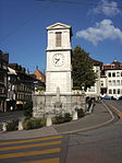
6542 Upload a file Tour et fontaine de l'Horloge (1773) Tour et fontaine de l'Horloge (1773) No images B G Rue d'Italie Vevey
46° 27′ 29.77″ N, 6° 51′ 00.25″ E Kartographer map based on OpenStreetMap.View all coordinates using: OpenStreetMapinfo


9513 Upload a file Viaduc autoroutier de Chillon sur la N9 Viaduc autoroutier de Chillon sur la N9 No images A G Veytaux
46° 24′ 48.74″ N, 6° 55′ 49.3″ E Kartographer map based on OpenStreetMap.View all coordinates using: OpenStreetMapinfo


6544 Upload a file Château de Chillon Château de Chillon No images A G Avenue de Chillon 21 Veytaux
46° 24′ 51.12″ N, 6° 55′ 39.11″ E Kartographer map based on OpenStreetMap.View all coordinates using: OpenStreetMapinfo


10676 Upload a file Musée du Château de Chillon Musée du Château de Chillon No images B S Avenue de Chillon 21 Veytaux
46° 24′ 51.19″ N, 6° 55′ 38.5″ E Kartographer map based on OpenStreetMap.View all coordinates using: OpenStreetMapinfo