Commons:Wiki4Alps/Trogen

From Wikimedia Commons, the free media repository
Jump to navigation Jump to search
KGS-Nr Upload Foto   Object Other Cov. Cat. Type Address Town Coordinates
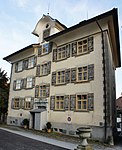
537 Upload a file Ehemaliges Haus Tobler am Berg Ehemaliges Haus Tobler am Berg No images A G Bergweg 1 [[:Category:|]]
47° 24′ 27.25″ N, 9° 27′ 50.94″ E Kartographer map based on OpenStreetMap.View all coordinates using: OpenStreetMapinfo


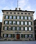
532 Upload a file Ehemaliges Haus Zellweger Ehemaliges Haus Zellweger No images A G Landsgemeindeplatz 4 [[:Category:|]]
47° 24′ 28.87″ N, 9° 27′ 56.05″ E Kartographer map based on OpenStreetMap.View all coordinates using: OpenStreetMapinfo


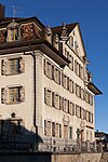
544 Upload a file Ehemaliges Mädchenkonvikt Ehemaliges Mädchenkonvikt No images A G Landsgemeindeplatz 10 [[:Category:|]]
47° 24′ 28.12″ N, 9° 27′ 51.44″ E Kartographer map based on OpenStreetMap.View all coordinates using: OpenStreetMapinfo


529 Upload a file Fünfeckpalast Fünfeckpalast No images A G Landsgemeindeplatz 7 [[:Category:|]]
47° 24′ 29.63″ N, 9° 27′ 50.94″ E Kartographer map based on OpenStreetMap.View all coordinates using: OpenStreetMapinfo


536 Upload a file Gasthaus Zur Krone Gasthaus Zur Krone No images A G Landsgemeindeplatz 3 [[:Category:|]]
47° 24′ 28.44″ N, 9° 27′ 55.58″ E Kartographer map based on OpenStreetMap.View all coordinates using: OpenStreetMapinfo


525 Upload a file Pfarr- und Gemeindehaus Pfarr- und Gemeindehaus No images A G Landsgemeindeplatz 1 [[:Category:|]]
47° 24′ 27.58″ N, 9° 27′ 54.18″ E Kartographer map based on OpenStreetMap.View all coordinates using: OpenStreetMapinfo


525 Upload a file Cantonsbibliothek Appenzell Ausserrhoden No images A S Landsgemeindeplatz 1 [[:Category:|]]
47° 24′ 27.83″ N, 9° 27′ 54.07″ E Kartographer map based on OpenStreetMap.View all coordinates using: OpenStreetMapinfo


527 Upload a file Rathaus Rathaus No images A G Landsgemeindeplatz 2 [[:Category:|]]
47° 24′ 28.08″ N, 9° 27′ 54.94″ E Kartographer map based on OpenStreetMap.View all coordinates using: OpenStreetMapinfo


526 Upload a file No images A G Landsgemeindeplatz [[:Category:|]]
47° 24′ 29.56″ N, 9° 27′ 55.4″ E Kartographer map based on OpenStreetMap.View all coordinates using: OpenStreetMapinfo


545 Upload a file Sonnenhof Sonnenhof No images A G Bühlerstrasse 1 [[:Category:|]]
47° 24′ 26.1″ N, 9° 27′ 52.96″ E Kartographer map based on OpenStreetMap.View all coordinates using: OpenStreetMapinfo


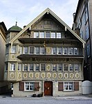
528 Upload a file Zellwegerscher Doppelpalast Zellwegerscher Doppelpalast No images A G Landsgemeindeplatz 5/6 {{{Town}}}
47° 24′ 29.34″ N, 9° 27′ 53.71″ E Kartographer map based on OpenStreetMap.View all coordinates using: OpenStreetMapinfo


530 Upload a file Bauernhaus No images B G Dicket 1 [[:Category:|]]
47° 23′ 52.8″ N, 9° 28′ 57.18″ E Kartographer map based on OpenStreetMap.View all coordinates using: OpenStreetMapinfo


14907 Upload a file Bauernhaus No images B G Dicket 5 [[:Category:|]]
47° 23′ 55.82″ N, 9° 29′ 10.36″ E Kartographer map based on OpenStreetMap.View all coordinates using: OpenStreetMapinfo


11397 Upload a file Bauernhaus No images B G Schwendi 2 [[:Category:|]]
47° 24′ 25.92″ N, 9° 29′ 05.64″ E Kartographer map based on OpenStreetMap.View all coordinates using: OpenStreetMapinfo


531 Upload a file Blaues Haus No images B G Untere Neuschwendi 1 [[:Category:|]]
47° 24′ 21.17″ N, 9° 28′ 11.53″ E Kartographer map based on OpenStreetMap.View all coordinates using: OpenStreetMapinfo


538 Upload a file Ehemalige Bleiche No images B G Bleichi 1 [[:Category:|]]
47° 24′ 29.81″ N, 9° 28′ 18.37″ E Kartographer map based on OpenStreetMap.View all coordinates using: OpenStreetMapinfo


14909 Upload a file Haus Vorderdorf No images B G Wädlerstrasse 4 [[:Category:|]]
47° 24′ 26.89″ N, 9° 27′ 57.06″ E Kartographer map based on OpenStreetMap.View all coordinates using: OpenStreetMapinfo


542 Upload a file Heidenhaus No images B G Ratholz 4 [[:Category:|]]
47° 23′ 53.95″ N, 9° 29′ 37.68″ E Kartographer map based on OpenStreetMap.View all coordinates using: OpenStreetMapinfo


11484 Upload a file Heidenhaus No images B G Langenhus 1 [[:Category:|]]
47° 23′ 37.68″ N, 9° 28′ 34″ E Kartographer map based on OpenStreetMap.View all coordinates using: OpenStreetMapinfo


11398 Upload a file Heidenhaus No images B G Äusserer Unterstadel 1 [[:Category:|]]
47° 24′ 10.73″ N, 9° 28′ 51.24″ E Kartographer map based on OpenStreetMap.View all coordinates using: OpenStreetMapinfo


8923 Upload a file Cantonsbibliothek Appenzell Ausserrhoden Cantonsbibliothek Appenzell Ausserrhoden No images B S Landsgemeindeplatz 7 [[:Category:|]]
47° 24′ 29.63″ N, 9° 27′ 51.01″ E Kartographer map based on OpenStreetMap.View all coordinates using: OpenStreetMapinfo


14908 Upload a file Wohnhaus No images B G Bach 11 [[:Category:|]]
47° 24′ 13.97″ N, 9° 29′ 30.48″ E Kartographer map based on OpenStreetMap.View all coordinates using: OpenStreetMapinfo


Upload a file Abdankungshalle No images G Schopfacker [[:Category:|]]
47° 24′ 37.62″ N, 9° 27′ 55.69″ E Kartographer map based on OpenStreetMap.View all coordinates using: OpenStreetMapinfo


Upload a file Gartenhaus No images G Nideren 2 [[:Category:|]]
47° 24′ 34.27″ N, 9° 27′ 46.44″ E Kartographer map based on OpenStreetMap.View all coordinates using: OpenStreetMapinfo


Upload a file Gartenhaus No images G Nideren 4 [[:Category:|]]
47° 24′ 34.52″ N, 9° 27′ 46.87″ E Kartographer map based on OpenStreetMap.View all coordinates using: OpenStreetMapinfo


Upload a file Gartenpavillon No images G Cantonsschulstrasse 6 [[:Category:|]]
47° 24′ 34.56″ N, 9° 27′ 49.82″ E Kartographer map based on OpenStreetMap.View all coordinates using: OpenStreetMapinfo


Upload a file Haus No images G Nideren 2 [[:Category:|]]
47° 24′ 35.03″ N, 9° 27′ 45.79″ E Kartographer map based on OpenStreetMap.View all coordinates using: OpenStreetMapinfo


Upload a file Haus No images G Nideren 4 [[:Category:|]]
47° 24′ 35.1″ N, 9° 27′ 45.72″ E Kartographer map based on OpenStreetMap.View all coordinates using: OpenStreetMapinfo


Upload a file Haus No images G Oberdorf 2 [[:Category:|]]
47° 24′ 28.69″ N, 9° 27′ 50.65″ E Kartographer map based on OpenStreetMap.View all coordinates using: OpenStreetMapinfo


Upload a file Haus No images G Schopfacker 1 [[:Category:|]]
47° 24′ 32.98″ N, 9° 27′ 56.84″ E Kartographer map based on OpenStreetMap.View all coordinates using: OpenStreetMapinfo


Upload a file Haus No images G Schopfacker 16 [[:Category:|]]
47° 24′ 33.05″ N, 9° 28′ 02.42″ E Kartographer map based on OpenStreetMap.View all coordinates using: OpenStreetMapinfo


Upload a file Haus Haus No images G Schopfacker 19 [[:Category:|]]
47° 24′ 33.41″ N, 9° 28′ 03.9″ E Kartographer map based on OpenStreetMap.View all coordinates using: OpenStreetMapinfo


Upload a file Remise No images G Cantonsschulstrasse 24 [[:Category:|]]
47° 24′ 30.24″ N, 9° 27′ 34.27″ E Kartographer map based on OpenStreetMap.View all coordinates using: OpenStreetMapinfo


Upload a file Remise No images G Schopfacker 19 [[:Category:|]]
47° 24′ 33.01″ N, 9° 28′ 04.55″ E Kartographer map based on OpenStreetMap.View all coordinates using: OpenStreetMapinfo


Upload a file Verwaltungsgebäude der Cantonsschule Trogen No images G Cantonsschulstrasse 24 [[:Category:|]]
47° 24′ 29.7″ N, 9° 27′ 35.32″ E Kartographer map based on OpenStreetMap.View all coordinates using: OpenStreetMapinfo


Upload a file Waschhaus No images G Landsgemeindeplatz 10 [[:Category:|]]
47° 24′ 27.79″ N, 9° 27′ 52.16″ E Kartographer map based on OpenStreetMap.View all coordinates using: OpenStreetMapinfo