| Name
|
Heritage list
|
Place
|
Street address
|
Coordinates
|
place_id
|
Image
|
| Chittering Park Homestead (Q66974879)
|
State Registered Place
|
Bullsbrook
|
|
31°37′00″S 116°06′36″E / 31.616791°S 116.10997°E / -31.616791; 116.10997
|
17882
|
|
| Chittering Road Board Office (Q66974881)
|
State Registered Place
|
Chittering
|
|
31°24′58″S 116°05′37″E / 31.41621°S 116.093624°E / -31.41621; 116.093624
|
478
|
|
| Chiverton House Complex (Q66974882)
|
State Registered Place
|
Northampton
|
|
28°21′20″S 114°37′49″E / 28.355665°S 114.630224°E / -28.355665; 114.630224
|
1912
|
|
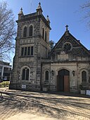
| Christ Church and Rectory, Claremont (Q66974884)
|
State Registered Place
|
Claremont
|
|
31°59′04″S 115°46′43″E / 31.98449°S 115.778591°E / -31.98449; 115.778591
|
491
|
|
| Christian Brothers College (Q5109371)
|
State Registered Place
|
Fremantle
|
|
32°03′06″S 115°45′10″E / 32.051666666667°S 115.75277777778°E / -32.051666666667; 115.75277777778
|
898
|

|
| Christian Brothers College Kalgoorlie (Q66974885)
|
State Registered Place
|
Kalgoorlie
|
|
30°45′05″S 121°28′22″E / 30.751383°S 121.472752°E / -30.751383; 121.472752
|
1310
|
|
| Christian Brothers' Agricultural School Group (Q66974888)
|
State Registered Place
|
Tardun
|
|
28°42′12″S 115°48′59″E / 28.703236°S 115.816332°E / -28.703236; 115.816332
|
1672
|
|
| Chung Wah Association Hall (Q66974890)
|
State Registered Place
|
Northbridge
|
|
31°56′53″S 115°51′27″E / 31.947945°S 115.857523°E / -31.947945; 115.857523
|
2027
|

|
| Church & Cemetery, Gwalla (Q66974891)
|
State Registered Place
|
Northampton
|
|
28°21′30″S 114°38′16″E / 28.358339°S 114.637803°E / -28.358339; 114.637803
|
1902
|
|
| Church of Our Lady in Ara Coeli (Q66974893)
|
State Registered Place
|
Northampton
|
|
28°21′02″S 114°37′51″E / 28.350491°S 114.630861°E / -28.350491; 114.630861
|
1904
|

|
| Church of Our Lady of Mount Carmel & Holy Apostles St. Peter & St. Paul, & Priesthouse (Q66974895)
|
State Registered Place
|
Mullewa
|
|
28°32′20″S 115°31′03″E / 28.538945°S 115.517517°E / -28.538945; 115.517517
|
1656
|

|
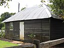
| Church of St. Nicholas, Australind (Q56052604)
|
State Registered Place
|
|
|
33°16′44″S 115°42′56″E / 33.27883861°S 115.7155233°E / -33.27883861; 115.7155233
|
1188
|
|
| Church of the Good Shepherd (Q56052606)
|
State Registered Place
|
Bellevue
|
|
31°54′03″S 116°01′37″E / 31.90096672°S 116.0268774°E / -31.90096672; 116.0268774
|
2458
|
|
| Church of the Holy Cross (Q56052607)
|
State Registered Place
|
|
|
29°12′43″S 116°00′27″E / 29.21193564°S 116.0076036°E / -29.21193564; 116.0076036
|
24866
|

|
| Church of the Holy Cross & Priest's Cell (Q56052608)
|
State Registered Place
|
|
|
29°12′43″S 116°00′26″E / 29.21185985°S 116.0072898°E / -29.21185985; 116.0072898
|
1612
|

|
| Circa 1905 Building (Q116258429)
|
State Registered Place
|
|
|
31°56′54″S 115°51′36″E / 31.948265°S 115.859977°E / -31.948265; 115.859977
|
26950
|

|
| Circa 1925 Building (Q116258414)
|
State Registered Place
|
|
|
31°56′55″S 115°51′36″E / 31.948542°S 115.859933°E / -31.948542; 115.859933
|
26992
|

|
| City Beach and Floreat Beach Precinct (Q118482212)
|
State Registered Place
|
|
|
31°56′20″S 115°45′17″E / 31.938886626951°S 115.75479427910292°E / -31.93888662695065; 115.75479427910292
|
9108
|

|
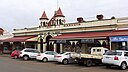
| City Markets (Q56052609)
|
State Registered Place
|
Kalgoorlie
|
|
30°44′52″S 121°28′17″E / 30.7479058°S 121.4713828°E / -30.7479058; 121.4713828
|
1297
|
|
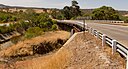
| Clackline Bridge (Q16890382)
|
State Registered Place
|
Clackline
|
|
31°43′14″S 116°31′19″E / 31.7206°S 116.522°E / -31.7206; 116.522
|
10910
|
|
| Claremont Council Offices & Surroundings (Q56052611)
|
State Registered Place
|
Claremont
|
|
31°59′00″S 115°46′55″E / 31.98341739°S 115.781853°E / -31.98341739; 115.781853
|
484
|

|
| Claremont Museum (Q66974898)
|
State Registered Place
|
Claremont
|
|
31°59′26″S 115°47′13″E / 31.990593°S 115.786954°E / -31.990593; 115.786954
|
497
|

|
| Claremont Police Station (Q66974900)
|
State Registered Place
|
Claremont
|
|
31°59′12″S 115°46′17″E / 31.986774°S 115.771261°E / -31.986774; 115.771261
|
18613
|
|
| Claremont Police Station, Lock-up & Stables (Q66974902)
|
State Registered Place
|
Claremont
|
|
31°59′12″S 115°46′16″E / 31.986792°S 115.771135°E / -31.986792; 115.771135
|
2044
|

|
| Claremont Post Office (Q38159204)
|
State Registered Place
|
Claremont
|
|
31°58′53″S 115°46′54″E / 31.981272°S 115.781565°E / -31.981272; 115.781565
|
483
|

|
| Claremont Primary School Precinct (Q66974903)
|
State Registered Place
|
Claremont
|
|
31°59′09″S 115°46′57″E / 31.985936°S 115.782401°E / -31.985936; 115.782401
|
7596
|
|
| Claremont School of Art Building (Q66974905)
|
State Registered Place
|
Claremont
|
|
31°59′09″S 115°46′58″E / 31.985965°S 115.782772°E / -31.985965; 115.782772
|
4097
|

|
| Claremont Teachers College (Q5126334)
|
State Registered Place
|
Claremont
|
|
31°59′14″S 115°47′17″E / 31.98713508924°S 115.78814260450636°E / -31.98713508924037; 115.78814260450636
|
482
|

|
| Claremont Teachers College War Memorial (Q110235992)
|
State Registered Place
|
|
|
31°59′15″S 115°47′16″E / 31.987381552301°S 115.78773125289663°E / -31.987381552300644; 115.78773125289663
|
15686
|

|
| Claremont railway station (Q5126341)
|
State Registered Place
|
Claremont
|
|
31°58′50″S 115°46′53″E / 31.980617°S 115.781481°E / -31.980617; 115.781481
|
486
|

|
| Clarence (Q25352424)
|
State Registered Place
|
|
|
32°10′47″S 115°46′37″E / 32.179788241716°S 115.77707057752065°E / -32.17978824171576; 115.77707057752065
|
17868
|
|
| Clayton Farm (Q66974906)
|
State Registered Place
|
Helena Valley
|
|
31°55′05″S 116°02′28″E / 31.917938°S 116.041145°E / -31.917938; 116.041145
|
3839
|
|
| Cleopatra Hotel (Q56294080)
|
State Registered Place
|
Fremantle
|
|
32°03′19″S 115°44′37″E / 32.055259°S 115.743653°E / -32.055259; 115.743653
|
910
|

|
| Cliff Grange Farmhouse (Q66974909)
|
State Registered Place
|
Greenough
|
|
28°56′19″S 114°44′32″E / 28.938514°S 114.742106°E / -28.938514; 114.742106
|
1154
|
|
| Clifton Residence , Rathmines (Q66974911)
|
State Registered Place
|
Bunbury
|
|
33°19′56″S 115°39′42″E / 33.332105°S 115.661692°E / -33.332105; 115.661692
|
3285
|

|
| Clinch's Mill (Q66974913)
|
State Registered Place
|
Greenough
|
|
28°56′19″S 114°44′27″E / 28.93852°S 114.740884°E / -28.93852; 114.740884
|
1146
|
|
| Clontarf Aboriginal College (Q5135068)
|
State Registered Place
|
Waterford
|
|
32°00′54″S 115°53′38″E / 32.014967057024°S 115.89394402273211°E / -32.014967057023924; 115.89394402273211
|
2401
|

|
| Co-operative Bulk Handling Building, West Perth (Q66974916)
|
State Registered Place
|
West Perth
|
|
31°56′44″S 115°50′42″E / 31.945428°S 115.84493°E / -31.945428; 115.84493
|
3550
|

|
| Cockman House (Q66974918)
|
State Registered Place
|
Wanneroo
|
|
31°47′01″S 115°48′22″E / 31.783745°S 115.805987°E / -31.783745; 115.805987
|
2675
|
|
| Coffee Pot and Waggrakine Well (Q66974919)
|
State Registered Place
|
Waggrakine
|
|
28°42′01″S 114°40′23″E / 28.700193°S 114.673185°E / -28.700193; 114.673185
|
475
|
|
| Cohn's Buildings & Tattersall's Hotel (Q66974921)
|
State Registered Place
|
Kalgoorlie
|
|
30°44′42″S 121°28′33″E / 30.745046°S 121.475825°E / -30.745046; 121.475825
|
1286
|
|
| Cole's Shaft (Q66974923)
|
State Registered Place
|
Armadale
|
|
32°09′48″S 116°01′24″E / 32.163202°S 116.023397°E / -32.163202; 116.023397
|
15263
|
|
| Collie Court House (Q66974924)
|
State Registered Place
|
Collie
|
|
33°21′46″S 116°09′29″E / 33.362813°S 116.158106°E / -33.362813; 116.158106
|
535
|

|
| Collie Post Office (Q66974926)
|
State Registered Place
|
Collie
|
|
33°21′41″S 116°09′28″E / 33.361459°S 116.157652°E / -33.361459; 116.157652
|
550
|

|
| Colonial Tavern & Stables, Northam (Q66974928)
|
State Registered Place
|
Northam
|
|
31°39′47″S 116°39′57″E / 31.66303°S 116.665715°E / -31.66303; 116.665715
|
1855
|
|
| Colwyn, Claremont (Q66974929)
|
State Registered Place
|
Claremont
|
|
31°59′24″S 115°47′06″E / 31.989868°S 115.785085°E / -31.989868; 115.785085
|
2080
|

|
| Commemoratives (Q66974932)
|
State Registered Place
|
Broome
|
|
17°57′16″S 122°14′36″E / 17.954345°S 122.243337°E / -17.954345; 122.243337
|
16848
|

|
| Commercial Bank building (Q66974934)
|
State Registered Place
|
Fremantle
|
|
32°03′19″S 115°44′35″E / 32.055371°S 115.743122°E / -32.055371; 115.743122
|
907
|

|
| Commercial Building (Q56052639)
|
State Registered Place
|
|
|
32°03′16″S 115°44′46″E / 32.05445627°S 115.7460005°E / -32.05445627; 115.7460005
|
4217
|
|
| Commercial Building (Q56052641)
|
State Registered Place
|
Perth
|
|
31°57′07″S 115°51′29″E / 31.95205511°S 115.8579336°E / -31.95205511; 115.8579336
|
1178
|
|
| Commercial Building (Q56052672)
|
State Registered Place
|
Perth
|
|
31°57′20″S 115°51′26″E / 31.95545786°S 115.8571433°E / -31.95545786; 115.8571433
|
2024
|

|
| Commercial Building (Q66974939)
|
State Registered Place
|
Fremantle
|
|
32°03′24″S 115°44′44″E / 32.056744°S 115.74555°E / -32.056744; 115.74555
|
16624
|
|
| Commercial Building & Attached Residence (Q56052642)
|
State Registered Place
|
Northbridge
|
|
31°56′39″S 115°51′23″E / 31.94424296°S 115.8563251°E / -31.94424296; 115.8563251
|
15226
|

|
| Commercial Building 8-12 Bannister Street (Q56052644)
|
State Registered Place
|
Fremantle
|
|
32°03′19″S 115°44′45″E / 32.05531522°S 115.7459132°E / -32.05531522; 115.7459132
|
934
|
|
| Commercial Building, 103 Market Street (Q66974943)
|
State Registered Place
|
Fremantle
|
|
32°03′22″S 115°44′48″E / 32.056197°S 115.746764°E / -32.056197; 115.746764
|
22924
|
|
| Commercial Building, 104-106 Stirling Terrace, Albany (Q66974935)
|
State Registered Place
|
Albany
|
|
35°01′37″S 117°53′07″E / 35.026881°S 117.885202°E / -35.026881; 117.885202
|
15550
|

|
| Commercial Building, 108-110 Stirling Terrace, Albany (Q66974936)
|
State Registered Place
|
Albany
|
|
35°01′35″S 117°53′07″E / 35.026497°S 117.885213°E / -35.026497; 117.885213
|
15551
|
|
| Commercial Building, 12 High Street (Q66974944)
|
State Registered Place
|
Fremantle
|
|
32°03′19″S 115°44′34″E / 32.055367°S 115.742852°E / -32.055367; 115.742852
|
4203
|

|
| Commercial Building, 12-14 Collie Street (Q66974946)
|
State Registered Place
|
Fremantle
|
|
32°03′23″S 115°44′46″E / 32.056507°S 115.74619°E / -32.056507; 115.74619
|
1022
|
|
| Commercial Building, 14 Mouat Street (Q66974947)
|
State Registered Place
|
Fremantle
|
|
32°03′18″S 115°44′36″E / 32.055018°S 115.743283°E / -32.055018; 115.743283
|
960
|

|
| Commercial Building, 16 High Street (Q66974949)
|
State Registered Place
|
Fremantle
|
|
32°03′19″S 115°44′34″E / 32.055367°S 115.742852°E / -32.055367; 115.742852
|
905
|

|
| Commercial Building, 16-20 Mouat Street (Q66974951)
|
State Registered Place
|
Fremantle
|
|
32°03′18″S 115°44′36″E / 32.055137°S 115.743334°E / -32.055137; 115.743334
|
961
|
|
| Commercial Building, 164-166 Stirling Terrace, Albany (Q66974938)
|
State Registered Place
|
Albany
|
|
35°01′36″S 117°52′59″E / 35.026723°S 117.882941°E / -35.026723; 117.882941
|
15553
|
|
| Commercial Building, 20-22 Collie Street (Q66974952)
|
State Registered Place
|
Fremantle
|
|
32°03′22″S 115°44′48″E / 32.056205°S 115.746575°E / -32.056205; 115.746575
|
3704
|
|
| Commercial Building, 3 Pakenham Street (Q66974954)
|
State Registered Place
|
Fremantle
|
|
32°03′14″S 115°44′39″E / 32.053969°S 115.744273°E / -32.053969; 115.744273
|
22519
|
|
| Commercial Building, 32 Marine Terrace (Q66974957)
|
State Registered Place
|
Fremantle
|
|
32°03′25″S 115°44′43″E / 32.056885°S 115.745197°E / -32.056885; 115.745197
|
20519
|
|
| Commercial Building, 37-45 Cliff Street (Q56065952)
|
State Registered Place
|
|
|
32°03′24″S 115°44′33″E / 32.056762238146°S 115.74259941168908°E / -32.056762238146064; 115.74259941168908
|
860
|
|
| Commercial Building, 4 Collie Street (Q66974960)
|
State Registered Place
|
Fremantle
|
|
32°03′25″S 115°44′44″E / 32.05703°S 115.745469°E / -32.05703; 115.745469
|
1023
|
|
| Commercial Building, 48 High Street (Q66974962)
|
State Registered Place
|
Fremantle
|
|
32°03′18″S 115°44′40″E / 32.054985°S 115.744425°E / -32.054985; 115.744425
|
22536
|
|
| Commercial Building, 54 Henry Street (Q66974963)
|
State Registered Place
|
Fremantle
|
|
32°03′24″S 115°44′42″E / 32.056702°S 115.745116°E / -32.056702; 115.745116
|
893
|
|
| Commercial Building, 6-8 Cliff Street (Q66974965)
|
State Registered Place
|
Fremantle
|
|
32°03′19″S 115°44′33″E / 32.055226°S 115.742396°E / -32.055226; 115.742396
|
22541
|

|
| Commercial Building, 85 Market Street (Q66974968)
|
State Registered Place
|
Fremantle
|
|
32°03′20″S 115°44′48″E / 32.055505°S 115.746656°E / -32.055505; 115.746656
|
22561
|
|
| Commercial Building, 85-87 High Street (Q66974969)
|
State Registered Place
|
Fremantle
|
|
32°03′18″S 115°44′45″E / 32.055019°S 115.745809°E / -32.055019; 115.745809
|
925
|
|
| Commercial Building, 93-97 Market Street (Q56052668)
|
State Registered Place
|
|
|
32°03′21″S 115°44′48″E / 32.05570009°S 115.746739°E / -32.05570009; 115.746739
|
21276
|
|
| Commercial Building, 99 Market Street (Q56052670)
|
State Registered Place
|
|
|
32°03′21″S 115°44′48″E / 32.05584385°S 115.7468006°E / -32.05584385; 115.7468006
|
14767
|
|
| Commercial Hotel (Q28951178)
|
State Registered Place
|
|
|
32°03′17″S 115°44′43″E / 32.054653°S 115.745406°E / -32.054653; 115.745406
|
921
|

|
| Commercial building, 49 Pakenham Street (Q56052643)
|
State Registered Place
|
|
|
32°03′24″S 115°44′44″E / 32.0565733°S 115.7454551°E / -32.0565733; 115.7454551
|
21518
|
|
| Commissariat Buildings (Q5152611)
|
State Registered Place
|
|
|
32°03′26″S 115°44′33″E / 32.05731514°S 115.742609°E / -32.05731514; 115.742609
|
857
|
|
| Commonwealth Bank (fmr), Bunbury (Q56052675)
|
State Registered Place
|
|
|
33°19′35″S 115°38′12″E / 33.32636491°S 115.6366638°E / -33.32636491; 115.6366638
|
4575
|

|
| Commonwealth Bank (former) (Q56052674)
|
State Registered Place
|
|
|
32°03′16″S 115°44′44″E / 32.05455274°S 115.7455254°E / -32.05455274; 115.7455254
|
923
|

|
| Commonwealth Bank Building (Q66974972)
|
State Registered Place
|
Perth
|
|
31°57′09″S 115°51′31″E / 31.952583°S 115.858683°E / -31.952583; 115.858683
|
2064
|

|
| Commonwealth Bank building, Narrogin (Q98861057)
|
State Registered Place
|
|
|
32°56′06″S 117°10′38″E / 32.934948°S 117.177361°E / -32.934948; 117.177361
|
1816
|

|
| Commonwealth Bank, Katanning (Q66974974)
|
State Registered Place
|
Katanning
|
|
33°41′25″S 117°33′24″E / 33.690384°S 117.556634°E / -33.690384; 117.556634
|
1350
|

|
| Commonwealth Bank, Northam (Q66974976)
|
State Registered Place
|
Northam
|
|
31°39′14″S 116°40′18″E / 31.653967°S 116.671656°E / -31.653967; 116.671656
|
1871
|
|
| Commonwealth Health Laboratory (Q66974977)
|
State Registered Place
|
Kalgoorlie
|
|
30°44′31″S 121°28′13″E / 30.74204°S 121.470176°E / -30.74204; 121.470176
|
1313
|
|
| Community Education Centre, Geraldton (Q66974979)
|
State Registered Place
|
Geraldton
|
|
28°46′38″S 114°36′19″E / 28.777147°S 114.605348°E / -28.777147; 114.605348
|
1061
|
|
| Community Health Services, Broome (Q66974981)
|
State Registered Place
|
Broome
|
|
17°57′41″S 122°14′10″E / 17.961461°S 122.236079°E / -17.961461; 122.236079
|
5368
|
|
| Congregational Hall & Congregational Church (Q66974982)
|
State Registered Place
|
Claremont
|
|
31°58′58″S 115°47′07″E / 31.982682°S 115.785159°E / -31.982682; 115.785159
|
487
|

|
| Connor Quinlan Building (Q66974984)
|
State Registered Place
|
Perth
|
|
31°57′16″S 115°51′37″E / 31.954451°S 115.860142°E / -31.954451; 115.860142
|
1991
|

|
| Connor's Mill (Q5161998)
|
State Registered Place
|
|
|
31°33′02″S 116°27′55″E / 31.550571°S 116.465315°E / -31.550571; 116.465315
|
2567
|

|
| Convent School (Q66974988)
|
State Registered Place
|
Coolgardie
|
|
30°57′09″S 121°09′42″E / 30.952483°S 121.161781°E / -30.952483; 121.161781
|
574
|
|
| Convent of the Sacred Heart (Q66974987)
|
State Registered Place
|
Northampton
|
|
28°21′03″S 114°37′50″E / 28.350767°S 114.630666°E / -28.350767; 114.630666
|
1903
|

|
| Convict Fence (Q53235663)
|
State Registered Place
|
|
|
32°01′14″S 115°53′45″E / 32.020562°S 115.895739°E / -32.020562; 115.895739
|
4609
|

|
| Coogee Hotel (Q24090020)
|
State Registered Place
|
Coogee
|
|
32°06′42″S 115°45′56″E / 32.111732°S 115.76542°E / -32.111732; 115.76542
|
24481
|

|
| Coogee Hotel and Post Office (Q66974992)
|
State Registered Place
|
Coogee
|
|
32°06′42″S 115°45′56″E / 32.111606°S 115.765515°E / -32.111606; 115.765515
|
3648
|
|
| Coogee Post Office (Q66974993)
|
State Registered Place
|
Coogee
|
|
32°06′41″S 115°45′55″E / 32.11128°S 115.765227°E / -32.11128; 115.765227
|
24500
|

|
| Cooinda House (Q123173456)
|
State Registered Place
|
|
|
31°55′58″S 115°52′37″E / 31.932646601158°S 115.8768996865582°E / -31.932646601158485; 115.8768996865582
|
9818
|

|
| Coolgardie Bowling Pavilion (Q66974995)
|
State Registered Place
|
Coolgardie
|
|
30°57′13″S 121°09′46″E / 30.953684°S 121.162915°E / -30.953684; 121.162915
|
3664
|
|
| Coolgardie Fire Station (Q66974997)
|
State Registered Place
|
Coolgardie
|
|
30°57′11″S 121°09′52″E / 30.952962°S 121.164519°E / -30.952962; 121.164519
|
1340
|
|
| Coolgardie Post Office & Associated Buildings (Q66974999)
|
State Registered Place
|
Coolgardie
|
|
30°57′15″S 121°09′55″E / 30.95428°S 121.165394°E / -30.95428; 121.165394
|
569
|

|
| Coolgardie Primary School (Q66975000)
|
State Registered Place
|
Coolgardie
|
|
30°57′01″S 121°10′00″E / 30.950146°S 121.166593°E / -30.950146; 121.166593
|
579
|
|
| Coolgardie Railway Station and Goods Shed (Q66975002)
|
State Registered Place
|
Coolgardie
|
|
30°57′23″S 121°09′45″E / 30.956437°S 121.162434°E / -30.956437; 121.162434
|
581
|
|
| Cooper's Mill (fmr) (Q71371578)
|
State Registered Place
|
|
|
32°34′35″S 115°45′55″E / 32.576389°S 115.765278°E / -32.576389; 115.765278
|
1771
|

|
| Cooya Pooya (Q16890666)
|
State Registered Place
|
|
|
21°01′59″S 117°08′24″E / 21.03302674°S 117.1399505°E / -21.03302674; 117.1399505
|
3376
|
|
| Cornwall Hotel (Q56052704)
|
State Registered Place
|
South Boulder
|
|
30°47′20″S 121°29′43″E / 30.78885668°S 121.4953325°E / -30.78885668; 121.4953325
|
201
|

|
| Coronado Hotel (Q56052705)
|
State Registered Place
|
Claremont
|
|
31°58′55″S 115°47′24″E / 31.98186887°S 115.7900545°E / -31.98186887; 115.7900545
|
492
|

|
| Corrigin Roads Board office (Q56052706)
|
State Registered Place
|
Corrigin
|
|
32°19′50″S 117°52′31″E / 32.33042759°S 117.8752654°E / -32.33042759; 117.8752654
|
24798
|
|
| Corrigin Town Hall (Q45918896)
|
State Registered Place
|
|
|
32°19′49″S 117°52′31″E / 32.33024618°S 117.8752653°E / -32.33024618; 117.8752653
|
24786
|

|
| Corrigin Town Hall & Road Board Office (Q56052708)
|
State Registered Place
|
|
|
32°19′49″S 117°52′31″E / 32.3303369°S 117.8752653°E / -32.3303369; 117.8752653
|
586
|

|
| Corringle (Q56052709)
|
State Registered Place
|
Greenough
|
|
28°54′08″S 114°41′55″E / 28.90231761°S 114.6987167°E / -28.90231761; 114.6987167
|
1134
|
|
| Corunna Downs Wartime Air Base (Q66975005)
|
State Registered Place
|
Marble Bar
|
|
21°25′46″S 119°47′01″E / 21.429435°S 119.783491°E / -21.429435; 119.783491
|
14200
|
|
| Cossack Cemetery (Q33166522)
|
State Registered Place
|
|
|
20°40′27″S 117°11′35″E / 20.674263°S 117.193168°E / -20.674263; 117.193168
|
3232
|

|
| Cossack Museum (Q64584641)
|
State Registered Place
|
|
|
20°40′41″S 117°11′18″E / 20.677964°S 117.188357°E / -20.677964; 117.188357
|
2346
|

|
| Cossack Post and Telegraph office (Q87377322)
|
State Registered Place
|
|
|
20°40′43″S 117°11′20″E / 20.678632°S 117.188798°E / -20.678632; 117.188798
|
2347
|

|
| Cottage (Q66975007)
|
State Registered Place
|
Guildford
|
|
31°54′01″S 115°58′09″E / 31.90032°S 115.969278°E / -31.90032; 115.969278
|
4096
|
|
| Cottage, Old Balcatta Road (Q66975009)
|
State Registered Place
|
Balcatta
|
|
31°51′30″S 115°47′38″E / 31.858356°S 115.79399°E / -31.858356; 115.79399
|
3442
|
|
| Cottesloe Beach (Q21955723)
|
State Registered Place
|
Cottesloe
|
|
31°59′45″S 115°45′02″E / 31.99583°S 115.7506°E / -31.99583; 115.7506
|
16637
|

|
| Cottesloe Beach Hotel (Q66975010)
|
State Registered Place
|
Cottesloe
|
|
31°59′41″S 115°45′09″E / 31.994707°S 115.752521°E / -31.994707; 115.752521
|
597
|

|
| Cottesloe Beach Pylon (Q66975014)
|
State Registered Place
|
Cottesloe
|
|
31°59′43″S 115°45′01″E / 31.99515°S 115.750281°E / -31.99515; 115.750281
|
7984
|

|
| Cottesloe Civic Centre (Q19872560)
|
State Registered Place
|
Cottesloe
|
|
31°59′37″S 115°45′20″E / 31.993689°S 115.755649°E / -31.993689; 115.755649
|
593
|

|
| Cottesloe Flour Mill (Q66975016)
|
State Registered Place
|
Cottesloe
|
|
31°59′27″S 115°45′43″E / 31.990925°S 115.761913°E / -31.990925; 115.761913
|
3234
|

|
| Cottesloe Police Station (Q66975018)
|
State Registered Place
|
Peppermint Grove
|
|
32°00′11″S 115°45′38″E / 32.00306°S 115.760487°E / -32.00306; 115.760487
|
1929
|

|
| Cottesloe Post Office & Telephone Exchange (Q66975019)
|
State Registered Place
|
Cottesloe
|
|
31°59′47″S 115°45′42″E / 31.996463°S 115.761565°E / -31.996463; 115.761565
|
599
|

|
| Cottesloe Primary School & Cottesloe School for the Deaf & Hearing Impaired (Q66975021)
|
State Registered Place
|
Peppermint Grove
|
|
32°00′08″S 115°45′41″E / 32.002092°S 115.76137°E / -32.002092; 115.76137
|
1933
|

|
| Council Club Hotel - Site of (Q66975023)
|
State Registered Place
|
Midland
|
|
31°53′18″S 116°00′12″E / 31.888428°S 116.003212°E / -31.888428; 116.003212
|
2510
|
|
| Council House (Q5176234)
|
State Registered Place
|
|
|
31°57′24″S 115°51′39″E / 31.956672222222°S 115.86075277777778°E / -31.956672222222224; 115.86075277777778
|
2097
|

|
| Court House & Registrar's Office (Q66975025)
|
State Registered Place
|
Southern Cross
|
|
31°13′54″S 119°19′40″E / 31.23158°S 119.327688°E / -31.23158; 119.327688
|
2804
|

|
| Court House, Fremantle (Q66975026)
|
State Registered Place
|
Fremantle
|
|
32°03′26″S 115°44′37″E / 32.0571473°S 115.7437453°E / -32.0571473; 115.7437453
|
946
|

|
| Courthouse and Police Station Cottages (Q56054287)
|
State Registered Place
|
|
|
31°53′19″S 116°46′09″E / 31.8887084°S 116.769243°E / -31.8887084; 116.769243
|
2882
|
|
| Cowalla Homestead Group (Q66975028)
|
State Registered Place
|
Cowalla
|
|
31°03′23″S 115°33′53″E / 31.056321°S 115.56466°E / -31.056321; 115.56466
|
1088
|
|
| Creaton Ruins (Q71371548)
|
State Registered Place
|
|
|
32°35′50″S 115°52′43″E / 32.597222222222°S 115.87861111111113°E / -32.59722222222222; 115.87861111111113
|
1757
|

|
| Cremorne Arcade (Q56052736)
|
State Registered Place
|
Perth
|
|
31°57′17″S 115°51′41″E / 31.95466903°S 115.8613943°E / -31.95466903; 115.8613943
|
1988
|

|
| Cremorne Theatre and Gardens (Q45919917)
|
State Registered Place
|
|
|
30°44′39″S 121°28′34″E / 30.7441508°S 121.4760681°E / -30.7441508; 121.4760681
30°44′37″S 121°28′34″E / 30.74352678°S 121.4761923°E / -30.74352678; 121.4761923
|
3468
|
|
| Criterion Hotel (Q18165493)
|
State Registered Place
|
Perth
|
|
31°57′17″S 115°51′42″E / 31.954842°S 115.861773°E / -31.954842; 115.861773
|
1989
|

|
| Cronshaw's Store (Q56052738)
|
State Registered Place
|
Bunbury
|
|
33°19′28″S 115°38′12″E / 33.32454695°S 115.6365964°E / -33.32454695; 115.6365964
|
375
|

|
| Crossland House, Guildford (Q106541757)
|
State Registered Place
|
|
|
31°53′49″S 115°58′16″E / 31.896983592396°S 115.9709746687046°E / -31.896983592396086; 115.9709746687046
|
2485
|

|
| Cuballing Civic Group (Q56052739)
|
State Registered Place
|
|
|
32°49′08″S 117°10′39″E / 32.81886857°S 117.1776342°E / -32.81886857; 117.1776342
|
618
|

|
| Cuballing Post Office & Quarters (Q56052740)
|
State Registered Place
|
|
|
32°49′07″S 117°10′41″E / 32.8187197°S 117.1781841°E / -32.8187197; 117.1781841
|
617
|

|
| Cuddy Cuddy Changing Station, Howatharra (Q56052741)
|
State Registered Place
|
|
|
28°31′20″S 114°37′50″E / 28.52224416°S 114.6306275°E / -28.52224416; 114.6306275
|
15838
|
|
| Cue Masonic Lodge (Q66975573)
|
State Registered Place
|
Cue
|
|
27°25′22″S 117°53′41″E / 27.422779°S 117.894796°E / -27.422779; 117.894796
|
637
|

|
| Cue Municipal Chambers (fmr) (Q56052742)
|
State Registered Place
|
|
|
27°25′25″S 117°53′45″E / 27.42374149°S 117.8957058°E / -27.42374149; 117.8957058
|
641
|
|
| Cue Pensioners Cottages (Q56052743)
|
State Registered Place
|
|
|
27°25′16″S 117°53′59″E / 27.42120488°S 117.8996845°E / -27.42120488; 117.8996845
|
6516
|
|
| Cue Public Buildings (Q66975030)
|
State Registered Place
|
Cue
|
|
27°25′23″S 117°53′59″E / 27.422941°S 117.89983°E / -27.422941; 117.89983
|
629
|

|
| Cue Railway Station (Q66975032)
|
State Registered Place
|
Cue
|
|
27°25′31″S 117°54′02″E / 27.425345°S 117.900459°E / -27.425345; 117.900459
|
3640
|

|
| Cue Shire Offices (Q66975033)
|
State Registered Place
|
Cue
|
|
27°25′21″S 117°53′54″E / 27.422626°S 117.89841°E / -27.422626; 117.89841
|
632
|

|
| Cummins Theatre (Q45920812)
|
State Registered Place
|
|
|
31°28′48″S 118°16′46″E / 31.480088°S 118.279412°E / -31.480088; 118.279412
|
1574
|

|
| Cunderdin Airfield (Q66975034)
|
State Registered Place
|
Cunderdin
|
|
31°37′13″S 117°13′15″E / 31.620183°S 117.220757°E / -31.620183; 117.220757
|
4570
|
|
| Curdnatta (Q66975035)
|
State Registered Place
|
Northam
|
|
31°39′10″S 116°39′52″E / 31.652913°S 116.664496°E / -31.652913; 116.664496
|
10881
|
|
| Customs Bonded Warehouse (Q66975037)
|
State Registered Place
|
Albany
|
|
35°01′41″S 117°53′11″E / 35.028078°S 117.886505°E / -35.028078; 117.886505
|
24545
|

|
| Customs House and Bond Store (Q64584693)
|
State Registered Place
|
|
|
20°40′44″S 117°11′21″E / 20.678896°S 117.189076°E / -20.678896; 117.189076
|
2345
|

|
| Cygnet Cinema (Q5199190)
|
State Registered Place
|
Como
|
|
31°59′37″S 115°51′30″E / 31.993553°S 115.85834°E / -31.993553; 115.85834
|
2404
|

|
| D & J Fowler Bag Store (Q66975044)
|
State Registered Place
|
Fremantle
|
|
32°03′21″S 115°44′42″E / 32.055906°S 115.745096°E / -32.055906; 115.745096
|
22569
|
|
| DUPLEX, 14 NAIRN STREET (Q56052827)
|
State Registered Place
|
|
|
32°03′21″S 115°44′47″E / 32.05586863°S 115.7463809°E / -32.05586863; 115.7463809
|
24612
|
|
| DUPLEX, 16 NAIRN STREET (Q56052828)
|
State Registered Place
|
|
|
32°03′21″S 115°44′47″E / 32.05584382°S 115.7464602°E / -32.05584382; 115.7464602
|
24817
|
|
| DUPLEX, 18 NAIRN STREET (Q56052829)
|
State Registered Place
|
|
|
32°03′21″S 115°44′48″E / 32.05581728°S 115.7465441°E / -32.05581728; 115.7465441
|
24620
|
|
| DUPLEX, 3 NAIRN STREET (Q56052835)
|
State Registered Place
|
|
|
32°03′23″S 115°44′45″E / 32.05637973°S 115.7459383°E / -32.05637973; 115.7459383
|
22563
|
|
| Dale Cottages (Q66975045)
|
State Registered Place
|
Armadale
|
|
32°09′27″S 116°00′49″E / 32.157372°S 116.013696°E / -32.157372; 116.013696
|
4667
|
|
| Dalgety House (Q66975047)
|
State Registered Place
|
Port Hedland
|
|
20°18′49″S 118°34′36″E / 20.313545°S 118.576715°E / -20.313545; 118.576715
|
3357
|

|
| Dalgety House, Roebourne (Q66975048)
|
State Registered Place
|
Roebourne
|
|
20°46′30″S 117°08′46″E / 20.774926°S 117.146147°E / -20.774926; 117.146147
|
13254
|
|
| Dalgety Wool Stores (Q28428584)
|
State Registered Place
|
Fremantle
|
|
32°02′51″S 115°45′03″E / 32.04741°S 115.750732°E / -32.04741; 115.750732
|
15820
|

|
| Dalgety's Bond Store (Q66975052)
|
State Registered Place
|
Fremantle
|
|
32°03′20″S 115°44′31″E / 32.055603°S 115.741832°E / -32.055603; 115.741832
|
976
|

|
| Dalkeith House (Q66975054)
|
State Registered Place
|
Fremantle
|
|
32°03′09″S 115°45′07″E / 32.052563693336°S 115.75192563242588°E / -32.05256369333598; 115.75192563242588
|
931
|

|
| Dampier Memorial (Q66975055)
|
State Registered Place
|
Broome
|
|
17°57′47″S 122°14′20″E / 17.963058°S 122.23884°E / -17.963058; 122.23884
|
2669
|
|
| Dardanup State School (former) (Q56052769)
|
State Registered Place
|
Dardanup
|
|
33°23′54″S 115°45′18″E / 33.39844481°S 115.7550126°E / -33.39844481; 115.7550126
|
4628
|

|
| Darjeeling, Roleystone (Q56052770)
|
State Registered Place
|
Roleystone
|
|
32°07′34″S 116°03′55″E / 32.12598707°S 116.0651579°E / -32.12598707; 116.0651579
|
3562
|
|
| Darnell's General Store (Q56052771)
|
State Registered Place
|
Witchcliffe
|
|
34°01′33″S 115°05′58″E / 34.025732°S 115.0994877°E / -34.025732; 115.0994877
|
4946
|

|
| David Foulkes-Taylor Showroom (former) (Q56052772)
|
State Registered Place
|
Nedlands
|
|
31°58′43″S 115°48′50″E / 31.97870696°S 115.8139498°E / -31.97870696; 115.8139498
|
13655
|
|
| Davies Park & Foundry Chimney (Q56052773)
|
State Registered Place
|
Karridale
|
|
34°12′38″S 115°04′33″E / 34.21060702°S 115.0758038°E / -34.21060702; 115.0758038
|
124
|

|
| Davilak House (Q56052774)
|
State Registered Place
|
Spearwood
|
|
32°05′47″S 115°46′11″E / 32.09635648°S 115.769805°E / -32.09635648; 115.769805
|
511
|

|
| Davis Wool Stores, Hall and Solomon Building (Q66976601)
|
State Registered Place
|
Fremantle
|
|
32°03′24″S 115°44′42″E / 32.056596°S 115.74498°E / -32.056596; 115.74498
|
892
|

|
| Day Cottage (Q56052776)
|
State Registered Place
|
East Rockingham
|
|
32°16′25″S 115°46′36″E / 32.27352216°S 115.7765567°E / -32.27352216; 115.7765567
|
4015
|

|
| Daylesford, Bassendean (Q56052777)
|
State Registered Place
|
Bassendean
|
|
31°54′30″S 115°57′40″E / 31.90823526°S 115.9611567°E / -31.90823526; 115.9611567
|
127
|
|
| Dempster Homestead, Esperance (Q66975058)
|
State Registered Place
|
Esperance
|
|
33°52′08″S 121°53′20″E / 33.868961°S 121.889027°E / -33.868961; 121.889027
|
822
|

|
| Denmark District Hospital (Q66975060)
|
State Registered Place
|
Denmark
|
|
34°57′28″S 117°21′15″E / 34.95781°S 117.354266°E / -34.95781; 117.354266
|
14171
|
|
| Dennehy House (Q66975061)
|
State Registered Place
|
South Perth
|
|
31°58′43″S 115°51′31″E / 31.978716°S 115.858725°E / -31.978716; 115.858725
|
4821
|
|
| Derby Police Gaol (Q66975063)
|
State Registered Place
|
Derby
|
|
17°18′22″S 123°38′09″E / 17.306171°S 123.635718°E / -17.306171; 123.635718
|
692
|
|
| Derby Town Commonage (Q66975064)
|
State Registered Place
|
Derby
|
|
17°20′52″S 123°40′06″E / 17.347689°S 123.668461°E / -17.347689; 123.668461
|
7214
|
|
| Derby Tramway Woolshed (Q66975066)
|
State Registered Place
|
Derby
|
|
17°18′01″S 123°37′31″E / 17.300295°S 123.625225°E / -17.300295; 123.625225
|
4661
|
|
| Desert Mounted Corps Memorial (Q66975067)
|
State Registered Place
|
Albany
|
|
35°01′31″S 117°53′46″E / 35.025352°S 117.896037°E / -35.025352; 117.896037
|
34
|

|
| Devon House (Q66975069)
|
State Registered Place
|
Perth
|
|
31°57′14″S 115°51′26″E / 31.953811°S 115.857252°E / -31.953811; 115.857252
|
2000
|

|
| Dewar's House (Q66975071)
|
State Registered Place
|
Gingin
|
|
31°21′01″S 115°54′28″E / 31.350158°S 115.907793°E / -31.350158; 115.907793
|
1083
|
|
| Dilhorn House (Q5276772)
|
State Registered Place
|
Perth
|
|
31°56′41″S 115°52′21″E / 31.944783702733°S 115.87239882454864°E / -31.944783702732565; 115.87239882454864
|
2168
|

|
| Dingup Anglican Church (Q66975074)
|
State Registered Place
|
Balbarrup
|
|
34°14′13″S 116°12′22″E / 34.236876°S 116.206236°E / -34.236876; 116.206236
|
1505
|
|
| Dirk Hartog Landing Site (Q1227877)
|
State Registered Place
|
Dirk Hartog Island
|
|
25°28′57″S 112°58′23″E / 25.48243293°S 112.9730074°E / -25.48243293; 112.9730074
|
23848
|
|
| Display Centre & Wing Loong New & Used Books (Q66975075)
|
State Registered Place
|
Northbridge
|
|
31°56′52″S 115°51′38″E / 31.947677°S 115.860451°E / -31.947677; 115.860451
|
16483
|

|
| District Education Office (Q66975077)
|
State Registered Place
|
South Kalgoorlie
|
|
30°45′40″S 121°29′16″E / 30.761107°S 121.487815°E / -30.761107; 121.487815
|
196
|
|
| District Medical Officer's Quarters (Q66975079)
|
State Registered Place
|
Port Hedland
|
|
20°18′37″S 118°34′40″E / 20.310216°S 118.577746°E / -20.310216; 118.577746
|
2286
|
|
| District Superintendent's House (Q66975080)
|
State Registered Place
|
Kalgoorlie
|
|
30°44′37″S 121°28′12″E / 30.743566°S 121.470018°E / -30.743566; 121.470018
|
1280
|
|
| Dock Buildings (Q66498312)
|
State Registered Place
|
Fremantle
|
|
32°03′18″S 115°44′33″E / 32.055111111111°S 115.74261111111°E / -32.055111111111; 115.74261111111
|
4221
|

|
| Doctor's House, Norseman (Q66975085)
|
State Registered Place
|
Norseman
|
|
32°11′56″S 121°46′15″E / 32.198865°S 121.770729°E / -32.198865; 121.770729
|
10120
|
|
| Dominican Convent Chapel of St Hyacinth (Q66975087)
|
State Registered Place
|
Yalgoo
|
|
28°20′21″S 116°40′40″E / 28.33929°S 116.677653°E / -28.33929; 116.677653
|
2776
|

|
| Dominican Convent, Greenough (Q66975086)
|
State Registered Place
|
Greenough
|
|
28°56′39″S 114°44′39″E / 28.944272°S 114.744092°E / -28.944272; 114.744092
|
1142
|
|
| Don Aitken Centre (Q111395495)
|
State Registered Place
|
|
|
31°57′25″S 115°52′38″E / 31.957044826952°S 115.87714574879558°E / -31.957044826952156; 115.87714574879558
|
26494
|
|
| Donegan's Cottage (Q66975088)
|
State Registered Place
|
Toodyay
|
|
31°32′46″S 116°27′30″E / 31.546227°S 116.458347°E / -31.546227; 116.458347
|
4555
|
|
| Dongara Police Station, Courthouse & Gaol (Q66975090)
|
State Registered Place
|
Dongara
|
|
29°15′09″S 114°55′50″E / 29.252544°S 114.930498°E / -29.252544; 114.930498
|
1235
|
|
| Dongara Post Office & Quarters (Q66975092)
|
State Registered Place
|
Dongara
|
|
29°15′07″S 114°55′50″E / 29.252076°S 114.930587°E / -29.252076; 114.930587
|
1236
|

|
| Dongara Schoolmaster's House (Q66975093)
|
State Registered Place
|
Dongara
|
|
29°15′02″S 114°55′52″E / 29.250505°S 114.931208°E / -29.250505; 114.931208
|
1233
|
|
| Dongara Uniting Church (Q56052803)
|
State Registered Place
|
Dongara
|
|
29°15′06″S 114°55′53″E / 29.25172968°S 114.9312934°E / -29.25172968; 114.9312934
|
1234
|

|
| Donnelly River Mill (Q56052804)
|
State Registered Place
|
|
|
34°06′06″S 115°58′39″E / 34.1016252°S 115.9774482°E / -34.1016252; 115.9774482
|
2966
|

|
| Donnelly River Mill & Townsite Precinct (Q56052805)
|
State Registered Place
|
|
|
34°06′09″S 115°58′35″E / 34.10237449°S 115.9762538°E / -34.10237449; 115.9762538
|
8198
|

|
| Donnybrook Post Office (Q56052806)
|
State Registered Place
|
|
|
33°34′19″S 115°49′27″E / 33.57205288°S 115.8241118°E / -33.57205288; 115.8241118
|
727
|

|
| Donnybrook Railway Precinct (Q56052807)
|
State Registered Place
|
|
|
33°34′24″S 115°49′25″E / 33.57338485°S 115.8236286°E / -33.57338485; 115.8236286
|
5012
|

|
| Doy Forrest Boatshed (Q56052808)
|
State Registered Place
|
Peppermint Grove
|
|
32°00′05″S 115°46′23″E / 32.00136448°S 115.773061°E / -32.00136448; 115.773061
|
15931
|

|
| Dr Bartlett's Residence (former) & Surrounds (Q56052810)
|
State Registered Place
|
|
|
29°15′15″S 114°55′37″E / 29.25410699°S 114.9270657°E / -29.25410699; 114.9270657
|
1221
|

|
| Drakesbrook School (former) (Q56052811)
|
State Registered Place
|
|
|
32°51′10″S 115°55′28″E / 32.85274492°S 115.9244227°E / -32.85274492; 115.9244227
|
3091
|

|
| Drew Robinson & Co (130-140 Stirling Terrace) (Q66975095)
|
State Registered Place
|
Albany
|
|
35°01′35″S 117°53′04″E / 35.02642°S 117.884516°E / -35.02642; 117.884516
|
15552
|

|
| Drew Robinson & Company building (82-84 Stirling Terrace) (Q26837215)
|
State Registered Place
|
Albany
|
|
35°01′37″S 117°53′09″E / 35.027025°S 117.885731°E / -35.027025; 117.885731
|
52
|

|
| Drill Hall, Leederville (Q66975098)
|
State Registered Place
|
Leederville
|
|
31°56′10″S 115°50′24″E / 31.936144°S 115.840135°E / -31.936144; 115.840135
|
8764
|

|
| Dryandra Woodland Settlement (Q66975100)
|
State Registered Place
|
Congelin
|
|
32°46′58″S 116°58′11″E / 32.78285°S 116.969822°E / -32.78285; 116.969822
|
3856
|

|
| Duffy's Store & Billiard Saloon (Q66975101)
|
State Registered Place
|
Three Springs
|
|
29°32′03″S 115°45′45″E / 29.534296°S 115.762536°E / -29.534296; 115.762536
|
5261
|

|
| Dumas House (Q5313634)
|
State Registered Place
|
West Perth
|
|
31°57′11″S 115°50′37″E / 31.953148°S 115.84359°E / -31.953148; 115.84359
|
3849
|

|
| Duplex for Superintendent & Gatekeeper, 12 The Terrace (Q66975103)
|
State Registered Place
|
Fremantle
|
|
32°03′17″S 115°45′10″E / 32.054809°S 115.752698°E / -32.054809; 115.752698
|
23374
|

|
| Duplex, 20 Nairn Street (Q66975104)
|
State Registered Place
|
Fremantle
|
|
32°03′21″S 115°44′48″E / 32.055794°S 115.746619°E / -32.055794; 115.746619
|
24829
|
|
| Duplex, 10 Knutsford Street (Q66975106)
|
State Registered Place
|
Fremantle
|
|
32°03′12″S 115°45′20″E / 32.053385°S 115.755633°E / -32.053385; 115.755633
|
21120
|
|
| Duplex, 12 Knutsford Street (Q66975108)
|
State Registered Place
|
Fremantle
|
|
32°03′12″S 115°45′20″E / 32.053385°S 115.755633°E / -32.053385; 115.755633
|
23356
|

|
| Duplex, 13 Nairn Street (Q66975109)
|
State Registered Place
|
Fremantle
|
|
32°03′22″S 115°44′47″E / 32.056228°S 115.746412°E / -32.056228; 115.746412
|
21316
|
|
| Duplex, 20 Ord Street (Q56052830)
|
State Registered Place
|
|
|
32°03′11″S 115°45′19″E / 32.05314885°S 115.7551932°E / -32.05314885; 115.7551932
|
24614
|

|
| Duplex, 22 Ord Street (Q56052831)
|
State Registered Place
|
|
|
32°03′12″S 115°45′19″E / 32.05325691°S 115.7551817°E / -32.05325691; 115.7551817
|
24615
|

|
| Duplex, 26 Norfolk Street (Q56052832)
|
State Registered Place
|
|
|
32°03′26″S 115°44′55″E / 32.05710276°S 115.7486764°E / -32.05710276; 115.7486764
|
24621
|

|
| Duplex, 28 Norfolk Street (Q56052834)
|
State Registered Place
|
|
|
32°03′25″S 115°44′56″E / 32.05703551°S 115.7487708°E / -32.05703551; 115.7487708
|
24624
|
|
| Duplex, 6 Knutsford Street (Q66975111)
|
State Registered Place
|
Fremantle
|
|
32°03′12″S 115°45′20″E / 32.053275°S 115.755424°E / -32.053275; 115.755424
|
21119
|
|
| Duplex, 8 Knutsford Street (Q66975113)
|
State Registered Place
|
Fremantle
|
|
32°03′12″S 115°45′20″E / 32.053324°S 115.755504°E / -32.053324; 115.755504
|
23355
|

|
| Dwelling (502), Tower Street, Gwalia (Q66975132)
|
State Registered Place
|
Gwalia
|
|
28°54′45″S 121°19′50″E / 28.912564°S 121.330497°E / -28.912564; 121.330497
|
24397
|
|
| Dwelling (504), Tower Street, Gwalia (Q66975133)
|
State Registered Place
|
Gwalia
|
|
28°54′47″S 121°19′50″E / 28.912927°S 121.330497°E / -28.912927; 121.330497
|
24448
|
|
| Dwelling - Senior Telegraphist's Residence Wireless Hill (Q66975131)
|
State Registered Place
|
Ardross
|
|
32°01′38″S 115°49′41″E / 32.027332°S 115.828045°E / -32.027332; 115.828045
|
6062
|
|
| Dwelling, 13 Station Street, Gwalia (Q66975120)
|
State Registered Place
|
Gwalia
|
|
28°54′48″S 121°19′44″E / 28.913289°S 121.328945°E / -28.913289; 121.328945
|
10973
|
|
| Dwelling, 14 Manning Street, Gwalia (Q66975130)
|
State Registered Place
|
Gwalia
|
|
28°54′48″S 121°19′46″E / 28.913471°S 121.329442°E / -28.913471; 121.329442
|
10971
|
|
| Dwelling, 913 Tower Street, Gwalia (Q66975115)
|
State Registered Place
|
Gwalia
|
|
28°54′26″S 121°19′50″E / 28.907209°S 121.330435°E / -28.907209; 121.330435
|
10966
|
|
| Dwelling, Caretaker's House, Robertson Park (Q66975135)
|
State Registered Place
|
North Perth
|
|
31°56′28″S 115°51′21″E / 31.941147°S 115.855769°E / -31.941147; 115.855769
|
11436
|

|
| Dwelling, Lot 1267 Tower Street, Gwalia (Q66975127)
|
State Registered Place
|
Gwalia
|
|
28°54′28″S 121°19′54″E / 28.907645°S 121.331592°E / -28.907645; 121.331592
|
10965
|
|
| Dwelling, Lot 566 Tower Street, Gwalia (Q66975117)
|
State Registered Place
|
Gwalia
|
|
28°54′42″S 121°19′53″E / 28.911566°S 121.331259°E / -28.911566; 121.331259
|
10958
|
|
| Dwelling, Lot 577 Gwalia Street, Gwalia (Q66975118)
|
State Registered Place
|
Gwalia
|
|
28°54′42″S 121°19′55″E / 28.911566°S 121.331826°E / -28.911566; 121.331826
|
10959
|
|
| Dwelling, Lot 856 Otterburn Street, Gwalia (Q66975128)
|
State Registered Place
|
Gwalia
|
|
28°54′35″S 121°19′48″E / 28.909841°S 121.329867°E / -28.909841; 121.329867
|
10967
|
|
| Dwelling, Lot 858 Tower Street, Gwalia (Q66975123)
|
State Registered Place
|
Gwalia
|
|
28°54′36″S 121°19′50″E / 28.910023°S 121.330434°E / -28.910023; 121.330434
|
10963
|
|
| Dwelling, Lot 868 Tower Street, Gwalia (Q66975125)
|
State Registered Place
|
Gwalia
|
|
28°54′33″S 121°19′53″E / 28.909298°S 121.331259°E / -28.909298; 121.331259
|
10964
|
|
| Dwelling, Lot 872 Tower Street, Gwalia (Q66975122)
|
State Registered Place
|
Gwalia
|
|
28°54′36″S 121°19′53″E / 28.910083°S 121.331259°E / -28.910083; 121.331259
|
10962
|
|
| E Shed Markets (Q16927141)
|
State Registered Place
|
|
|
32°03′12″S 115°44′33″E / 32.053347°S 115.742571°E / -32.053347; 115.742571
|
3483
|

|
| Earlsferry (Q66975136)
|
State Registered Place
|
Bassendean
|
|
31°54′01″S 115°57′35″E / 31.900244°S 115.959861°E / -31.900244; 115.959861
|
128
|

|
| East Fremantle Honour Roll, Council Offices (Q66975138)
|
State Registered Place
|
East Fremantle
|
|
32°02′29″S 115°45′47″E / 32.041451°S 115.763008°E / -32.041451; 115.763008
|
12112
|

|
| East Fremantle Post Office (Q66975140)
|
State Registered Place
|
East Fremantle
|
|
32°02′29″S 115°45′45″E / 32.041298°S 115.76239°E / -32.041298; 115.76239
|
787
|

|
| East Fremantle Primary School (Q66975141)
|
State Registered Place
|
Fremantle
|
|
32°02′53″S 115°45′33″E / 32.048004°S 115.759064°E / -32.048004; 115.759064
|
3608
|

|
| East Fremantle Town Hall (Q28947885)
|
State Registered Place
|
East Fremantle
|
|
32°02′28″S 115°45′47″E / 32.041168°S 115.763052°E / -32.041168; 115.763052
|
788
|

|
| East Perth Cemeteries (Q5329138)
|
State Registered Place
|
East Perth
|
|
31°57′21″S 115°52′43″E / 31.95582°S 115.878656°E / -31.95582; 115.878656
|
2164
|

|
| East Perth Power Station (Q5329142)
|
State Registered Place
|
East Perth
|
|
31°56′47″S 115°52′49″E / 31.946251°S 115.880239°E / -31.946251; 115.880239
|
3318
|

|
| East Perth Primary School (Q66975143)
|
State Registered Place
|
East Perth
|
|
31°57′10″S 115°52′25″E / 31.952843°S 115.873542°E / -31.952843; 115.873542
|
2174
|

|
| Eastern Railway - Three Bridges (Q66975145)
|
State Registered Place
|
Hovea
|
|
31°52′56″S 116°05′32″E / 31.882209°S 116.092312°E / -31.882209; 116.092312
|
2663
|
|
| Eastern Railway Deviation (Q66975146)
|
State Registered Place
|
Hovea
|
|
31°52′56″S 116°05′32″E / 31.882209°S 116.092312°E / -31.882209; 116.092312
|
2660
|

|
| Eclipse Island Lighthouse (Q15216040)
|
State Registered Place
|
|
|
35°10′58″S 117°53′12″E / 35.18277778°S 117.88666667°E / -35.18277778; 117.88666667
|
15740
|
|
| Edenvale (Q56052866)
|
State Registered Place
|
|
|
32°37′38″S 115°52′32″E / 32.62708436°S 115.8755861°E / -32.62708436; 115.8755861
|
1753
|

|
| Edenvale Group (Q56052867)
|
State Registered Place
|
|
|
32°37′37″S 115°52′32″E / 32.627037°S 115.8755267°E / -32.627037; 115.8755267
|
1798
|
|
| Edinburgh House (Q56052868)
|
State Registered Place
|
|
|
35°01′37″S 117°53′12″E / 35.02695921°S 117.8865331°E / -35.02695921; 117.8865331
|
63
|

|
| Edith Cowan's House & Skinner Gallery (former) (Q56052869)
|
State Registered Place
|
Perth
|
|
31°57′11″S 115°50′52″E / 31.95318827°S 115.8476406°E / -31.95318827; 115.8476406
|
3847
|

|
| Edith Dircksey Cowan Memorial (Q5338532)
|
State Registered Place
|
West Perth
|
|
31°57′15″S 115°50′40″E / 31.954051°S 115.844368°E / -31.954051; 115.844368
|
2232
|

|
| Edna May Tavern, Westonia (Q56052870)
|
State Registered Place
|
|
|
31°18′10″S 118°41′48″E / 31.30275755°S 118.6966963°E / -31.30275755; 118.6966963
|
2707
|
|
| Educational Resources Centre (Q56052871)
|
State Registered Place
|
|
|
35°01′21″S 117°52′56″E / 35.02244141°S 117.8821582°E / -35.02244141; 117.8821582
|
24547
|

|
| Edward Barnett & Co Building (former) (Q56052872)
|
State Registered Place
|
|
|
35°01′37″S 117°53′07″E / 35.02699689103°S 117.88539836381553°E / -35.02699689102971; 117.88539836381553
|
66
|

|
| Edward Millen Home (former) (Q56052873)
|
State Registered Place
|
East Victoria Park
|
|
31°59′35″S 115°54′29″E / 31.992972040921°S 115.90797243643888°E / -31.99297204092074; 115.90797243643888
|
2176
|

|
| Edward's House & Archaeological Sites (Q66975148)
|
State Registered Place
|
Henley Brook
|
|
31°48′45″S 116°00′13″E / 31.812428°S 116.003714°E / -31.812428; 116.003714
|
4112
|
|
| Elders Woolstores (Q66975149)
|
State Registered Place
|
Fremantle
|
|
32°03′02″S 115°44′53″E / 32.050546°S 115.747931°E / -32.050546; 115.747931
|
852
|

|
| Electricity Substation, Hay Street (Q66975152)
|
State Registered Place
|
Subiaco
|
|
31°56′50″S 115°49′55″E / 31.947357°S 115.831831°E / -31.947357; 115.831831
|
5424
|

|
| Eliza's Cottage (Q55610740)
|
State Registered Place
|
|
|
31°53′55″S 116°46′09″E / 31.89864°S 116.7692°E / -31.89864; 116.7692
|
2868
|
|
| Ellen's Brook Estate - Cape Lilac Tree (Q66975154)
|
State Registered Place
|
Belhus
|
|
31°46′46″S 116°00′02″E / 31.779366°S 116.000563°E / -31.779366; 116.000563
|
23596
|
|
| Ellen's Brook Estate - Homestead Kiln (Q66975155)
|
State Registered Place
|
Belhus
|
|
31°46′47″S 116°00′02″E / 31.779851°S 116.000681°E / -31.779851; 116.000681
|
23583
|
|
| Ellen's Brook Estate - Worker's Quarters (Q66975157)
|
State Registered Place
|
Belhus
|
|
31°46′45″S 116°00′01″E / 31.779074°S 116.000212°E / -31.779074; 116.000212
|
23601
|
|
| Ellen's Brook Estate Homestead (Q66975158)
|
State Registered Place
|
Belhus
|
|
31°46′46″S 116°00′01″E / 31.779412°S 116.000384°E / -31.779412; 116.000384
|
14561
|
|
| Ellen's Brook Estate Homestead Toilets (Q66975160)
|
State Registered Place
|
Belhus
|
|
31°46′47″S 116°00′02″E / 31.779725°S 116.000593°E / -31.779725; 116.000593
|
14563
|
|
| Ellen's Brook Estate Machinery Shed (Q66975161)
|
State Registered Place
|
Belhus
|
|
31°46′44″S 116°00′02″E / 31.778789°S 116.00059°E / -31.778789; 116.00059
|
14567
|
|
| Ellenbrook Estate Millstream Bridge (Q66975163)
|
State Registered Place
|
Ellenbrook
|
|
31°46′49″S 116°00′03″E / 31.78027°S 116.00092°E / -31.78027; 116.00092
|
14568
|
|
| Ellensbrook (Q71255018)
|
State Registered Place
|
|
|
33°54′37″S 114°59′31″E / 33.9103°S 114.992°E / -33.9103; 114.992
|
115
|

|
| Elverd's Cottage (Q66975165)
|
State Registered Place
|
Kojonup
|
|
33°49′34″S 117°09′13″E / 33.826017°S 117.153627°E / -33.826017; 117.153627
|
1400
|

|
| Empire Buildings (Q24191366)
|
State Registered Place
|
|
|
35°01′36″S 117°53′02″E / 35.02672°S 117.88394°E / -35.02672; 117.88394
|
77
|

|
| Enderslea (Q66975166)
|
State Registered Place
|
Chittering
|
|
31°28′10″S 116°05′53″E / 31.46948°S 116.098102°E / -31.46948; 116.098102
|
3569
|
|
| Esperance Fish Cannery (Q66975168)
|
State Registered Place
|
Chadwick
|
|
33°51′01″S 121°54′02″E / 33.85041°S 121.900497°E / -33.85041; 121.900497
|
5056
|
|
| Esperance RSL Building, Norfolk Island Pine Trees and War Memorial (Q66975170)
|
State Registered Place
|
Esperance
|
|
33°51′36″S 121°53′35″E / 33.860057°S 121.893077°E / -33.860057; 121.893077
|
18402
|

|
| Esplanade Hotel, Fremantle (Q5399021)
|
State Registered Place
|
Fremantle
|
|
32°03′27″S 115°44′47″E / 32.057364598501°S 115.7463455962405°E / -32.0573645985008; 115.7463455962405
|
947
|

|
| Esplanade Reserve (Q5399035)
|
State Registered Place
|
Perth
|
|
31°57′26″S 115°51′26″E / 31.957337°S 115.857155°E / -31.957337; 115.857155
|
3850
|

|
| Eucla Jetty (Q98925939)
|
State Registered Place
|
Eucla
|
|
31°43′22″S 128°53′14″E / 31.722711°S 128.887127°E / -31.722711; 128.887127
|
4222
|

|
| Eucla Telegraph Station (Q105327991)
|
State Registered Place
|
|
|
31°42′51″S 128°53′11″E / 31.714065803807°S 128.88645365245296°E / -31.71406580380716; 128.88645365245296
|
3558
|

|
| Eureka Mill & Warehouse (Q66975171)
|
State Registered Place
|
Fremantle
|
|
32°03′22″S 115°44′45″E / 32.05604°S 115.745827°E / -32.05604; 115.745827
|
15541
|
|
| Evan Davies Building (Q28382628)
|
State Registered Place
|
|
|
32°03′21″S 115°44′50″E / 32.05587684°S 115.7472121°E / -32.05587684; 115.7472121
|
861
|

|
| Everett Buildings (Q24191234)
|
State Registered Place
|
|
|
35°01′38″S 117°53′13″E / 35.02709448°S 117.8869216°E / -35.02709448; 117.8869216
|
15548
|

|
| Exchange Hotel (Q16931135)
|
State Registered Place
|
|
|
30°44′46″S 121°28′29″E / 30.746051°S 121.474732°E / -30.746051; 121.474732
|
1289
|

|
| Eyre Bird Observatory (Q5422982)
|
State Registered Place
|
|
|
32°14′47″S 126°18′07″E / 32.2464°S 126.302°E / -32.2464; 126.302
|
16522
|
|
| Fairbridge (Q5430041)
|
State Registered Place
|
|
|
32°36′05″S 115°56′55″E / 32.60134434°S 115.9487295°E / -32.60134434; 115.9487295
|
1762
|

|
| Fairholme (Q56052902)
|
State Registered Place
|
|
|
31°53′54″S 115°57′45″E / 31.89844839°S 115.9624783°E / -31.89844839; 115.9624783
|
24487
|
|
| Fairholme Group (Q56052904)
|
State Registered Place
|
Guildford
|
|
31°53′54″S 115°57′43″E / 31.89822113°S 115.9620233°E / -31.89822113; 115.9620233
|
2466
|
|
| Falk & Company Warehouse (Q5501476)
|
State Registered Place
|
|
|
32°03′15″S 115°44′38″E / 32.054033°S 115.74389°E / -32.054033; 115.74389
|
879
|

|
| Faversham (Q56052906)
|
State Registered Place
|
Mundaring
|
|
31°54′12″S 116°09′17″E / 31.90338487°S 116.1546585°E / -31.90338487; 116.1546585
|
4546
|
|
| Faversham House (Q56276228)
|
State Registered Place
|
|
|
31°53′08″S 116°45′59″E / 31.885526°S 116.766279°E / -31.885526; 116.766279
|
2876
|

|
| Federal Hotel Wagin (Q66975173)
|
State Registered Place
|
Wagin
|
|
33°18′30″S 117°20′39″E / 33.308321°S 117.344202°E / -33.308321; 117.344202
|
2630
|

|
| Fermoy House, Northam (Q66975174)
|
State Registered Place
|
Northam
|
|
31°39′28″S 116°40′42″E / 31.657749°S 116.678331°E / -31.657749; 116.678331
|
1874
|
|
| Ferniehurst (Q66975175)
|
State Registered Place
|
East Fremantle
|
|
32°01′56″S 115°45′59″E / 32.032145°S 115.766386°E / -32.032145; 115.766386
|
799
|
|
| First Church of Christ, Scientist, Perth (Q27896098)
|
State Registered Place
|
Perth
|
|
31°57′07″S 115°50′57″E / 31.9519°S 115.8492°E / -31.9519; 115.8492
|
11595
|

|
| Fitzgerald Hotel (Q66975179)
|
State Registered Place
|
Northbridge
|
|
31°56′41″S 115°51′12″E / 31.944854°S 115.853472°E / -31.944854; 115.853472
|
3294
|
|
| Fitzroy Crossing Police Group (Q66975180)
|
State Registered Place
|
Fitzroy Crossing
|
|
18°10′44″S 125°35′32″E / 18.179°S 125.592201°E / -18.179; 125.592201
|
696
|
|
| Fitzroy Crossing Post Office (Q66975182)
|
State Registered Place
|
Fitzroy Crossing
|
|
18°10′42″S 125°35′38″E / 18.178383°S 125.593873°E / -18.178383; 125.593873
|
2984
|
|
| Five Houses, 85-93 Parry Street (Q66975184)
|
State Registered Place
|
Perth
|
|
31°56′54″S 115°52′05″E / 31.94846°S 115.867925°E / -31.94846; 115.867925
|
15797
|
|
| Flats 72-74 Thomas Street (Q66975185)
|
State Registered Place
|
West Perth
|
|
31°56′55″S 115°50′10″E / 31.948629°S 115.836183°E / -31.948629; 115.836183
|
15761
|

|
| Floriculture Nursery (Q66975187)
|
State Registered Place
|
Kalamunda
|
|
31°58′29″S 116°02′14″E / 31.974693°S 116.037322°E / -31.974693; 116.037322
|
15265
|
|
| Flying Boat Wreckage Site (Q66975188)
|
State Registered Place
|
Broome
|
|
17°59′05″S 122°14′47″E / 17.984713°S 122.24652°E / -17.984713; 122.24652
|
4859
|
|


.jpg)
.jpg)


.jpg)


_(4261519950).jpg)
,_Bunbury.jpg)


.jpg)
.jpg)


.jpg)


.jpg)
.jpg)


.jpg)


_01.jpg)


.JPG)


.jpg)


,_September_2019_03.jpg)


_-_panoramio.jpg)


,_East_Perth,_March_2022_01.jpg)

.jpg)


.jpg)


.jpg)
.jpg)


.jpg)

.jpg)

