File:Динамика границы Казахстана и Узбекистана.png
Jump to navigation
Jump to search
Size of this preview: 800 × 406 pixels. Other resolutions: 320 × 162 pixels | 640 × 324 pixels | 1,024 × 519 pixels | 1,280 × 649 pixels | 2,229 × 1,130 pixels.
Original file (2,229 × 1,130 pixels, file size: 129 KB, MIME type: image/png)
Captions
Captions
Add a one-line explanation of what this file represents
Summary[edit]
| Description |
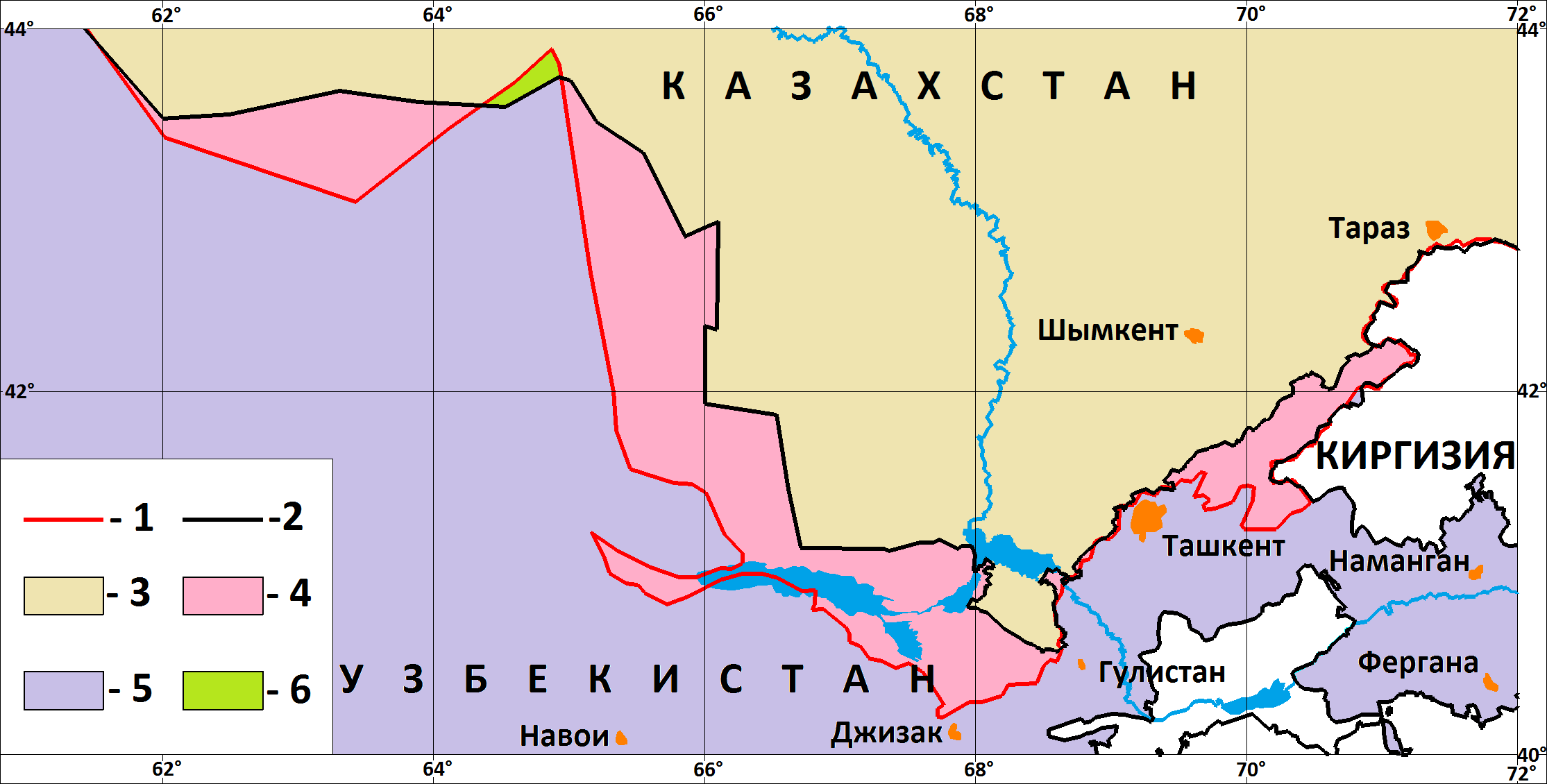
Русский: Изменение границы Казахстана и Узбекистана: красным граница 1939 года (согласно Большому советскому атласу мира), черным - современные государственные границы.
Розовым - территории, отошедшие от Казахстана к Узбекистану Зеленым - территория, отошедшая от Узбекистана к Казахстану Фиолетовым - территория Узбекистана, которая не меняла своей принадлежности при изменении границы с Казахстаном Желтоватым - территория Казахстана, которая не меняла своей принадлежности при изменении границы с Узбекистаном |
| Date | |
| Source | Own work |
| Author | Bogomolov.PL |
Licensing[edit]
I, the copyright holder of this work, hereby publish it under the following license:
| This file is made available under the Creative Commons CC0 1.0 Universal Public Domain Dedication. | |
| The person who associated a work with this deed has dedicated the work to the public domain by waiving all of their rights to the work worldwide under copyright law, including all related and neighboring rights, to the extent allowed by law. You can copy, modify, distribute and perform the work, even for commercial purposes, all without asking permission.
|
File history
Click on a date/time to view the file as it appeared at that time.
| Date/Time | Thumbnail | Dimensions | User | Comment | |
|---|---|---|---|---|---|
| current | 16:57, 22 April 2011 | | 2,229 × 1,130 (129 KB) | Bogomolov.PL (talk | contribs) | {{Information |Description ={{ru|1=Изменение границы Казахстана и Узбекистана: красным граница 1939 года (согласно Большому советскому атласу мира), черны� |
You cannot overwrite this file.
File usage on Commons
There are no pages that use this file.
File usage on other wikis
The following other wikis use this file:
- Usage on kk.wikipedia.org
- Usage on ru.wikipedia.org