File:سنگ قبرهای قدیمی - آرامستان های شهر قم - ۲۰۱۲ میلادی-عکس های اسنادی دانشنامه ویکیپدیا-استفاده رایگان 10.jpg
Jump to navigation
Jump to search

Size of this preview: 450 × 600 pixels. Other resolutions: 180 × 240 pixels | 360 × 480 pixels | 576 × 768 pixels | 768 × 1,024 pixels | 1,536 × 2,048 pixels | 3,456 × 4,608 pixels.
Original file (3,456 × 4,608 pixels, file size: 11.45 MB, MIME type: image/jpeg)
Captions
Captions
Add a one-line explanation of what this file represents
Summary
[edit]
| Description |
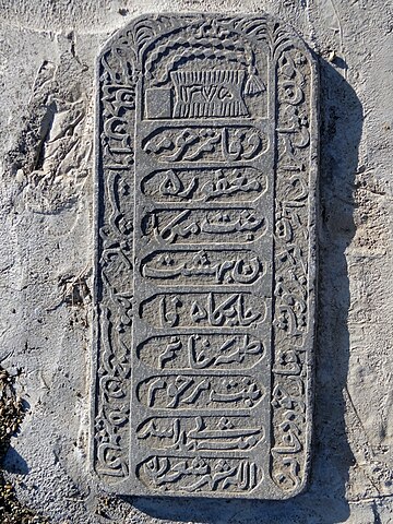
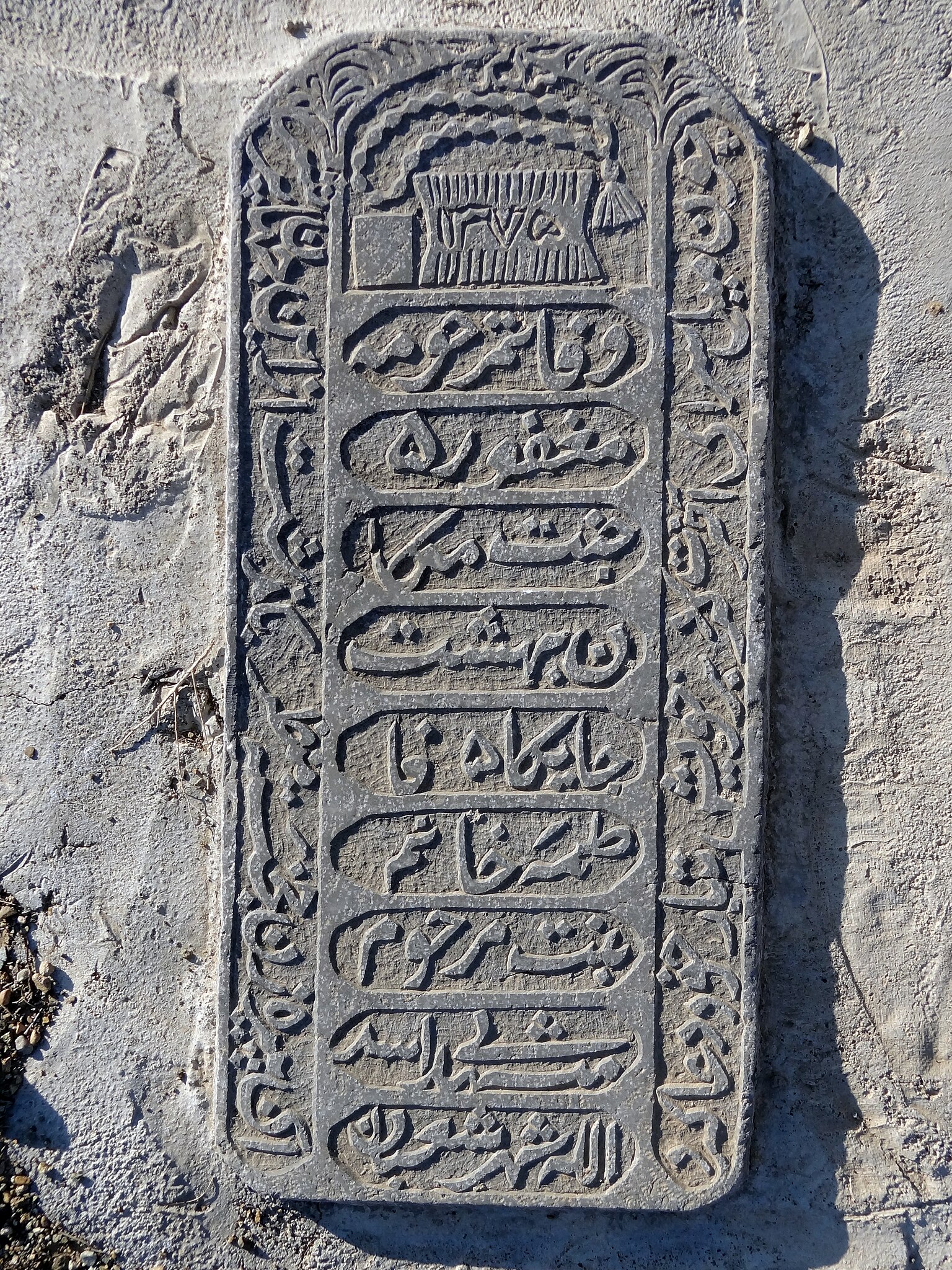
فارسی: گورنوشته، واژهها یا جملات یا اشعار ستایش آمیزی است که بر روی سنگ قبر حک میشود. منظور از حک این نوشتهها یادآوری مشخصات فرد درگذشته و ادای احترام به او است.
English: An epitaph is a short text honoring a deceased person. Strictly speaking, it refers to text that is inscribed on a tombstone or plaque, but it may also be used in a figurative sense.
Español: Un epitafio, es el texto que honra al difunto, normalmente inscrito en una lápida o placa sobre su tumba. Tradicionalmente un epitafio está escrito en verso, pero hay excepciones. Se han conocido muchos poetas que han compuesto su propio epitafio.
Русский: Эпита́фия— изречение (часто стихотворное), сочиняемое на случай чьей-либо смерти и используемое в качестве надгробной надписи.
ქართული: ეპიტაფია (ბერძ. epitaphios — საფლავზედა) — წარწერა საფლავის ქვაზე. წარმოიშვა ანტიკურ სამყაროში. ეპიტაფიისთვის დამახასიათებელია მცირე ფორმა, მიმართვა მიცვალებულისადმი ან მიცვალებილისა ამ ქვენად დარჩენილებთან.
العربية: النقش التذكاري والكتابة هو عبارة عن خطاب تذكاري على الضريح عينه لتكريم المتوفى، وغالبًا ماتكون اللغة لغة مجازية. أخذت الكلمة من كلمة (ἐπιτάφιος) اليونانية التي تنطق (إبيتافيوس)، فالمقطع «إبي» بمعنى فوق و«تافوس» بمعنى قبر.
Português: Epitáfios são frases escritas sobre túmulos, mausoléus e campas cemiteriais para homenagear pessoas ali sepultadas. |
| Date | |
| Source | Own work |
| Author | Mostafameraji |
| Camera location | | View this and other nearby images on: OpenStreetMap |
|---|
Licensing
[edit]
I, the copyright holder of this work, hereby publish it under the following license:
| This file is made available under the Creative Commons CC0 1.0 Universal Public Domain Dedication. | |
| The person who associated a work with this deed has dedicated the work to the public domain by waiving all of their rights to the work worldwide under copyright law, including all related and neighboring rights, to the extent allowed by law. You can copy, modify, distribute and perform the work, even for commercial purposes, all without asking permission.
|
File history
Click on a date/time to view the file as it appeared at that time.
| Date/Time | Thumbnail | Dimensions | User | Comment | |
|---|---|---|---|---|---|
| current | 09:36, 8 December 2022 | | 3,456 × 4,608 (11.45 MB) | Mostafameraji (talk | contribs) | Uploaded own work with UploadWizard |
You cannot overwrite this file.
File usage on Commons
There are no pages that use this file.