File:(2006) Into the Open Sea.jpg
Original file (1,920 × 1,440 pixels, file size: 3.28 MB, MIME type: image/jpeg)
Captions
Captions
Summary[edit]
_Into_the_Open_Sea.jpg&action=edit§ion=1)
| Description |
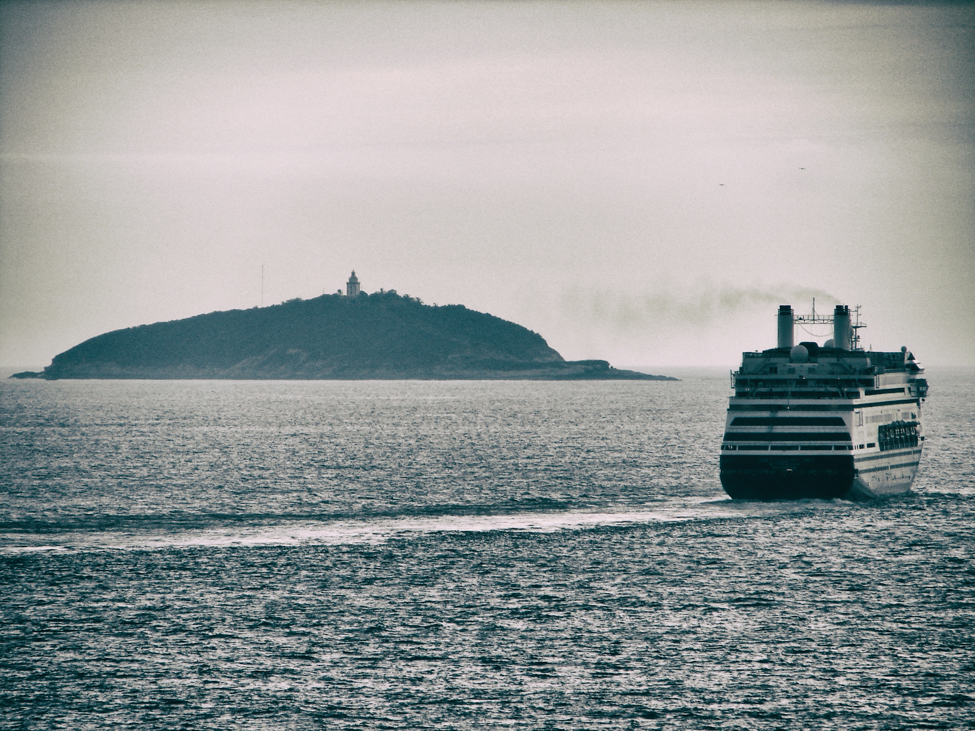
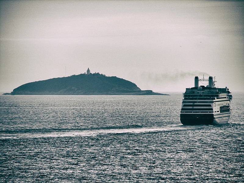
English: Holland America Line's MS Rotterdam with Ilha Rasa (Portuguese for Shallow Island) and its Lighthouse on the background, in Rio de Janeiro, Brazil.
About the Lighthouse, according to Wikipedia: Before the construction of the lighthouse a fire was lit every night on the summit of Ilha Rasa signalling the entrance to the Port of Rio de Janeiro. João VI decided the construction of the lighthouse on the island and the works began in 1819 employing prisoners as workforce under the supervision of the engineer João de Souza Pacheco Leitão. The tower was completed in 1825, but its inauguration was postponed as the Argentine pirates attacked the ship transporting the optical instruments from France where they were built. The lighthouse was lit on July 31, 1829; it is a 3-storey square prism stone building surmounted by a cylindrical tower with balcony and lantern. The tower, painted in white with brown trim, is 26 metres (85 ft) high and the walls are 1.3 metres (4.3 ft) thick. The lantern was equipped with first-order rotary catoptrics system and three parabolic reflectors lit by 21 lamps burning rapeseed oil. On December 2, 1883 was inaugurated a new 1st-order Doppler lens, manufactured by Lepaute et Sautter & Lemonnier and installed by engineer Louis Belenot. The lantern is currently equipped with one of the two mesoradial lenses built in 1909. Since 1951 the lighthouse operate with electric power supplied by diesel engines. The lighthouse emits two white alternate flashes and one red every 15 seconds visible up to 51 nautical miles (94 km; 59 mi) for the white light and 45 nautical miles (83 km; 52 mi) for that red. The lighthouse is managed by the Brazilian Navy and is identified by the country code number BR-2420. en.wikipedia.org/wiki/Ilha_Rasa_Lighthouse |
| Date | |
| Source | https://www.flickr.com/photos/31018257@N00/39179329252/ |
| Author | Diego3336 |
| Camera location | | View this and other nearby images on: OpenStreetMap |
|---|
_Into_the_Open_Sea.jpg¶ms=-23.063651_N_-043.146035_E_globe:Earth_type:camera__&language=en)
Licensing[edit]
_Into_the_Open_Sea.jpg&action=edit§ion=2)
| This image was originally posted to Flickr. Its license was verified as "cc-by-2.0" by the UploadWizard Extension at the time it was transferred to Commons. See the license information for further details. |
- You are free:
- to share – to copy, distribute and transmit the work
- to remix – to adapt the work
- Under the following conditions:
- attribution – You must give appropriate credit, provide a link to the license, and indicate if changes were made. You may do so in any reasonable manner, but not in any way that suggests the licensor endorses you or your use.
File history
Click on a date/time to view the file as it appeared at that time.
| Date/Time | Thumbnail | Dimensions | User | Comment | |
|---|---|---|---|---|---|
| current | 22:53, 19 January 2018 | | 1,920 × 1,440 (3.28 MB) | DarwIn (talk | contribs) | User created page with UploadWizard |
You cannot overwrite this file.
File usage on Commons
There are no pages that use this file.
_Into_the_Open_Sea.jpg&oldid=733053180)