File:0 Maubray (Morlies) - Tranchée du canal Pommerœul-Péronnes (1).JPG
Jump to navigation
Jump to search

Size of this preview: 800 × 533 pixels. Other resolutions: 320 × 213 pixels | 640 × 427 pixels | 1,024 × 683 pixels | 1,280 × 853 pixels | 2,560 × 1,707 pixels | 3,456 × 2,304 pixels.
Original file (3,456 × 2,304 pixels, file size: 5.62 MB, MIME type: image/jpeg)
Captions
Captions
Add a one-line explanation of what this file represents
Summary
[edit]| Description |
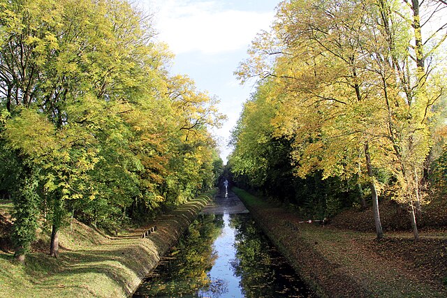
Français : Maubray (Belgique), bief du canal Pommerœul-Péronnes (1823-1826), dénommé localement "la tranchée" et situé en amont du "pont royal" dans le hameau de Morlies.
English: Maubray (Belgium), Pommerœul-Péronnes canal (1823-1826) known locally with the name "la tranchée" and located upstream of the "Pont Royal" in the Morlies hamlet.
Nederlands: Maubray (België), Kanaal bereiken Pommerœul-Peronnes (1823-1826), plaatselijk genoemd "la tranchée" stroomopwaarts van de "Pont Royal" in het gehucht van Morlies.
Walon : Mombré (Bèljike), bî do canal Pommerœul-Péronnes (1823-1826), lumè vêla "l'tranchée" èt s'trovant èn amont do "Pont Royal" dins li amau di Morlies. |
||
| Date | |||
| Source | Own work | ||
| Author | Jean-Pol GRANDMONT | ||
| Permission (Reusing this file) |
|

_-_Tranch%C3%A9e_du_canal_Pommer%C5%93ul-P%C3%A9ronnes_(1).JPG&action=edit§ion=1)
| Camera location | | View this and other nearby images on: OpenStreetMap |
|---|
_-_Tranch%C3%A9e_du_canal_Pommer%C5%93ul-P%C3%A9ronnes_(1).JPG¶ms=050.562294_N_0003.495378_E_globe:Earth_type:camera_region:BE_heading:337.50&language=en)
Licensing
[edit]_-_Tranch%C3%A9e_du_canal_Pommer%C5%93ul-P%C3%A9ronnes_(1).JPG&action=edit§ion=2)
I, the copyright holder of this work, hereby publish it under the following licenses:
This file is licensed under the Creative Commons Attribution-Share Alike 3.0 Unported license.
- You are free:
- to share – to copy, distribute and transmit the work
- to remix – to adapt the work
- Under the following conditions:
- attribution – You must give appropriate credit, provide a link to the license, and indicate if changes were made. You may do so in any reasonable manner, but not in any way that suggests the licensor endorses you or your use.
- share alike – If you remix, transform, or build upon the material, you must distribute your contributions under the same or compatible license as the original.

|
Permission is granted to copy, distribute and/or modify this document under the terms of the GNU Free Documentation License, Version 1.2 or any later version published by the Free Software Foundation; with no Invariant Sections, no Front-Cover Texts, and no Back-Cover Texts. A copy of the license is included in the section entitled GNU Free Documentation License. |
You may select the license of your choice.
File history
Click on a date/time to view the file as it appeared at that time.
| Date/Time | Thumbnail | Dimensions | User | Comment | |
|---|---|---|---|---|---|
| current | 20:45, 25 October 2012 | | 3,456 × 2,304 (5.62 MB) | Jean-Pol GRANDMONT (talk | contribs) | {{Information |Description ={{fr|1=Maubray (Belgique), bief du canal Pommerœul-Péronnes (1823-1826), dénommé localement "la tranchée" et situé en amont du "pont royal" dans le hameau de Morlies.}} {{en|1=Maubray ... |
You cannot overwrite this file.
File usage on Commons
The following 2 pages use this file:
_-_Tranch%C3%A9e_du_canal_Pommeroeul-P%C3%A9ronnes_(1).JPG&redirect=no)
File usage on other wikis
The following other wikis use this file:
- Usage on fr.wikipedia.org
- Usage on lb.wikipedia.org
- Usage on www.wikidata.org
_-_Tranchée_du_canal_Pommerœul-Péronnes_(1).JPG&oldid=765867863)