File:1573 Attendorn im Brüsseler Atlas.png
Jump to navigation
Jump to search
Size of this preview: 800 × 502 pixels. Other resolutions: 320 × 201 pixels | 640 × 402 pixels | 1,024 × 643 pixels | 1,403 × 881 pixels.
Original file (1,403 × 881 pixels, file size: 2.58 MB, MIME type: image/png)
Captions
Captions
Add a one-line explanation of what this file represents
Summary
[edit]
| Description |
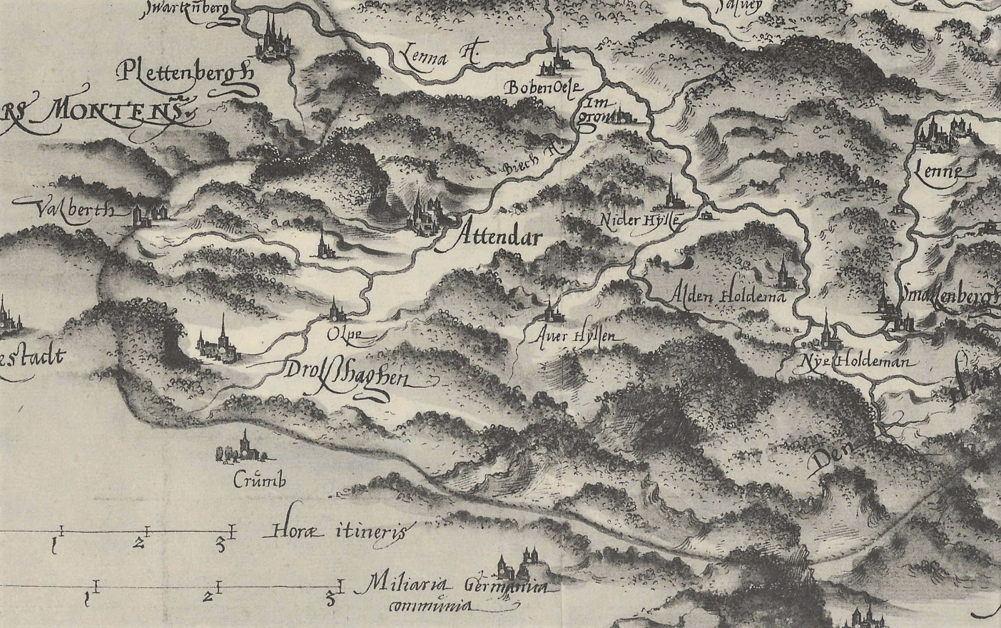
Deutsch: Herzogtum Westfalen, Kartenausschnitt der Territorialkarte aus dem Brüsseler Atlas (1573). Beschreibung: „ca. 1 : 230.000 – 43,5 x 49 – fotografischer Nachdruck 1959 – Kartograph Christian s'Grooten – B Nr. 309“. Die Karte mit dem Territorium des Herzogtums Westfalen von s'Grooten kann als älteste bekannte kartographische Landesaufnahme Nordwestdeutschlands bezeichnet werden. |
| Date | |
| Source | Landesarchiv NRW, DFG-Viewer, Abteilung Westfalen Kartensammlung A Nr. 15402. |
| Author | Christian s'Grooten (um 1525–1603) |
Licensing
[edit]
|
This work is in the public domain in its country of origin and other countries and areas where the copyright term is the author's life plus 100 years or fewer. This work is in the public domain in the United States because it was published (or registered with the U.S. Copyright Office) before January 1, 1929. | |
| This file has been identified as being free of known restrictions under copyright law, including all related and neighboring rights. | |
File history
Click on a date/time to view the file as it appeared at that time.
| Date/Time | Thumbnail | Dimensions | User | Comment | |
|---|---|---|---|---|---|
| current | 11:58, 17 March 2019 | | 1,403 × 881 (2.58 MB) | Bärwinkel,Klaus (talk | contribs) | {{Information |Description={{de|1=Herzogtum Westfalen, Territorialkarte aus dem Brüsseler Atlas (1573). Beschreibung: „ca. 1 : 230.000 – 43,5 x 49 – fotografischer Nachdruck 1959 – Christian s'Grooten – B Nr. 309“.}} |Source=Landesarchiv NRW, DFG-Viewer, Abteilung Westfalen Kartensammlung A Nr. 15402. |Date=1573 |Author=Christian s'Grooten |Permission= |other_versions= }} == {{int:license}} == {{free screenshot|license={{GPL}} }} Category:History of Attendorn |
You cannot overwrite this file.
File usage on Commons
There are no pages that use this file.