File:1745 Seale Map or Chart of the Mediterranean Sea - Geographicus - Mediterranean-seale-1845.jpg
Ir a la navegación
Ir a la búsqueda

Tamaño de esta previsualización: 800 × 390 píxeles. Otras resoluciones: 320 × 156 píxeles | 640 × 312 píxeles | 1024 × 500 píxeles | 1280 × 625 píxeles | 4000 × 1952 píxeles.
Archivo original (4000 × 1952 píxeles; tamaño de archivo: 1,44 MB; tipo MIME: image/jpeg)
Leyendas
Leyendas
Añade una explicación corta acerca de lo que representa este archivo
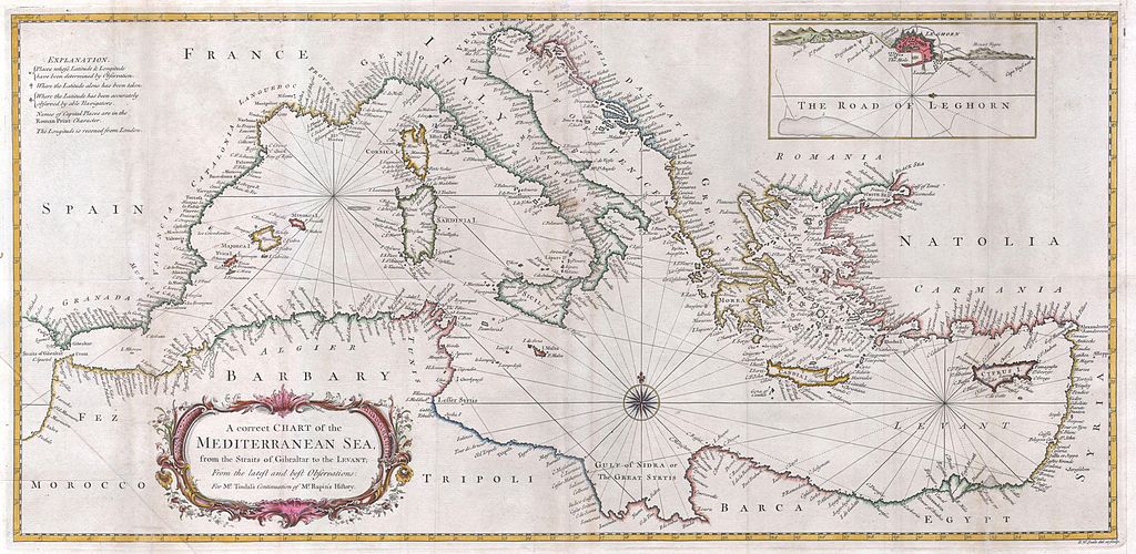
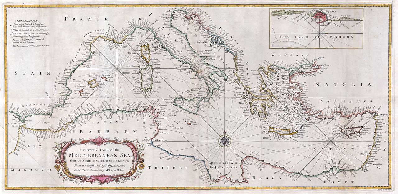
| Richard William Seale: A correct Chart of the Mediterranean Sea, from the Straits of Gibraltar to the Levant; From the latest and best Observations: for Mr. Tindal’s Continuation of Mr. Rapin’s History..
( |
||||||||||||||||||||
|---|---|---|---|---|---|---|---|---|---|---|---|---|---|---|---|---|---|---|---|---|
| Artista |
|
|||||||||||||||||||
| Título |
A correct Chart of the Mediterranean Sea, from the Straits of Gibraltar to the Levant; From the latest and best Observations: for Mr. Tindal’s Continuation of Mr. Rapin’s History.. |
|||||||||||||||||||
| Descripción |
English: A large and attractive hand colored 1745 sea chart of the entire Mediterranean region. Drawn in considerable detail with most ports clearly labeled. Large title cartouche in the lower left quadrant. Rumb lines throughout with a decorative compass rose at center. An inset depicts “The Road to Leghorn” or Livorno harbor. |
|||||||||||||||||||
| Fecha | 1745 | |||||||||||||||||||
| Dimensiones | altura: 14 in (35,5 cm); ancho: 28,5 in (72,3 cm) | |||||||||||||||||||
| Número de inventario |
Geographicus link: Mediterranean-seale-1845 |
|||||||||||||||||||
| Fuente/fotógrafo |
|
|||||||||||||||||||
| Permiso (Reutilización de este archivo) |
|
|||||||||||||||||||
Historial del archivo
Haz clic sobre una fecha y hora para ver el archivo tal como apareció en ese momento.
| Fecha y hora | Miniatura | Dimensiones | Usuario | Comentario | |
|---|---|---|---|---|---|
| actual | 11:34 24 mar 2011 | | 4000 × 1952 (1,44 MB) | BotMultichillT (discusión | contribs.) | {{subst:User:Multichill/Geographicus |link=http://www.geographicus.com/P/AntiqueMap/Mediterranean-seale-1845 |product_name=1745 Seale Map or Chart of the Mediterranean Sea |map_title=A correct Chart of the Mediterranean Sea, from the Straits of Gibraltar |
No puedes sobrescribir este archivo.
Usos del archivo
La siguiente página usa este archivo:
Uso global del archivo
Las wikis siguientes utilizan este archivo:
- Uso en es.wikipedia.org