File:17U 2018-02-15 1640Z.jpg
Jump to navigation
Jump to search
Size of this preview: 600 × 600 pixels. Other resolutions: 240 × 240 pixels | 480 × 480 pixels.
Original file (800 × 800 pixels, file size: 97 KB, MIME type: image/jpeg)
Captions
Captions
Add a one-line explanation of what this file represents
Summary[edit]
| Description |
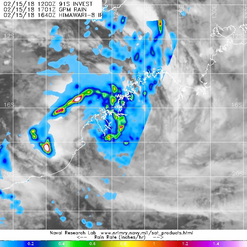
English: NASA/JAXA's Global Precipitation Measurement Mission or GPM core satellite measured rainfall at about 1 inch (25 mm) per hour in a band north of the center, from the Southern Indian Ocean stretching east over coastal Western Australia.
System 91S, the tropical Low, had sustained winds near 45 kilometres per hour (28 mph). The center is near 17.2 degrees South 123.3 degrees East, about 35 kilometres west northwest of Derby. System 91S is moving to the west southwest at 22 kilometres (13.6 mph) per hour. |
| Date | |
| Source | https://www.facebook.com/NASAHurricane/photos/a.121853331194802.11206.112998395413629/1677553702291416/?type=3&theater |
| Author | NRL |
Licensing[edit]
This file is a work of a sailor or employee of the U.S. Navy, taken or made as part of that person's official duties. As a work of the U.S. federal government, it is in the public domain in the United States.
|
 | |
| This file has been identified as being free of known restrictions under copyright law, including all related and neighboring rights. | ||
File history
Click on a date/time to view the file as it appeared at that time.
| Date/Time | Thumbnail | Dimensions | User | Comment | |
|---|---|---|---|---|---|
| current | 02:58, 24 March 2018 | | 800 × 800 (97 KB) | A1Cafel (talk | contribs) | User created page with UploadWizard |
You cannot overwrite this file.
File usage on Commons
There are no pages that use this file.
File usage on other wikis
The following other wikis use this file:
- Usage on en.wikipedia.org