File:1801 Cary Map of Portugal - Geographicus - Portugal-cary-1801.jpg
Ir a la navegación
Ir a la búsqueda
Tamaño de esta previsualización: 666 × 599 píxeles. Otras resoluciones: 267 × 240 píxeles | 533 × 480 píxeles | 853 × 768 píxeles | 1138 × 1024 píxeles | 2276 × 2048 píxeles | 5000 × 4500 píxeles.
Archivo original (5000 × 4500 píxeles; tamaño de archivo: 6,49 MB; tipo MIME: image/jpeg)
Leyendas
Leyendas
Añade una explicación corta acerca de lo que representa este archivo
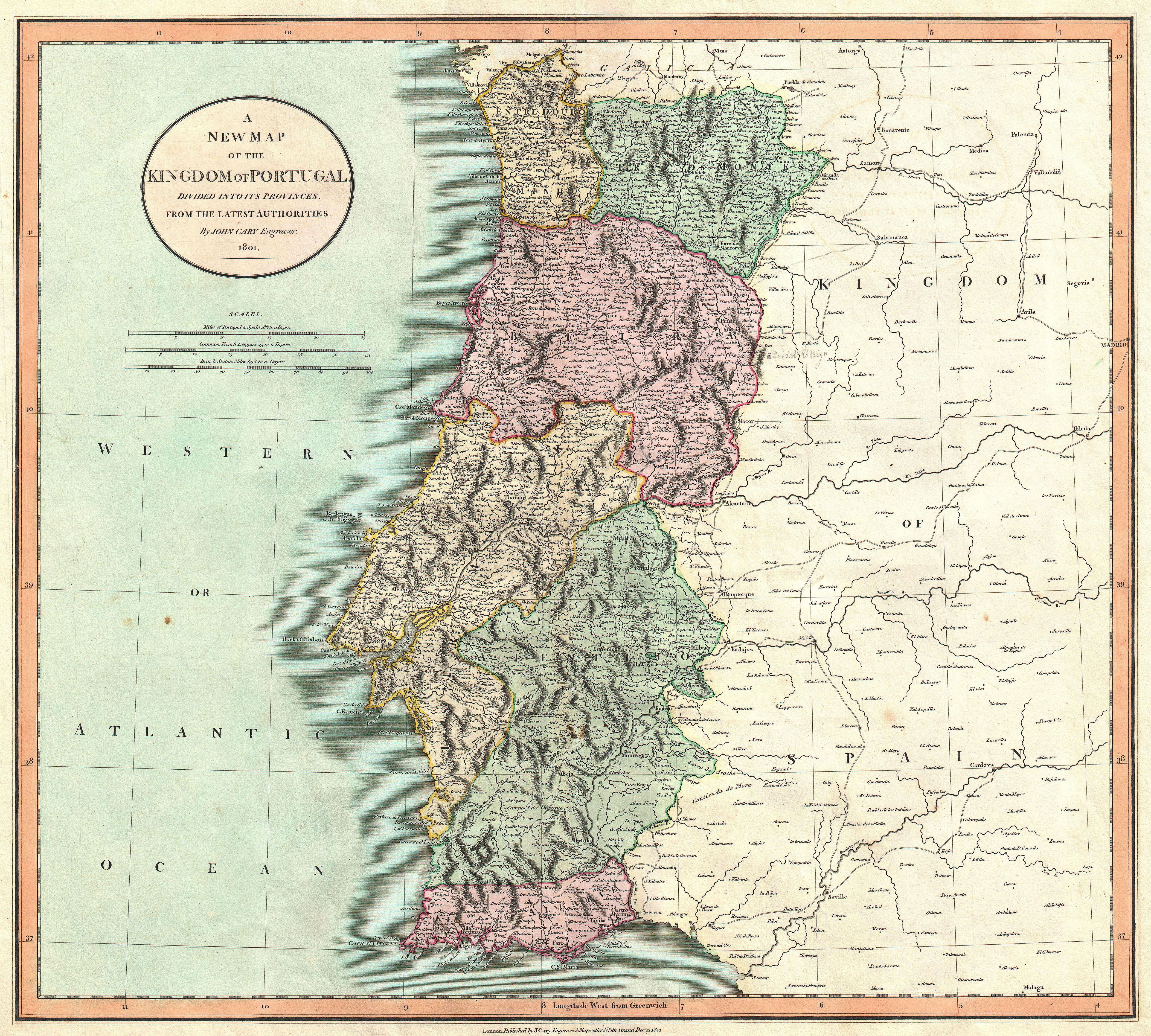
| John Cary: A New Map of the Kingdom of Portugal, Divided into its Provinces, from the Latest Authorities.
( |
||||||||||||||||||||||||||
|---|---|---|---|---|---|---|---|---|---|---|---|---|---|---|---|---|---|---|---|---|---|---|---|---|---|---|
| Artista |
|
|||||||||||||||||||||||||
| Título |
A New Map of the Kingdom of Portugal, Divided into its Provinces, from the Latest Authorities. |
|||||||||||||||||||||||||
| Descripción |
English: An extremely attractive example of John Cary’s 1801 map of Portugal. Highly detailed and color coded according to region. All in all, one of the most interesting and attractive atlas maps Portugal to appear in first years of the 19th century. Prepared in 1801 by John Cary for issue in his magnificent 1808 New Universal Atlas . |
|||||||||||||||||||||||||
| Fecha | 1801 (dated) | |||||||||||||||||||||||||
| Dimensiones | altura: 18,5 in (46,9 cm); ancho: 20,5 in (52 cm) | |||||||||||||||||||||||||
| Número de inventario |
Geographicus link: Protugal-cary-1801 |
|||||||||||||||||||||||||
| Fuente/fotógrafo |
Cary, John, Cary's New Universal Atlas, containing distinct maps of all the principal states and kingdoms throughout the World. From the latest and best authorities extant. London: Printed for J. Cary, Engraver and Map-seller, No. 181, near Norfolk Street, Strand, 1808.
|
|||||||||||||||||||||||||
| Permiso (Reutilización de este archivo) |
|
|||||||||||||||||||||||||
Historial del archivo
Haz clic sobre una fecha y hora para ver el archivo tal como apareció en ese momento.
| Fecha y hora | Miniatura | Dimensiones | Usuario | Comentario | |
|---|---|---|---|---|---|
| actual | 11:54 22 mar 2011 | | 5000 × 4500 (6,49 MB) | BotMultichillT (discusión | contribs.) | {{subst:User:Multichill/Geographicus |link=http://www.geographicus.com/P/AntiqueMap/Protugal-cary-1801 |product_name=1801 Cary Map of Portugal |map_title=A New Map of the Kingdom of Portugal, Divided into its Provinces, from the Latest Authorities. |desc |
No puedes sobrescribir este archivo.
Usos del archivo
Las siguientes páginas usan este archivo:
Uso global del archivo
Las wikis siguientes utilizan este archivo: