File:1827 Finley Map of Ohio - Geographicus - Ohio-finley-1827.jpg
跳至導覽
跳至搜尋
預覽大小:461 × 599 像素。 其他解析度:185 × 240 像素 | 369 × 480 像素 | 591 × 768 像素 | 788 × 1,024 像素 | 2,308 × 3,000 像素。
原始檔案 (2,308 × 3,000 像素,檔案大小:1.95 MB,MIME 類型:image/jpeg)
說明
說明
添加單行說明來描述出檔案所代表的內容
| Anthony Finley:Ohio.
( |
||||||
|---|---|---|---|---|---|---|
| 作家 | ||||||
| 標題 |
Ohio. |
|||||
| 描述 |
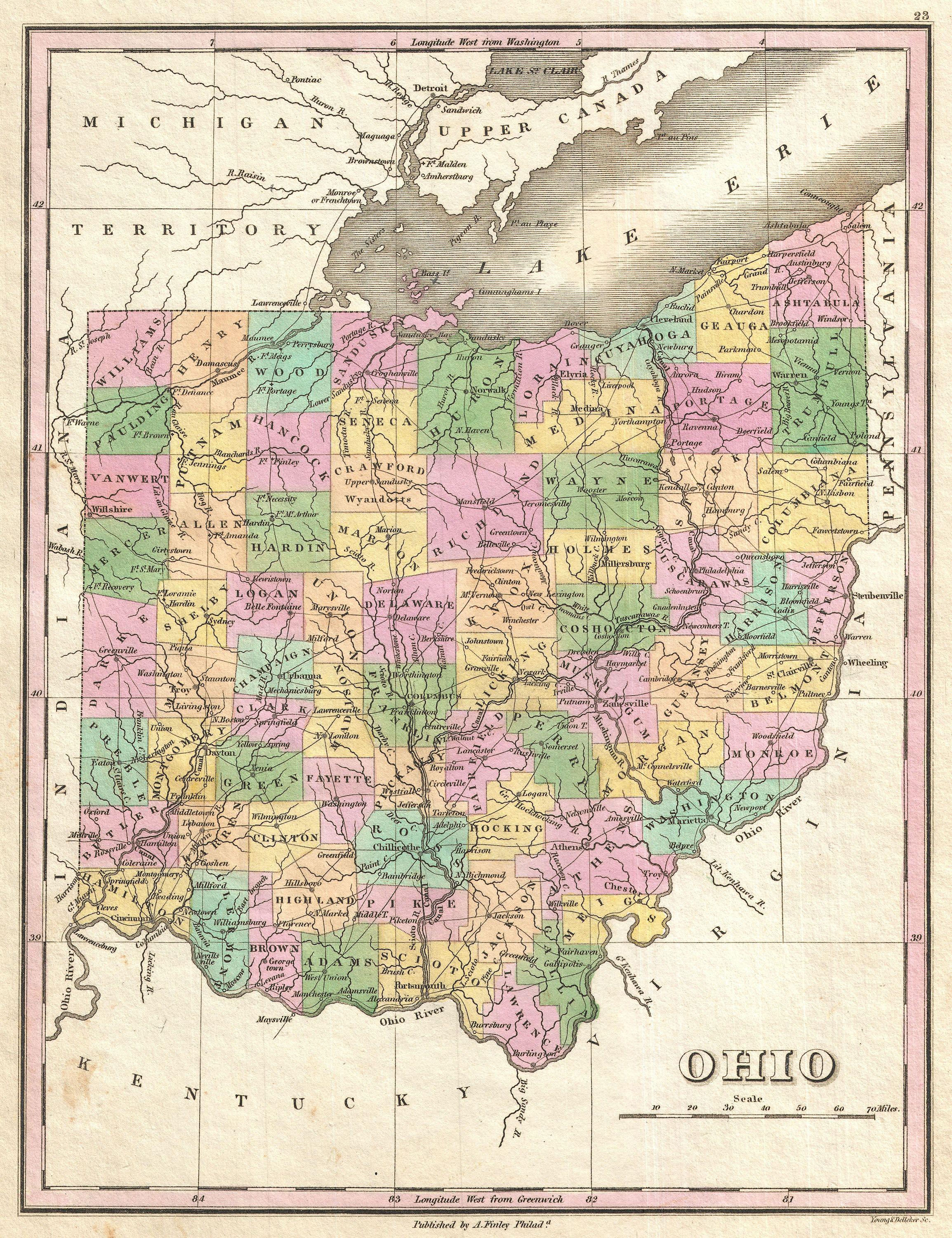
English: A beautiful example of Finley's important 1827 map of Ohio. Includes much of Lake Erie. Depicts the state with moderate detail in Finley's classic minimalist style. Shows river ways, roads, canals, and some topographical features. Offers color coding at the county level. Title and scale in lower right quadrant. Engraved by Young and Delleker for the 1827 edition of Anthony Finley's General Atlas . |
|||||
| 日期 | 1827年 (undated) | |||||
| 尺寸 | 高度:11.5英寸(29.2釐米);寬度:9英寸(22.8釐米) | |||||
| 登錄號 |
Geographicus link: Ohio-finley-1827 |
|||||
| 來源/攝影者 |
Finley, Anthony, A New General Altas, Comprising a Complete Set of Maps, representing the Grand Divisions of the Globe, Together with the several Empires, Kingdoms and States in the World; Compiled from the Best Authorities, and corrected by the Most Recent Discoveries, Philadelphia, 1827.
|
|||||
| 授權許可 (重用此檔案) |
|
|||||
檔案歷史
點選日期/時間以檢視該時間的檔案版本。
| 日期/時間 | 縮圖 | 尺寸 | 用戶 | 備註 | |
|---|---|---|---|---|---|
| 目前 | 2011年3月23日 (三) 09:05 | | 2,308 × 3,000(1.95 MB) | BotMultichillT(對話 | 貢獻) | {{subst:User:Multichill/Geographicus |link=http://www.geographicus.com/P/AntiqueMap/Ohio-finley-1827 |product_name=1827 Finley Map of Ohio |map_title=Ohio. |description=A beautiful example of Finley's important 1827 map of Ohio. Includes much of Lake Er |
無法覆蓋此檔案。
檔案用途
全域檔案使用狀況
以下其他 wiki 使用了這個檔案:
- ru.wikipedia.org 的使用狀況
- zh.wikipedia.org 的使用狀況